Communities across North Carolina’s Cape Fear River Basin are facing renewed uncertainty after the Environmental Protection Agency’s (EPA) proposed rollback of drinking water protections for several PFAS chemicals, commonly known as “forever chemicals.”
The EPA recently announced two proposed rules on May 18, 2026. One would roll back protections for several PFAS compounds, while the other would delay implementation of existing standards.
What are PFAS?
PFAS are a group of human-made chemicals that can enter rivers and streams through industrial discharges and other sources. They are highly persistent in the environment. Exposure, even at very low concentrations, can cause human health concerns and developmental impacts on infants and children. Drinking water standards are critical to protecting public health. They also create incentives for industries to reduce PFAS pollution at its source—often the most effective and affordable way to protect rivers, communities, and downstream drinking water supplies.
Two years ago, the EPA finalized the nation’s first enforceable drinking water standards for several PFAS chemicals, which marked a major step forward in addressing long-standing contamination concerns. For communities like the ones downstream of the Chemours facility in Fayetteville, North Carolina, that action reflected years of local advocacy, scientific attention, and public pressure to address PFAS pollution in the Cape Fear River system.
PFAS in the Cape Fear River Basin
Communities in the Cape Fear River Basin, just like others across the country, have already borne significant costs associated with PFAS contamination. Now, with these proposed rollbacks, communities are once again confronting basic questions about drinking water safety, long-term health protections, and whether current systems are doing enough to prevent future pollution.
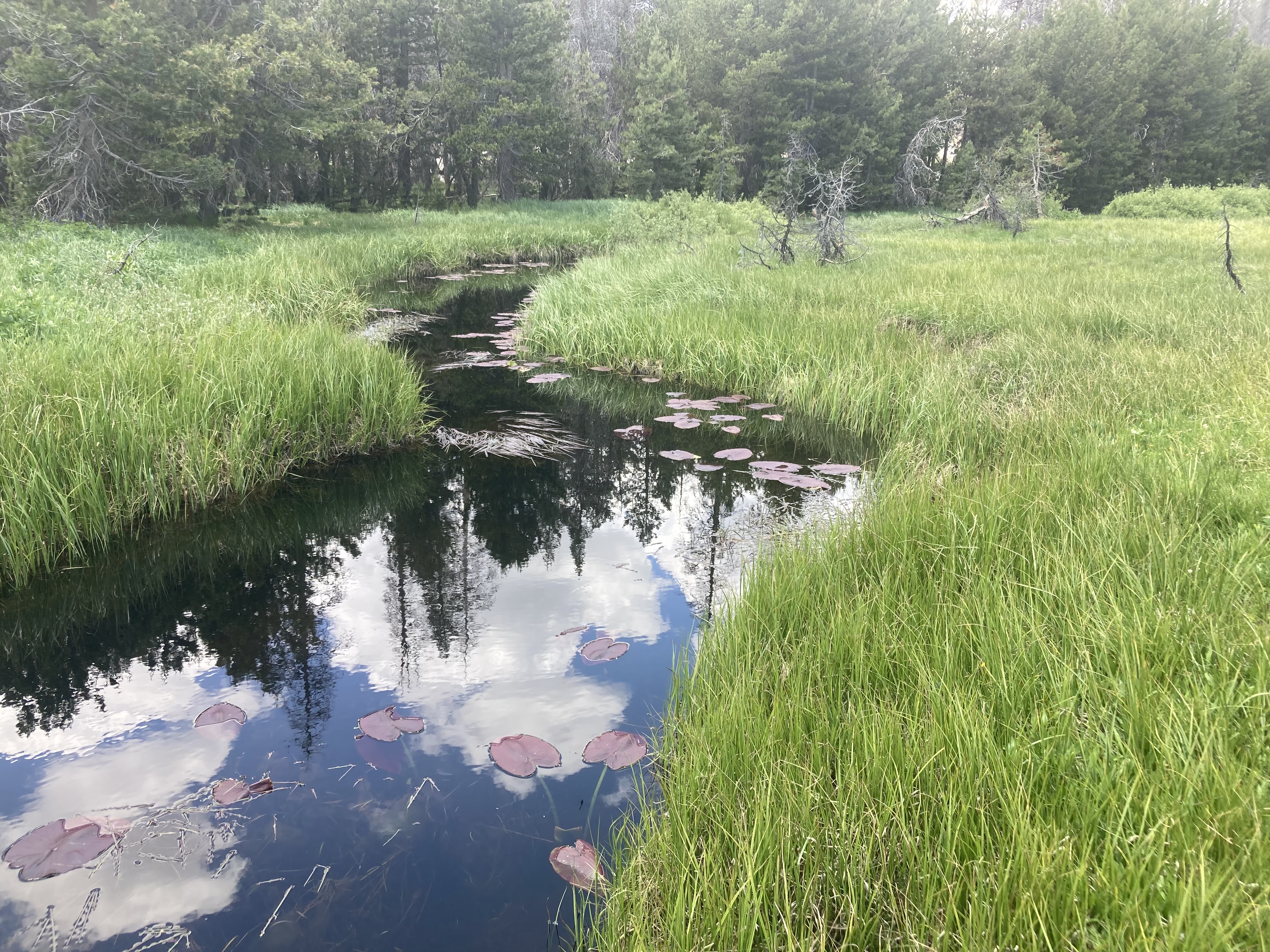
The Cape Fear River Basin is one of the most ecologically diverse regions in North Carolina, with interconnected rivers, wetlands, and floodplains that support unique wildlife, local economies, recreation, and drinking water supplies.
The proposed changes to existing standards focus on drinking water, but they also raise broader concerns about how communities address pollution in rivers and waterways. Communities in the Cape Fear River Basin are facing the reality that protecting clean water requires sustained attention, coordinated action, and accountability across entire watersheds.
American Rivers is proud to support our local partner organizations working in those communities most directly impacted. Across the watershed, local partner organizations continue to play a critical role in elevating community concerns, documenting pollution impacts, and advancing solutions that protect both people and clean water. Clean Cape Fear, Cape Fear River Watch, Haw River Assembly, and Sustainable Sandhills have helped build public awareness of PFAS contamination while advocating for stronger protections and greater accountability from polluters.
What can we do to protect clean water?
American Rivers supports bipartisan federal legislation that would help communities address PFAS contamination and modernize aging water infrastructure.
Congress can help strengthen protections for communities facing PFAS contamination. We are asking Senators to support the Healthy H2O Act (H.R. 4721 / S. 2436), which would help rural homeowners and communities access water quality testing and treatment resources for contaminants such as PFAS, particularly in areas that rely on private wells.
Protecting drinking water requires more than treating pollution after it reaches the tap. It also means preventing harmful chemicals from entering rivers and wastewater systems in the first place. Keeping pollution out of rivers protects public health, reduces treatment costs, and helps safeguard fish, wildlife, and recreation.
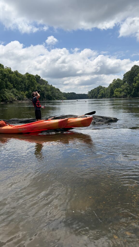
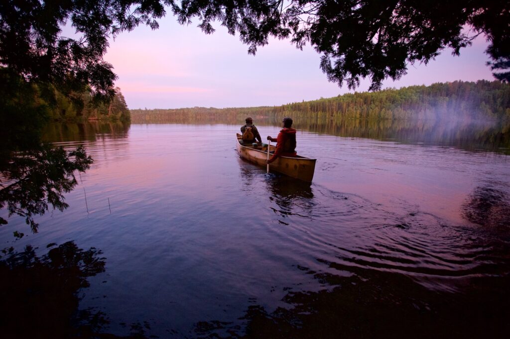
Summer is here! That means longer days for fishing, hiking, kayaking, swimming – more daylight for all of your favorite river activities. Summer is my favorite time of year. To me, nothing compares to creating memories with friends and loved ones during group paddles and river hangs. Even alone, just sitting and listening to the water as it makes its way downstream – the riffles, the rapids, the birds, the fish splashing grounds me and reminds me that rivers have life within and around them — life that depends on them.
For National Rivers Month, we want to celebrate the common belief that Life Depends on Rivers®. There is a reason it is the American Rivers tagline. Rivers provide our drinking water, grow our food, and provide vital habitat for fish and wildlife. All life requires healthy rivers to survive.
This year has been a challenging year for rivers, with many threats putting clean water and ecosystems at risk. That’s why it is more important than ever to recognize and celebrate the progress we make together.
I hope you enjoy some celebratory updates from the past year that show the impact we can have if we all work together to protect our rivers under the shared belief that Life Depends on Rivers®.
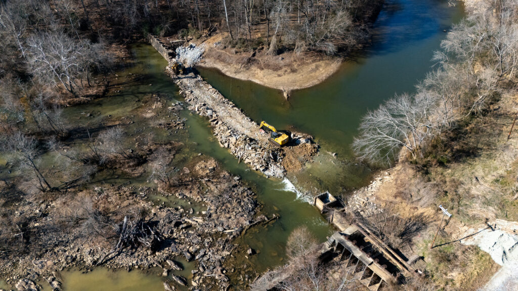
100 Dams Down: A Big Year for Reconnecting Rivers in the U.S.
In 2025, the United States removed 100 dams. One hundred outdated, often crumbling, and frequently dangerous structures were pulled from our waterways across 30 states. In their wake, more than 4,893 miles of river were reconnected — the most upstream miles ever reconnected in a single year in the U.S. through dam removal. In these rivers, water is flowing freely again for the first time in decades, sometimes centuries. Learn more…
Tijuana River’s landmark agreement to stop toxic pollution
The Tijuana River ranked #2 in our 2025 America’s Most Endangered Rivers® report due to toxic pollution threatening border communities. This designation, developed with partners Surfrider Foundation and Un Mar de Colores, helped catalyze swift federal action. Within three months of the April report release, American Rivers and others were invited to meet with EPA Administrator Lee Zeldin, which helped build momentum for a landmark agreement between the United States and Mexico to address the ongoing public health crisis. This demonstrates how strategic advocacy, combined with persistent community leadership, drives solutions for rivers and their communities. Learn more…
Texas voters approve $20 billion investment for water and flood resilience
In a groundbreaking victory, Texas voters approved a ballot initiative dedicating $1 billion annually for 20 years to fund water infrastructure improvements, wetland and floodplain restoration, and river reconnection projects. This is the largest state-based investment in water resources in U.S. history — a bipartisan triumph showing that water wins at the ballot box. American Rivers Action Fund worked alongside the National Wildlife Federation Action Fund and Texans for Opportunity to support this groundbreaking measure, paving the way for similar successes across the country. Learn more…
Celebrating a long-awaited urban wetland restoration in Seattle
After years of planning and partnership, a headwater wetland restoration project in West Seattle reached a major milestone — and in February, the community gathered to celebrate. As our Northwest Region team’s first urban wetland restoration project, this work demonstrates how restoring headwater wetlands can strengthen neighborhoods, improve habitat, and serve as a model for other urban communities. Learn more…
In California’s Central Valley, a river can look alive and still be starving. The San Joaquin winds through farmland and former floodplain country, but for much of the last century, it has been cut off from the seasonal flooding that is the lifeforce of juvenile fish. That is why inland salmon and steelhead — ocean-going rainbow trout — recovery conversations keep circling back to one idea: The river must be reconnected to the land beside it.
When the San Joaquin ran dry
The modern San Joaquin reflects decades of intensive flow regulation and water diversion. Completed in 1942, Friant Dam, located on the upper San Joaquin River near Fresno, California, was built to store water for irrigation and provide flood control. The dam helped set in motion a long period in which large sections of the upper San Joaquin ran dry as water was diverted into canals.
The San Joaquin feeds into the Sacramento-San Joaquin Delta, a key migration corridor and rearing environment for Central Valley salmon. With a dry riverbed and no small inlets or marshy wetlands where they can spawn and rear, spring-run Chinook salmon and steelhead disappeared from the mainstem river for decades.
Friant Dam is a defining chapter, but the broader Central Valley pattern is bigger than a single structure. Across the Central Valley, levees and engineered channels pinned rivers into place, cutting them off from the floodplains that once spread across the valley floor each winter and spring. The result was a loss of productive food webs and sheltered rearing areas for young fish.
Why floodplains make for healthier fish
Some of the best fish habitat on the San Joaquin is not in the river channel itself. In wet years, the shallow edges of the valley floor — the same landscapes we now think of as grasslands and fields — are where young salmon are able to find food and room to grow.
Healthy floodplains are extremely special for salmon and steelhead because of the food availability and the time they provide for young fish to mature. When water spreads out over shallow floodplain surfaces, it warms faster than the main channel as sunlight penetrates the surface, letting aquatic bugs, microbes, zooplankton, and algae flourish. That burst of new food helps young fish put on size fast at exactly the life stage when growth is the difference between making it to the ocean and being lost along the way.
Decades of Central Valley research show the same pattern. Juvenile Chinook that access floodplain habitat grow faster and survive better than fish confined to the main channel. This is largely because floodplains produce far more food. More recent work on managed floodplains, including seasonally flooded agricultural fields, has confirmed that floodplain access can drive some of the fastest juvenile growth rates recorded in the region. No two years look the same on a working river, but many different studies come back with the same result: Floodplain access gives young fish a real survival advantage.
That’s why floodplain reconnection is treated as core salmon and steelhead recovery logic in California. In the San Joaquin system, restoration planning recognizes that floodplains and the food they produce can shape how fast juvenile Chinook grow and how well they survive. Program scientists are directly asking how floodplain productivity predicts juvenile Chinook biomass and growth, and how that information can be used to guide adaptive management on the river.
The restoration fix anglers should care about
If the benefits floodplains provide for fish are repeatedly backed by science, the question becomes: Where and how can floodplains be restored?
This is where American Rivers comes in. Working in partnership with agencies, as well as local communities and organizations throughout the Central Valley, we advance projects that reconnect rivers to their floodplains — not just to restore the functional habitat of native fish and wildlife, but also to improve water quality and lower flood risk in nearby communities.
This includes giving rivers room to spread out during high flows. It also means helping to align the reconnection of San Joaquin’s floodplain with long-term recovery for salmon, steelhead, and other species.
State and federal restoration plans in the San Joaquin frame floodplain reconnection as a way to create shallow and productive rearing habitat for juvenile Chinook and other floodplain-dependent species like Sacramento splittail — a native feeder fish. This includes projects at the San Joaquin River National Wildlife Refuge that manage how floodwater moves onto and off of restored floodplain habitat.
The river and the surrounding valley floor historically functioned as a connected system, where seasonal flooding shaped both aquatic habitat and the grasslands along the river’s edge. Reconnecting the river to parts of that landscape is about restoring floodplain processes that let the river function more naturally, which creates the seasonal habitat young fish depend on.
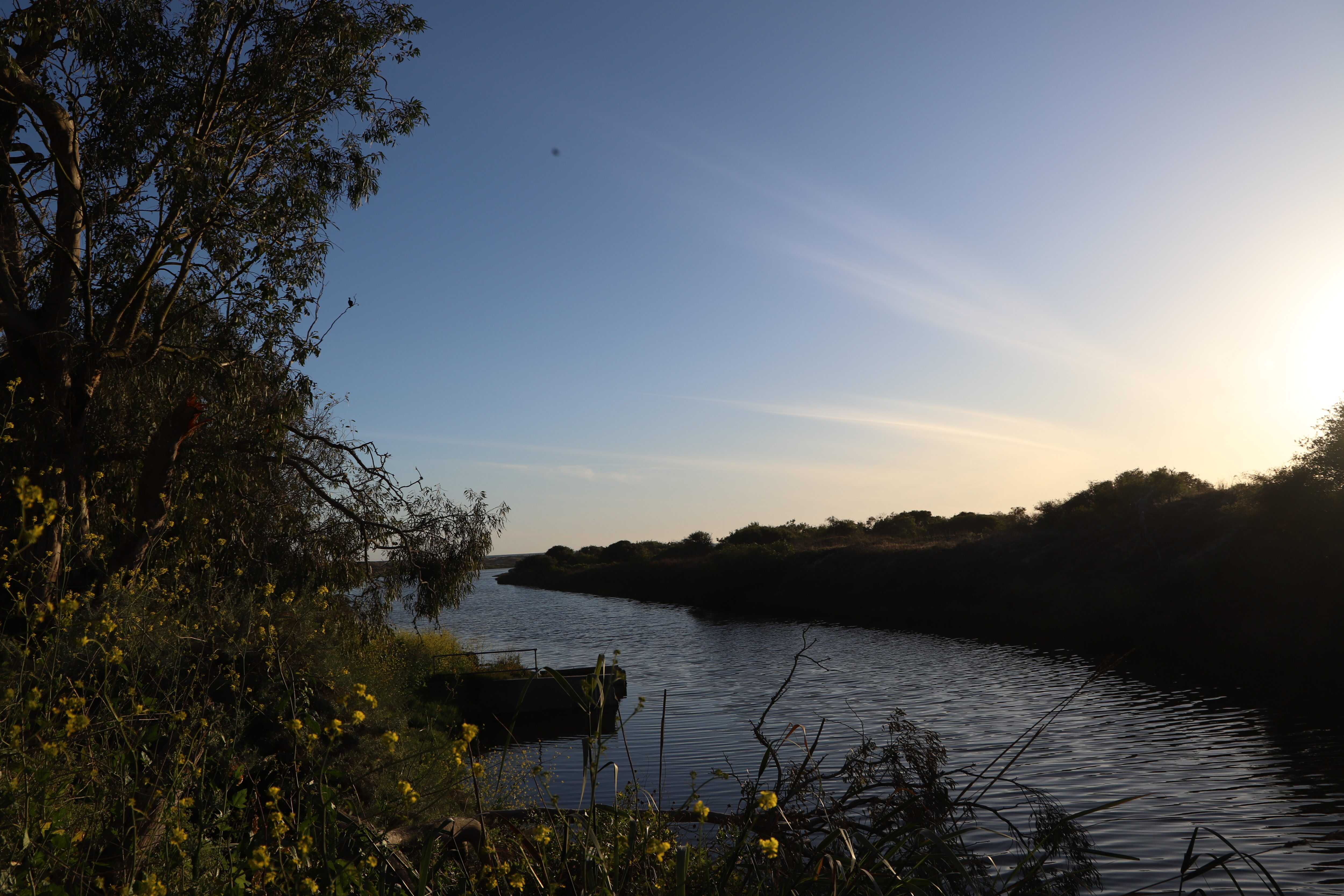
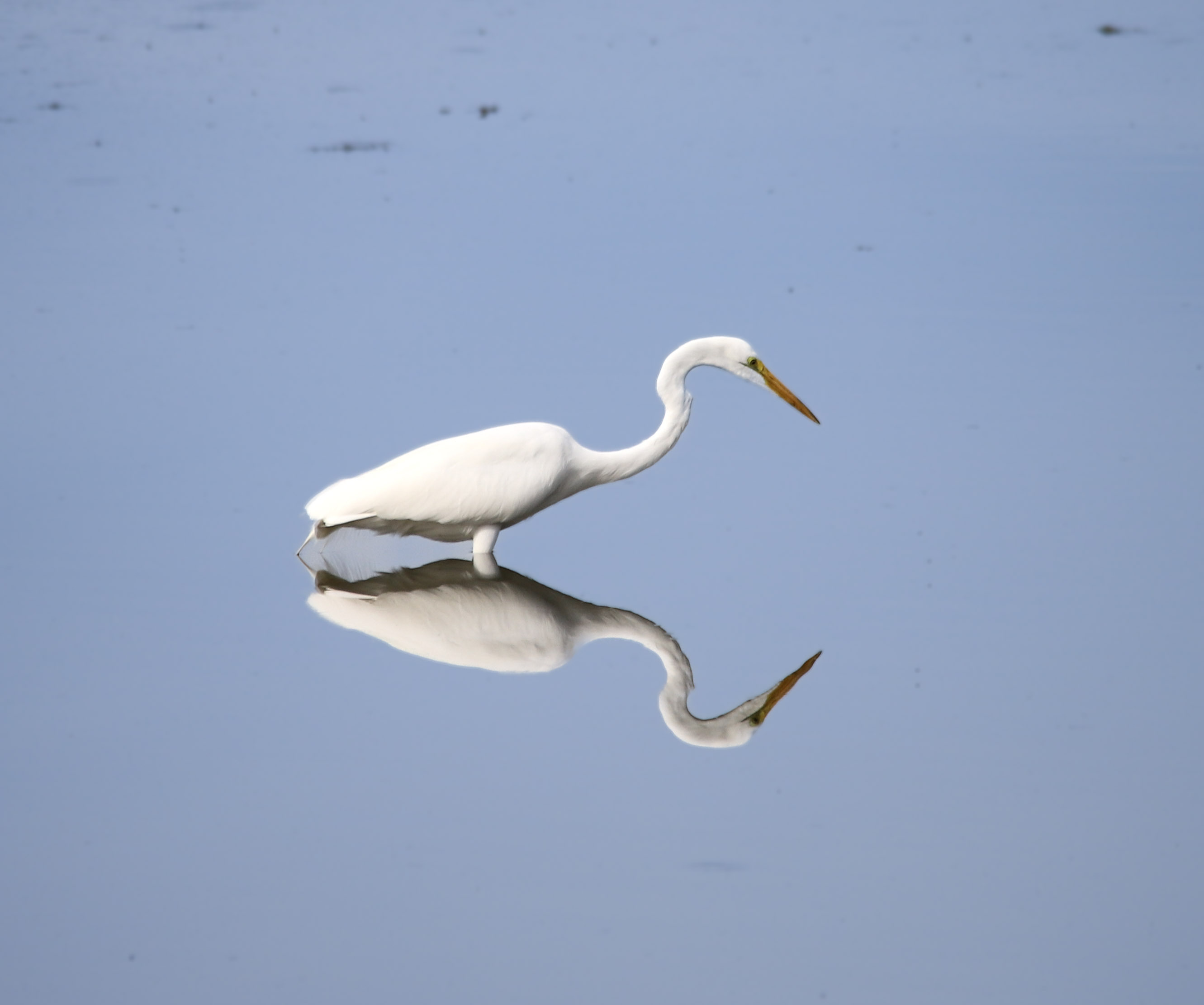
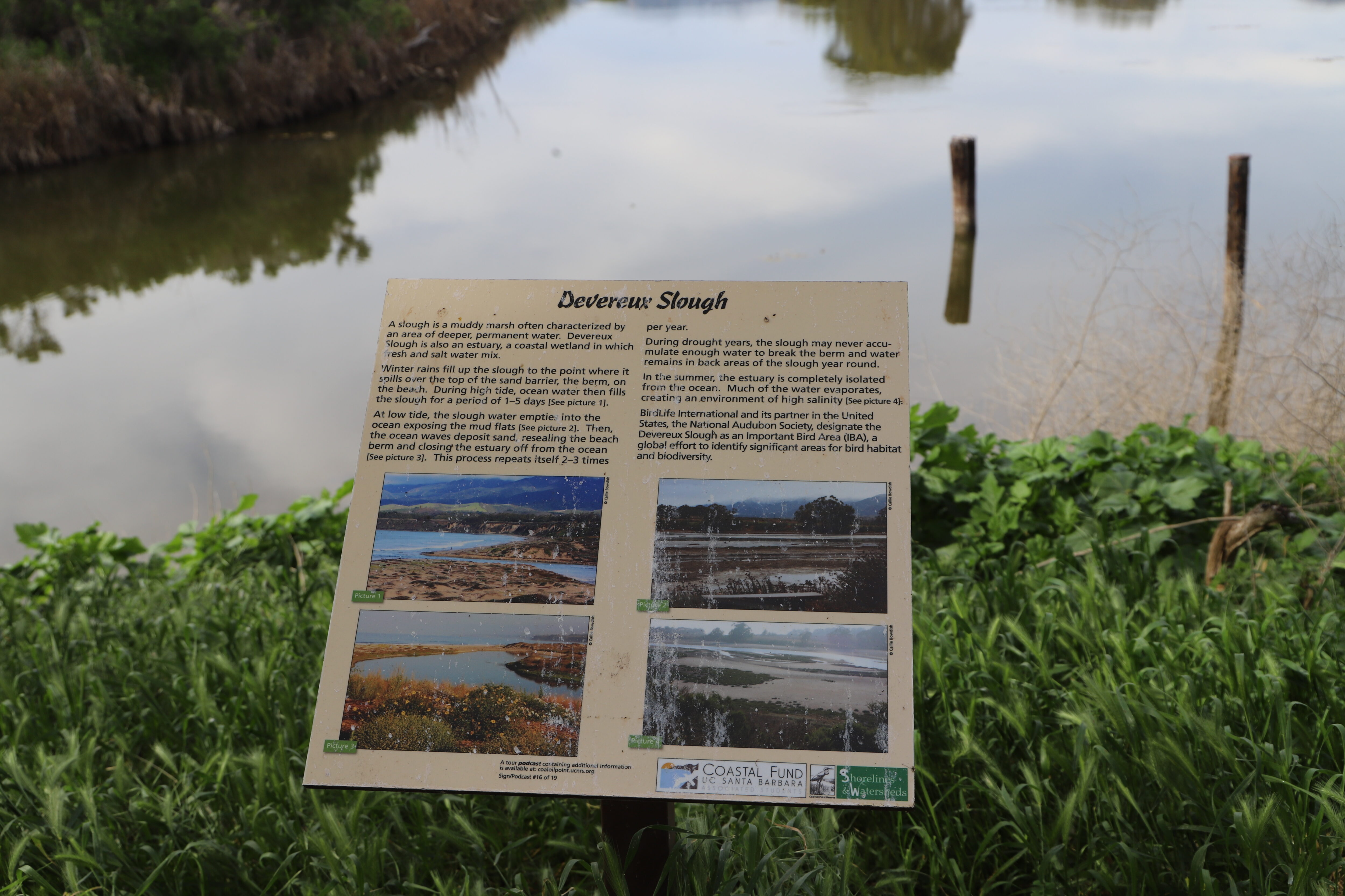
Most students at the University of California, Santa Barbara pass this place every day without fully realizing how special it is.
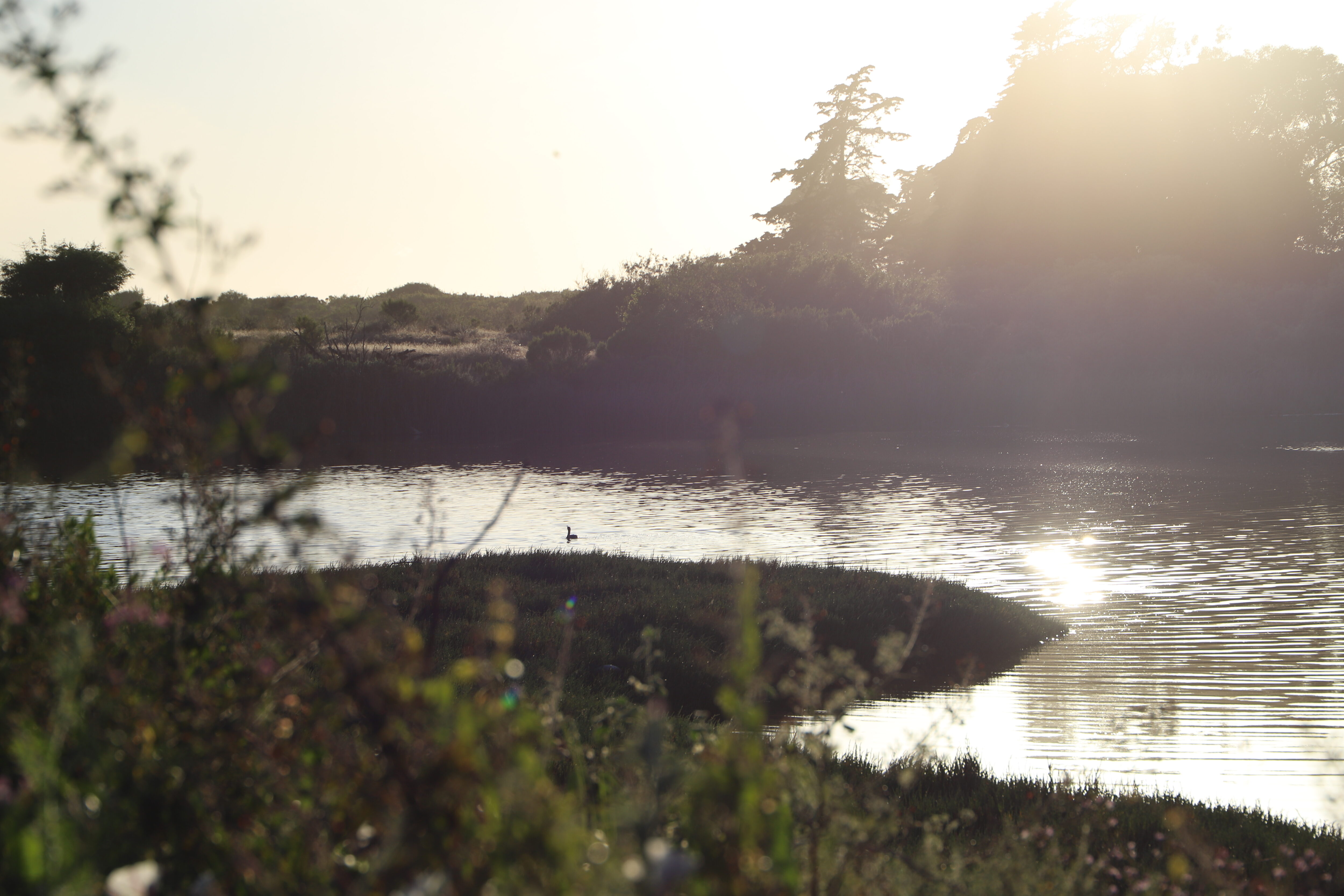
Just beyond campus sits Coal Oil Point Reserve and Devereux Slough, a tidal wetland shaped by shifting water and a surprising abundance of life. What might look like an open stretch of land from a distance is actually a dynamic, water-connected landscape.
We asked UCSB students what this place means to them.
“It just feels like a quiet break from everything, even if you’re right next to campus.” — UCSB Environmental Studies Student
More Than Open Space
Coal Oil Point Reserve spans over 170 acres and protects a mix of coastal habitats, including salt marshes, estuaries, dunes, grasslands, and seasonal wetlands. At the center of it all, Devereux Slough shifts throughout the year, sometimes filling with water and at other times drying into salt flats and shallow channels.
That constant transformation is part of what makes the landscape so compelling. It moves and responds, changing with the seasons.
“Spaces like Coal Oil Point give students a controlled but natural environment to not just conduct research in, but also connect to it. These spaces allow UCSB undergrads to be as close as possible to some of our beautiful native wetland species, such as great blue herons, brown pelicans, garter snakes, slender salamanders, and countless more wildlife.” — UCSB Seeds Club Communications Chair
A Landscape Full of Life
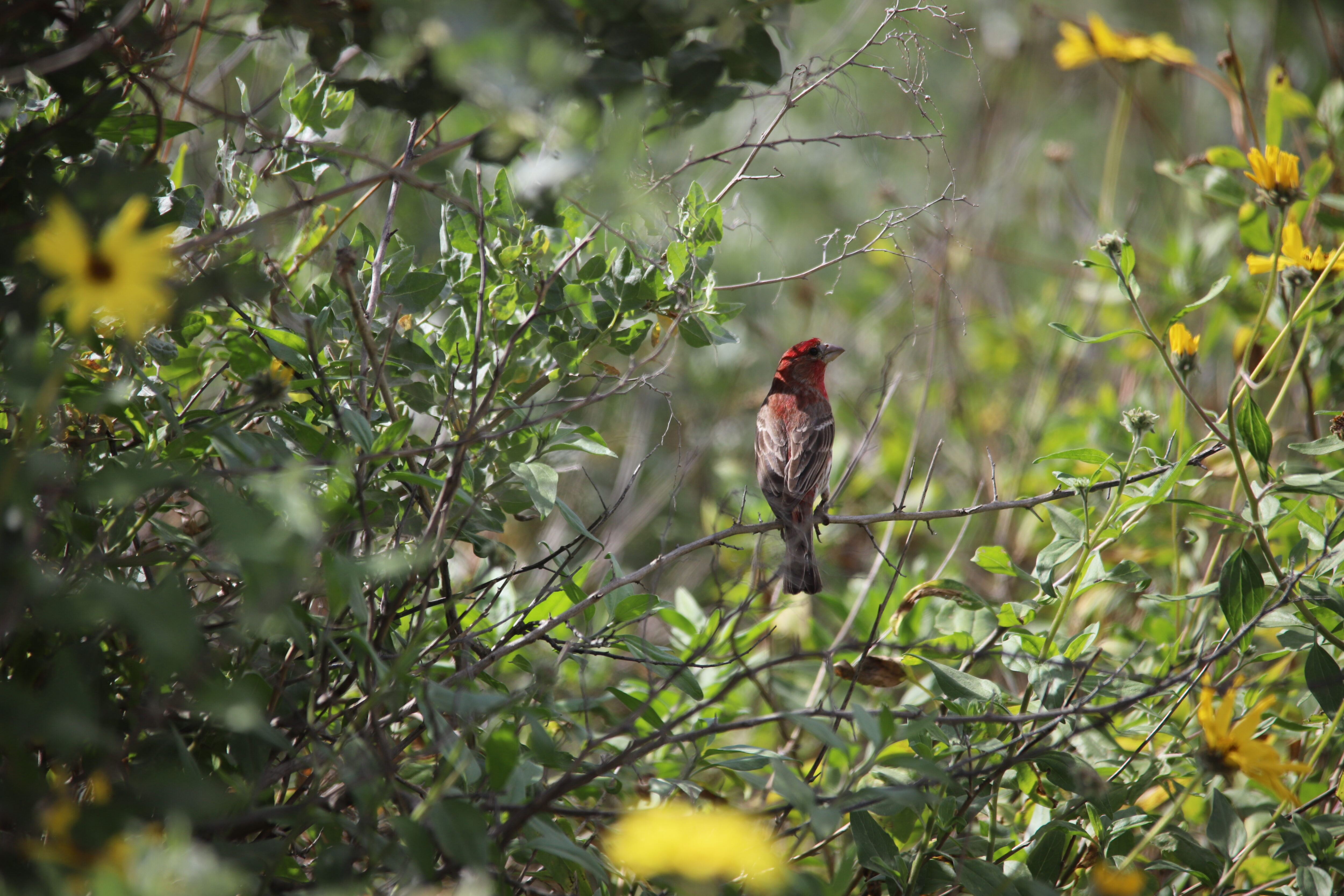
Look closer, and the wetland reveals itself as a place full of activity. Birds move through the area in large numbers using the slough and surrounding habitats to rest and feed, as well as lay their nests.
Coal Oil Point is especially known for the western snowy plover, which is a small shorebird that relies on this coastline. Each winter, hundreds gather here, which makes it one of the most significant sites for the species in the United States.
“Once you actually stop and look, there’s so much going on. Birds and so many sounds, it’s definitely way more alive than you might think.” — Earth Sciences UCSB Student
“I didn’t realize how important the area is for wildlife until one of my classes talked about it. It really makes you want to visit it more during the school year.” — UCSB Student
What People See in a Place Like This
People connect to landscapes like this in different ways. For some, it’s about wildlife. For others, it’s about peace and simply having a place nearby that feels different from everyday routines.
“It’s just nice that it’s there. Like you can go out and it’s quiet for a second, even during midterm seasons when things get hectic.” — UCSB Geography Student
“It’s really pretty at sunset. That’s honestly when I notice it the most.”— UCSB Biological Studies Student
“As an environmental student, it’s kind of a reminder for me that there’s really ecologically important functioning habitat right next to all this developed space.”— UCSB Environmental Studies Student
Why It Matters
Places like Devereux Slough are easy to overlook, but they play a critical role in coastal ecosystems. Wetlands filter water, provide habitat, support biodiversity, and connect land and ocean systems in ways that are not always visible.
They also offer a way for people to connect with water and nature in their everyday lives.
“It reminds me that we live in nature, not just around it, and we should always keep working to ease the integration of people with our environment.” — UCSB Coastal Fund Board Member
Coal Oil Point sits at the boundary between campus life and a living, changing ecosystem. It’s a place many students enjoy for recreation, whether they are jogging, biking, doing wildlife photography, or having a picnic. Students fill the area. Once they notice it, community members throughout Goleta find themselves returning to the peaceful haven.
A Closing Reflection
Over the past year, as American Rivers’ Communications Intern, I’ve spent a lot of time thinking about the connection between people and the natural places around them. It could be a nationally recognized river system or a quiet wetland beside a college campus, and in both cases, I’ve found that these landscapes matter because they give people a chance to pause and remember that nature is a central and meaningful part of our everyday lives.
That’s part of the power of conservation storytelling. Sometimes protecting a place means starting with simply noticing it.
The next time you walk past your town’s natural oasis like Devereux Slough, I suggest you stop for a few minutes. Watch the birds glide across the water and listen to the breeze through the tall grasses, maybe even sit quietly at sunset before heading back into the rush of the day.

As my time with American Rivers comes to a close, it feels fitting to end with a place like this one. This is a place that reminds us that even in the middle of busy lives and constant movement, there is still value in slowing down long enough to connect with the landscapes around us.
Places like Devereux Slough reveal that the natural spaces woven into our everyday lives are both beautiful and deeply worth protecting for our future generations.
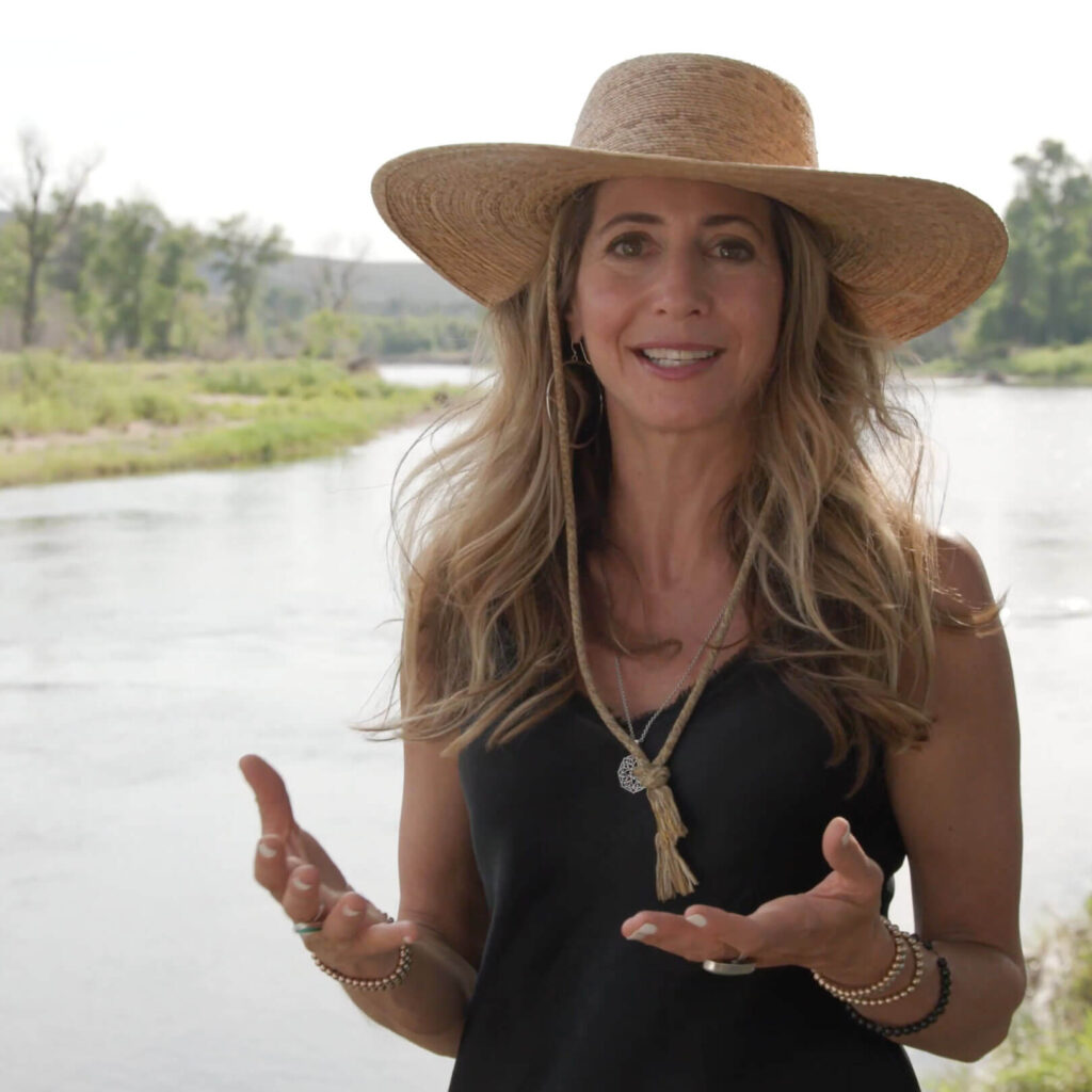
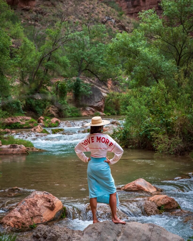
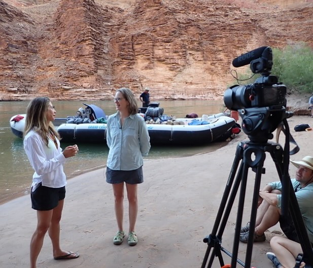
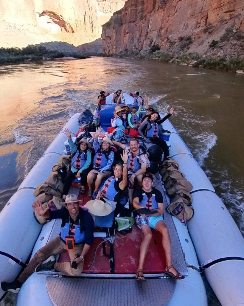
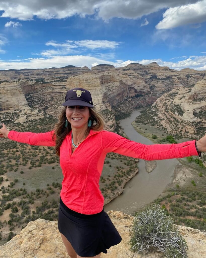
Tillie Walton is a conservationist, hydrologist, river guide, and the host of the PBS series, Wild Rivers with Tillie. She is also a dear friend of American Rivers.
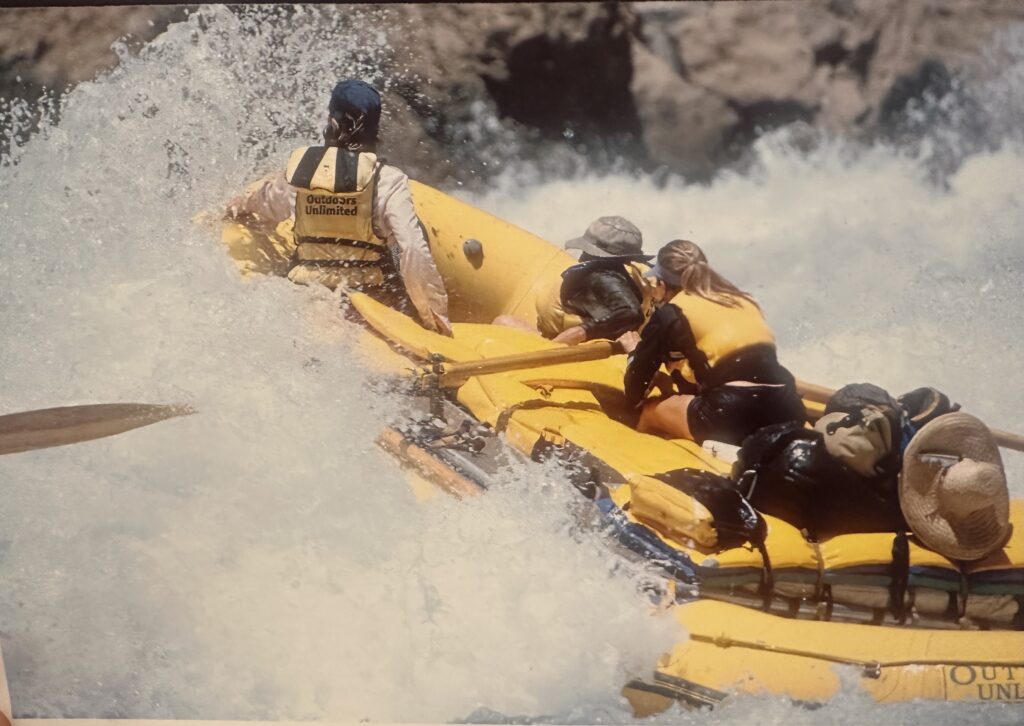
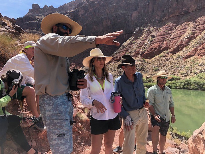
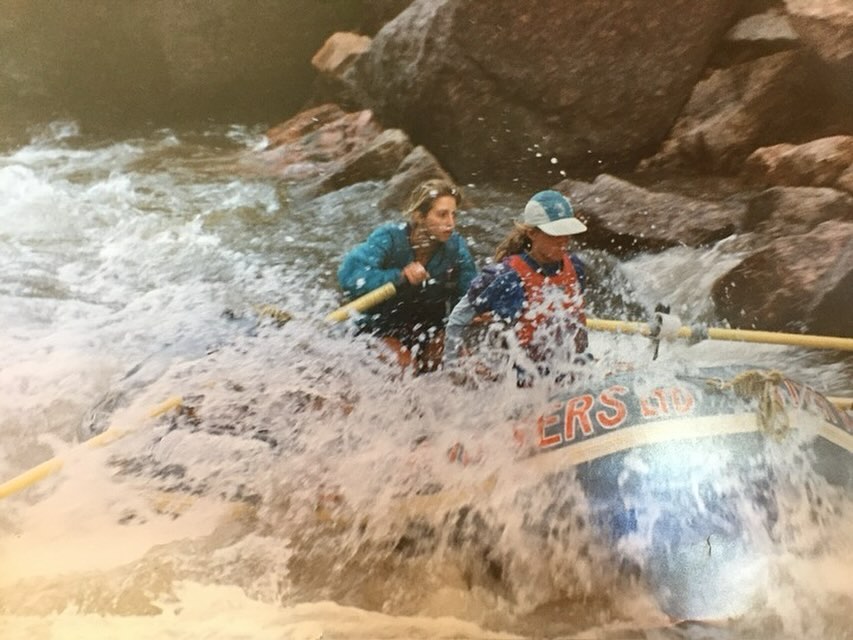
In season 1 of Wild Rivers with Tillie, she brought viewers down some of the West’s most beloved rivers. Some face perilous threats, and others offer a playbook for how to protect and preserve these cherished bodies of water. Viewers can join Tillie on the Rogue, the Colorado through Glen and Grand Canyon, the Yampa, and on the Snake. Throughout the season and on each of the rivers she explores, Tillie engages experts in thoughtful conversation about conservation, drought, and the future of the rivers that tether us to the landscape and to each other.
We had the opportunity to ask Tillie a few questions about the inspiration for her work (including hosting the show), some fun behind-the-scenes anecdotes, and what else she’s been working on (Tillie doesn’t sit down much)…
1) Tell us about the first river you remember spending time on.
What made the biggest impact on me was a 3-week trip in Big Bend National Park as a senior in high school. We spent three days canoeing on the Rio Grande through Santa Elena Canyon, and that changed my life forever. We were all inner-city kids, and some of us didn’t know how to swim. We were given these tippy little canoes, and I was secretly glad that I was with the instructor because I really did not want to flip my canoe! I was terrified.
At one point, the instructor told me, “I want you to put your paddle down.” I said, “What?” He said, “Put your paddle down, lie back, and just keep your eyes open.” And as I leaned back, I felt the river underneath me, the canyon walls towering around me, and the sky passing above me. We were drifting along the river, meandering through the canyon walls, and I don’t know how to describe it, except that something just clicked. And I instantly knew, this is it. This is what I want to do, and since then I’ve never looked back. That trip changed my life, and I’m so grateful.
2) Why dedicate so much of your life to rivers?
Honestly, it never occurred to me not to. Rivers have truly shaped who I am, and I feel most like my true self when I’m on a river. There are so many life lessons that the river teaches us, and in my career as a Grand Canyon guide, I saw how the river can open us up to something larger than ourselves and connect us to each other – regardless of politics, religion, socioeconomics, etc.
I’ve witnessed people light up, laugh, play, and heal by spending time on the water. And even though rivers can be intimidating, I’ve found my sense of peace and connection by being on, in, and around rivers. I want everybody to have the opportunity to experience that sense of awe, wonder, peace, connection, and freedom. It’s part of what I hope to give back to the world.
-
Havasu Creek, Grand Canyon -
Tillie and David Yetman filming at the Hance Rapid | Dan Duncan -
Sunshine Falls, Arkansas River -
Tillie and Margaret Bowman filming in the Grand Canyon
There are so few places that we can go in this world that give us a chance to quiet our minds and just really connect with something that’s beyond ourselves. Rivers put our smallness as humans into perspective, as well as our infinite grandeur. And I want to help preserve and protect these places.
Perhaps you could describe my drive for doing this as a love affair with the river, and sometimes with love, you have no choice—it’s just part of who you are.
3) What are the best, worst, and weirdest parts about filming season one?
Well, the best part is the people I’ve gotten to meet—from Native American leaders to conservative ranchers to river-running hippies. Talking with folks and recognizing that, despite how different our outer appearances may be, people are saying the exact same thing about their connection to the land and the river.
It always amazes me how much people truly care about these places and how much they are doing to protect the land and rivers in their own ways.
I also love getting to explore wild rivers, like the Devil’s River (which was probably one of my favorites), and go places I would have never thought to visit otherwise. It’s opened my eyes to rivers I didn’t know about and left me with a newfound sense of gratitude for our planet.
The worst part is cold river trips, disgusting hotel rooms, and all the driving. Most of these places are in the middle of nowhere and involve hours of driving with a very cramped car full of camera gear, and the three of us (Dan Duncan, our photographer and producer, the sound person, who is often a volunteer, and I) sharing a car with all of the gear for days on end. The hotel rooms can be kind of less than desirable in the middle of nowhere, but we make it work. And of course, I like warm weather, so the cold trips are not my favorite, but it’s still good to be on the river.
The weirdest (and fun) part is that Wild Rivers with Tillie is completely unscripted. River trips are unpredictable, and we are often going on the river, filming and talking with people I have just met. We never know what the storyline will be or how it will turn out until after the trip is over.
4) What is the thing that you’re most excited about right now in terms of your conservation work?
I’m most excited for the opportunity to show big love for Big Bend and the Rio Grande River. That’s the place I was talking about earlier that transformed my life. It’s under threat right now because there are plans to build a steel-structure border wall through the middle of our National Park, which will go through some of the most special places on earth and the Rio Grande River.
I hope others will realize this is a phenomenal place that needs to be protected. Our National Parks, and the rivers that flow through them, are some of America’s greatest treasures. I’m excited to have an opportunity to be a voice for that river and am always looking to get folks who are making decisions that impact these places on the river to experience it for themselves.
I’d like to issue an open invitation to anybody who is a policymaker—let me take you down the river and let the river speak for itself so that you can know why these places are truly treasures that we need to protect.
5) If you could embed everyone in the world with one piece of knowledge or understanding about rivers, what would it be?
Rivers are the exquisite jewels of our planet, and all of life depends on fresh water. Not only do rivers sustain life on an ecological and biological level, but they’re so good for the soul. I would say get out there and just spend some time by water! Water—whether it’s the ocean, rivers, lakes, taking a shower, or drinking a glass of water—it makes us all feel better!
Rivers make up less than 1% of all water on Earth. If you think of it in terms of jewelry, rivers decorate the earth like rare, beautiful, glistening diamond necklaces that sustain and support all life. These are the most exquisite gems of our planet, and I really wish that we could learn to take care of them as such. So learn about your local river, enjoy time on it, and learn what you can do to protect it.
Want to experience a river right now? Check out THIS immersive trip down the Grand Canyon that Tillie and her team created.
Voters throughout the West continue to care deeply about the protection of clean water and public lands as well as the wildlife habitats they contain. The values protected by Wild and Scenic Rivers are the same values that Western voters consistently say they care about. Across roughly 15 years of polling in the West, including Colorado College’s Conservation in the West poll, the University of Montana’s biannual Public Lands Survey, and polling by the Center for Western Priorities, voters have consistently identified access to clean water and public lands, as well as wildlife protection, as top priorities.
The Wild and Scenic Rivers Act is designed to safeguard exactly those kinds of values and resources. Congress created the National Wild and Scenic Rivers System in 1968 to protect rivers that have outstanding natural, cultural, and recreational values for present and future generations. The act protects a river’s free-flowing character and water quality and preserves “outstandingly remarkable values” such as fish and wildlife, scenery, recreation, geology, history, and culture.

Clean Water, Public Lands, and Wildlife Remain Top Priorities Across the West
Colorado College’s 2026 Conservation in the West poll covering Nevada, Idaho, Montana, Wyoming, Utah, New Mexico, Colorado, and Arizona provides the broad regional picture—85% of voters said issues involving public lands, waters, and wildlife are important in deciding whether to support an elected public official. That support resonated on both sides of the aisle, with nearly 8 in 10 Republicans and more than 9 in 10 Democrats saying those issues matter greatly to them. Those numbers do not mean every voter agrees on every designation in every place. What it does demonstrate is that the underlying values of Wild and Scenic Rivers still matter to voters across the region, including Republicans and Independents. When people hear “Wild and Scenic,” the phrase may sound like a label. In practice, it refers to protecting exactly the kinds of river values voters already say they want to keep. These shared priorities help explain why, when voters are asked about specific rivers, support carries through to long-term protections and, in some places, to Wild and Scenic River designation.
In Eastern Idaho, Priorities Translate to Local Rivers
A May 2025 poll in eastern Idaho shows this connection clearly. The survey polled registered voters in six eastern Idaho counties, with roughly two-thirds of respondents identifying as Republican.
These voters, who live at the headwaters of the Snake River system, were asked what they found most convincing about protecting local rivers. Fish and wildlife habitat emerged as the top reason, followed by economic benefits and clean drinking water. The results show that many voters view river protection through concrete benefits like wildlife habitat, clean water, and community well-being.
The same poll found that voters identified water pollution and increasing development pressure along riverbanks as the two biggest threats to eastern Idaho’s rivers. These concerns reflect the kinds of threats that long-term river protections are designed to address.
Support Carries Through to Wild and Scenic Designation
This pattern is not limited to just general attitudes about rivers in specific places. When voters are asked about specific designations, support remains strong.
The University of Montana’s Public Lands Survey in 2020, 2024, and 2026 found strong voter backing for designating the Gallatin, Madison, and other rivers near Bozeman, Montana, as part of the Wild and Scenic Rivers System. Similarly, polling in New Mexico shows broad agreement with protecting the Gila River watershed. A 2020 statewide poll found that more than three-quarters of voters support designating portions of the Gila and San Francisco Rivers as Wild and Scenic Rivers, including clear majorities in counties surrounding the rivers themselves.
Together, these findings reinforce a consistent trend across the West that when voters are asked about real rivers and real places, support for Wild and Scenic River designation remains strong.
As Congress considers bills like the Greater Yellowstone Recreation Enhancement and Tourism Act and the M.H. Dutch Salmon Greater Gila Wild and Scenic River Act, these polls offer a clear message. For more than a decade, Western voters have consistently expressed their support for clean water, wildlife, and protected rivers. The opportunity now is for their public lands champions in Congress to act on those priorities and move these bills across the finish line this session.
The Through Line
Polling does not replace local knowledge and river management plans or the careful work that goes into any proposed designation. But it helps answer a broad, important question: Do the values behind Wild and Scenic Rivers connect with Western voters? The evidence here suggests yes.
Across the West, voters continue to say that public lands, clean water, and wildlife matter to urban and rural ways of life. In New Mexico and Montana, those same values translated into strong support for protecting rivers through Wild and Scenic River designation, demonstrating how broad priorities for clean water and wildlife carry through to specific rivers and real policy decisions. Wild and Scenic Rivers protect the qualities that make rivers matter, and many voters across party lines favor protecting those qualities.
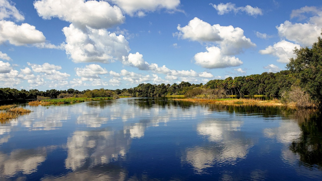
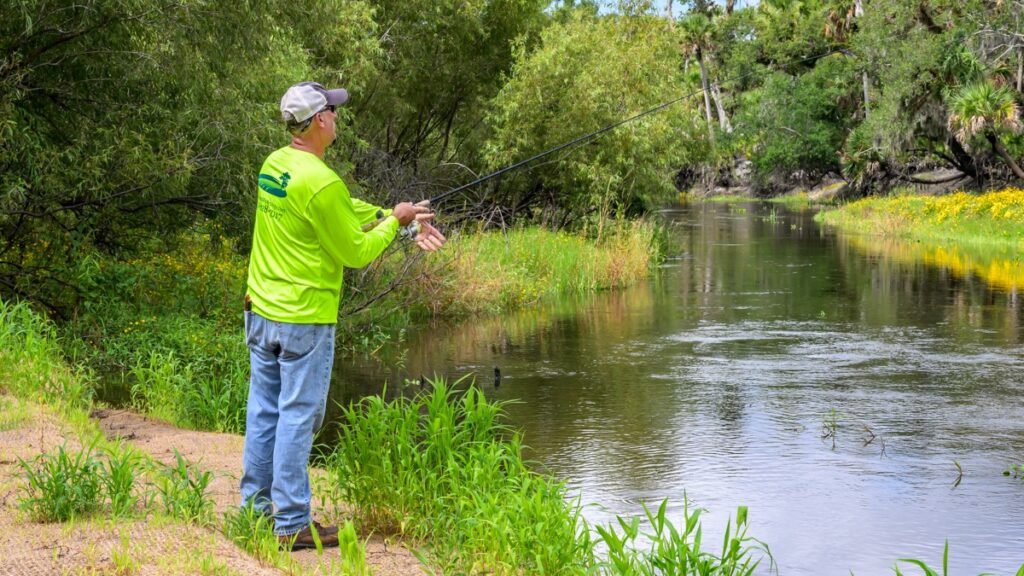
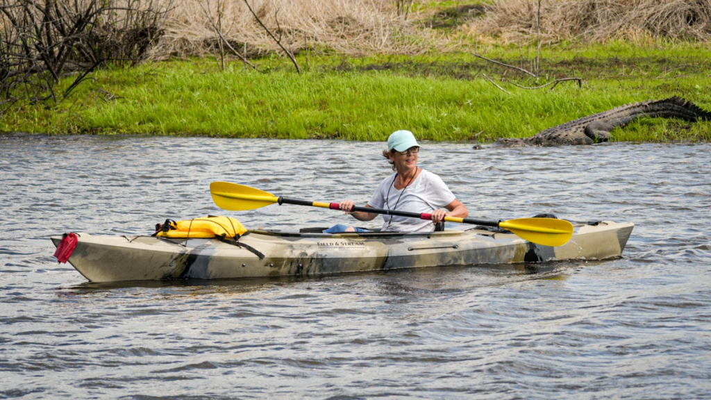
A river with deep local meaning
The Myakka River is woven into everyday life in Sarasota County, Florida, with sunny mornings on the water, fishing, and paddling along the gentle waters with the occasional manatee sighting, if you’re lucky. Like all rivers, its value lies in many things at once. It is a habitat. It is a livelihood. It is clean water. It is local identity, and the backdrop for the memories people carry with them. It is dollars and cents in the pockets of local businesses. It is also part of a larger watershed that connects people together and to the beauty around them amid one of the fastest-growing areas in America.
The Myakka is a rain-fed river, rising and falling with the seasons, sometimes shrinking back to expose dry stretches of riverbed and then filling again with the next rains.
Miri Hardy, founder of the Myakka River Partnership and a longtime advocate for the river, alludes to its emotional pull. She describes what she calls “The Myakka’s magic … it’s just one of those places that gets under your skin.” Her accounts of the river’s meaningful connection to people in the region reflect a broader pattern where people form strong, lasting connections to specific natural backyard places.
Why the Myakka is a case study in cooperative conservation
The Myakka is an inspiring example of how local commitment can shape national conservation efforts through a rich history of cooperation and dedicated river stewardship.
The Myakka River Management Coordinating Council was established in 1985 under Florida’s Myakka River Wild and Scenic Designation and Preservation Act, state-level protection enacted to coordinate management of the river across state agencies.
As Hardy puts it, federal designation is “icing on the cake, but you have to have the cake first.” In other words, federal Wild and Scenic River designation builds on committed, long-term local and state-scale conservation efforts.
That foundation is also part of what has generated strong local enthusiasm to protect the Myakka and its magic. Hardy says, “You just say ‘Myakka’ and their face … it just relaxes, and it breaks into a smile.” For many in Sarasota County, the river is tied to a shared sense of place.
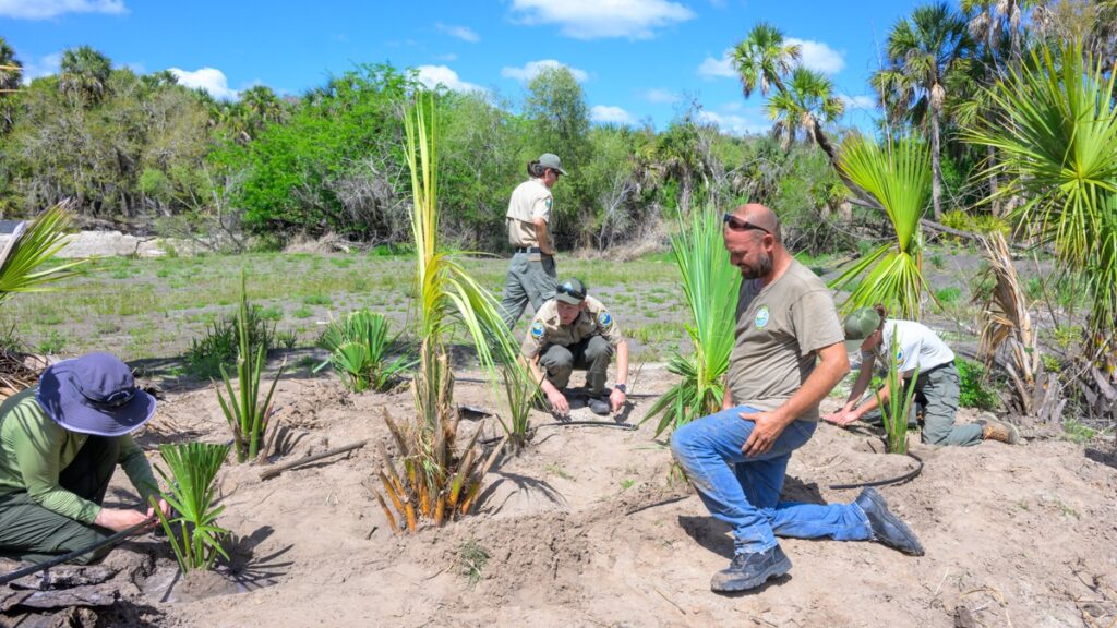
After decades of local effort in one of the fastest-growing regions in the country, residents and advocates recognized that protecting the river would require more than local commitment alone. Ensuring its future meant pursuing protections at the federal level.
Enter Rep. Greg Steube (R-FL-17) and Sen. Rick Scott (R-FL) and the Myakka Wild and Scenic River Act of 2025—a major step towards federal protection.
Established in 1968, the Wild and Scenic Rivers System keeps rivers free-flowing, protects their water quality, and preserves their natural, cultural, and recreational values for future generations. The law that created this special river system was enacted in recognition of the important role that rivers play in communities and for wildlife.
With federal designation, the magical Myakka will join 18 other rivers protected as Partnership Wild and Scenic Rivers. These 18 rivers flow through a patchwork of public lands, private property, and various local jurisdictions in eastern states, as opposed to Wild and Scenic Rivers in the west, which cross vast expanses of public lands. Partnership Wild and Scenic River designations bring together communities, tribes, nonprofits, and local governments before designation to hammer out a clear plan for managing rivers across jurisdictional boundaries.
Rivers do not recognize our maps and boundaries. Flowing across public and private lands, they connect people and places in ways that demand shared responsibility. That’s where Partnership Wild and Scenic Rivers designations shine. By empowering local communities to lead, this approach brings people together across property lines to protect what they share. Rivers may not follow our boundaries, but through collaboration, they can benefit from lasting protection.
A broader lesson for river protection
The story of the Myakka River offers a larger lesson for our nation. Our 4.4 million miles of rivers are alarmingly under-protected. Roughly 80% lack adequate safeguards, and about two-thirds have no protection at all. Meanwhile, community demands on these waterways are growing, and the threats they face—from extreme weather to pollution—are increasing. Wild and Scenic River designations remain our strongest tool to ensure these rivers continue to support people and wildlife for generations to come. After all, freshwater is one of our nation’s most valuable resources.
People connect to rivers in many ways, but those bonds create a shared understanding of why protecting them matters. Partnership Wild and Scenic Rivers offers a locally focused approach, recognizing that protection can take different forms depending on the landscape and the community involved. The Myakka River shows what this can look like in practice.
When people feel connected to a river, they show up for it—and as the Myakka Wild and Scenic River Act of 2025 shows, that connection can turn into powerful long-term national protection.
Outside the halls of Congress, few are familiar with the legislative tool called the Congressional Review Act. Seemingly innocuous, even boring in its name, the Congressional Review Act – or CRA – is a powerful, consequential political device, and it’s increasingly being used to undermine protections for our public lands and waters.
The Congressional Review Act was first enacted in 1996 and was designed to allow Congress to review major federal regulations that are listed as rules in the Federal Register. Historically, it was used infrequently. Before 2016, the CRA had been used only once. Today, it’s often used to undo administrative rules the current Congressional majority disagrees with. Still, its use as a public lands management tool is unprecedented.
The CRA was never intended to apply to presidential action under the Antiquities Act, land withdrawals grounded in statutes, or site-specific land protections. National monuments and major land protections are exercises of delegated Congressional power, not agencies interpreting law. Because of this distinction, using the CRA in the context of public lands management stretches the word “rule” far beyond how it’s been understood before.
In January 2026, the House passed a Congressional Review Act resolution to overturn a mining ban near Minnesota’s pristine Boundary Waters. Shortly after, the Government Accountability Office issued a groundbreaking opinion concluding that the Bureau of Land Management’s 2025 management plan for Grand Staircase-Escalante National Monument could be overturned using the CRA, prompting a countdown for votes to undo protections for the Escalante River.
For the first time, environmental protections for beloved fish species like cutthroat and lake trout, mining bans in sensitive watersheds, and public lands management decisions are being subjected to the CRA and its consequences, without public input. Once rules are revoked by the CRA, the creation of similar rules is prohibited without another act of Congress.
When Congress votes to overturn hard-won public lands and water protections, they are overturning years of rigorous scientific review and sidelining public input, including the voices of hunters and anglers, Tribal and local communities, and conservationists around the country. They are risking the right of all Americans to enjoy access to public lands, jeopardizing local recreation economies, and harming sources of clean water.
Our love for public lands, clean water, and abundant wildlife is something that unites us all. Our public lands deserve durable protection. Let’s remind our elected leaders that the Congressional Review Act shouldn’t be used to permanently strip protections from public lands and waters.
We all need clean, safe water for our families — no matter where we live or what we look like. Much of our water comes from rivers, which also provide crucial habitat for fish and wildlife. Our economy, farms, and cities depend on river water for growth. And rivers give us ways to connect with nature and each other.
But America’s rivers are losing their life-giving power – choked by dams, contaminated by pollution, and overwhelmed by increasingly severe floods and droughts. This is not just an environmental tragedy, but a profound threat to our health, communities, and safety. We can still protect our vital lifelines, but we have to do it quickly.
This is why, each year, American Rivers issues America’s Most Endangered Rivers® – a call to action for the rivers we all depend on.
In the unenviable lead position on the America’s Most Endangered Rivers® list this year is the Potomac River. This river, threatened by both data center expansion and pollution, exemplifies how the compounding threats our rivers are facing can collide, creating impacts that can reverberate far downstream.
Each year, in partnership with local advocates and communities, the report draws attention to urgent threats and the solutions needed to protect the rivers that sustain us all. At a time when new and emerging pressures are reshaping how we manage water, acting now has never been more critical.
America’s Most Endangered Rivers® of 2026: 10 Rivers in Need of Your Help
- Potomac River: The rapid, unchecked buildout of data centers along the Potomac River threatens the drinking water for our nation’s capital and surrounding areas, while a historic sewage spill raises alarms about aging infrastructure.
- San Joaquin: A massive gravel mine proposed along the river would jeopardize drinking water supplies for the Fresno region and reverse major salmon restoration progress.
- Boundary Waters Canoe Area Wilderness: The Twin Metals mine would bring acid-mine drainage to an iconic wilderness—endangering clean water, wildlife, and a major outdoor recreation economy.
- Lumber River: Toxic “forever chemicals” known as PFAS and other industrial pollution are pushing this Wild and Scenic River to the brink.
- Rogue River: Mining pollution and the potential loss of Roadless Rule safeguards threaten this river’s remarkable salmon runs and incredible recreational value.
- Chilkat River: The ongoing development of a large–scale hard rock mine threatens habitat for fish and wildlife and would irreparably harm Alaskan Native communities.
- Nissequogue River: A failed dam that freed a major section of Long Island’s largest river might be replaced, threatening fish and wildlife recovery.
- Dan River: Fossil fuel pipeline construction threatens drinking water supplies with pollution and increased flood risk for downstream communities.
- Amargosa River: Mining operations threaten drinking water supplies and the unique fish and wildlife that depend on this desert lifeline.
- Suwannee River: Excessive water withdrawals, sewage, and agricultural pollution are testing this river’s limits in the extreme.
America’s Most Endangered Rivers® has a long history of driving real change. For 41 years, this campaign has built momentum behind solutions that protect clean water and healthy rivers. Our nation’s 4.4 million miles of rivers deserve nothing less than our best.
This year’s endangered rivers can become tomorrow’s success stories if we act now. Learn more about the rivers at risk in 2026 and take action today!
The situation is clear: the precipitation outlook in the Colorado River Basin is dire, the river cannot sustain the demands placed on it, and this year we’re likely to face unprecedented management decisions with potentially catastrophic consequences.
Despite decades of warnings and years of negotiations, there remains no clear blueprint for how the West can live with less water. That future is no longer hypothetical—it is already here.
We often talk about the Colorado River and drought in ways that can feel removed, impersonal, abstract, and buried in jargon. But beneath the stories, there are real lives, livelihoods, ecosystems, and traditions that make the region what it is, and that are very much at stake.
On March 3, for example, the US Drought Monitor released their latest report, revealing that “snow water equivalent” is less than 70% of normal across the Central Rockies, and less than 50% in the Four Corners.
Snow water equivalent is essentially how the water in the snow translates to real, wet water – the kind rivers and people rely on. By some accounts, the prediction for this year’s total is now on par with – and potentially worse than – 2002, which previously held the record for one of the worst water years on the Colorado River. For those who live in the region, the catastrophic wildfires of 2002 are not abstract: the Hayman fire burned for over a month, killed six people, destroyed more than 600 homes, and amounted to estimates of $42 million worth in damages. That same year, Arizona experienced the Rodeo-Chediski fire, which burned nearly half a million acres.
But it isn’t just one fire in one year – throughout the Southwest and in California, regions are experiencing some of the largest, most catastrophic wildfires in history, and they’re occurring much more frequently.
Fires are just one way that the consequences of this hydrology are real.
Bad water years are felt by farmers and ranchers crunching the numbers and being forced to make impossible decisions about land, crops, and cattle.
They are felt by entire communities and businesses facing water cutbacks and rising energy costs.
They are felt by rivers warming beyond what fish and wildlife can withstand and by forests burning hotter and longer.
They are felt most by families who can least afford the inevitable lack of access to fresh water, threats of wildfires, and energy rate hikes.
It’s not one dry year that has placed the Colorado River and all who rely on it in peril; it’s decades of drought amplified by warming temperatures and a system still adjusting, or refusing to adjust, to the reality of a smaller river. The sponge is wrung dry, and we’re a long way from re-saturation. A “Miracle May” might be welcome, but it cannot erase two decades of declining flows and depleted reservoirs to save us at this point.
Aquifers are drained.
Soils are thirsty, trees are thirsty, animals are thirsty.
And we are thirsty and grow thirstier – continuing to promise water in a region that’s long been in debt.
We cannot stop the drought or the wildfires. We cannot get more water into Lake Powell than Mother Nature will provide, without significant impacts to communities and economies.
The one thing we do have control over is how we respond. Though there are variables we can’t predict, we can control our collective actions. The reality is less water, and we must start there. With collaboration, transparency, and reliable funding, the West that is grounded in reality and capable of proactively managing scarcity rather than through litigation and denial. The opportunity to manage the river with the river itself at the core of considerations is now. And any leadership, any blueprint for the future must center the fact that without a healthy river, we can’t have healthy communities, economies, or ecosystems.
But that future is contingent upon leadership, and developing and implementing a clear, transparent, and responsive blueprint through the new interim guidelines for Colorado River management. The guidelines should, at a minimum, address the following:
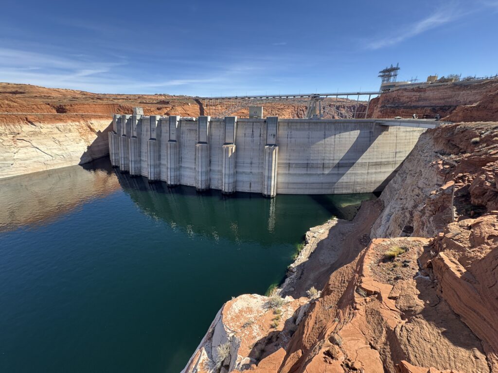
- If water managers consider emergency releases from upper basin reservoirs (such as Flaming Gorge, Blue Mesa, or Navajo) to move water into Lake Powell, how are they ensuring that each drop of water used is benefiting as many values as possible?
- How will reservoir operations at Lake Powell and Lake Mead be managed to preserve hydropower reliability while maintaining flows through the Grand Canyon, and what are the implications for energy prices and the availability of power?
- Are they considering testing the bypass tubes (which were resurfaced after damage from the 2022 simulated flood in the Grand Canyon) to see if water could be directed into the Canyon via those tubes? What do we know about the constraints on that system?
- The official elevation for the minimum power pool at Glen Canyon Dam (the point at which the dam can no longer generate hydropower) is 3,490 ft, but as the elevation declines (currently sitting at 3,530), at what point do whirlpools begin to form, sucking air into the turbines, and forcing Reclamation to shut down the turbines? In other words, can the models tell us when cavitation* will force a shutdown?
- How will flows through Glen Canyon dam be maintained into Grand Canyon, and what actions could be enacted to preserve fish and wildlife (and curtail invasive fish like smallmouth bass) and the rafting economy that depends on the flows as these lake levels decline?
- As reductions to Colorado River supplies continue to affect Central Arizona Project (a lifeline to urban centers like Phoenix and Tucson) deliveries, how will cities, tribes, and agriculture adapt, and what investments will be needed to maintain reliable supplies? What should water users anticipate? Is there a risk of the CAP going dry?
These questions are not theoretical. The current operating rules for the Colorado River expire in 2026, and the basin states and federal government are debating the next framework for managing a smaller river. The choices made in the coming months will shape how the West lives with less water for decades to come.
In short, it is both imminent and imperative that state and federal leadership plans for and communicate a response to a (very likely) severe shortage scenario. As John Fleck emphasized in his recent blog, if that planning is already happening, leaders need to “tell us what they’re going to do”.
If planning isn’t underway, the moment to step up to avoid certain catastrophe and ensure a water-secure future is now.
With forethought, collaboration, planning, and clarity, we can do more with less. But with the uncertainty we’re currently experiencing, short-term crisis response that’s poorly communicated, lacks leadership, and is temporary in nature will only result in greater losses of life and livelihoods.
The Colorado River will continue to shape the future of the West. The question is whether we confront reality now—with planning, cooperation, and investment—or continue reacting to crisis. Leadership today will determine which future we inherit. We urge, and we’re not above pleading, leaders to guide us into a future where the river flows, and our realities ebb and flow with it, instead of at its expense.
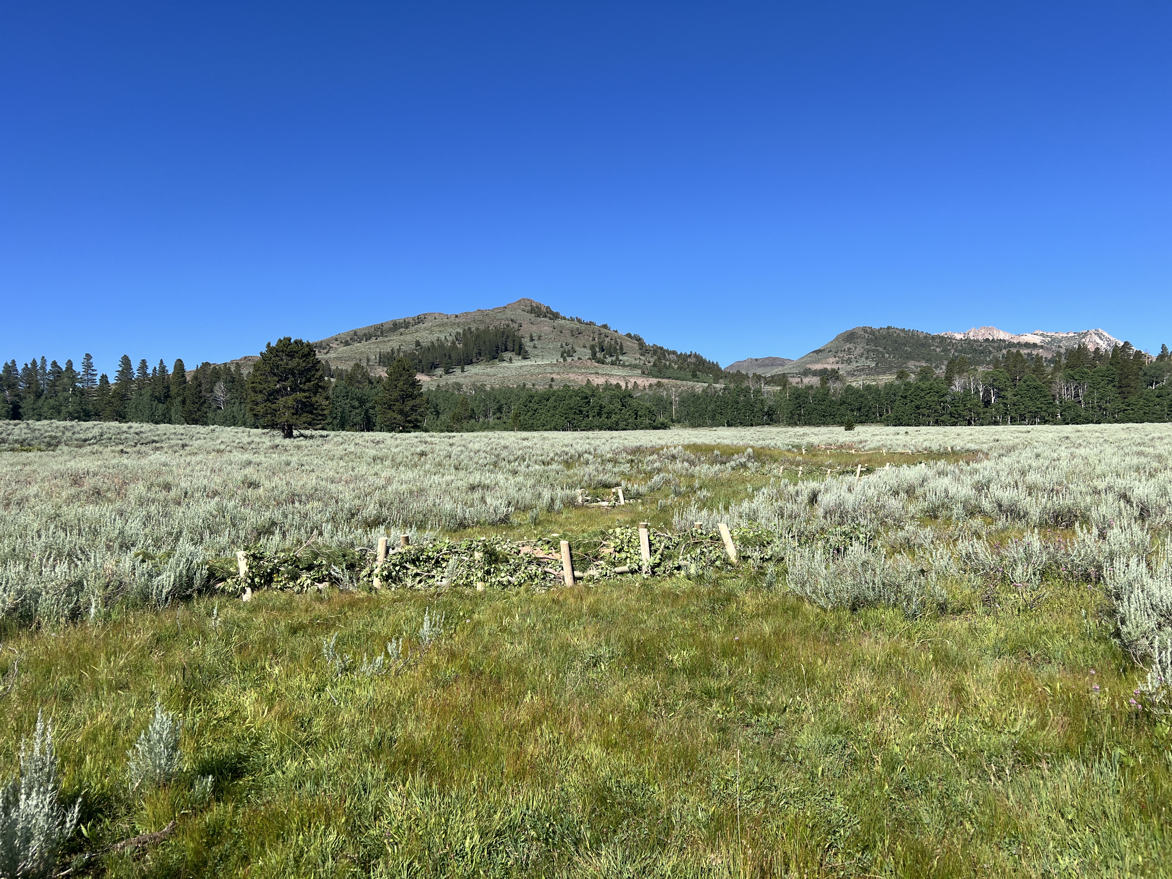
What an amazing year for river restoration in California–from the Oregon border to the U.S.-Mexico border to the south. We saw salmon return to the upper watershed of the Klamath River for the first time in over a century. We broke ground and completed a massive floodplain restoration project at Great Valley Grasslands State Park in California’s Central Valley. We moved the needle on cleaning up the Tijuana River and protecting the communities of San Diego County. But California is a big state–the fourth largest economy in the world and larger in area than Germany and Japan. Sometimes it helps to zoom in. In the Sierra Nevada, our headwaters team has been restoring meadows across the range and planning for the future–healthy biomes in one of the world’s most stunning and biodiverse mountain ranges.
Ackerson Meadow
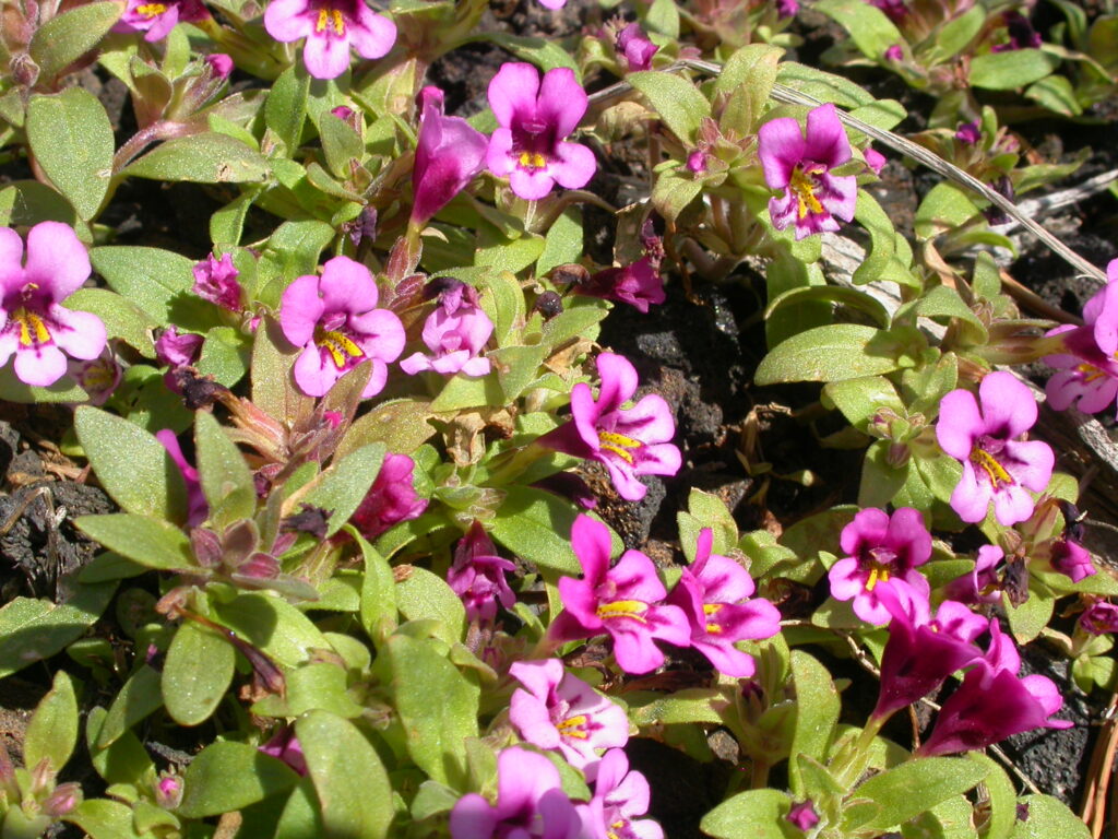
The landmark restoration at Ackerson Meadow finished in the summer of 2025, kick-starting the recovery of a meadow that had been dewatered and degraded the meadow for the last century. Now we see the return of native meadow plants like the slender-stemmed monkeyflower and wildlife like the Great Gray Owl and Northwestern pond turtle. This was the largest wetland restoration in the history of Yosemite National Park, and a powerful collaboration between American Rivers, National Park Service, US Forest Service, Yosemite Conservancy, public lands grazers, and many funders. Stay tuned for a new video about the project and its ongoing development!
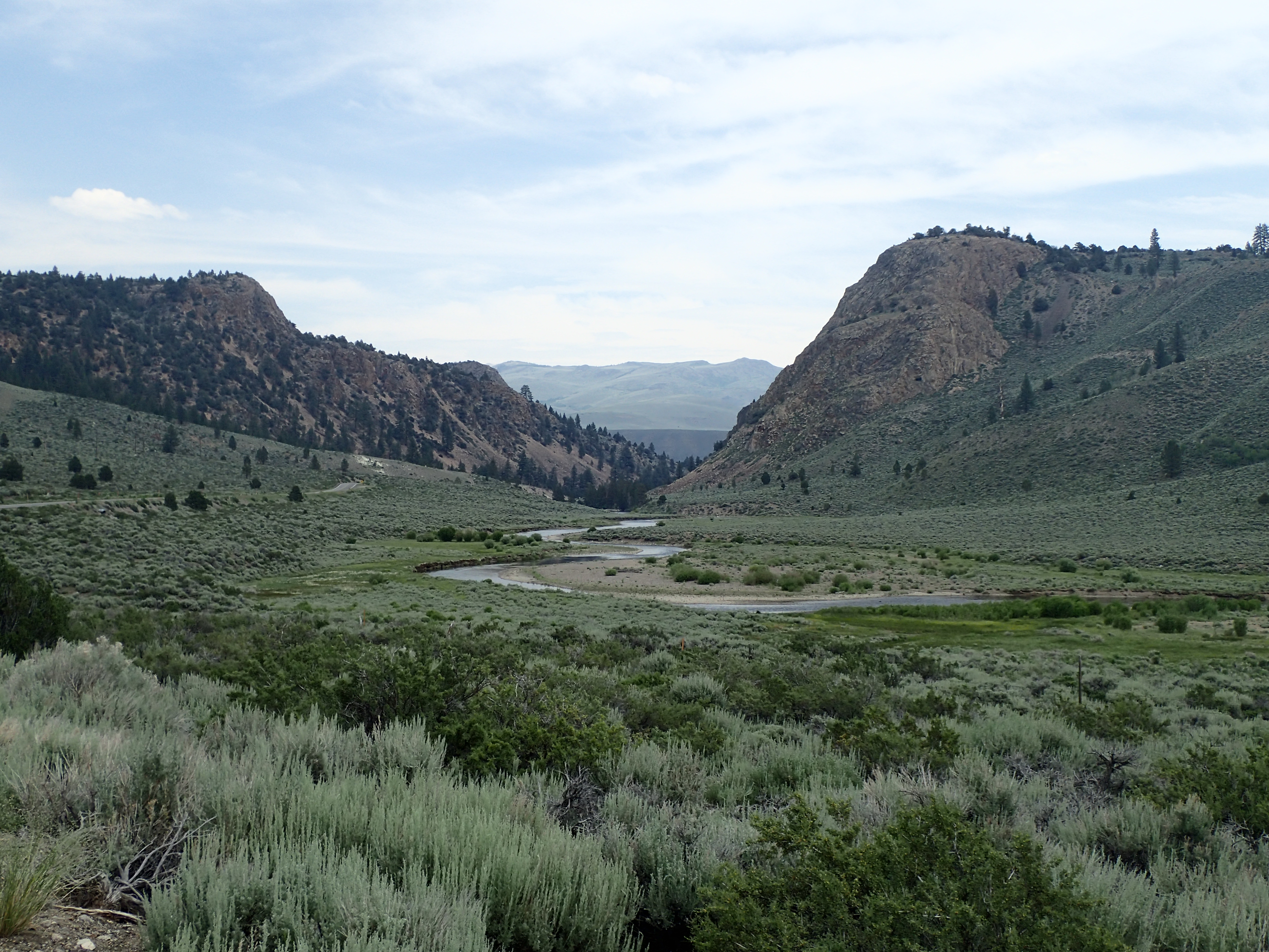
Confluence Meadow
The restoration at Confluence Meadow nears completion!. By reconnecting Pine Creek and Little Harvey Creek to their meadows, we can reduce erosion and allow water to spread and soak back into the landscape to ensure more water flows into Pine Creek rather than draining out through incised channels. A healthy Pine Creek provides important spawning habitat for Eagle Lake Rainbow Trout, a species found only in the Eagle Lake watershed. Our monitoring shows groundwater staying closer to the surface for longer, helping wet meadow habitat recover and stay green later into the season. And the impacts go further! Native vegetation has re-established across treated areas, stabilizing soils and improving habitat for wildlife, while ongoing work on the site continues to strengthen the meadow’s long-term resilience.
Grouse Meadow
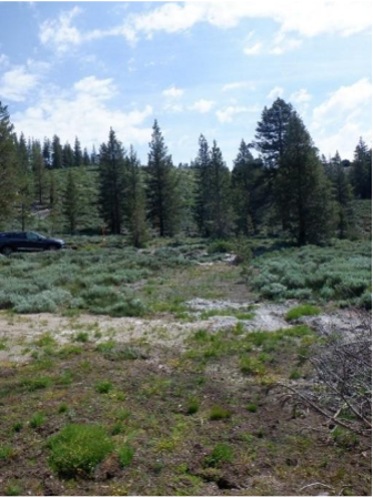
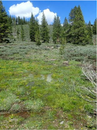
We completed restoration at Grouse Meadow in the West Walker River watershed this past July 2025, replacing a culvert with a low-water crossing to prevent degradation, building beaver dam analogs in an adjacent tributary, and filling and stabilizing several headcuts throughout the meadow. Now we will monitor the site and see how vegetation responds to restoration!
Pickel Meadow
At Pickel Meadow, also in the West Walker River watershed, we recently received nearly $5M from the CA Wildlife Conservation Board to restore this 450-acre meadow. This effort, in partnership with the California Department of Fish and Wildlife and the US Forest Service (Humboldt-Toiyabe National Forest) will impact the ecology of this critical habitat and expand recreational opportunities, reconnecting a 3.2-mile section of the West Walker River to its historic alluvial fan, restore over 250 acres of wet meadow habitat, and enhance habitat through revegetation and the installation of in-stream features. It will also improve a water diversion to prevent fish entrapment, improve water supply for local grazing, protect a spring with wildlife-friendly fencing, and create a parking lot and trail improvements. And we are set to begin construction in summer 2026!
Lower Sardine Meadow
Sometimes restoration work needs follow-up. Working with the US Forest Service Humboldt-Toiyabe National Forest, American Rivers restored Lower Sardine back in 2019, but our site monitoring suggested that small tweaks were needed. We have adaptive management planned for fall 2026 to ensure the success of the restoration. We’ll be placing wood and rock in places where channel incision is starting to form, revegetating a former parking lot, enhancing a public trail, and removing small lodgepole pines that are encroaching on the meadow. We can protect this precious meadow for future generations.
Forni Meadow Complex
In 2025, the California headwaters team, alongside the US Forest Service Eldorado National Forest, was in the thick of planning for restoration at the Forni Meadow Complex. The Complex is made up of a group of three meadows at the headwaters of the South Fork American River in the Eldorado National Forest. We are monitoring the impacts of restoration by photographing the site over time and measuring groundwater levels to ensure our collaborative work stands the test of time. This project builds on our longstanding partnership with the Eldorado National Forest, where we have partnered to complete two other projects as part of ENF’s first meadow restoration efforts, as well as conducting the Caldor Fire meadow assessment and prioritization effort, which identified the Forni Meadow Complex as a high priority for restoration. This year, we will be busy getting ready to start the construction phase of the project, with on-the-ground restoration anticipated to begin later this summer.
On a cold and overcast day in November 2025, a small team stood at the edge of a degraded wetland in Seattle, Washington, and excitedly discussed construction plans for a wetland restoration project that had been decades in the making.
A 10,000-year-old wetland in Roxhill Park known as the Roxhill Bog is one of the few surviving fragments of a much larger peat bog ecosystem that once flourished in the Northwest. The 5.3-acre wetland is the headwaters of Longfellow Creek, which travels for about four miles before entering the Duwamish River, the only naturally flowing river that still runs through Seattle, and one of America’s Most Endangered Rivers® in 2019.
Peat bogs occur in cool, wet environments and are exceedingly rare, covering only 3% of the Earth’s land. They form over millennia from the accumulation of dead plant material and act like sponges, holding water and slowly releasing it over time. This provides stable flows and cooler water to downstream river systems during drier summer months and helps to retain water when it floods.
Peat bogs filter water pollutants and provide a home for many unique plants and animals, including sphagnum moss, bog laurel, Labrador tea, Makah butterflies, and bog lemmings. They also contribute outsized benefits to the world’s climate, storing about 30% of land carbon.
Over time, peat bogs in Seattle were drained, filled, and paved over by urban development. The remaining patch in Roxhill Park slowly dried up due to groundwater diversions, which impaired water quality, destroyed downstream salmon habitat, and limited safe public access to open recreational spaces.
“One of my colleagues at Seattle Public Utilities put it best — the bathtub is broken, the natural processes that once allowed water to remain onsite are no longer working,” said Danielle Devier, senior urban ecology analyst with Seattle Parks and Recreation. “Repairing the broken bathtub is one of the best ways to rewet the bog.”
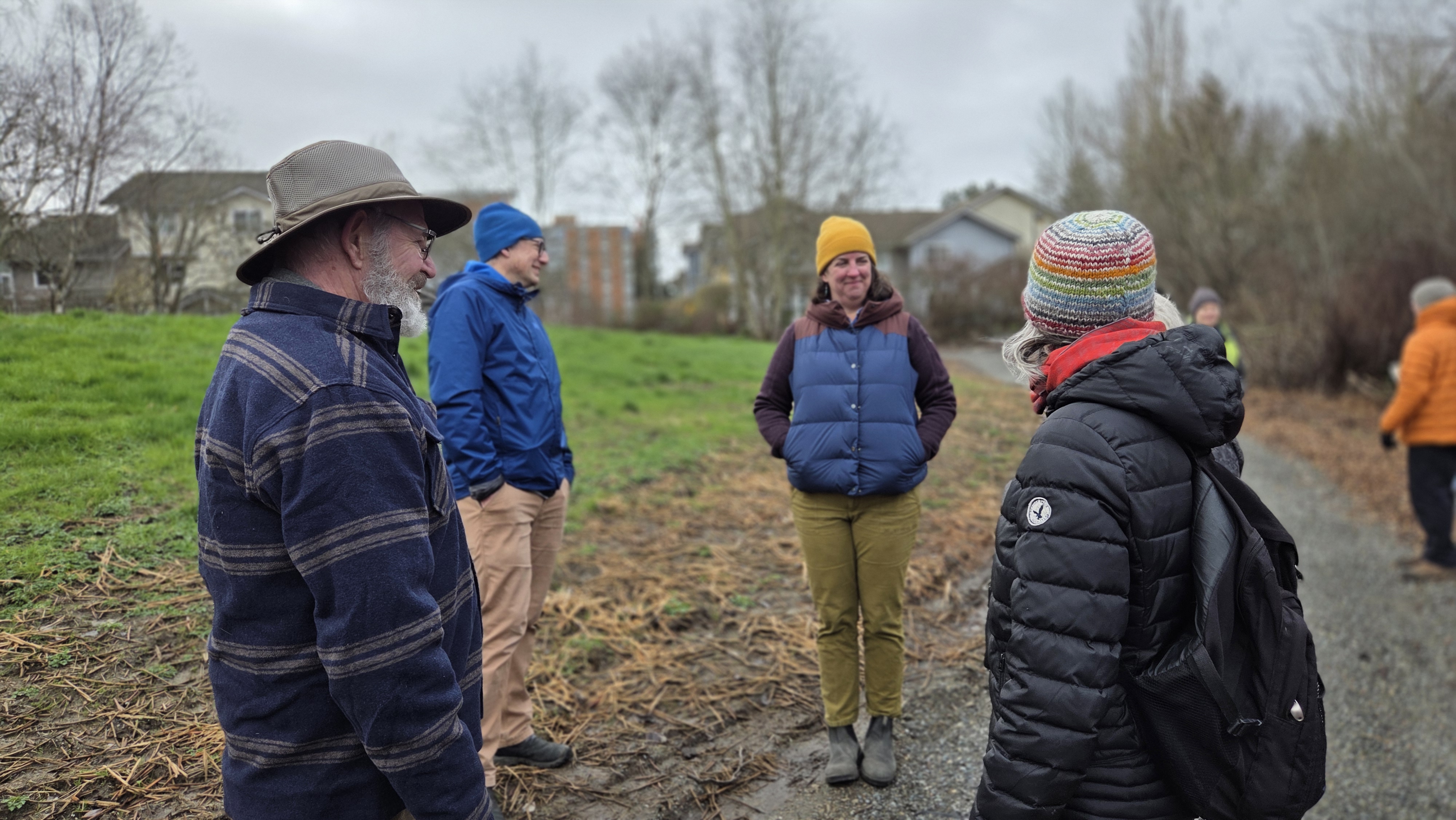
Members of the surrounding community in West Seattle were alarmed at what was happening in their local park. They came together in 1999 to advocate for the restoration of the Roxhill Bog to help recover lost habitat and ecosystem functions.
“This is the last of Seattle’s original 32 peat wetlands, located within an urban area of low-income, diverse communities where this natural area is their sole connection to nature,” explained Sharon Leishman, executive director of the Duwamish Alive Coalition.
“People gather here to experience the ethereal bloom of the fawn lily, hear chorus frogs at twilight, and see the magic of dragonflies, but this special ecosystem is being lost.
The power of community, which started with two neighbors, has grown into a broad, collaborative effort of persistence, patience, and passion. We are all stewards of these lands and waters. We are all connected.”
With support and funding from the Seattle Parks Foundation, King County Wastewater Treatment Division, the Rose Foundation, and the Cox Foundation, plans for the bog’s restoration eventually began to form. American Rivers joined the effort in 2019, serving as project manager for engineering and construction.
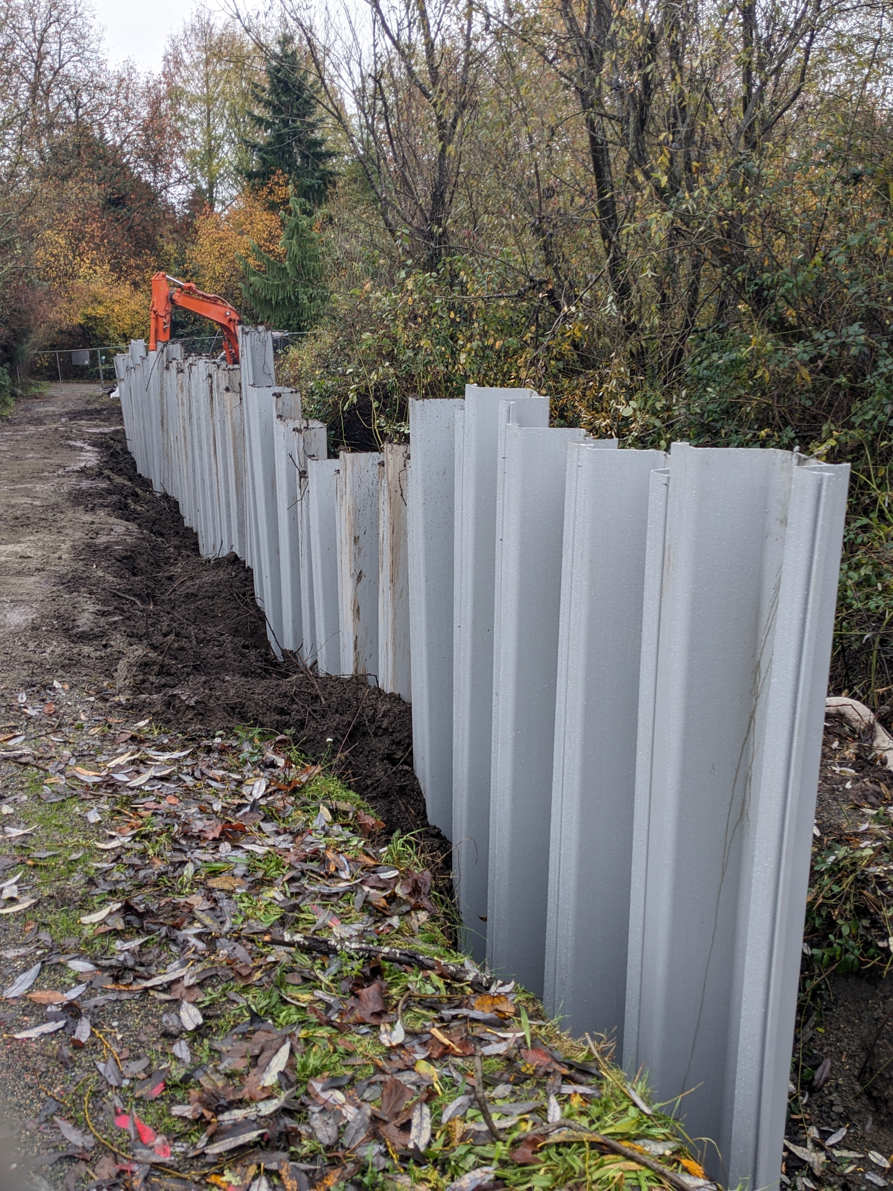
Finally, in late November 2025, construction contractors with Rodarte Construction, Inc., excavated earth and installed 15-foot-high pilings into the Roxhill peat. The pilings form an underground wall for 300 feet along the park’s trails. The wall is designed to slow the flow of groundwater and raise water levels to rehydrate the degraded peat wetland.
Just like the day construction started, rain drizzled down as contractors placed the last shovel of gravel. Nature responded almost immediately. By mid-December, groundwater had risen three feet, with water pooling at the surface of the bog. This showed the engineering design of the groundwater block was working well and starting to rehydrate the peat bog.
“Completing this first phase of the bog’s restoration provides a model for how urban areas across the country can restore wetland functions and improve the quantity and quality of water for people, fish, and wildlife,” said Sarah Dyrdahl, Northwest regional director for American Rivers. “In addition to the West Seattle community, we hope salmon in the downstream Duwamish will be the big winners of this work.”
The bog’s water level will be monitored over the coming years to help inform additional restoration, including work by Seattle Public Utilities to reroute stormwater and by Seattle Parks and Recreation, which may install more blocks to increase groundwater retention.
A few days after construction, community volunteers planted native species in the project area to jumpstart the revitalization of the wetland ecosystem. Local organizations and project partners, such as the Delridge Neighborhoods Development Association, plan to host more nature walks, art activities, and class field trips centered on peat bog ecology. They are also facilitating trash pick-up events in collaboration with the Green Seattle Partnership.
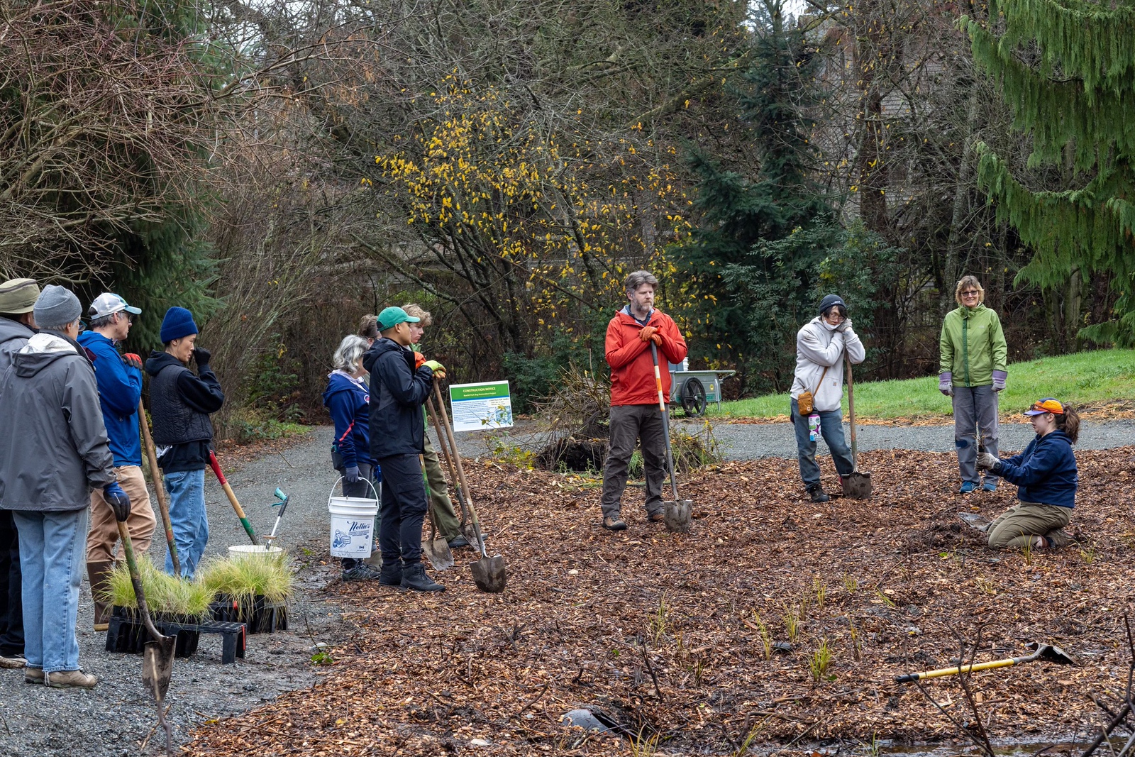
“It’s been an honor to be part of the restoration of Roxhill Bog and to work alongside the community in caring for this important ecosystem,” said Caroline Borsenik, environmental programs director with the Delridge Neighborhoods Development Association. “I’m excited to see Roxhill continue to grow as a place where restoration and community come together, and where people can connect with, celebrate, and enjoy this special place.”