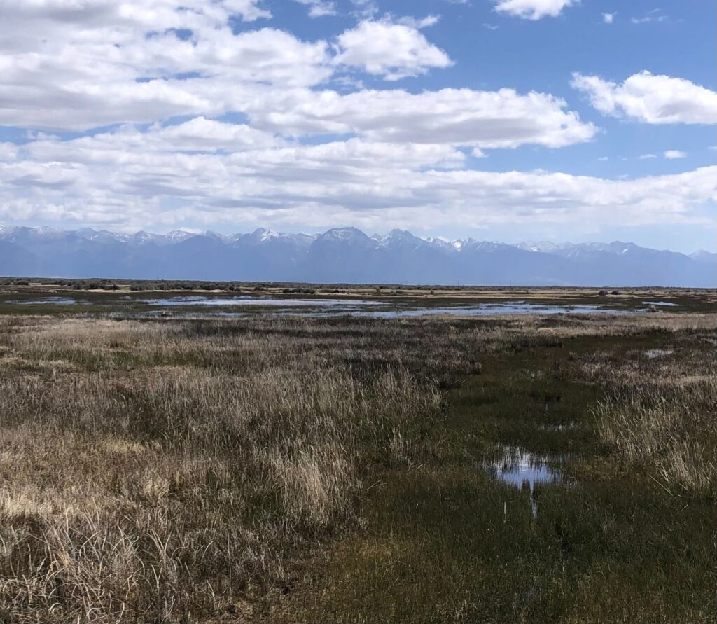
Like much of the Southwest, the San Luis Valley in Southern Colorado, home to the headwaters of the Rio Grande, is facing a historic, near record-setting snow drought; early runoff and all signs point to a severe water shortage. Snow water equivalent (SWE) – how much liquid water is available in snow – in the region is among the lowest on record, triggering dire concerns about the impacts of reduced runoff on agriculture, communities, and ecosystems.
The Rio Grande is essential to the livelihood of people, economies, and the environment, and the demands from human populations and the impacts of climate change have put the Rio under increasing pressure. These pressures are well documented; numerous studies conclude that rivers in the southwest are facing critical shortages, largely as a result of these compounding pressures. Local communities, including those along the Rio Grande and its tributaries, are acutely aware of their water challenges and have come together to identify innovative solutions to address the threats. River and riparian restoration projects, agricultural efficiency and modernization projects, recharging the local aquifer, and protecting small streams and wetlands are just some of the initiatives communities along the Rio are undertaking to protect and restore their community’s lifeblood.
In the San Luis Valley (Valley), the community has long been working on flexible, innovative water solutions to make every drop count. Water managers, conservation organizations, irrigation companies, communities, businesses, agencies, and recreationists have come together to identify programs and projects that provide multiple benefits while also addressing drought and water scarcity challenges head on. Many of the solutions being implemented have known benefits while others are in the earlier stages of research and impact analysis, but early indications suggest some of these solutions provide significant opportunities to address some of the challenges facing Valley communities, and beyond.
Frozen Assets
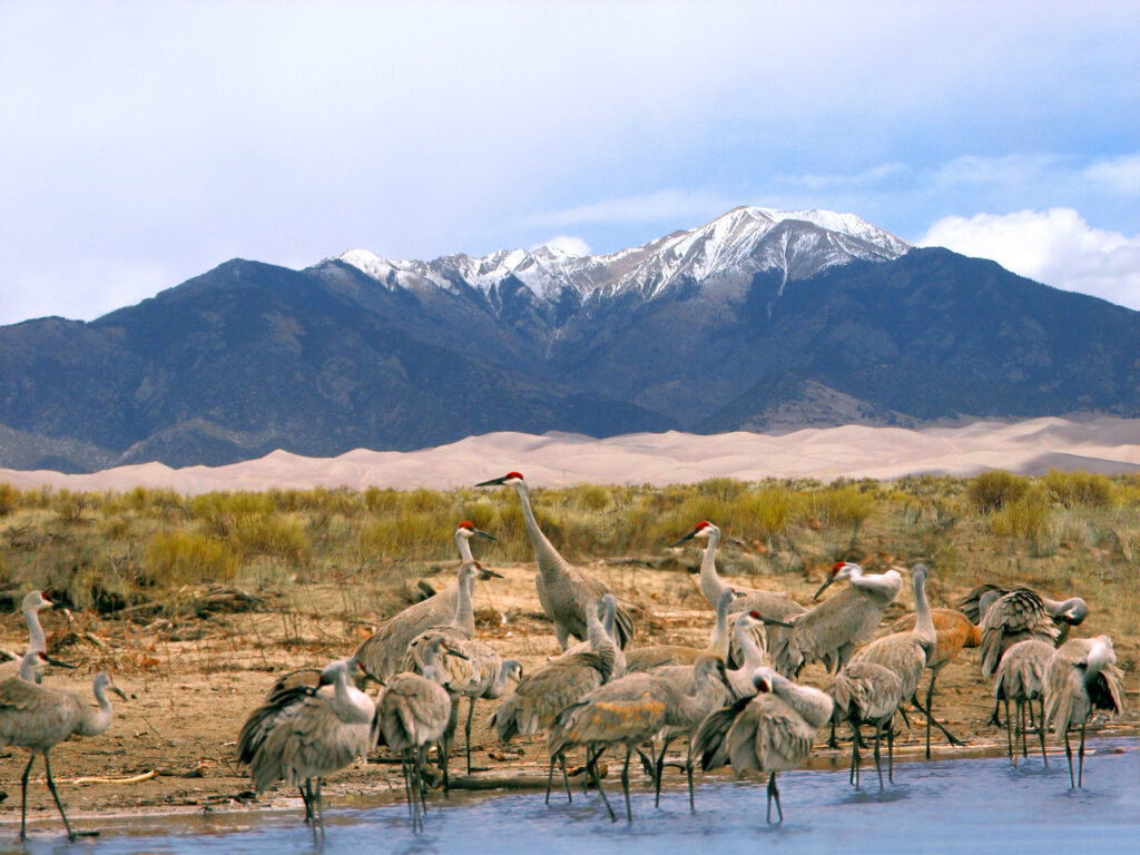
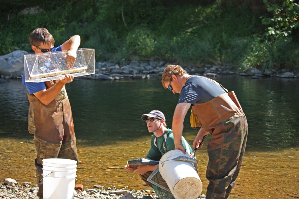
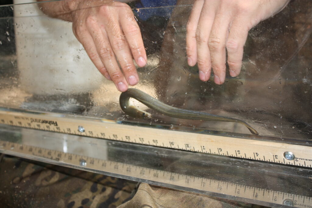
One such project, “Frozen Assets,” is an innovative and collaborative water management project under way in the San Luis Valley, led by American Rivers in close collaboration with our partners from Wetland Dynamics, Ducks Unlimited, Rio Grande Headwaters Land Trust, Colorado Parks and Wildlife, and other private, state, and federal partners. Frozen Assets is an ongoing project designed to research how winter sheet ice, an innovative water management strategy that mimics natural processes, can support aquifer recovery, assist with native re-vegetation on retired agricultural lands, enhance wildlife habitat, and allow flexibility for agricultural producers in the Valley.
Winter sheet ice has been used historically in the Valley to spread water shallowly across the landscape during the winter and ‘store’ it as ice for early spring use. Sheet ice starts developing when temperatures freeze in the fall, and, through consistent application of water in the winter, producers slowly ‘push’ shallow water across the surface to build upon the frozen layer, creating a large sheet of ice. The slowly melting ice provides water and foraging resources for over-wintering birds and wildlife and early spring migrants like waterfowl and cranes. This slow process results in less water lost to evaporation and transmission, and allows water to infiltrate soils and recharge aquifers, facilitating the growth of early season plant species.
This Project is designed to simultaneously equip water users with information about winter sheet ice and demonstrate its viability as an alternative for seasonal water use that is beneficial to wildlife, enhances soil moisture retention, boosts the resilience of local water tables, improves habitat quality, and promotes the growth of native plant communities.
Rye Resurgence
The Rye Resurgence Project has benefited not just the Valley, but businesses and consumers around Colorado and the greater Southwest region. Established to address the Valley’s groundwater depletion challenges and improve soil health, the Rye Resurgence Project is a community-driven initiative focused on revitalizing the local agricultural economy and environment by promoting San Luis Valley Rye. A winter cover crop, rye requires significantly less water than other rotational crops and has a deep, complex flavor profile that can be used in a larger variety of ways.
The Rye Resurgence Project has a dual mission, partnering with local farmers to grow rye and establishing a market for Valley rye. Ensuring there is a market and diverse buyers for new crops is an essential piece of the puzzle for producers when considering less thirsty crops. The Project has made connections with local and regional businesses – including bakers, millers, brewers, and distillers – to utilize rye in their products. In its first year, the project partnered with farmers to grow 4,500 acres of winter rye in the fall of 2023, which yielded an estimated 4,670 acre-feet in water savings over the course of the first year, and 24 businesses identified as partners.
River and Habitat Projects
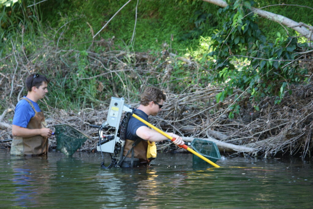
The rivers and water flowing through San Luis Valley provide critical habitat for many different species of wildlife; multiple wildlife refuges and state wildlife areas line the river throughout the Valley. The Alamosa National Wildlife Refuge (NWR) provides important habitat for native fish. However, the NWR experiences a highly variable flow regime that places stress on both riparian and aquatic health, and lower streamflows are occurring more frequently, resulting in stress on aquatic species, including fish. To address these challenges, the Rio Grande Headwaters Restoration Project worked with partners to plan and implement the Rio Grande Corridor Restoration Project at the Alamosa NWR.
This Project resulted in restoration and aquatic habitat enhancement both within the Alamosa NWR and on adjacent private lands by reshaping and stabilizing eroding streambanks with rock and native plants, which allows for better floodplain access when higher flows are present. Additionally, channel shaping and enhanced instream habitat improved low-flow and off-channel aquatic habitat. Importantly, this included a specific off-channel habitat feature created for Rio Grande chub, which are present in the area. The Project also benefited visitors to the NWR by redefining adjacent public trail access that reduces recreational disturbance to the area. This is just one example of the many multi-benefit, cross-sector river restoration projects happening in the Valley.
Water is the lifeblood of this region, and collaborative solutions like these will help preserve the economic vitality of the Valley while conserving its most precious resource for the human and wildlife communities that depend on it.
For many Idahoans, the Teton River is forever linked to one fateful day: June 5, 1976.
That morning, the Teton Dam catastrophically failed during its initial filling, unleashing a wall of water that devastated downstream communities and changed lives in an instant. But another loss often receives less attention: before the failure, the dam’s reservoir had inundated the Teton Canyon, flooding one of the Northern Rockies’ special river landscapes.
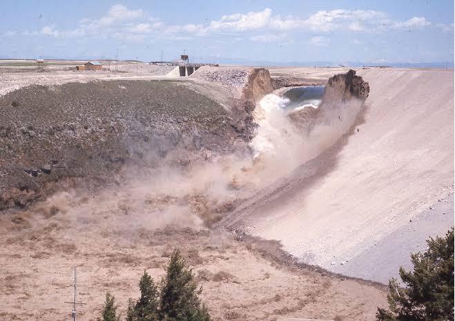
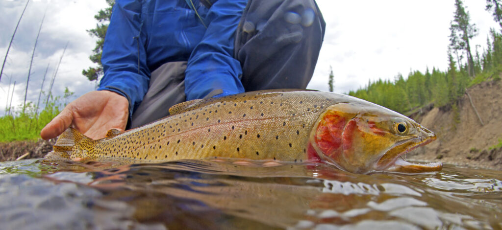
The Teton Canyon is more than a footnote on dam failures and lost rivers. In the 50 years since the dam failed, both the canyon and the river have had an opportunity to recover. Today, the Teton once again carries cool, clear water through one of the Northern Rockies’ remarkable deep canyons. The canyon is again an important place for the protection and restoration of Yellowstone cutthroat trout, a species central to the region’s ecology and angling heritage. Anglers, hunters, boaters, and families again value this place. The canyon and river are part of eastern Idaho’s identity, and today the Teton remains eastern Idaho’s only major river without a large dam and reservoir system altering its character.
After the failure, the Teton River received something precious: a second chance.
Across the country, communities are proving that rivers can recover when people invest in restoration, remove outdated infrastructure, and work together to reconnect and repair damaged waterways. However, opportunities to reverse major damage do not come easily, and meaningful recovery takes time, commitment, and partnership.
Over the last several decades, people throughout the region have invested in restoring and improving the Teton River system, and it shows. In the Teton Valley upstream, conservationists, farmers, and communities have worked together to find practical solutions that support agriculture while protecting and restoring river health.
Those partnerships — including Friends of the Teton River and Trout Unlimited’s Idaho chapter — matter because water challenges in the West are real. Communities need reliable water supplies. Farmers need certainty. Rivers need enough water to sustain fisheries, wildlife, and recreation economies. Too often, those needs are framed as incompatible; the work done in the Teton Valley has shown another path.
As Scott Bosse, the Director of American Rivers’ Northern Rockies Region, says in the film Second Chance:
“What is happening in the Teton River Valley, where conservationists and farmers and irrigators are coming together with innovative solutions to meet each other’s needs without building big dams in a way that satisfies all of them, while not just protecting the river but restoring it. It’s a unique culture that’s been built, especially on the upper Teton, and I’d like to see it replicated all over the West.”
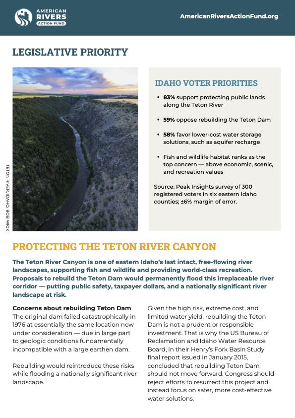
This lesson matters today because some downstream interests are again promoting rebuilding the Teton Dam.
Rebuilding the dam would not simply create a reservoir, it would once again flood the Teton Canyon and place at risk a river system that communities have spent decades improving. It would ignore the progress already being made through collaboration and innovative approaches that recognize healthy rivers and healthy communities can succeed together.
As Scott says later in the film: “That river almost died in 1976. It’s had a resurrection. You don’t get many second chances in life, and you’ve got to seize them when you do.”
The Teton River got a second chance. Let’s not squander it.
Visit the Fishcamp Collab for Conservation and watch the short film Second Chance and enter to win amazing raffle items!
The broken dam
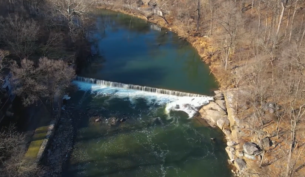
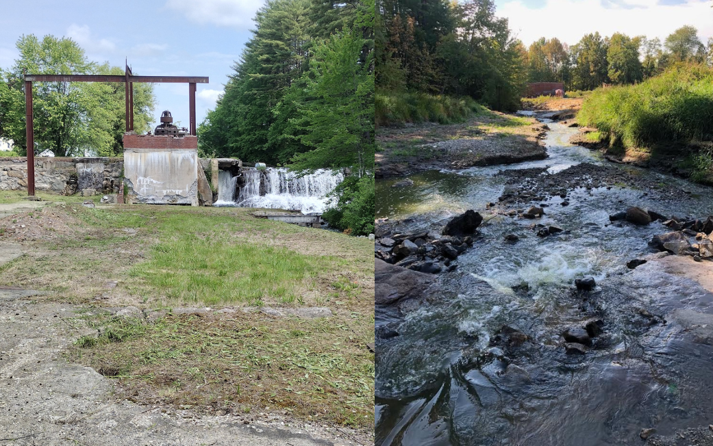
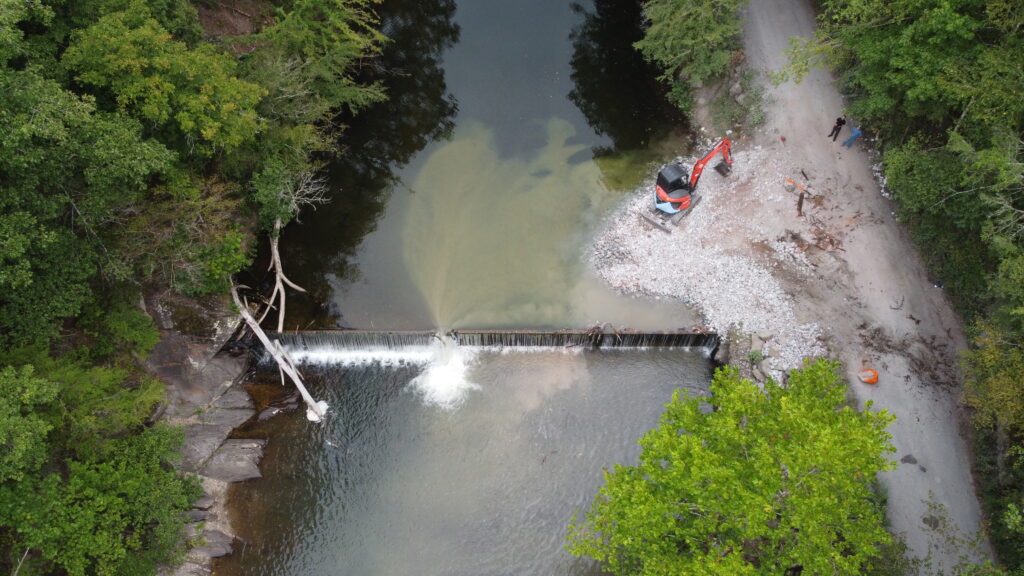
In a small village in the Catskill Mountains, the century-old Lake Jefferson Dam still stands, crumbling.
This seemingly innocuous dam has the potential to cause a fatal flood if it fails. Its spillway, completed in 1926, is no longer large enough to safely pass the floods the region is facing as storms grow more intense. It has already been damaged in past floods. Today the owners, whose home sits just below the dam, are working with partners to remove the obsolete structure before it catastrophically collapses.
Built on the pristine East Branch of Callicoon Creek in the Upper Delaware River Basin, the decaying dam also blocks important habitat for fish and other species. Decades of sediment have built up, leaving the dam’s impoundment only a few feet deep. The spillway is scarred from past floods and chunks of concrete are missing, exposing the core of the structure.
The Lake Jefferson Dam was built for recreation and later repurposed as a micro-hydropower project in the 1980s. Now it sits unused and in disrepair, waiting to be safely removed. It provides no flood control and in fact poses a serious hazard for flooding. If it were to fail, it could send a wall of water downstream, threatening nearly a hundred homes.
This dam is not unique.
Across the country, dams are failing, or on the verge of failing, more than ever. Over the past twenty years, the number of dam failures or emergency incidents has risen from an average of three per year to more than 70.
We are facing an infrastructure crisis hidden in plain sight.
Rising dam safety emergencies
Dam safety challenges are being driven by two major forces: aging infrastructure and increasingly severe storms.
While age alone does not make a dam unsafe, older dams require more maintenance and upgrades to remain secure. At the same time, more intense storms are producing floods that many dams were never designed to withstand, making failures more likely. In addition, development has often expanded downstream of dams, putting more people at risk should dams fail.
Bringing dams up to modern dam safety standards is expensive. For owners of uneconomic dams or obsolete dams, it is often a nonstarter. As a result, many dams are poorly maintained and, in some instances, abandoned altogether.
State dam safety offices are responsible for regulating more than seventy percent of the dams that are in the U.S. National Inventory of Dams. Yet many offices lack the staff and resources needed to oversee their vast inventory of dams. As a result, dam safety offices are forced to prioritize their oversight, leaving thousands of dams unchecked. Even when safety upgrades are identified, dam owners often lack the resources or will to implement them.
Dam safety offices need greater funding and capacity not only to monitor existing dams, but also to support the removal of those that are obsolete and unsafe.
Unregulated killers
Some dams pose a danger not just if they fail, but simply by existing.
Low head dams, typically less than 15 feet tall, are designed to allow water to continuously flow over the crest of the dam. This design can create a powerful recirculating current at the base of the dam, a hydraulic that can trap and hold swimmers, paddlers, and even rescuers underwater.
These structures are often referred to as “drowning machines,” and have been linked to at least 780 deaths in the U.S.
Most low head dams fall outside of state dam safety jurisdiction. While some states require warning signs, enforcement is often limited by gaps in authority and resources. As a result, known lethal hazards can remain in place for decades, long after they have outlived any useful purpose.
Maintain them or drain them
Selective removal of dams, particularly those that have become obsolete or unsafe, is an increasingly practical and cost-effective solution.
Dam removal eliminates long-term liability for dam owners while also improving river health, making it an economical and effective solution to costly repairs and upgrades. More than 2,300 dams have been removed around the country, most within the past two decades, and dam removal is now widely recognized as part of the natural lifecycle of infrastructure.
Dam safety professionals are increasingly embracing this approach. Federal and state guidance, along with technical resources, now help dam owners evaluate when removal makes more sense than repair. As well-known dam safety engineer Charles Karpowicz often puts it, “Maintain ‘Em or Drain ‘Em.”
Beyond eliminating safety risks, dam removal can also strengthen climate resilience. Research from Utah State University found that removing aging and obsolete barriers helps rivers regain their natural function, allowing them to better adjust to and recover from extreme weather events.
In other words, strategically removing dams doesn’t just reduce risk, it helps prevent future disasters.
Back in New York
Each spring, ice melts off Lake Jefferson, revealing the aging dam beneath it.
This spring, engineers have been collecting data and finalizing plans to remove the structure and restore the East Branch of Callicoon Creek. The work takes time, but the goal is simple: eliminate a known hazard before it becomes a catastrophe.
The dam owners, community members, and dam safety officials are all working toward the same outcome: a future where this stretch of river flows freely again and where the community downstream can breathe a little easier, knowing one more dangerous dam is no longer a risk.
May 31 is National Dam Safety Awareness Day. Find out what dams are at risk near your community and push for repairs, upgrades, or removal.
Americans in 2026 continue to strongly support the rivers that sustain their communities and outdoor traditions throughout the country. Clean water and access to public lands are values uniting voters across all political lines. According to the 2026 Colorado College Conservation in the West poll, 85 percent of voters say conservation issues involving public lands, waters, and wildlife are important in their decision of choosing if they want to support an elected official.
Pressures on rivers are increasing. Extreme weather, water shortages, mining, and pollution are placing new demands on waterways that were already concerningly under protected. According to our National Protected Rivers Assessment, nearly two-thirds of the nation’s 4.4 million miles of rivers lack any protection at all. The rivers we drink from, the rivers we recreate on, the rivers that support life in our country are at risk.
Our rivers need urgent action right now. Wild and Scenic River designations are a good place to start.
In 1968, Congress passed the Wild and Scenic Rivers Act, one of our nation’s most effective tools for protecting incredible rivers. This protection is a commonsense, bipartisan tool that lets communities protect their local water resources, while also allowing for the responsible use and management of the river corridor. Today, the Act protects more than 13,000 river miles, a small slice of what’s needed but a huge opportunity to build upon decades of successful conservation.
In this Congress, there are more than 15 Wild and Scenic River bills that have been introduced, from the Florida to Washington. Each of these bills represents the opportunity for our elected leaders to demonstrate strong bipartisanship leadership to protect clean water.
Five Reasons to Pass Wild and Scenic River Protections in 2026
1. River protection reflects the values Americans share
Voters across the country repeatedly expressed their support for the protection of clean water and wildlife habitat, and rivers are at the heart of these priorities. Communities rely on them for everything from clean drinking water to fishing, recreation, and tourism–even local identity (who lives in a “river city”?). Wild and Scenic River designations let Congress sustain these values head on. Safeguarding rivers that hold outstanding ecological, recreational, or cultural importance ensures lawmakers protect the landscapes people care about most, keeping them and their communities healthy, accessible, and economically vibrant. Wild and Scenic River designations preserve existing river character at a time when communities nationwide are facing increasing pressure from development.
2. Wild and Scenic Rivers are supported on both sides of the aisle
These are just a few of the bill introductions demonstrating that protecting rivers and clean water is commonsense bipartisan policy and something that can unite us all.
Rep. Greg Steube (R-FL) and Sen. Rick Scott (R-FL) introduced the Myakka Wild and Scenic River Act of 2025 in the Senate and House, respectively, to protect portions of the rain-fed Myakka River. Wild and Scenic River designation would protect this river’s manatees, American alligators, support multi-generational cattle ranching, and honor a 50-year legacy of protection by Sarasota County and the state of Florida.
Rep. Ryan Zinke (R-MT) has emphasized the importance of conserving public lands and river corridors that are tied to Montana’s outdoor recreation, hunting and fishing heritage. Through his Greater Yellowstone Recreation Enhancement and Tourism Act, nearly a hundred miles of the Gallatin and Madison Rivers would be protected for generations of anglers to come.
Sen. Heinrich (D-NM) and Rep. Gabe Vasquez (D-NM) introduced the M.H. Dutch Salmon Greater Gila Wild and Scenic River Act to protect nearly 450 miles of the Gila and San Francisco Rivers and their tributaries as well as the $450 million they bring into the New Mexico economy annually.
3. Wild and Scenic Rivers support local economies and outdoor recreation
Protected rivers are the backbone of many local economies. Communities have long benefited from the fishing, paddling, rafting, wildlife viewing, and tourism that healthy river systems crucially support. River-based tourism sustains outfitters, guides, retail stores, hotels, breweries, restaurants, and other local businesses that benefit from outdoor recreation. Wild and Scenic River designations help guarantee that the natural character of rivers stay intact, which is essential for attracting visitors and their tourism dollars.
4. River protections allow for continued responsible land management
River protection and land stewardship go hand-in-hand. River corridors protected by Wild and Scenic River designations are compatible with forest management, including wildfire mitigation efforts. Each river has a management plan developed to ensure that conservation goals are balanced with responsible stewardship of the river’s surrounding lands. This collaborative approach allows communities and land managers to protect river values while also achieving fuels reduction, forest health, recreation, and timber objectives.
5. Wild and Scenic Rivers are built on community-driven conservation
Wild and Scenic River designations always begin with local communities. Local governments, private landowners, tribes, conservation groups, state agencies, local businesses, and passionate community members work together for years to study rivers, develop their management plans, and elevate their importance to elected officials. This teamwork builds support for river protection before, during, and after legislation is introduced in Congress. This community-driven model helps make certain that river protections reflect the needs of the people who actually live closest to them.
Protecting Rivers is a Practical Step Forward
Americans nationwide are navigating complex environmental challenges, including drought and wildfire. As pressures on water systems intensify, communities need solutions that are both effective and broadly supported. Protecting rivers through the Wild and Scenic Rivers Act provides that path forward.
The Wild and Scenic Rivers Act safeguards clean water and protects wildlife habitat. It also encourages the outdoor traditions that define many communities in the United States. They also demonstrate that conservation can succeed when local collaboration and bipartisan leaders come together backed by consistent support from the public.
In 2026, Congress has a clear opportunity to act. During Wild and Scenic Rivers Hill Week last week, lawmakers heard directly from communities and partners across the country about the importance of protecting free-flowing rivers. Advancing new Wild and Scenic River designations now would build on a proven legacy of bipartisan conservation while ensuring the rivers communities depend on continue to flow freely for generations to come.
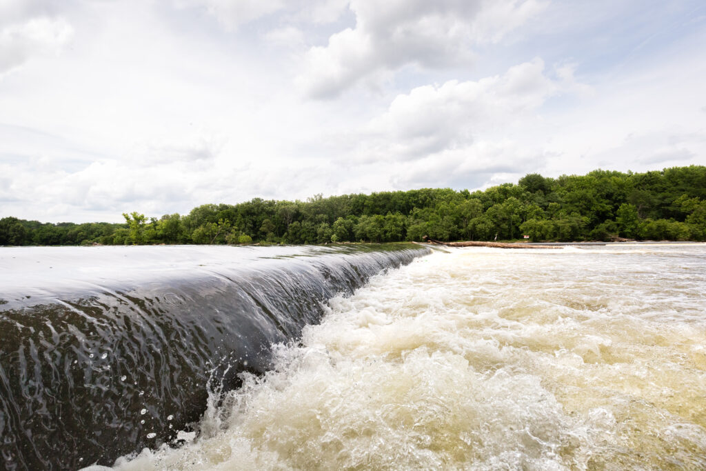
If you’ve ever stood beside a rushing river and felt a particular kind of peace — the sound of water moving the way it was always meant to move — you might appreciate just how significant our new report on dam removals across the country really is.
In 2025, the United States removed 100 dams. One hundred outdated, often crumbling, and frequently dangerous structures were pulled from our waterways across 30 states. In their wake, more than 4,893 miles of river were reconnected — the most upstream miles ever reconnected in a single year in the U.S. through dam removal. In these rivers, water is flowing freely again for the first time in decades, sometimes centuries.
That’s not just a conservation win. That’s a transformation.
There have now been 2,350 documented dam removals in the U.S. since 1912.
So why are we removing dams, exactly?
You might be wondering: weren’t dams built for a reason? Yes, but most of those reasons are outdated, much like these dams. The U.S. has more than 500,000 dams in its national inventory, and a staggering number of them are simply sitting there: no longer generating power, no longer supplying water, no longer serving any practical purpose. What they are doing is blocking fish from reaching spawning habitat, warming water in stagnant reservoirs, threatening public safety, and accelerating flooding risks during storms.
Removing a dam is one of the fastest and most effective ways to bring a river back to life. Within days of removal, bugs return. Within weeks, native fish are swimming reaches they haven’t accessed in generations. The whole watershed starts breathing again.
American Rivers has a bold goal: remove 30,000 dams by 2050. With 2,350 removals logged since 1912 — and momentum clearly building — that mission feels more achievable than ever.
The most common reason cited for removal? Ecology — cited in 59 of the 100 projects last year. Dilapidated or failing structures came in second (37 projects), followed by safety concerns (20). It’s a telling breakdown: communities aren’t just tearing out dams because they’re falling apart. They’re doing it because they understand that living river systems depend on free-flowing water to thrive.
Where are Dams Coming Out?
Pennsylvania continues to lead the nation in dam removals, with 14 dams removed in 2025, for a total of 433 dams removed since 1912. Pennsylvania has been a historical leader in dam removal and river restoration, its momentum illustrating an acknowledgment of state agency leadership in prioritizing the removal of obsolete and failing infrastructure.
The Northeast region really showed up in 2025 as well— Massachusetts removed 11 dams, and Vermont removed nine! Massachusetts and Vermont learned valuable lessons after significant flooding in their states highlighted the need to address failing dams and undersized road-stream crossings.
In particular, Massachusetts’ Division of Ecological Restoration has provided much-needed funding and technical support to restore rivers, streams, and wetlands. Their effort is further supported by the Dam and Seawall Repair or Removal Program, which provides funding for critical water resource projects and is a good model for other states. Vermont’s momentum can, in part, be attributed to first-of-its-kind legislation— the Flood Safety Act— passed by the state in 2024. The law made significant investments in protecting people from the flood risk that aging dams present while also restoring rivers and community health.
That’s not all! The Southeast alone reconnected 2,424 upstream river miles in 2025. The Great Lakes and Central regions added more than 1,446 miles. These numbers represent real habitat — real spawning grounds, real migration corridors, real flood buffers — returned to function as nature intended. The record reconnection of upstream river miles in 2025 was driven by major river stretches in the Great Lakes and Southeast regions from Florida, Indiana, Kentucky, Ohio, and Tennessee. Communities across the nation are showing up in support of healthy rivers and safer river corridors.
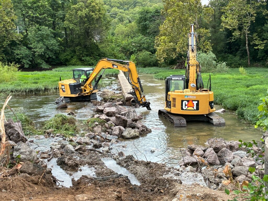
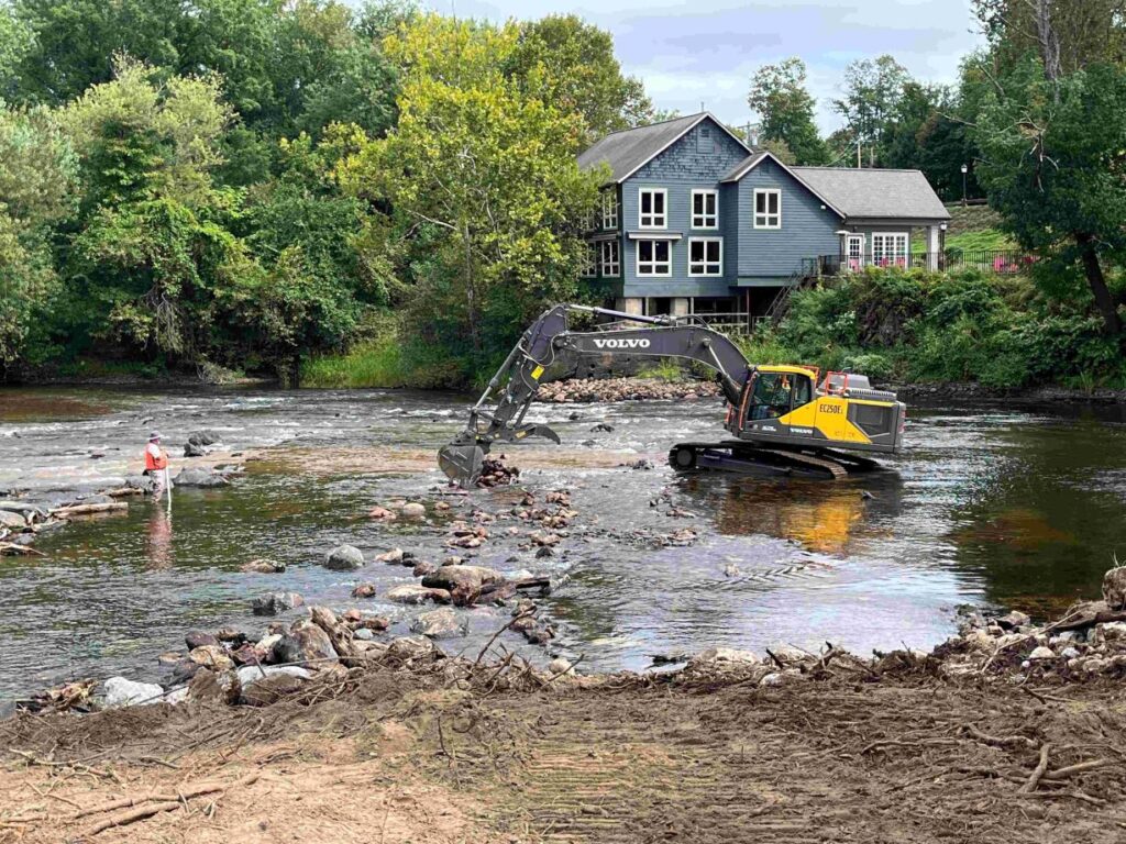
In Iowa, the Forest City Dam came down on the Winnebago River, reconnecting 99 upstream miles for fish passage and opening up wetland spawning habitat for northern pike. It also reduced flood risk to a local park — a reminder that dam removal benefits extend well beyond the water itself.
In Delaware, the historic DuPont Experimental Station Dam on the Brandywine River was removed as part of a multi-dam effort. After a previous removal upstream in 2019, American shad were spotted spawning in the Brandywine in Wilmington for the first time in over a century. These projects are literally bringing back fish that had not been seen in living memory.
In Virginia, the Georges Mill Dam came out of the South Mayo River. Seven people had drowned at that site over the years. Its removal didn’t just improve passage for the endangered orangefin madtom — it eliminated a genuine hazard that had cost human lives.
In Maine, the Mill Pond Dam removal on the Sabattus River was part of a broader effort to open access to 2,429 acres of spawning habitat and 75 miles of stream for sea-run fish. The potential? An annual run of more than one million adult alewives — a keystone species that feeds everything from eagles to whales.
In California, the Jenny Creek Diversion Dam near the Klamath River was removed by Trout Unlimited and the state Department of Fish and Wildlife, with the Yurok Tribe and Shasta Indian Nation participating in cleanup and cultural monitoring. It’s a powerful example of how dam removal can be an act of cultural restoration just as much as an ecological one.
In Utah, Zion National Park’s Temple of Sinawava Dam came down as part of a program to restore the Virgin River — a Wild and Scenic River — for species like the Virgin River chub and woundfin, fish that once thrived there and are now fighting for survival.
What This Means for the Future
Dam removal isn’t just an environmental story — it’s a community story. It’s about cities in Indiana removing hazardous low head dams that were threatening kayakers. It’s about a college in Vermont turning a dam removal into a living classroom for students. It’s about Tribal Nations in California and the Pacific Northwest reclaiming cultural practices tied to salmon runs that were nearly wiped out.
The goal of 30,000 dam removals by 2050 is ambitious. But 2025’s 100 dams down is proof that when communities, agencies, conservation groups, and tribal nations work together, rivers can come back — and they can come back fast.
One hundred dams. Nearly five thousand miles of river, flowing free again. Not bad for a single year.
If you want to learn more about some of the great projects completed in 2025, check out our annual summary.
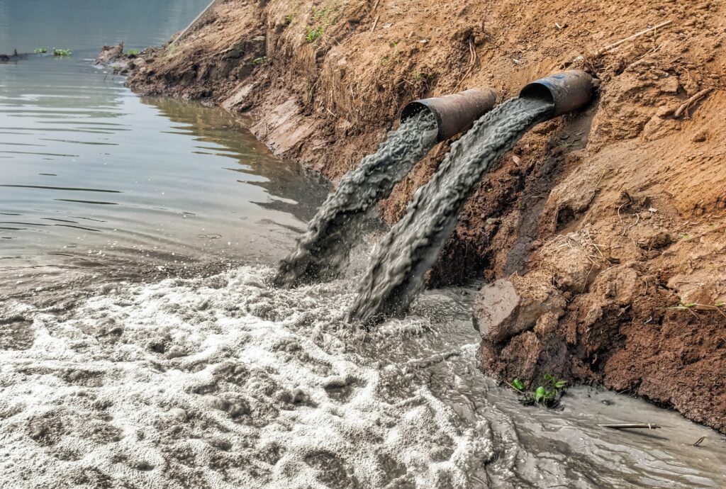
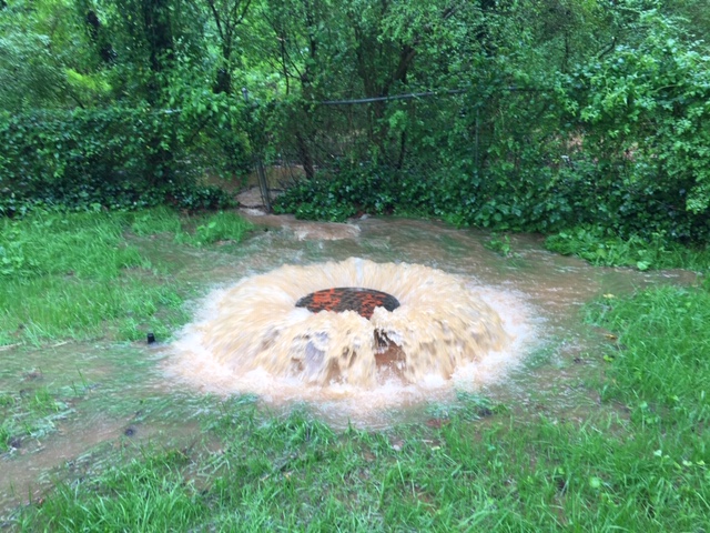
On January 19, 2026, the Potomac Interceptor, a major sewer pipeline, collapsed along Clara Barton Parkway in Montgomery County, Maryland. The pipeline runs through the C&O Canal National Historical Park near the Potomac River, and the collapse caused the significant overflow of 200-300 million gallons of untreated wastewater into the Potomac River.
Crews installed emergency bypass and flow-control measures to reduce and ultimately contain the overflow while the longer-term repairs are planned alongside federal, state, and local agencies. The incident brought increasing attention to the condition of aging infrastructure that carries wastewater beneath our communities every day. It also raises scary questions about the consequences that occur when those systems fail.
The Potomac Interceptor’s collapse functions as an important symbol. It represents the risk that communities across the country face on a daily basis as they rely on wastewater systems that were built decades ago and which now exceed the amount of time they were intended to function. These systems break down, and the impacts go far beyond utilities and ratepayers. The failures can threaten water quality and harm river ecosystems. They require costly emergency responses that take resources away from long-term solutions.
The scale of the challenge is national. The U.S. Environmental Protection Agency’s Clean Watersheds Needs Survey is the federal government’s comprehensive assessment of wastewater and stormwater infrastructure needs. It notes that about $630 billion will be required over the next 20 years simply to maintain and modernize publicly owned wastewater treatment works and other clean water infrastructure across our nation. This figure shows how much investment is truly needed to repair these aging systems and meet water quality goals in order to protect rivers and downstream communities. Infrastructure failures will continue to occur without sustained funding, and with them will be real consequences for public health and the environment.
What Are State Revolving Funds?
State Revolving Funds (SRFs) are one of the best and most important tools at cities’ disposal to solve this need for better infrastructure. The Clean Water State Revolving Fund and the Drinking Water State Revolving Fund are long-standing federal–state partnerships that provide affordable financing to communities for water infrastructure projects. SRFs support investments in wastewater treatment and stormwater management. They also aid projects that protect drinking water supplies. These programs allow states to tailor investments to local needs, which can mean anything from upgrading treatment plants to improving stormwater systems to restoring natural features that support water quality.
SRFs are designed to let public dollars stretch over time because, as loans are repaid, the money goes back into the fund and can be used again to support new projects. SRFs are a proven tool that empowers states to address community water needs and support job creation and long-term economic benefits tied to infrastructure investment.
Why SRFs Work for Rivers and Communities
SRF investments help prevent failures in these systems — like what happened on the Potomac — because they enable communities to upgrade infrastructure before it reaches a breaking point. SRFs play an important role in cutting down pollution and improving water quality while supporting resilient water systems. SRFs can fund nature-based infrastructure such as wetlands and floodplains, and some recent policy proposals call for dedicating a significant share of SRF capitalization to these projects because of their flood-risk and water-quality benefits. They are an incredible tool to deliver co-benefits for people and rivers.
These approaches are especially valuable as communities face increasing pressure from extreme weather and changing hydrologic conditions. Investing in solutions that work with natural processes, SRF-funded projects can strengthen resilience while protecting drinking water sources and downstream ecosystems.
Why This Moment Matters
The Potomac Interceptor collapse offers a clear illustration of what happens when aging systems are pushed beyond their time limits. Emergency repairs and temporary fixes are costly, and they are disruptive. This clean-up is far less effective and more expensive than proactive investment. At the same time, the EPA’s national assessment shows that infrastructure needs are widespread and substantial. These realities point to a simple conclusion that continuing to defer investment will only increase risks and costs over time.
The nation’s documented clean water infrastructure needs are roughly seven times greater than current annual federal investment levels. While the State Revolving Funds (SRF) are currently authorized up $3-4 billion per year, American Rivers estimates that at least $10 billion annually is needed to adequately address wastewater and stormwater infrastructure demands.
People across the country depend on functioning wastewater systems every day, even though many rarely think about them. The failure of these wastewater systems can contaminate rivers and impact recreational waters, causing communities to face significant environmental and financial consequences. Investing in water infrastructure is therefore a choice to dedicate funds for the protection of public and river health, as well as community resilience.
A Call to Action for Congress
Investing in State Revolving Funds is one of the most direct ways Congress can help communities modernize wastewater systems and protect rivers. State Revolving Funds work, but their impact depends on strong federal leadership. It is key to reauthorize and strengthen SRFs through increased federal investment and streamlined access for small and disadvantaged communities. In addition, there must be dedicated funding to natural infrastructure and modernization of permitting and project delivery. These reforms would help ensure that SRFs are equipped to meet today’s infrastructure challenges and support solutions that protect both people and rivers.
The infrastructure needs identified by EPA and the visible consequences of water system failures like the Potomac Interceptor collapse show that this is not a problem Congress can afford to ignore. We know how to fix the problem. What is needed now is the political will to scale to match the magnitude of the challenge.
As Congress considers a water infrastructure package, American Rivers will urge Members of Congress to enact SRF reforms to fix our pipes, modernize water systems, and protect rivers.
You can join us by taking action now.
In 2023 and 2024, the Washington State Legislature acted with clear foresight, directing state agencies to evaluate options for maintaining water, energy, recreation, and transportation services in the absence of the four lower Snake River dams.
With the dams’ future long the subject of debate, investing in these studies is prudent. It means the Northwest will be informed and ready to adapt with resilient alternatives should Congress decide the dams must be removed.
That remains a possibility, one that would honor tribal treaties, help restore the once-great salmon runs of the Snake River basin, and prevent the extinction of our region’s endangered Southern Resident orcas.
The four studies are underway, and they already show viable alternatives for continuing the services the lower Snake dams currently provide. Let’s begin with transportation. It turns out that ending barge portage of wheat, fertilizer, and some wood products along the lower Snake River could have surprising benefits.
A recent analysis by the Washington State Department of Transportation (WSDOT) shows that shifting from barge to rail would reduce how far trucks have to travel from farms to rail terminals or river ports by about 18 million miles every year. That reduction would lower annual emissions by approximately 29,000 metric tons of carbon dioxide equivalent. Cleaner air and less road wear and tear are some of the other obvious benefits.
How much would this change cost? The same WSDOT analysis shows a total annual increase of $8 million to farming enterprises. Farm support to offset this amount would be justified, considering taxpayers are projected to spend $4.5 billion to $8.35 billion over the next 50 years to keep the four dams, and this eye-popping expenditure would no longer be needed.
The study by WSDOT is progressing on schedule, with a final report due to the legislature by this December.
On water supply, we know the reservoir behind Ice Harbor Dam irrigates up to 55,000 acres of farmland, and Lewiston and Clarkston use the reservoir behind Lower Granite Dam for municipal water. In their draft study last year, the Washington Department of Ecology and the Bureau of Reclamation found there will be more than enough water in a free-flowing lower Snake River to cover these needs. Ecology is expected to release the final study by early summer.
The Washington State Recreation and Conservation Office and the Department of Fish and Wildlife are expected to analyze the business opportunities for recreational activities on 140 miles of free-flowing river. The possibilities here are exciting and endless, including increased fishing and the potential to create the state’s only multi-day rafting experience. The proposed study would generate hard economic numbers on the significant recreation jobs and revenue that would result for our local and regional economy. Globally, nature-based tourism generates more than $600 billion a year, and Washington’s unique river and mountain ecosystems offer us the chance to bite into a bigger slice of this pie.
Finally, we want to address the state study into the hydropower the four lower Snake dams produce. Pacific Northwest National Laboratory (PNNL) completed phase one of this study last year. It determined that the dams produce an average of 700 megawatts each year, far less than is usually stated. Water availability, grid constraints, and ensuring critical fish passage impact the dams’ energy production, which is less than 4% of the Northwest’s total average power generation.
The PNNL report shows the lower Snake River dams are not designed to significantly increase output when it’s most needed, particularly during extreme weather events. Further, their role is overshadowed by upriver federal storage dams. It also found that because the lower Snake dams are dependent on seasonal stream flows, their future contributions will likely be reduced as the region trends toward less snowpack.
PNNL acknowledged the local grid support that the dams provide to the Tri-Cities. Other national studies show that strategically placed battery storage can provide the fastest reactive power for communities and grid support. Governor Bob Ferguson has asked that the full energy study be completed by 2027.
These state studies are not authorized to decide the fate of the dams on the lower Snake River. Their power and purpose rest in preparing all of us for such an eventuality. American Rivers is grateful they are happening, so communities are ready, and so the intertwined environment and economy all life depends upon in the Northwest can continue to thrive into the future.
This blog was first published in the Tri-City Herald, Feb. 22, 2026 https://www.tri-cityherald.com/opinion/opn-columns-blogs/article314580320.html
I recently visited the site of the Potomac River Sewer Spill — what is now likely one of the largest accidental sewage spills in U.S. history. Given the ice and snow still on the ground, it was a challenge to get to, but I immediately knew I was going in the right direction because the smell kept getting stronger.
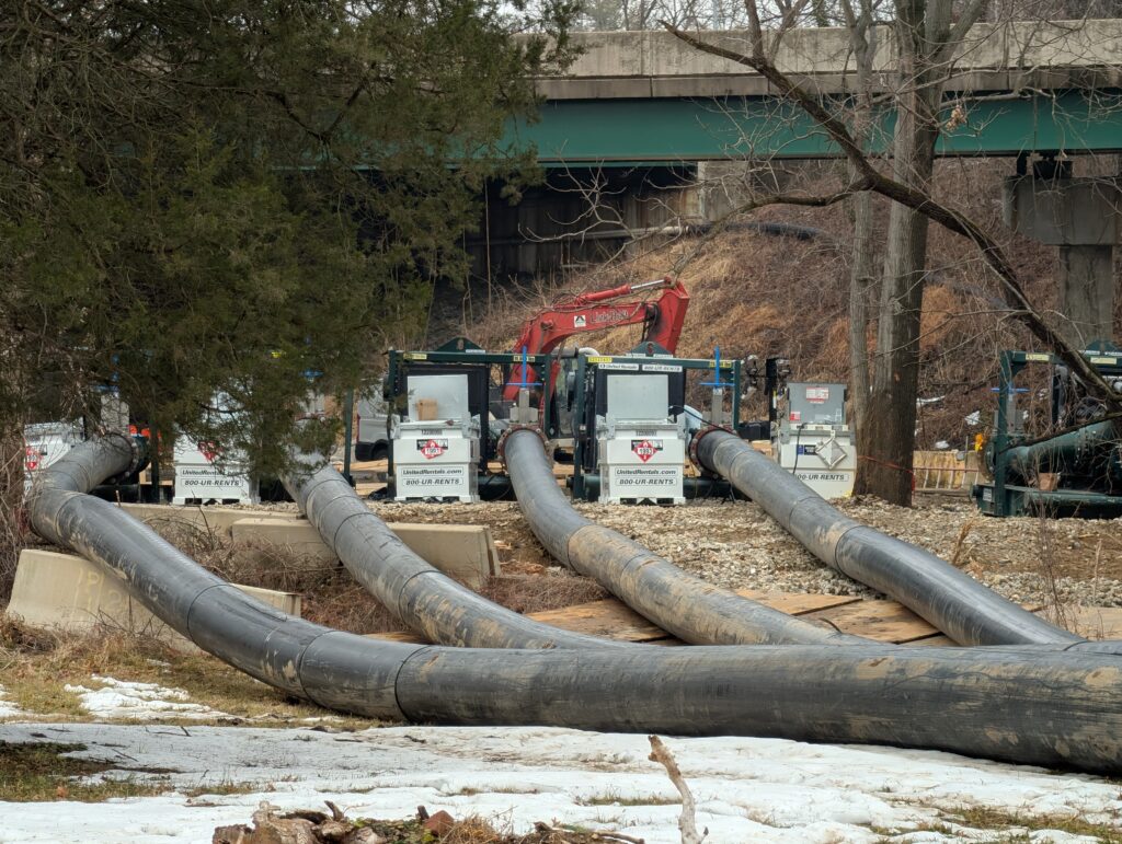
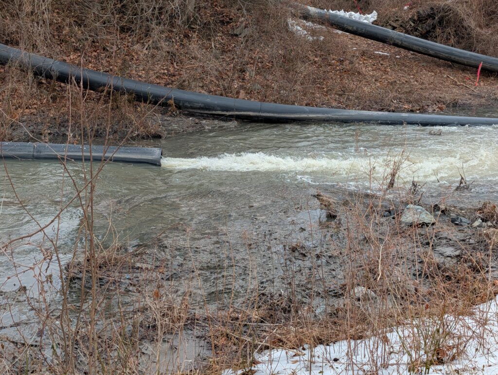
I bumped into someone that lives nearby who was also walking to inspect the damage. When we finally arrived at the site, we were both a little taken aback by how much equipment was there. Several massive pumps are taking raw sewage out above the breach in the Potomac Interceptor pipe — a massive 72-inch concrete pipe — and putting it into the C&O Canal, which runs parallel to the river. From there the sewage flows down about a quarter of a mile before it is re-routed back into the undamaged portion of the interceptor pipe.
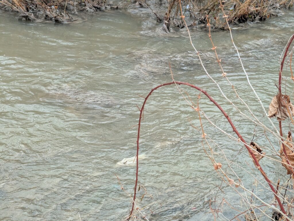
It’s funny how sewage doesn’t look like you might think — rather than a brown sludge, it’s very gray colored water. This is due to the quantity of water going down our drains, which washes everything through the pipes. However, you can tell this is definitely sewage both by smell, and the amount of toilet paper and “flushable” wipes you see getting caught up on sticks and branches in the canal. These wipes aren’t actually flushable and can wreak havoc on our rivers and water infrastructure even when there’s not an emergency. This was the driving motivation behind the introduction of the WIPPES Act in Congress last year.
Normally, the pipe transfers roughly 40 million gallons of sewage every day. When the pipe failed on January 19, massive amounts of sewage poured into the canal, which then overflowed, sending sewage into the Potomac River. Over the course of 10 days, before the site was contained, it’s estimated between 200 to 300 million gallons of sewage ended up in the river. That’s like filling every bathtub in the nation’s capital with sewage, many times over, and then letting it all run into the river.
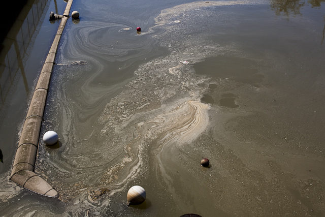
Fortunately, according to D.C. Water, drinking water supplies were not impacted, but the spill caused health advisories and urgent warnings to avoid contact with the water in both the river and the Canal. While necessary, this is a disappointing development as the Potomac is widely used for recreation — be it kayaking, rowing, rafting or boating.
Our partners, Potomac Riverkeeper Network, have been tirelessly collecting data and finding that in the midst of the overflow, bacteria levels in that stretch of the river skyrocketed to over 4000 times the safe recreational level. It’s too early to say what the long-term impact on the Potomac will be — some sewage was frozen during the recent cold weather, and as that melts we could see bacteria levels spike again. It’s also possible that other pollutants commonly found in sewage — forever chemicals, pharmaceuticals, etc — will end up settling into river sediment, killing or poisoning the fish, birds and insects that live in those stretches of the river.
If you live in this area as I do, the C&O canal area is a popular spot to walk, bike, and access the river for fishing and boating. It’s part of the National Park System. We have been taking our kids there ever since they were toddlers. I can still picture my daughter giggling at the sight of a Blue Heron grabbing a fish there. While the sewage overflow is no longer flowing into the river (for now), the historic canal is being used as a bypass for the sewage. There is a literal river of sewage flowing open along the towpath that parallels the canal. The estimated repair time is going to be 9-10 months, disrupting the communities nearby. This doesn’t include time for the environmental remediation (removing contaminated soil, etc.) that will have to be done on the area afterwards.
The most frustrating thing about all of this is how preventable it all was. That sewer line was built in the early 60’s and it was already known to be past the end of it’s service life. That’s why D.C. Water was in the process of replacing parts of it; ironically the section that failed was due to be replaced this spring. If only we had invested in repairs a couple of years ago.
And that’s the rub — this is a problem for the entire country — we don’t invest enough in sewer infrastructure repairs. Instead we tend to react crisis by crisis, instead of being proactive. The American Society of Civil Engineer’s Bridging the Gap report states that over the next 20 years, we will have a $270 billion funding gap for sewer system repairs and a $176 billion gap for stormwater systems.
None of these sewer system collapses are inevitable — we have the technology and the know-how to understand where repairs are needed and when. Most of the problem is the lack of funding and political will. Which sadly means, unless we get our act together, there will be more of these spills in our future.
In May of 2023, the Supreme Court handed down a decision that significantly limited the scope of the Clean Water Act, undoing protections that safeguarded the nation’s waters for over 50 years. Specifically, it erased critical protections for tens of millions of acres of wetlands, threatening the clean drinking water sources for millions of Americans.
While the Biden administration amended rules to comply with the Supreme Court ruling, the Trump administration recently released a new draft rule that would go further than even the Supreme Court in limiting what waters can be protected.
The Clean Water Act’s definition of “Waters of the United States” (WOTUS) is core to defining what waters are protected and which aren’t. Unfortunately, the Trump Administration’s newly proposed WOTUS rule would roll back protections for vast areas of wetlands and river tributaries. It’s estimated that close to 80% of America’s remaining wetlands would lose Clean Water Act protections. As written, the rule would leave many waterways vulnerable to pollution, degradation, and destruction, threatening water quality and community resilience across the country.
Here are our top four concerns with the new WOTUS proposal
1. The rule requires streams and wetlands to have surface water “at least during the wet season” in order to qualify for protection. But it never defines what the wet season actually is.
What this means for rivers: Wet seasons vary dramatically from region to region, and without a clear, science-based definition, many healthy and ecologically important streams risk being excluded.
2. Narrow definitions and expanded exemptions shrink the scope of protected waters.
What this means for rivers: By redefining “tributary” to include only streams with year-round or steady “wet-season” flow, and expanding exemptions for wastewater and waste-treatment systems, the new rule would eliminate protections for many intermittent streams and man-made infrastructure that function like natural streams, opening the door to more unregulated pollution. Many rivers in the Southwest only flow for part of the year. This updated definition would put many of these rivers at risk.
3. The rule suggests any artificial or natural break in flow cuts off upstream protection.
What this means for rivers: Under the proposed rule, a culvert, pipe, stormwater channel, or short dry stretch can sever jurisdiction. This means upstream waters that feed larger rivers may no longer be protected, allowing pollution to still flow into nominally protected rivers and streams.
4. The rule significantly eliminates wetland protections by requiring “wetlands” to physically touch a protected water and maintain surface water through the wet season.
What this means for rivers: The new definition excludes many wetlands, which naturally store floodwater, filter pollutants, and safeguard communities. This puts the drinking water for millions at risk and increases the risks of flooding for many communities.
The health of our rivers depends on the small streams and wetlands that feed them. By discarding science, narrowing long‑standing definitions, and creating confusing jurisdictional tests, the Trump Administration’s proposed WOTUS rule risks undoing decades of progress toward cleaner, safer water. America’s rivers—and the communities that depend on them—deserve better.
These rollbacks will put our waterways and the life that depends on them in jeopardy. The public comment period to speak up and defend clean water protections is open until January 5. Please take action today and send a letter to the EPA urging them to keep the current definition of Waters of the United States in place!
We are once again heading into a government shutdown, which is paralyzing Washington, D.C. The last shutdown stretched a record 35 days in 2018–2019—and whether this one is brief, partial, or prolonged, the damage will be real.
A shutdown is not just a Washington problem. It directly threatens our river economy, undermining the clean water, healthy ecosystems, and infrastructure that local businesses and communities rely on. From commercial navigation and fishing to recreation and tourism, shutdown disruptions ripple downstream, hitting small businesses, workers, and families across the country.
Anticipated Impacts on the River Economy and Beyond
Environmental Protection Agency (EPA)
- Halts cleanups and inspections at Superfund sites along rivers and watersheds.
- Suspends routine inspections of drinking water systems and hazardous waste facilities, raising risks for communities and industries downstream.
- Pauses State Revolving Fund (SRF) programs for clean and drinking water, as well as brownfield grants critical to riverfront redevelopment.
- Delays Clean Water Act permits and compliance plans, stalling infrastructure projects and private-sector investments, including shutting down laboratories that test water quality samples, undermining timely detection of pollution.
National Park Service (NPS)
- Closes or cuts staffing at national parks and historic sites that anchor river-based tourism economies.
- Shuts down visitor centers, restrooms, and trash collection, leaving river recreation areas unsafe and unwelcoming.
- Delays maintenance on river trails, roads, bridges, and facilities, raising risks of damage or accidents.
- Curtails search-and-rescue and wildfire mitigation in river-adjacent lands.
U.S. Fish and Wildlife Service (USFWS)
- Furloughs most non-emergency staff, stalling habitat restoration and riverbank stabilization projects.
- Halts Endangered Species Act consultations and permitting reviews, creating regulatory limbo that hurts both conservation and development planning.
- Suspends wildlife monitoring and refuge management along river corridors.
National Oceanic and Atmospheric Administration (NOAA)
- Suspends coastal and riverine resilience grants, marine debris removal, and estuary water quality monitoring.
- Slows or stops monitoring of harmful algal blooms- critical for drinking water safety and fisheries health.
- Reduces fisheries management and enforcement capacity, hurting river-dependent fishing communities.
- Delays research and mapping that support states and local governments in planning for flood resilience and economic development.
Congress can Keep Government Open and Deliver a Bipartisan Solution
A shutdown doesn’t just freeze time in Washington – it weakens and paralyzes our ability to protect rivers, support clean water, and grow the river economy, which employs hunters, anglers, engineers, construction workers, outfitters, guides, dam operators, and small business owners. Congress must act together to keep the government open and protect the resources and communities that depend on a fully funded and open government.
Urge Congress to protect our rivers and communities.
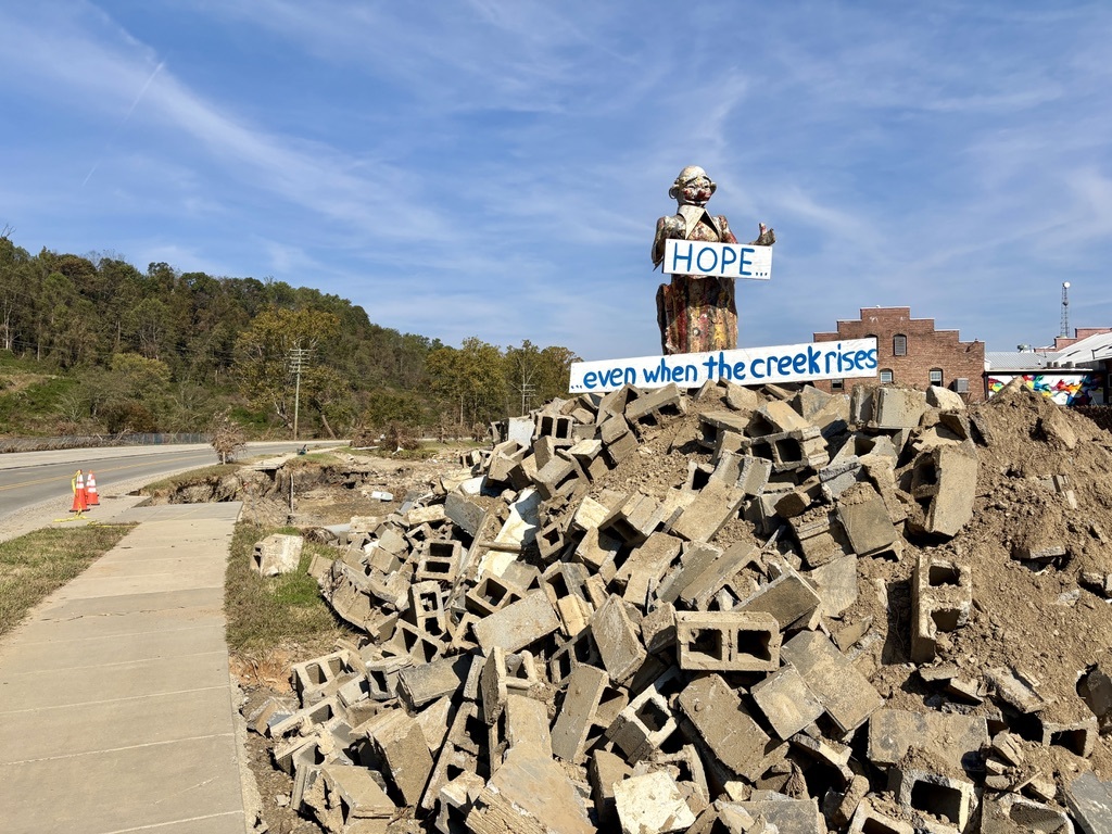
One year ago today, Helene devastated my southern Appalachian home and the surrounding communities. The storm touched river valleys and communities from East Tennessee to western North Carolina, upstate South Carolina to Georgia, and beyond.
We lost valued community members.
We lost access to natural spaces we relied on for recharge and connection.
The rivers we loved for fishing, paddling, and sustaining local businesses were left clogged with trash and debris.
Infrastructure like roads, bridges, and dams failed — leaving disconnection and communities at risk.
When I think back to those early days, I remember hearing the same question again and again: “Where can I help?” And the answer was simple, help your neighbors. We formed flush brigades (without running water we hauled non-potable water for flushing toilets), filled each other’s drinking water jugs, and shared hot drinks in my driveway as we organized to make sure that everyone had what they needed most.
Of course, restoring rivers is also my job. In order to be most helpful, I knew we needed to work together with local partners — who in many cases were my neighbors. With MountainTrue and Riverlink we listed the Rivers of Southern Appalachia on America’s Most Endangered Rivers® list to call for the resources we need to recover. Our advocacy centered on making rivers and communities safer — by addressing high-risk dams, removing storm debris, rebuilding stronger water infrastructure, supporting voluntary floodplain buyouts, and ensuring access to federal recovery funds.
The progress of the past year has been grounded in one clear goal: not just to repair rivers, but to make them more resilient for the future. One major win came through House Bill 1012 that created the new North Carolina Dam Safety Grant Fund with $10 million dedicated to addressing high-hazard dams damaged by Helene. Additional resources flowed to MountainTrue to support storm debris cleanup which created jobs and ensured ongoing reciprocity for our rivers. Another silver lining was when we brought the community together to celebrate at New Belgium Brewing to toast our hard work and take action for the work that’s ahead.
Recovery doesn’t end when the debris is cleared or when the funding comes through for the dam removal. True resilience means preparing for the future knowing that the next storm is on the horizon, focusing on advocacy efforts that will help long term.
America’s Most Endangered Rivers® calls on communities to spotlight the rivers at a crossroads, where decisions in the next year will shape their future for decades. Nominations are open now and it is a powerful way to keep community safety at the forefront of public attention.
As I mark this anniversary, I feel deep gratitude for the rivers that keep flowing, for the partners who stood shoulder to shoulder in recovery, and for the colleagues who continued to inspire me with their commitment and care. Helene reminded me that resilience is both a collective and personal journey. As we look ahead, I carry the resolve that we can and must build a future where rivers — and the people who depend on them — are ready not just to survive the next storm but to thrive in its aftermath.
What do you learn watching a river for fifteen years?
Do you notice little changes along with big ones? Do the animals tell a story? Does the water share its secrets?
How does public funding investment help to restore rivers?
American Rivers has been working with a group of experts along the Patapsco River in Maryland for more than a decade to answer these very questions. It has been a monumental group effort to document the river’s response to dam removal in terms of changes to biology and physical structure.
The process of monitoring the Patapsco River started back in 2009 before the Union and Simkins dams were removed (2010 and 2011) and continued through the removal of Bloede Dam in 2018. Monitoring the river was required by regulators for five years following completion of each project to track any changes to the river and its aquatic communities.
The main goals of these dam removal projects were to:
- Reconnect historic migration routes for fish species moving between saltwater and freshwater
- Provide access to upstream spawning and rearing habitat for migratory and resident aquatic species
- Eliminate a documented public safety hazard and attractive nuisance
Monitoring the river allowed us to figure out if our projects goals were met and to ensure nothing crazy happened as a result of the dam removals.
We considered questions like— what will happen to the native fish if we remove these dams? Will migratory fish be able to access spawning habitat upstream? Will the tiny critters known as benthic macroinvertebrates (essentially, water bugs) experience any changes as a result of habitat alterations?
We also considered what would happen to sediment and water flow if these dams were removed. We contemplated questions like— how fast will the sediment leave the former impoundments and move downstream? Where will the sediment go and what will be left behind? Aquatic animals live in and on the sediment, and they may look for certain sediments for spawning, so these queries impact them as well.
I am happy to share that through the extensive monitoring effort, American Rivers and our partners have determined that the objectives of this dam removal project were achieved.
American Rivers has compiled our Patapsco River Restoration Project Research into one easy to access page: https://www.americanrivers.org/patapsco-river-restoration-project-research/. This page illustrates the depth and breadth of the vast amount of knowledge that was gained from this publicly funded effort. We plan to continue updating the site as more data and articles are published.
Key Takeaways
Biological Monitoring
- Some species of migrating fish, including alewife and blueback herring, are making their way above the former Bloede Dam and spawning. MBSS even noted that nine species known previously to only be observed downstream of the Bloede Dam were observed upstream.
- Egg/larvae sampling results further verified that blueback herring actively spawned in the restored reach above Bloede Dam in 2024.
- Both alewife and blueback herring environmental DNA (eDNA— these are little bits of genetic material that living things leave behind in the water) was detected at sites upstream of Bloede Dam after the dam’s removal, but not before.
- American eel spread out once the Bloede Dam was removed and were climbing the eel ladder at Daniels Dam in droves.
- Benthic macroinvertebrates and resident fish seemed to recover fairly quickly after the completion of the project.
Physical Monitoring
- The physical (or geomorphic) changes to the river followed what was predicted by researchers based on site-specific modeling and monitoring results at other dam removal sites.
- The vast majority of sediment within the Bloede Dam impoundment evacuated within the first year post-removal.
- The sediment was observed moving downstream relatively quickly and causing no significant problems downstream. The river came to resemble a more natural system once again.
If you would like to dig a bit deeper into the findings of the monitoring efforts (but maybe don’t have time to read the full reports), check out this page.
What Happens Now
It’s important, especially in cases of such a significant investment of effort and public funds, to share these results with the broader community of researchers, practitioners, and regulators. Consequently, American Rivers and our partners have been presenting on this project at conferences and other events. We will be sharing a series of conversations on this project with our National Dam Removal Community of Practice in June. You can register here.
Our partners at MBSS are working on a collection of articles for publication exploring the response of different species to the removal of the dams. Our partners at USGS are working on their second publication highlighting the sediment response to the Bloede Dam removal. A series of other publications have already been produced and can be found here. As more publications come out, we will post them to that page.
In addition, we are now talking with Maryland DNR and the broader community surrounding Patapsco Valley State Park about potentially removing the upstream Daniels Dam. Those conversations will be ongoing this year as we work through a feasibility study and community engagement process. We offer an abundance of gratitude to our funders at the National Oceanic and Atmospheric Administration (NOAA) and the U.S. Fish and Wildlife Service (USFWS) for supporting this long-term monitoring project. Public investment in river restoration is critical to ensuring that healthy rivers are supported for the benefit of all.