Yuba River
An Enduring Sierra Classic
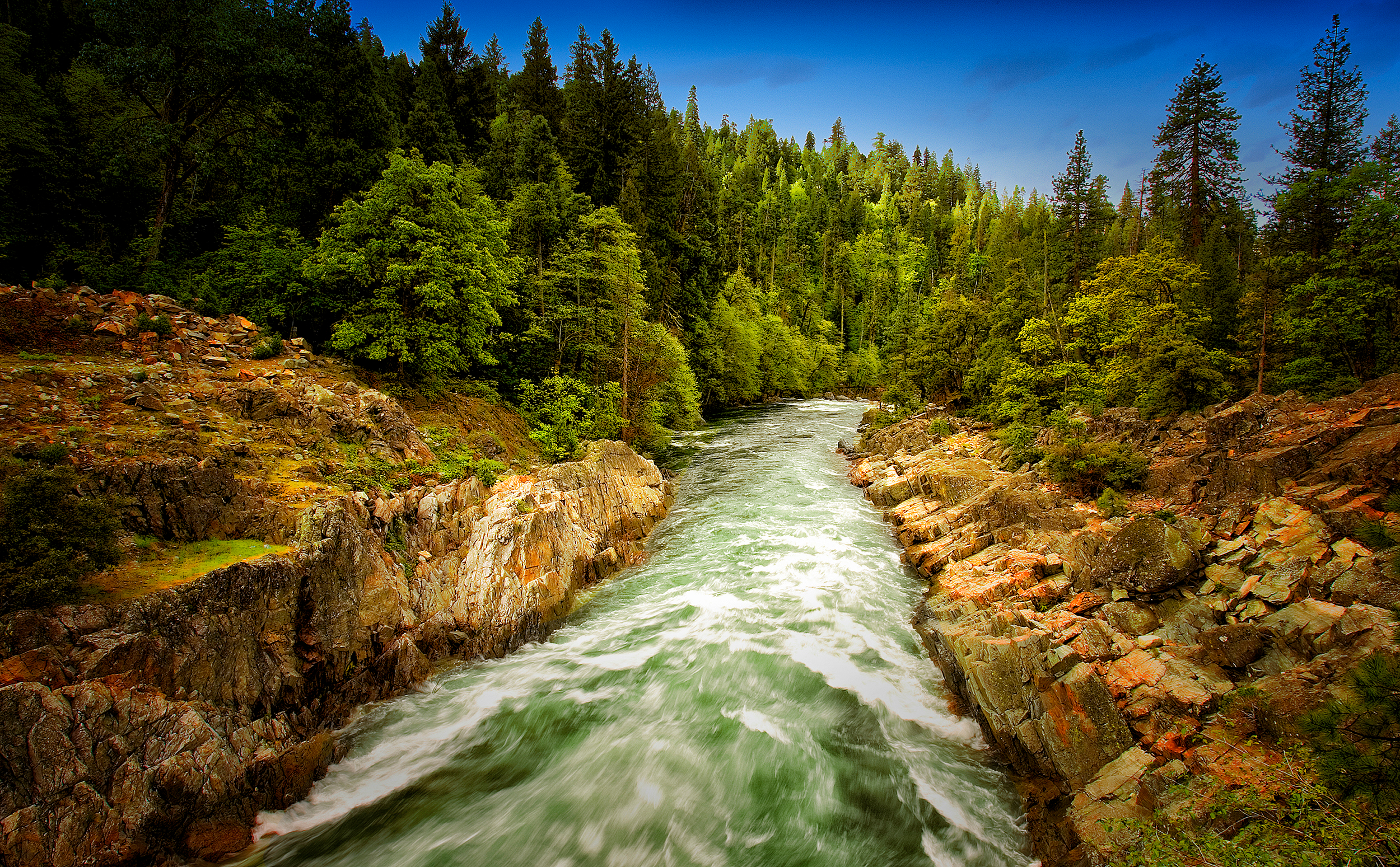
The Yuba River is a California classic. In the best sense, that includes the giant, polished granite boulders and emerald green water that creates cascades perfect for whitewater paddlers during high spring flows, transforming to idyllic swimming holes in the warm summer months.
Rising on the eastern border of the Tahoe National Forest, the Yuba’s North, Middle, and South Forks all have distinct characteristics, but each shares the beauty of the Sierra Nevada surroundings—and the legacy of mining and hydropower that comes with it.
Did You know?
The millions of cubic yards of hydraulic mining debris carried down the Yuba River raised stream beds up to 50 feet in some places, increasing flood risks. Hydraulic mining was eventually banned in 1884 due to the impacts of the debris flows on farming.
Much of the hydraulic mining debris remains as the “Yuba Goldfields,” a 10,000-acre riverside plot of oddly shaped gravel mountains, ravines, and pools created as mine waste flushed downstream.
Englebright Dam was built in 1941 to trap mining debris following the re-legalization of hydraulic mining in the 1930s. Today Englebright serves primarily for hydroelectricity generation.
The region’s historic gold rush once made it one of the most productive placer mining rivers in California, with operations quickly turning into large-scale industrial hydraulic mining before the practice was banned. And the steep, narrow canyons proved just a little too tempting to aquatic engineers, who left their mark with more than 30 dams, 20 powerhouses, and 500 miles of canals sprawling across the watershed.
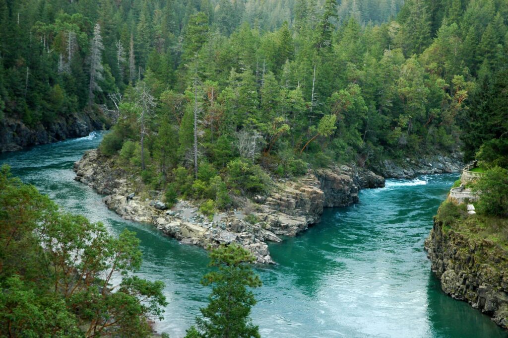
Between reservoirs and hydropower installations lie miles of top-tier whitewater runs that draw paddlers from around the West to the various forks of the river with a captivating wilderness feel despite often close proximity to roads. The undammed North Fork drains the beautiful Sierra Buttes that provide a lookout all the way to Mt. Shasta to the north and west to Mt. Diablo in the Bay Area. And the snowmelt runoff provides excellent cold water habitat for trout and reintroduced historic species like Chinook salmon and steelhead.
Let's stay in touch!
We’re hard at work in the California for rivers and clean water. Sign up to get the most important news affecting your water and rivers delivered right to your inbox.
A state Wild and Scenic River, the South Fork Yuba is the centerpiece of the South Yuba River State Park that stretches 20 miles to Englebright Reservoir, formed by a dam across the Yuba River’s main stem. The Pacific Crest Trail is among several passing through the watershed, making the area popular with backpackers, and a network of mountain bike trails pulls in fat tire fans.
In keeping with California culture, members of a local colony of artists, poets and musicians affectionately known as the “Yuba Nation” frequent the river for inspiration in summer months and to protest dams and other potential impacts to the river as they arise.
The Backstory
The Yuba River watershed is home to some of the first hydropower dams in California, in some cases dating back to structures built during the gold-rush era. These dams block access for anadromous fish along the 1,339-square-mile watershed that is considered one of the last remaining strongholds for Chinook salmon and steelhead runs.
Dams owned by the U.S. Army Corps of Engineers, Yuba County Water Agency, Nevada Irrigation District, and Pacific Gas & Electric affect more than 250 miles of rivers by reducing stream flow levels, altering habitat, and affecting native amphibians and resident fish.
The threat of hydropower dams placed the Yuba River on the America’s Most Endangered Rivers® report for 2011. Meanwhile, remains from hydraulic mining operations are prevalent along the Yuba River, although restoration efforts along the altered Lower Yuba River are in progress.
The Future
Dams on the Yuba—including Englebright Reservoir, Bullards Bar hydroelectric dam, and Daguerre Point Dam—are currently going through the Federal Energy Regulatory Commission (FERC) relicensing process, offering American Rivers an opportunity to push for improved stream flows, river habitat, and recreation access. Most significantly, it offers the opportunity for reintroduction of salmon and steelhead into their historic habitat in the upper Yuba basin.
For the foreseeable future, that reintroduction will come in the form of a “trap and transport” program circumventing the 260-foot Englebright Dam to reach the abundance of quality fish habitat found on the Yuba’s North Fork. As California continues to experience climate change and considers how to adapt to future climate conditions, fishery managers have come to recognize the importance of reintroducing salmon and steelhead to historic habitat at higher, and thus cooler, elevations to promote their recovery.
Until a realistic longterm solution is attainable, the transport method is the most effective way to return these fish to the Sierra Nevada for the first time in perhaps a century. Cold water flowing out of Englebright Dam combined with AR’s habitat restoration work on the lower Yuba River offers additional opportunity to establish a robust downstream fishery for spring-run Chinook and steelhead.