Meteorologists are forecasting a historically strong El Niño system this coming winter after a 2025 defined by prolonged drought and a weak snowpack, with a 95% chance of extreme precipitation. California sits on a climatic boundary where drought and deluge are recurring features of our hydrology, and unpredictability comes with the territory. Climate change is intensifying those swings. Increasingly, much of the water system we built over the last century was designed around an unreliable assumption: that the hydrology of the future will look much like the hydrology of the past.
Whatever this winter brings, one thing is clear: California needs a different kind of infrastructure strategy for the century ahead.
Some of our dams, levees, aqueducts, and reservoirs still serve a useful purpose. Others have outlived theirs. But for generations, we have treated built infrastructure as an asset while too often treating healthy rivers and watersheds as something separate from the systems that sustain our communities.
That distinction no longer makes sense. Healthy rivers are living infrastructure.
Nature has spent millennia perfecting myriad ways to move, spread, and store water across California’s landscape; when we’ve allowed it to do so, our fire risk is reduced, our water supply is more secure, our ecosystems thrive, and our communities have better access to clean drinking water. These aren’t simply environmental amenities. They are functioning parts of California’s water system.
Yet much of the 19th and 20th centuries brought a wave of development within and along our rivers – particularly the construction of dams and levees – that block and constrain those natural processes. More than 8,000 dams block California’s rivers (many of which are aging and/or obsolete), while thousands of miles of levees separate rivers from their historical floodplains. Degraded mountain meadows and forests have lost some of their ability to slow and hold water in our headwaters. And at the same time our rivers are under threat, decreasing annual snowpack and increasingly extreme storms means we are going to rely more, not less, on the ability of our watersheds to safely move and store water.
For the past century, California has invested heavily in our ability to control water. The next century will require us to invest just as deliberately in restoring the ability of watersheds to manage it. That requires moving beyond a collection of one-off restoration projects and managing rivers as connected systems. A healthy river depends on processes operating across an entire watershed – from forests to meadows in its headwaters to the floodplains, groundwater basins, and communities downstream.
The intervention will differ from river to river. In some places, it means restoring mountain meadows and forests that can slow and store water higher in the watershed. In others, it means reconnecting rivers to floodplains where doing so can reduce flood risk, expand habitat, and create opportunities for groundwater recharge. And in some places, it means removing obsolete dams whose costs and risks now outweigh their benefits. The objective should be the same: restore the processes that allow watersheds to function as resilient systems.
California already knows these approaches can work.
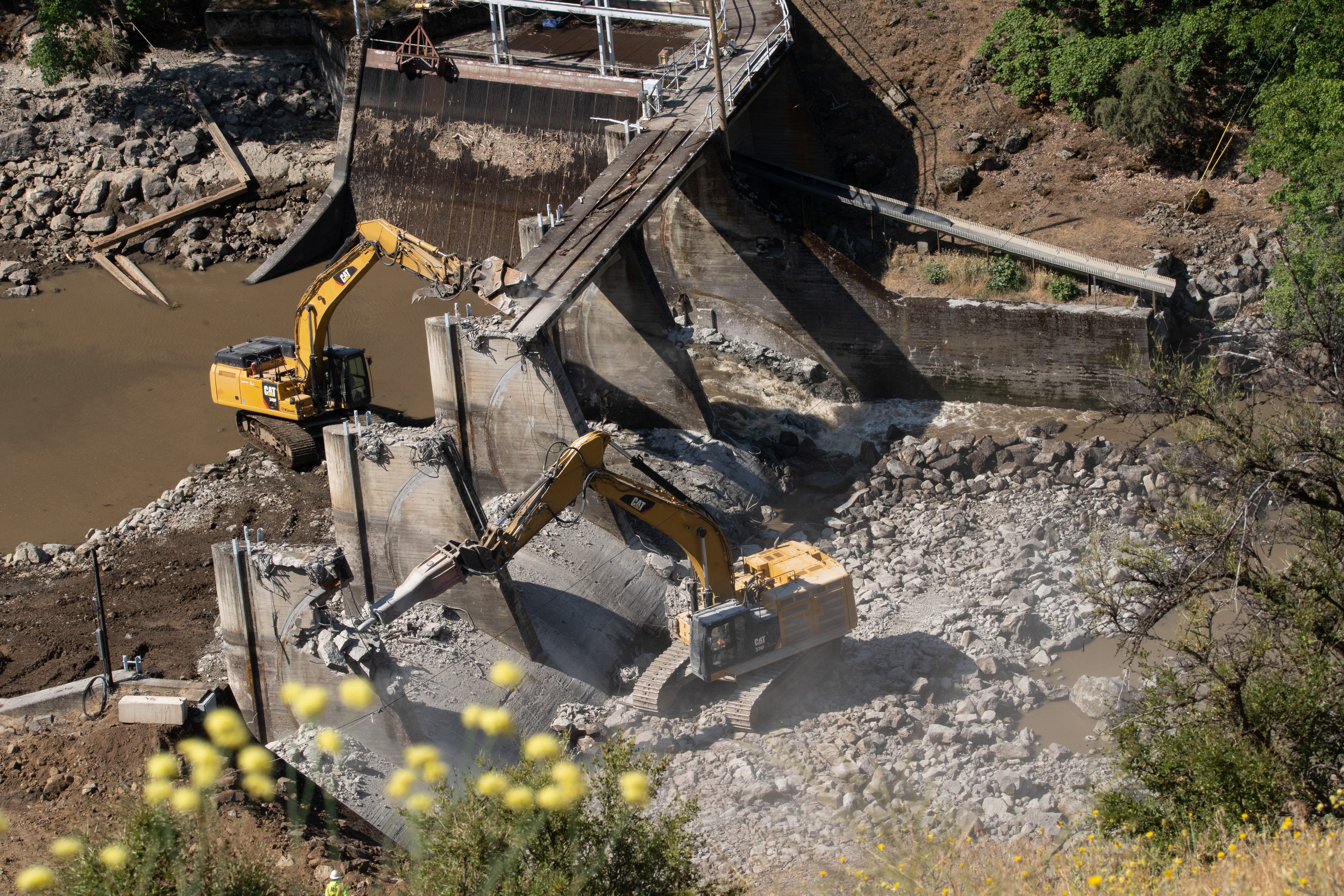
In the Central Valley, restoration in the Yolo Bypass demonstrates the multiple benefits that emerge when we give rivers more room to access their floodplains. In the Sierra Nevada, the restoration of Ackerson Meadow in the Tuolumne River watershed is returning a deeply eroded landscape into a functioning wet meadow. And on the Klamath River, Tribally led removal of four hydroelectric dams has reconnected hundreds of miles of river habitat in the largest dam removal project in U.S. history when cheaper energy alternatives made those dams obsolete.
The challenge now is not simply to demonstrate that river restoration works. It is to move from proofs of concept to implementation at scale.
California should recognize healthy rivers and watersheds as essential infrastructure – and invest in restoring them with the same seriousness we bring to the infrastructure we’ve built. That means making watershed-scale river restoration a core component of state water planning and directing public investment toward places where restoring natural processes can provide measurable water supply, reduce flood risk, improve public safety, and benefit ecosystems.
It also means moving away from fragmented approaches that treat forests, meadows, rivers, floodplains, and groundwater as separate systems. They are pieces of the same hydrologic landscape. Restoring them strategically, at watershed scale, can create benefits that isolated projects cannot.
This approach is not about choosing nature over people, or rivers over communities. Those are false choices. Healthy rivers and healthy communities are not only compatible – they are inseparable. When rivers are healthy, they do irreplaceable work for us: reducing flood risk, storing water across the landscape, recharging aquifers, supporting clean water and providing habitat. When rivers lose those functions, communities ultimately bear the consequences and the costs.
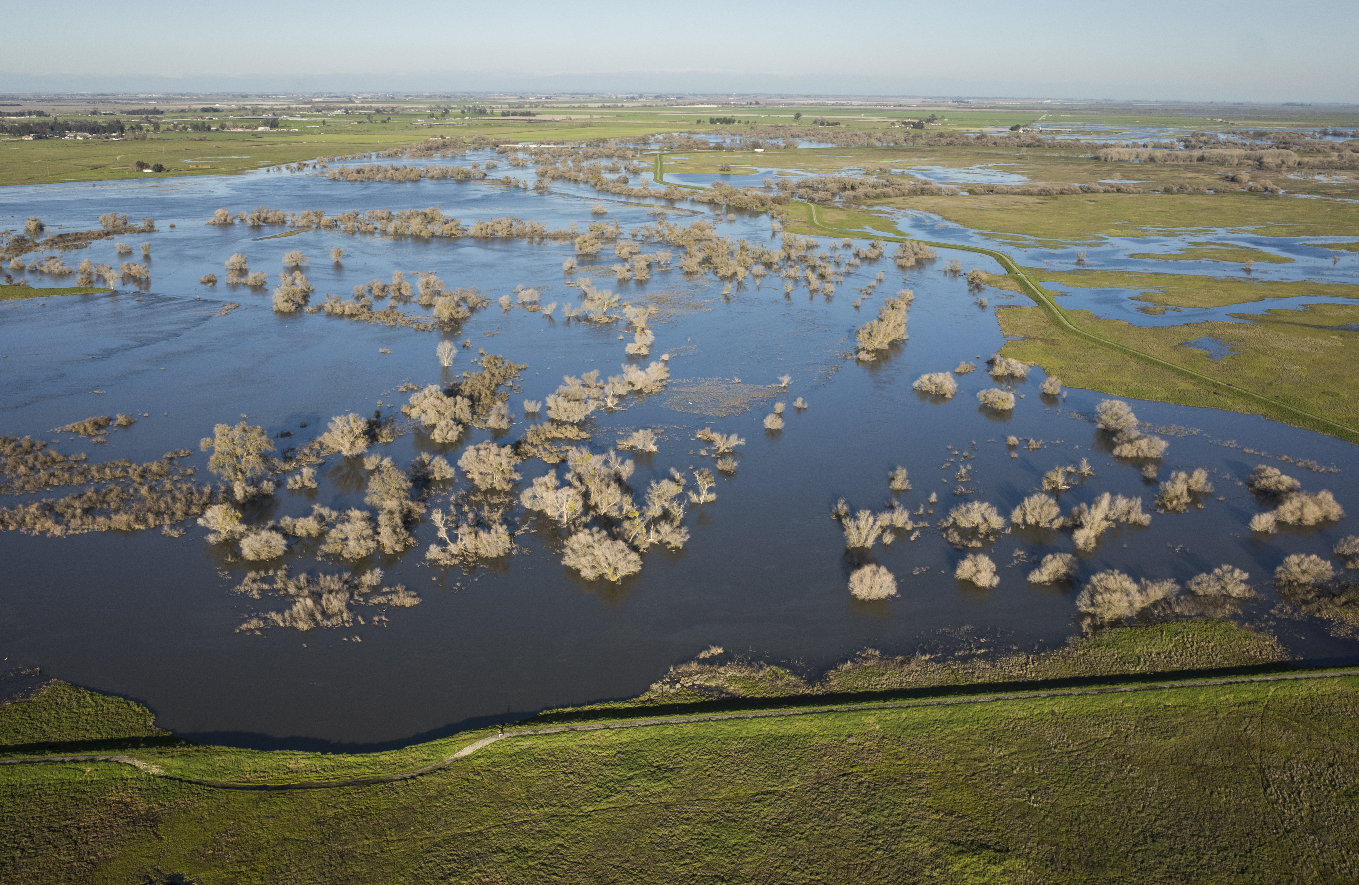
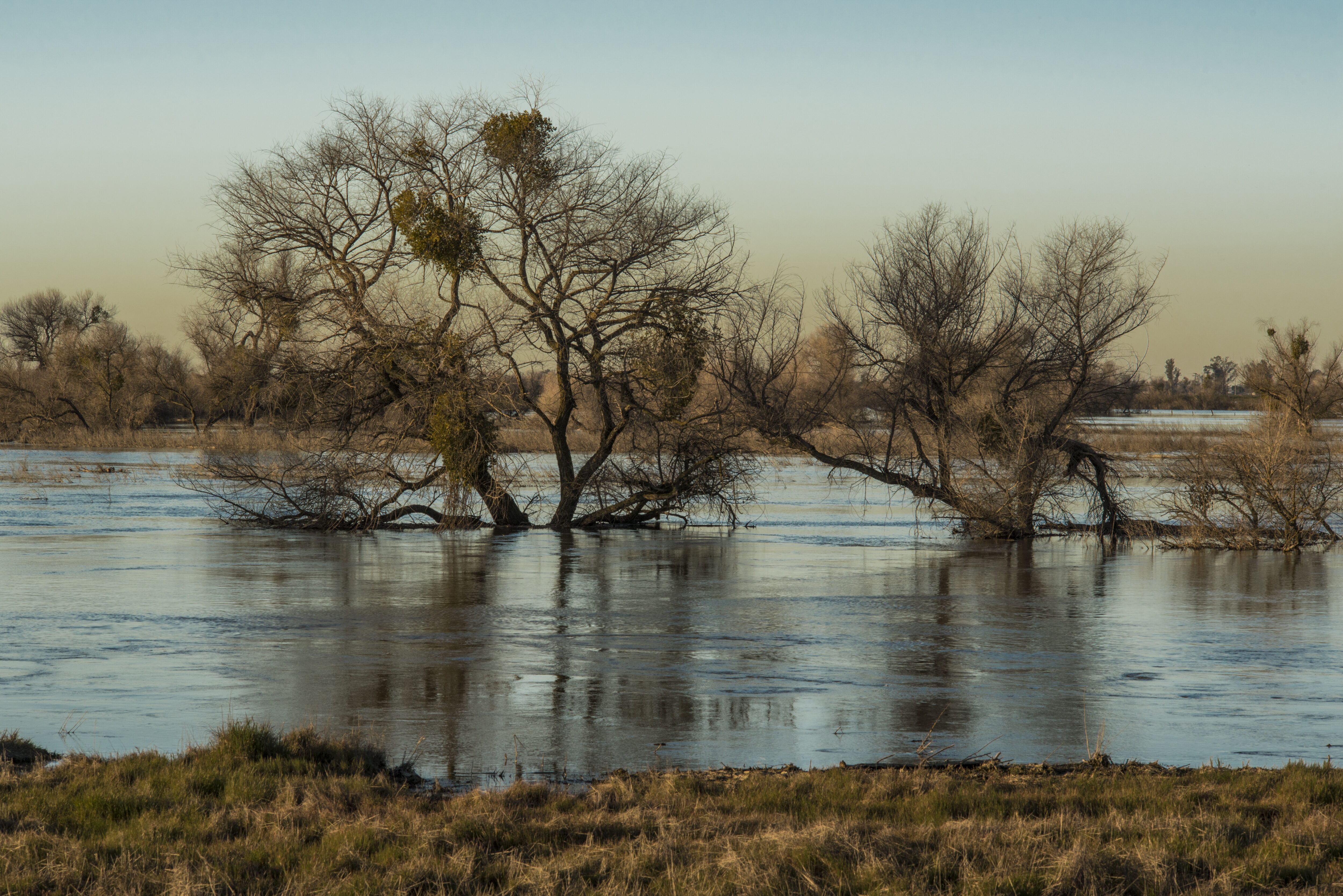
Healthy rivers and healthy communities are not only compatible – they are inseparable. When rivers are healthy, they do irreplaceable work for us: reducing flood risk, storing water across the landscape, recharging aquifers, supporting clean water and providing habitat. When rivers lose those functions, communities ultimately bear the consequences and the costs.
Nor is the choice simply between gray and green infrastructure. The question California should be asking is more practical: what combination of built and living infrastructure will make our water system most resilient to the conditions we now face? That question becomes especially urgent when another extreme winter is approaching. Our immediate attention will understandably turn toward reservoir operations, levees, flood preparation, and emergency response. But we should not lose the larger opportunity to modernize our water management when the storms pass.
A century ago, California transformed its rivers to meet the needs of a growing state. Now we face different challenges. We need to decide which pieces of that legacy infrastructure continue to serve us, retire those that no longer do, and restore the living infrastructure we will increasingly depend upon.
The next drought will come. So will the next flood. California cannot control that cycle. But we can create a water system better prepared for both.
Healthy rivers aren’t beneficiaries of infrastructure investment. They are infrastructure worth investing in.
The Roadless Rule is a landmark national policy adopted by the U.S. Forest Service in 2001 to maintain approximately 58.5 million acres of largely healthy, undeveloped National Forest System lands. The Rule accomplished this by prohibiting new road construction and commercial timber harvest in designated Inventoried Roadless Areas (IRAs) while allowing reasonable exemptions for access to strategically cut timber to reduce fires and in order to respond to emergencies and public safety needs.
For over 25 years, the Roadless Rule has protected access to clean drinking water for millions, provided essential habitat for wildlife, helped mitigate wildfire risks, and preserved critical watershed health. Sadly, the U.S. Department of Agriculture recently announced it is seeking to revoke the Roadless Rule, which would be the single largest rollback of protections for rivers in U.S. history — putting clean water and freshwater habitat at serious risk.
A lot of the Roadless Rule rollback conversation has centered around existing Inventoried Roadless Areas (IRAs) in the western part of the country. But what about the Eastern part of the country? There are hundreds of thousands of acres of healthy forest land in the East that are protected by the Roadless Rule. These forests protect critical drinking water supplies and provide some of the best places to fish, paddle, hunt, and play east of the Mississippi.
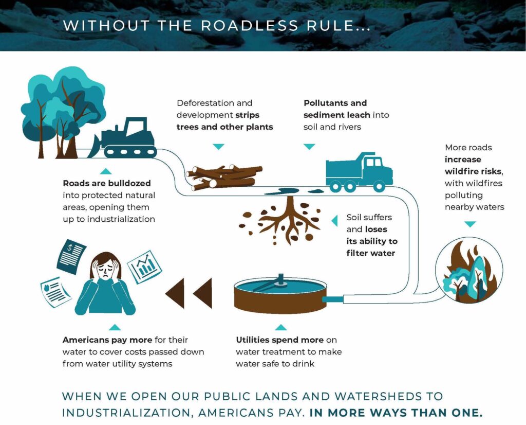
The risks of rescission and costs are significant. The Roadless Rule has proven to be cost-effective and successful for more than a quarter century by protecting drinking water, fishing, and hunting opportunities.
Rescinding the Rule will inevitably result in:
- Higher-cost, lower-quality drinking water
- Diminished fish and wildlife habitat, which would result in fewer, more fragmented fishing and hunting opportunities
- Increased wildlife-vehicle collisions
- Lower stream health
- Threaten hiking, paddling, climbing, and outdoor recreation opportunities and businesses.
Let’s Zoom In
In the Chesapeake Bay Watershed, drinking water resources will be made more vulnerable to sediment, litter, and toxic pollutants introduced through new roads, construction, and logging, which is in direct opposition to the Bay’s cleanup plan that is seeking to reduce these exact pollutants. This would, in turn, increase direct costs to ratepayers and businesses to meet heightened demands of utility water treatment.
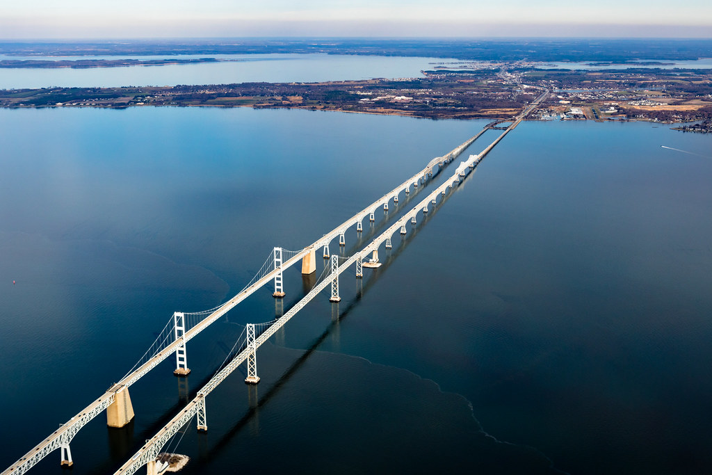
In Virginia, Inventoried Roadless Areas under the Roadless Rule protect almost 400,000 acres of public land and more than 700 river miles from industrialization and the pollution risk that comes with it. If the Roadless Rule were rescinded, 80% of the river miles protected by IRAs in Virginia would lose their main source of protection.
Communities like Shenandoah, Virginia, rely on IRAs for their drinking water. The county recently spoke out against the misguided efforts to rescind the Roadless Rule in a letter to the United States Forest Service:
“Beyond water security, our roadless areas offer outdoor recreation opportunities for local families and visitors, which is an important economic driver in our region. They feature world-class resources alongside a rich heritage of backcountry hunting and fishing. Crucially, these areas protect vital wildlife habitats— sheltering Virginia’s premier native brook trout streams, which report the largest populations south of the Mason-Dixon line.
Ultimately, the Roadless Rule ensures balanced, responsible forest management while leaving the majority of our national forests available for other uses. Given the Forest Service’s existing maintenance backlogs, it would be fiscally irresponsible to build new roads that cannot be maintained, especially at the expense of irreplaceable backcountry areas and downstream impacts.
Shenandoah County deeply values and depends on these wild spaces. They ensure everyone can experience solitude and adventure for future generations and protect our cultural heritage. Because they support our economy and protect our water supply, we strongly urge the Forest Service to maintain current forest management standards and retain the Roadless Rule.”
In North Carolina, Inventoried Roadless Areas protect more than 170,000 acres of public land; rescinding the Roadless Rule would remove the main source of protection for more than 44% of river miles protected by IRAs.
As you can see, the Roadless Rule has been a vital landmark national policy for the last quarter century. Rescinding the Roadless Rule threatens the foundation of our drinking water infrastructure and some of the best places for recreation east of the Mississippi. Learn more about the Roadless Rule and how it protects our nation’s rivers.
Sometimes a trip down a wild river is all that’s needed to make the world right again. I first paddled the Gila River headwaters in 2020 when, during the depths of COVID, my friend Pete (who made a film during the trip), and I packrafted the storied wilderness section of the river. We met up in Gila Hot Springs, NM, and slept out under the stars on our friend John’s deck the night before we launched. Over the next five days, the little river did what protected areas always seem to do for me when I need them to: it provided a respite from our modern world, which at the time was in the throes of a pandemic.
Overhanging groves of old growth sycamores gives the Gila River Canyon an intimate feel, and its free-flowing nature ensures that there is always a comfortable gravel bar for two river rats to sleep out on each night. Water levels were low on our trip, necessitating long days of paddling, but that just gave us an excuse not to rush. I left that trip convinced that the Gila River, with its intact landscape, robust and diverse wildlife populations, and jaw-dropping scenery, is exactly the type of river that the framers of the Wild and Scenic Rivers Act envisioned protecting when they passed the law in 1968.
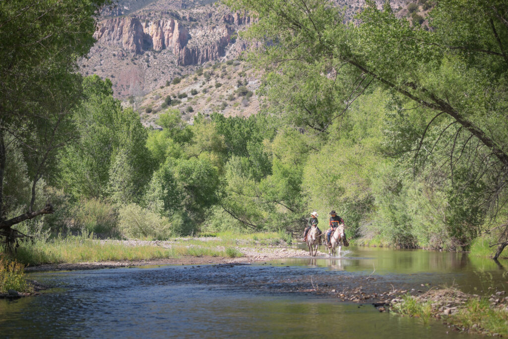
The southernmost tributary of the Colorado River, the 650-mile-long Gila River is the backbone of a massive, 60,000-square-mile watershed that includes tributaries like the San Franciso, San Pedro, Santa Cruz, Salt (and the Salt’s largest tributary, the Verde), the Agua Fria, and Hassayampa rivers. This river system gave rise to the large, complex, agricultural civilizations of the Hohokam and Mogollon peoples. For Indigenous and non-indigenous peoples alike, this continues today, with the clean water provided by the Gila River supporting communities and farms like Silver City, NM and the fields of the Gila River Indian Community, to the greater urban metropolis of Phoenix, AZ, and 180,000 acres of leafy greens grown in Yuma County. All this civilization extracts a cost though: the lower Gila regularly runs dry in a number of places and struggles to retain its natural character on its long trek across Arizona to the Colorado River.
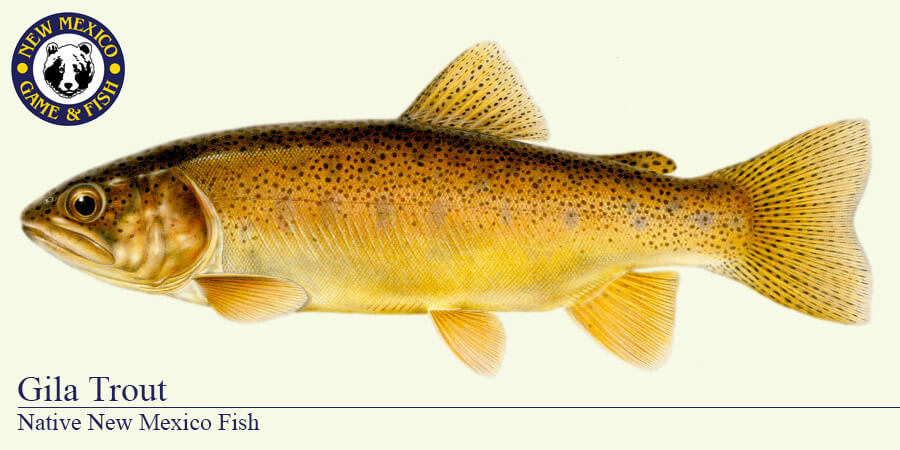
This hasn’t been the fate of the Gila’s headwaters in southwest New Mexico, though – at least not yet. Emanating from the Continental Divide in the Black Range and cutting a series of canyons through the Gila Mountains, the forks of the Gila and San Francisco rivers constitute the largest free-flowing headwaters system remaining in the Southwest U.S. These headwater ecosystems are a stronghold of Gila trout, elk, mule deer, black bears, and Mexican wolves; the area is also the home of the reclusive Gila monster, soaring peregrine falcon, and lyrical canyon wren. Deep, shaded grottos drain the volcanic slopes and high-altitude forests and meadows that our nation’s first designated wilderness area is known for. The river smells and sounds alive.
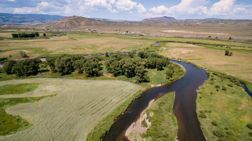
At a time of unprecedented water stress in the Colorado River system, the accelerating heat and aridity of the Southwest, and the inexorable grind of development, protecting headwaters systems like the greater Gila River headwaters is an act of care – care for the rivers that are our nation’s natural water towers, care for the wildlife with whom we find kinship and wonder, and care for the future of humanity. Beautiful, intact rivers like the Gila not only support our cities, our agriculture, and our economies, but also our collective spirit.
Faced with a plan to dam and divert the Gila River, and recognizing the immense value of keeping the Gila as it is, a bipartisan group of people worked with Senator Martin Heinrich – and later, Representative Gabe Vasquez – and eventually the whole New Mexico delegation to create and introduce the M.H. Dutch Salmon Greater Gila Wild and Scenic River Act. Named for Maynard Hubbard “Dutch” Salmon, a Silver City-based writer, conservationist, and fierce advocate for the Gila River who passed away in 2019, the bill would protect 450 miles of 30 free-flowing headwaters rivers, and 144,000 miles of riverside lands under the Wild and Scenic Rivers Act – the only federal protection that guarantees that a river will remain free-flowing forever.
This effort is supported by a wide range of local and state interests, including the Grant County Board of Supervisors, City of Bayard, Town of Silver City, Town of Hurley, the Fort Sill Chiricahua Warm Springs Apache Nation, the All Pueblo Council of Governors, 2 faith-based organizations, 2 veteran’s organizations, 4 outdoor recreation organizations, 7 sportsman’s organizations, 35 conservation organizations, and more than 150 local businesses. From backcountry horse packing and hunting to bird watching and family picnics, New Mexicans see themselves and their values reflected in this bill.
The M.H. Dutch Salmon Greater Gila Wild and Scenic River Act has been introduced and had hearings in three different Congresses and is as well positioned for passage as any natural resources bill awaiting Congressional action today. In an era when people are tempted to paint conservation as a dilemma between either protecting wild places or supporting economic growth, we can learn from efforts like the one to protect the Gila River that those values are in fact interdependent, and that we have the wisdom and foresight to do both by protecting the wild landscapes that create our rivers, recharge our groundwater, and provide clean water for communities and agriculture downstream.
The same is true for over a dozen Wild and Scenic River bills that have been introduced and are currently awaiting action by Congress. Some, like the Gila, have been waiting for many years. With Congress’ help, that wait could be over soon.
For more than the last century, the flows of the Colorado River have been managed and dictated by the demands of a rapidly growing and changing West. There are founding legal documents, and then agreements stacked on those, often known as the “Law of the River.” These agreements are between states, between sovereign nations, including Tribal Nations and Mexico; between districts and companies and branches of the US Government. It’s hard to find the appropriate metaphor for how all of these agreements work together (and at times against one another) to manage the Colorado River system. But even fraught metaphors are sometimes the only way to get through something so complicated.
Imagine the web of agreements and founding legal documents that guide the management of the Colorado River as a body. The 1922 Colorado River Compact would be the skeleton, the framework upon which all the other functions of the body are built. The limbs could be the communities, farms, Tribes, businesses, ecosystems, and economies that rely on the river’s blood (Colorado River water). The agreements that build on the framework of the Compact, such as the 2007 Interim Guidelines or the 2019 Drought Contingency Plan (DCP), act as nerves that facilitate or trigger movement and action. Perhaps the brain is the network of decision makers – the Bureau of Reclamation, the states, the Tribes, Mexico and others whose decisions and cooperation keep the system functioning, underscoring why coordination and consensus are so important: a body whose different parts are working at cross-purposes cannot function effectively. The blood then, of course, is the Colorado River water allocated to parts of the body.
Continuing the body metaphor for the contemporary management of the Colorado River system, additional agreements (or the nerves that trigger certain action) were added to the body.
On Friday, August 24, the Bureau of Reclamation released three documents outlining a 10-year framework for how the Colorado River will be managed for the next two years and how management decisions for the subsequent 8 years will be made. You can read the Bureau’s summary doc here.
- The Final Environmental Impact Statement (FEIS): evaluates the many proposed plans Reclamation considered for how the river should be managed going forward, and identifies a preferred alternative, a 10-year framework built on operating plans developed in at least two-year increments;
- The Record of Decision (ROD): adopts the 10-year operating framework and sets the principles and guardrails for future operations including how water can be stored, shortage sharing, critical infrastructure protection, consultation, and the movement of water between Lake Powell and Lake Mead; and
- The 2027-2028 guidelines: establish the specific operating approach for the first two years under the new framework.
While the two-year guidelines put real numbers and real movement on the table, the ultimate test is whether the guidelines, alongside the side agreements, investments, and management tools needed to support them, are put in place and function as intended – and whether, together, they can keep the body upright.
Six months from now, the more consequential questions will be whether the new guidelines:
- provide more certainty and transparency, including clear pathways for addressing disputes and disagreements when they arise;
- support flexible and adaptive management tools that can respond to changing hydrology and conditions;
- meaningfully include Tribal Nations in both decision-making and implementation;
- reduce reliance on emergency operations and short-term crisis response; and
- create a workable path toward long-term resilience — one that can withstand disagreement, including litigation, without bringing implementation and collaboration to a halt.
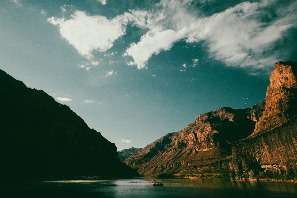
Finally, and critically, these new guidelines must recognize healthy rivers and watersheds as a core element of the Basin’s resilience infrastructure, because in the middle of all the agreements – at the core of all the collaboration and controversy, the skeleton and nerves and muscles that move it, there is a river – there is a heart; the whole reason blood moves through the system at all.
Colorado River in the Grand Canyon, Arizona | Nick Kelley
Healthy rivers and forests, connected floodplains, and intact watersheds are essential to the body, to the Basin. They support the reliability of our water supplies, reduce the risks and impacts of wildfire; they sustain fish and wildlife, support recreation, and strengthen the Basin’s ability to withstand drought and changing conditions. They are invaluable.
Which is to say, at the center of all the agreements and negotiations and collaboration and controversy, is the river. Has always been the river. And if we succeed at all in our management, if we have any hope of keeping this body upright, there will always be the river.
From its start as a pure snowflake in the Rocky Mountains of Montana to its clouded, churning confluence with the Mississippi River in St. Louis, the “Big Muddy” has for centuries been incrediby impactful to the communities that call it home. Native Americans were first to recognize the importance of the Missouri River, with twenty-nine Tribal Nations recognized to hold cultural, economic, or water rights to this current day. Followed by Lewis and Clark on their historic “Corps of Discovery Expedition”, the river opened up a new horizon for the newly established United States of America to expand.
As time moved on, the Missouri and its floodplain became more developed, heavily farmed, tightly constricted, and eventually dammed. The Pick-Sloan Flood Control Act of 1944 changed the wild and free Big Muddy like never before; building massive dams and reservoirs, and thousands of miles of levees to facilitate flood control, farm irrigation, commercial navigation, and hydropower generation. While it can be debated as to the successes of Pick-Sloan, one thing is certain, a new wave of threats to the health and function of the river itself was set in motion and continues to grow today.
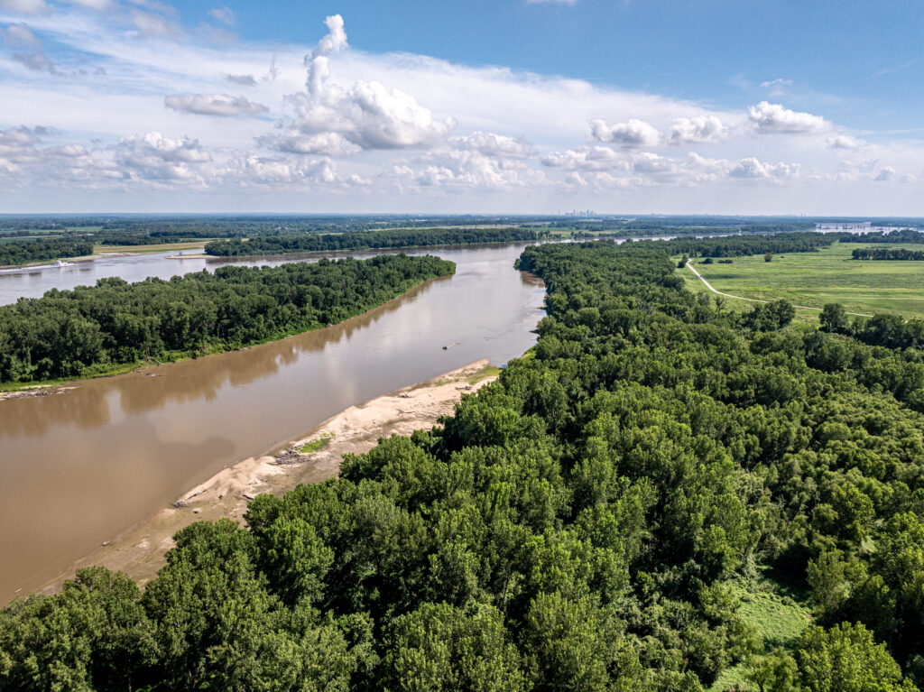
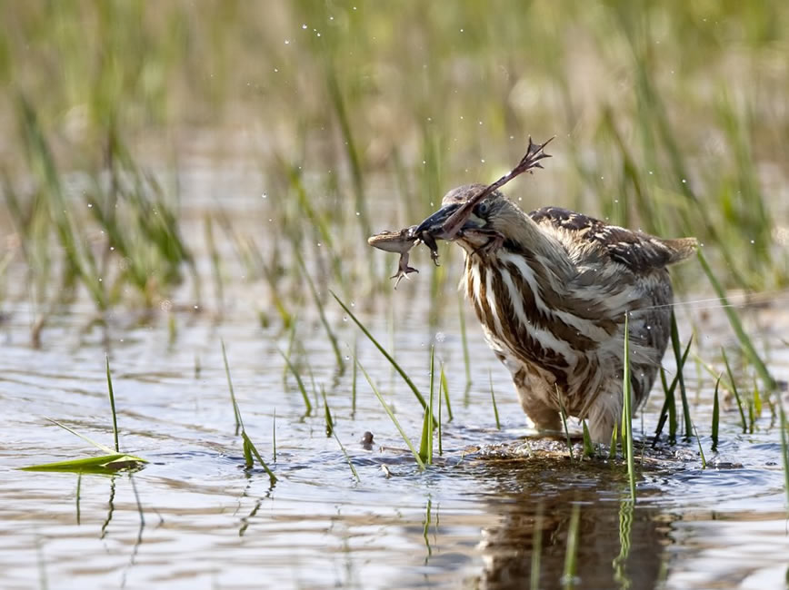
One of the first major rivers that was a focus of conservation efforts by American Rivers, we pushed for the endangered species listing of the pallid sturgeon, piping plover, and interior least tern. Changes in the river connectivity, historic hydrology, and natural sandbar creation severely impacted these species’ ability to survive. We were also a primary advocate in the subsequent actions for the Congressional creation of the U.S. Army Corps of Engineers’ (USACE) Missouri River Recovery Program (MRRP).
The MRRP is focused on:
- (1) avoiding actions that jeopardize federally listed species, and
- (2) the Bank Stabilization and Navigation Project Fish & Wildlife Mitigation Project (BSNP).
While advances have been made, including the de-listing of the interior least tern and the slow completion of levee-setbacks to establish floodplain re-connection, there is still over halfway to go to complete the total 166,750 acres of Missouri River floodplains that were approved to be acquired and restored as part of the BSNP.
The continued threats facing the health and function of the Missouri River and its watershed, however, are increasingly evident as flooding and drought events become more erratic and severe, source water protections are in jeopardy, and public recreational access is limited. To both position American Rivers as a MRRP advocate and conservation delivery partner, and to increase the rate of floodplains conservation toward this approximately 167,000-acre goal, our staff are official “Fish and Wildlife Stakeholders” to the Missouri River Recovery Implementation Committee (MRRIC).
As an advisory stakeholder to the agencies responsible for the delivery of the MRRP, we are well-positioned to advocate for the continued Congressional funding support and on-the-ground floodplains protection, reconnection, and restoration acres outlined in the BSNP – all of which will then become lands open for public recreation. Through our Floodplains Conservation and River Protection programs, we are actively working across all sectors of government, non-profit, business, community, and private landowner river interests to identify conservation and policy solutions to these current threats. In the coming years, we are focusing our Missouri River floodplain protection and restoration work on both increasing the rate of BSNP acquisitions and restorations and enrollments in U.S. Farm Bill conservation programs, and through federal and state policies that bring the needs of the Big Muddy to the forefront. Such a storied river… deserves a healthy future.
For more than 50 years, the Endangered Species Act has protected species from going extinct and disappearing from our planet forever. Animals and plants alike have benefited from these protections, and many are thriving today. One of the most crucial aspects of the Endangered Species Act that has led to such success is ensuring that no “harm” can be inflicted upon them or their habitat.
Disappointingly, in the last month, the administration changed the definition of “harm” to exclude “habitat”, leaving crucial areas that these species depend on open to destruction. Without habitat protection, it is easier for extractive industries to degrade protected areas that serve as a lifeline for entire ecosystems. Habitat loss is already the leading cause of extinction, and freshwater species are going extinct at a significantly higher rate than land or ocean species.
When the Endangered Species Act was first written and passed with an overwhelming bipartisan majority in Congress, preserving habitat was part of the original intention. The Supreme Court has previously upheld the Fish and Wildlife Service’s definition of “harm” due to the known scientific importance of a species’ habitat. The Administration’s decision to eliminate this foundational and commonsense element of the Endangered Species Act goes against decades of precedent and work to protect these crucial species.
One group of species at greatest risk of extinction in the United States is freshwater mussels. Freshwater mussels are fascinating species that have a complex life cycle. Baby mussels even hitch a ride on fish to move upstream. They also play an important role in keeping streams clean and healthy since they are filter-feeders.
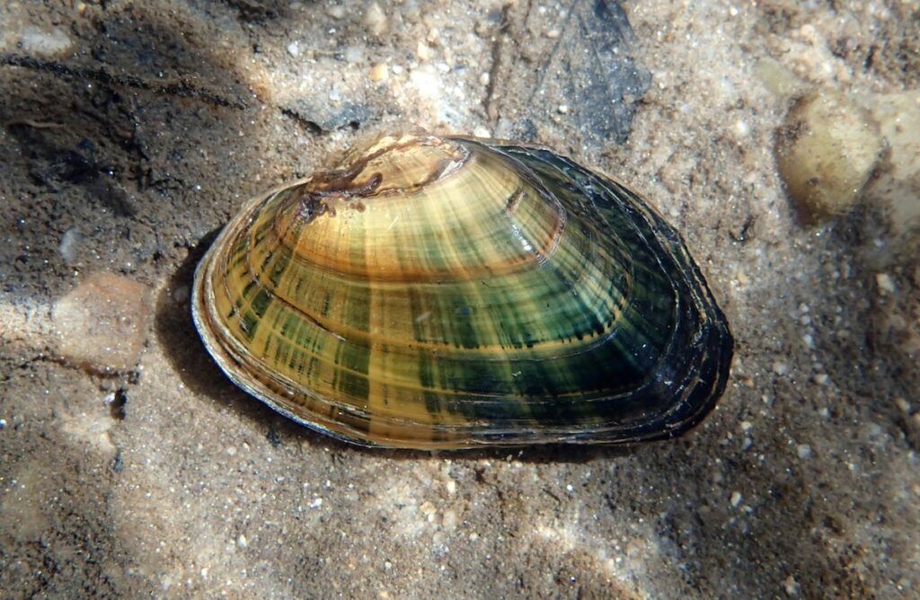
Some individual freshwater mussels can filter 30 gallons of water a day! And they can remove harmful pathogens such as E. coli from the water. Sadly, freshwater mussel populations are declining, and American Rivers is working with partners to identify the cause. This change in the Endangered Species Act is now another challenge. How will mussels be saved from extinction if the rivers they live in and depend on are being destroyed?
With proper protection, we can save species. The Roanoke logperch was recently delisted after almost 36 years, largely due to the locally supported removal of 4 obsolete dams, reconnecting hundreds of miles of its habitat in Virginia and North Carolina. Recognizing the importance of habitat under the Endangered Species Act, agencies funded and coordinated the work to reconnect river habitat and restore the Roanoke logperch.
Approximately a quarter of the world’s freshwater wildlife is already at risk of extinction due to loss of habitat. It is possible to bring more species back from the brink of extinction if local, state, and federal agencies all come together with a common goal of saving their habitat. Show your support for endangered species below!
On June 11, dozens gathered in the early morning light at Great Valley Grasslands State Park outside of Merced to celebrate a milestone 15 years in the making — the reconnection of the San Joaquin River with more than 220 acres of historic floodplain habitat. The energy was palpable as scientists, Tribal leaders, state officials, nonprofit partners, and community members came together to witness something that had taken the better part of two decades to achieve.
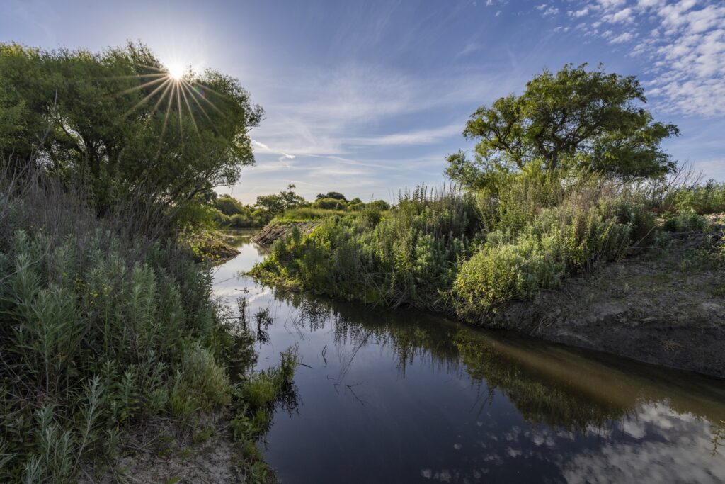
The Grasslands Floodplain Restoration Project, completed in February 2026, is one of the most significant floodplain restoration efforts in California’s San Joaquin Valley. The project will improve habitat for threatened and endangered fish and wildlife species, support groundwater recharge, and restore one of the last and largest undisturbed expanses of wetlands and native grasslands in the region.
American Rivers led the project implementation in close partnership with CA State Parks, River Partners, and Flow West. The celebration was timed to coincide with California State Parks Week and was one of five spotlight events held across the state.
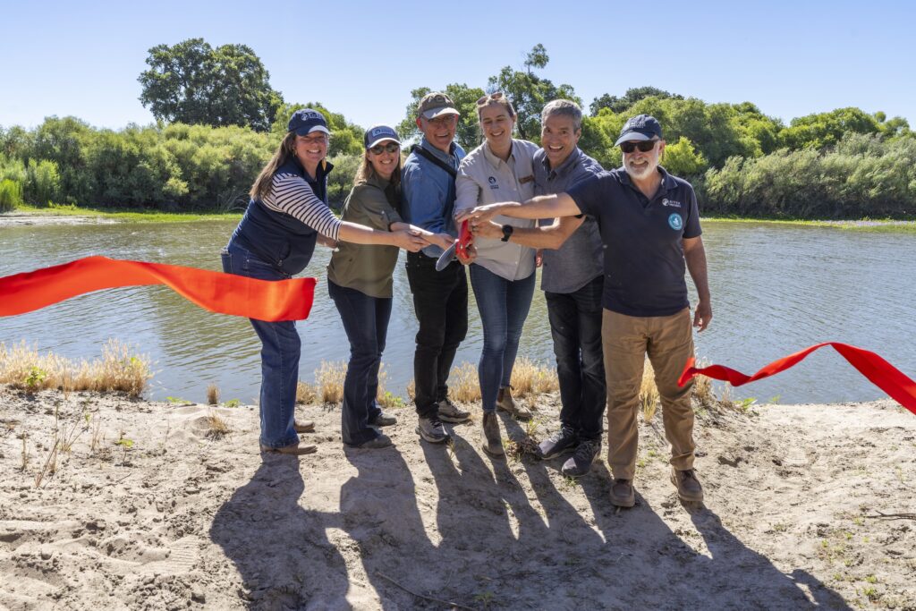
A Morning Worth Celebrating
The morning featured an inspiring lineup of speakers, including California Natural Resources Secretary Wade Crowfoot, Director of CA State Parks Armando Quintero, Chairperson of the Northern Valley Yokut Ohlone Tribe Kathy Perez, and Central Valley District Superintendent Danielle Gerhart. American Rivers’ California Regional Director Ann Willis delivered a particularly moving reflection on the power of partnerships, reminding the crowd that restoration is neither a sprint nor a marathon — but a relay. The partners that worked to restore the landscape are passing the baton on to the next generation to care for the land.
After the speeches, everyone walked together along the San Joaquin River to the site where the levee was notched — the precise point where the river will now flow onto its historic floodplain for the first time in over 75 years. The crowd cheered as a large red ribbon was cut across the new channel, a fitting symbol of a river finally finding its way home.
We were also proud to celebrate our partnership with Cox Enterprises, whose team traveled from Atlanta to see the completed construction firsthand and advance their commitment to replenishing groundwater and restoring habitat across the region.
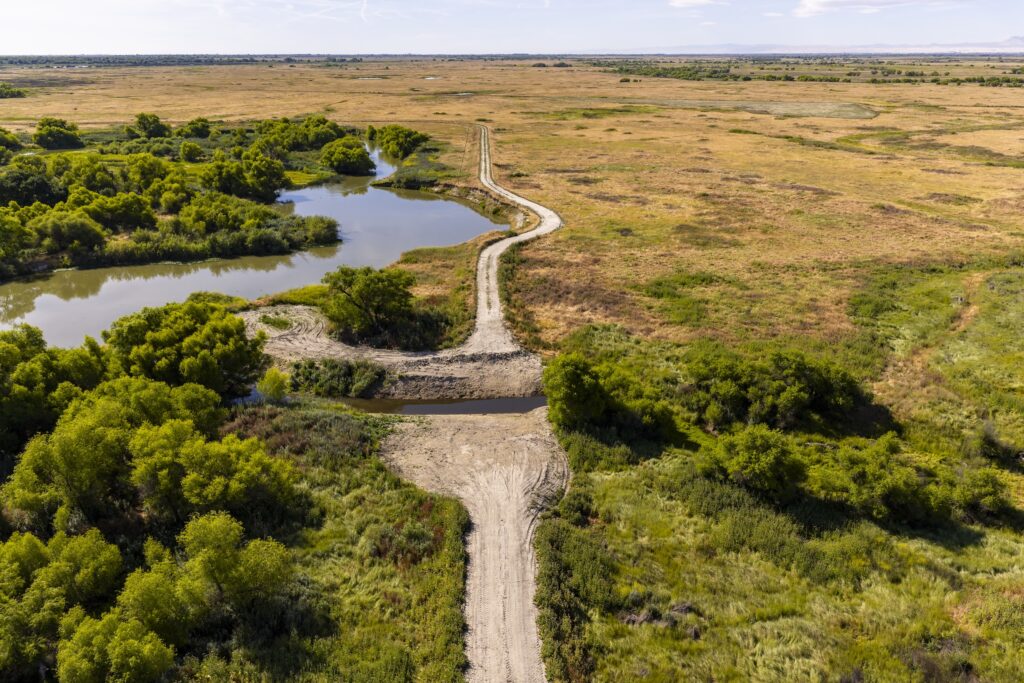
Why This Restoration Matters
The benefits of reconnecting the San Joaquin River to its floodplain extend far beyond Great Valley Grasslands State Park. Floodplains are among the most productive ecosystems on earth — they filter water, recharge groundwater supplies, buffer communities from flood damage, and provide critical habitat for fish and wildlife.
By breaching and removing segments of an old, decommissioned levee, the project allows the San Joaquin River to flood the grasslands seasonally, as it would have naturally decades ago. This return of historical flooding patterns will smother invasive exotic plants — which thrive in drier conditions — and replenish the native grasses and wetland plants that evolved alongside the river. In turn, this will re-create habitat for wildlife to live and thrive.
The reconnected floodplains will enable endangered Chinook salmon to once again be able to find shelter and food along this stretch of the San Joaquin River, improving the likelihood that they will survive, reach maturity, and spawn. The seasonal flooding will also create vernal pools — temporary wetland ecosystems that support aquatic amphibians, reptiles, and invertebrates that depend on these fleeting but vital habitats.
And the benefits aren’t just ecological. The project will support groundwater recharge in a region where aquifers have been significantly depleted by decades of agricultural pumping — a priority for partners like Cox Enterprises and the communities that depend on reliable water supplies in California’s Central Valley.
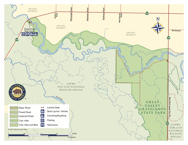
A Park with an Unlikely Origin Story
Great Valley Grasslands State Park wouldn’t exist if it weren’t for cheese. In 1982, Joseph Gallo — a former dairy farmer who built a successful cheese business — donated thousands of acres of Central Valley grasslands to the U.S. Fish and Wildlife Service and the state of California, with a request that the land be designated for wildlife refuges and parks.
Sitting just south of Modesto and west of Merced, the 2,826-acre park is one of California’s largest remaining native grassland areas. But unlike most state parks, it was never developed for public use — no visitor centers, no trails, no infrastructure to welcome people to this remarkable landscape along the San Joaquin River. In many places, you can’t safely reach the river without a motorized boat.
Adding to the challenge, when Gallo donated the land, a network of levees built in the 1950s crisscrossed the landscape. These levees weren’t built to hold back the river — they were designed to contain cattle from Gallo’s dairy operation. But even after the cattle stopped grazing, the levees remained, cutting off the grassland ecosystem from the San Joaquin River, altering the natural flood patterns that had shaped this landscape for thousands of years, and opening the door for invasive plant species to take hold.
What remained was a series of obsolete levees at an underused park — and an extraordinary opportunity for restoration.
How We Got Here
More than 15 years ago, American Rivers began working with the California Department of Parks and Recreation, River Partners, and other agencies, nonprofits, and private partners to identify opportunities to restore the park’s native grasslands and reconnect the San Joaquin River to its historic floodplains. It was a vision that took patience, persistence, and the contributions of many organizations over many years.
Funding from the California Department of Fish and Wildlife — through Propositions 1 and 68 — along with support from California State Parks’ Cannabis Watershed Protection Program and Cox Enterprises helped turn that vision into a construction project. But getting to the finish line was far from linear. Permitting delays paused work for extended periods. Construction in a naturally flood-prone area meant crews were regularly sidelined for months at a time as weather events intervened. Some of the State Parks staff and project engineers worked on this assignment for more than 15 years.
That’s why the red ribbon moment on June 11 meant so much. It wasn’t just a construction milestone — it was the culmination of a relay run by dozens of people across two decades.
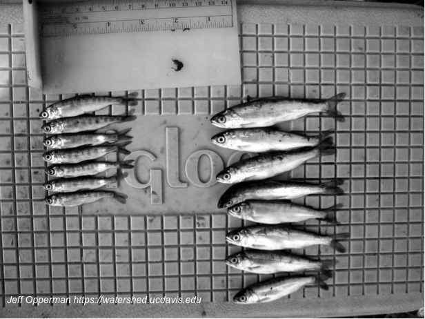
How do we know if the Restoration is a Success?
With construction now complete, the project team will shift focus to monitoring and learning. The team will track zooplankton, groundwater levels, water temperatures, native plant reintroduction, and wildlife use to measure how successfully the ecosystem is recovering. Floodplains provide the shelter and food juvenile salmon need to survive the arduous journey to the ocean. Zooplankton are microscopic organisms that drift along water currents and are an important food source for juvenile salmonids. When the river flows through the breach, we will measure zooplankton on the floodplain and in the San Joaquin River to determine the effectiveness of our efforts. This data will help inform future restoration efforts across the San Joaquin River and beyond.
What Comes Next
California’s Central Valley has long been recognized as one of the most “park-poor” regions in the state — most of California’s 280 parks lie along the coastline or within the mountains.
But that is beginning to change.
State Parks is gathering public input to develop a General Plan to improve public access at Great Valley Grasslands State Park so that residents and visitors can experience and enjoy this revitalized landscape. In addition, State Parks and American Rivers are continuing our partnership to restore and reconnect floodplains on over 1,000 acres of land north of the San Joaquin River with funding from the Wildlife Conservation Board. Soon Central Valley residents will be able to discover and enjoy this remarkable stretch of the San Joaquin River in their backyards.
On April 22, Governor Gavin Newsom announced State Parks Forward, a new initiative to expand the State Parks System and establish three new state parks in the Central Valley, including the 874-acre San Joaquin River Parkway in Fresno.
The San Joaquin River is flowing onto its floodplain again. The grasslands are beginning to heal. And the communities, Tribes, and wildlife that depend on a healthy river are a little better off for it.
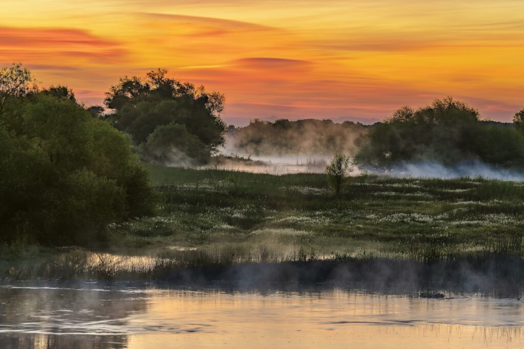
Here in the Southeast, drought is no stranger, and this summer it is impacting communities and rivers in the region just as in many other parts of the country. In North Carolina, much of the state has been in severe or extreme drought conditions for months, according to the U.S. Drought Monitor, and stream and river flows are near record-low levels in much of the state.
Rivers are accustomed to drought; it is a natural occurrence, but its impacts on rivers are often worsened when we alter their flows, draw too much water out of them, or pave over the landscape in areas of the watershed that would otherwise replenish groundwater and streamflow when it rains. Meanwhile, droughts themselves are becoming more severe and, in some places, more frequent in a changing climate.
In hot and dry weather, soils dry out quickly, a fact any home gardener knows all too well. At a river basin scale, the impacts of excessively hot and dry conditions on the natural systems that support our rivers with fresh water are significant and worrisome. When river flows drop low early in the season and stay low, river ecosystems can be pushed beyond their normal bounds, harming fish and wildlife, canceling river recreation activities, and threatening the supplies of communities that depend on these rivers for clean water.
Drought is not just a summertime occurrence: In the Southeast, it comes about in the first place due to a lack of rainfall to recharge groundwater and streams’ baseflow during the winter and cooler months. This is absolutely the case with the drought currently striking the region: a very dry winter left the region poorly prepared for the heat of summer, from a water availability standpoint. The current North Carolina drought conditions, in particular, intensified in the springtime (which should normally be a relatively rainy season in the Southeast)—not in the fall when we typically have our driest season.
In Georgia, the state has been lucky to receive rainfall that has moderated drought conditions in the early summer, but it’s not likely to see drought disappear altogether during the hot summer months. It takes a long time to get into a drought, and it will take a long time to get out. In North Carolina and other parts of the region, the current situation is more dire, and the timeline for recovery is likely much longer. (Meanwhile, a bit of weather whiplash between drought and flash flood conditions is implicated in this summer’s massive fish kill on the Chattahoochee River in Atlanta.)
American Rivers has worked for years advocating for the protection of the natural flows that sustain river ecosystems, for an “efficiency first” approach to securing water supply for our communities, and for smart water infrastructure planning that protects the natural flows that rivers need. It’s important for us all to conserve water to maintain community water supplies: reducing outdoor water use, fixing leaky plumbing fixtures, avoiding water waste, and much more. It’s also critically important for water utilities to plan, maintain, and manage water supply infrastructure in ways that protect river flows as much as possible. In particular, we must be planning for drought when we’re not in drought, in order to make our policies and our infrastructure as river-friendly as possible when drought arrives.
All this work becomes more important all the time, as population growth, urban sprawl, energy generation, and the advent of data centers together make even more demands on our freshwater resources and the water that both we and our rivers need.
Our National Monuments often contain treasured public lands and waters. They’re so important that forty Presidents, across both parties, have utilized the Antiquities Act to protect monuments that would go on to become Grand Canyon National Park, Olympic National Park, Acadia National Park, Glacier Bay National Park, Zion National Park, Arches National Park, and many more. President Teddy Roosevelt, one of our most famous conservation presidents, established 18 national monuments shortly after he signed the Antiquities Act into law. Since that time, nearly half of America’s National Parks started first as National Monuments—a part of our nation’s natural and cultural heritage.
Across the country, the 31 national monuments designated in the last 30 years directly protect 21,143 miles of rivers across 2,125 watersheds, affecting the clean water supplies of more than 13 million people. These monuments provide world-class fishing, hunting, paddling, and other forms of outdoor recreation fueling valuable and sustainable economic development for nearby gateway communities. These public lands are also our natural water towers, providing clean water to people and wildlife downstream.
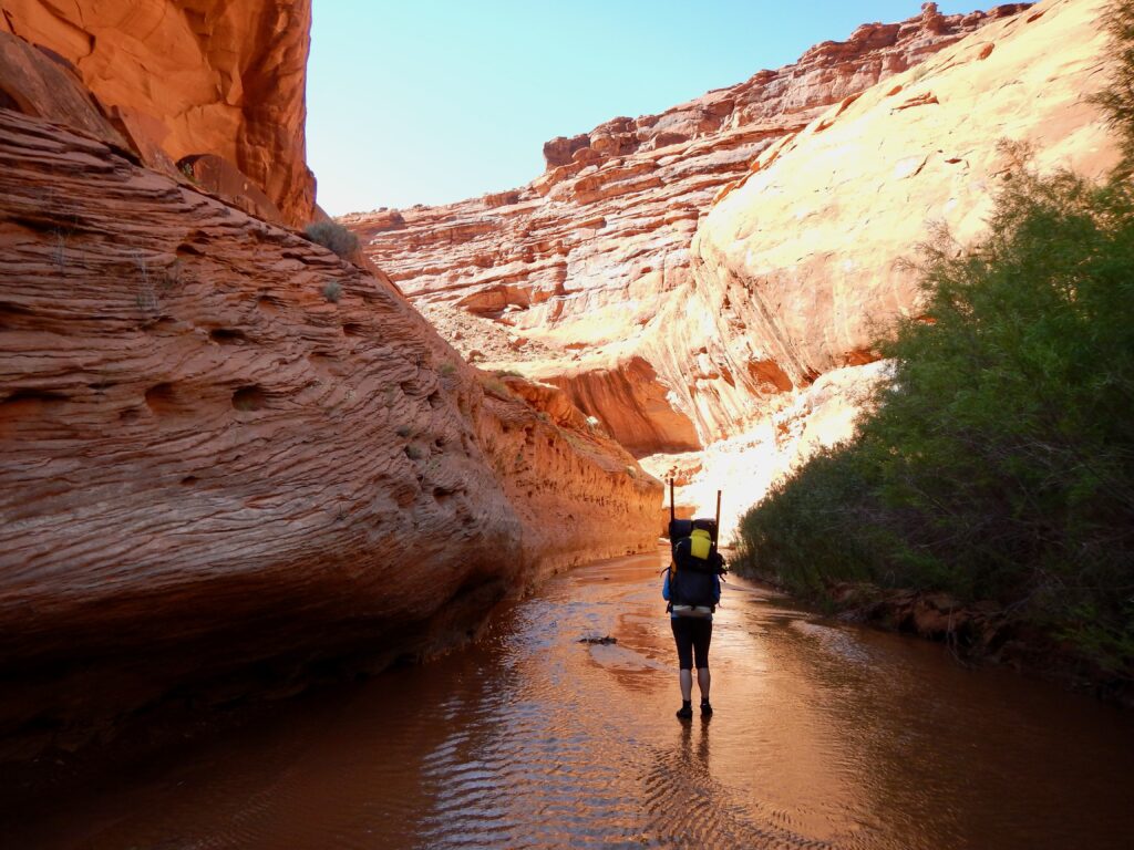
Taos, New Mexico, the gateway to the Rio Grande Del Norte National Monument, saw a 40% increase in tourism and over 20% increase in lodging tax revenue in the year after its designation. The protections the Monument provide for wildlife are immeasurable, as elk, pronghorn, bighorn sheep, and mule deer all use the river corridor as habitat and a major migration corridor. Acequias, Pueblos, agricultural producers, and local communities are also supported by water from the Monument.
In Maine, the watersheds of Katahdin Woods and Waters National Monument, including the East Branch Penobscot River, provided $3.4 million to the local economies of gateway communities according to a study by the National Park Service. The Monument safeguards more than 30 miles of the East Branch of the Penobscot River along with the Seboeis River and Wassataquoik Stream, protecting cold, clean headwaters that are essential to healthy rivers all the way downstream. These free-flowing waters and surrounding forests sustain endangered Atlantic salmon, wild brook trout, moose, Canada lynx, and bald eagles — proof that protecting a river means protecting the entire web of life that depends on it.
Our Local Monuments: Bears Ears and Grand Staircase-Escalante
Like others who live near or visit National Monuments near them or those in states across the country, my family and I take time – sometimes an extended weekend, sometimes two weeks – to do what we love most: Travel the desert rivers, buff-colored canyons, and pinion-juniper mesas of Bears Ears National Monument or Grand Staircase-Escalante National Monument afoot, afloat, astride a bicycle, or in a four-wheel drive vehicle.
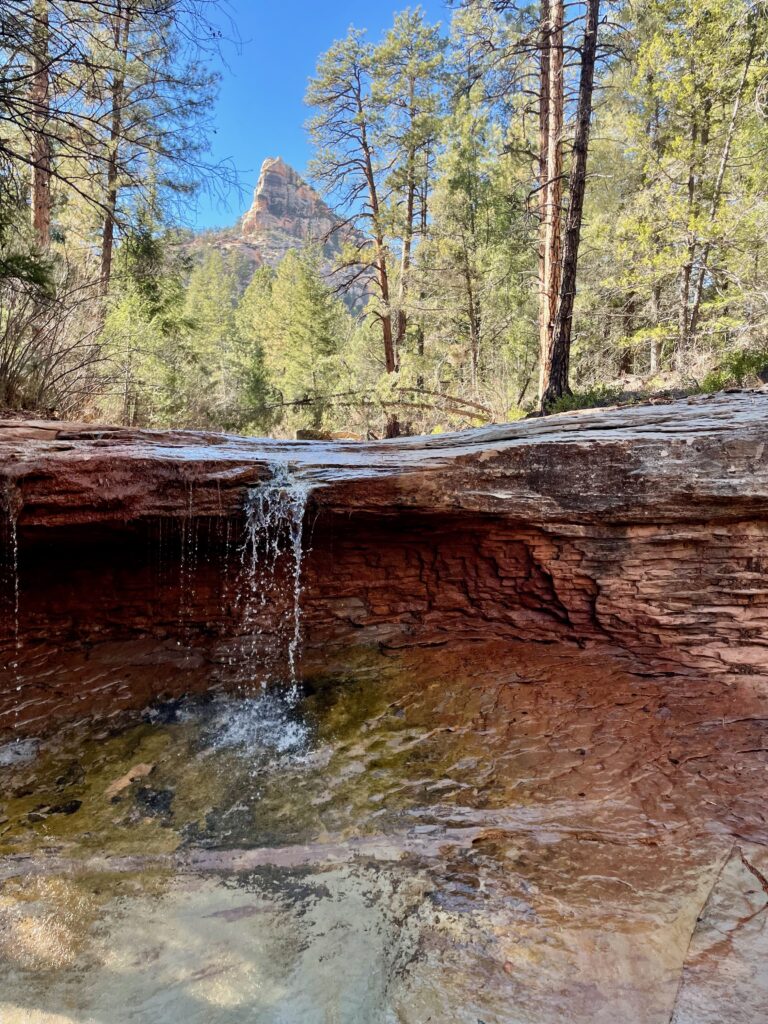
We have made this pilgrimage without exception every spring for over 20 years. The two monuments have very different characters, but they both have extraordinary qualities that make them special to us, pulling us back year after year. Sinuous, red rock canyons emanate from high-altitude mesas, picking up seeps and springs as they make their way to some of the most storied and intact river systems in the Southwest.
Together, these designations protect significant portions of the San Juan, Colorado, and Escalante river systems, safeguarding important cultural and ecological values, and ensuring clean water for people and wildlife downstream.
A Public Trust
Humans have been attached to Bears Ears and Grand Staircase-Escalante for millennia. The Ancestral Puebloan cliff houses, kivas, granaries, and rock art protected under the Antiquities Act make that clear, as do the seeps, springs, herbs, and natural landforms. Many tribal members continue to call these places their ancestral homelands and current sources of medicinal and ceremonial plants, among other irreplaceable natural and cultural resources. Bears Ears National Monument has been described as an open-air museum and cathedral, whereas Grand Staircase-Escalante was designated for its one-of-a-kind cultural, geologic, and palaeontologic values.
On Monday, July 13, 2026, two proclamations were issued to reduce the boundaries of Bears Ears and Grand Staircase-Escalante national monuments by 90% – almost 3 million acres combined- leaving just over 300,000 acres protected under monument designations. The Bears Ears Commission, established to inform the management of the lands and resources of Bears Ears, and made up entirely of Tribal representatives, was also disbanded, and the Tribes’ seals were removed from signage at the monument. This is a larger rollback than was attempted in 2017, when the boundaries of the monuments were decreased by about 2 million acres, a decision was ultimately reversed by President Biden. Over 1,000 people recently turned out in six cities across Utah to support maintenance of the original designations for Bears Ears and Grand Staircase-Escalante.
Coming to A National Monument Near You?
Other monuments are also potentially in peril, including ones that have significant local and state support.
There are places in the country where development is appropriate. But as a nation, we must continue the successes that we’ve had in conserving our most irreplaceable waterways and landscapes and in respecting tribal sovereignty. If you are fortunate enough to have the opportunity to visit some of these special places, go. See, for yourself, some of the best places we’ve protected as a country.
Tags: Bears Ears, Grand Staircase-Escalante, San Juan River, Escalante River, public lands, national monuments, Antiquities Act, tribes, river protection, river conservation, clean water
World Nature Conservation Day is July 28. It is more important than ever to speak up and make your voice heard for our nation’s rivers. We know there is a lot going on in the world that can make it overwhelming to figure out what you can do to help. That’s why we’ve put together 5 simple things you can do this World Nature Conservation Day to make an impact in your community and nationwide:
1. Take Action: Sign our Wild and Scenic Rivers Act petition
Wild and Scenic Rivers are our healthiest, cleanest, most intact waterways, protected for their scenic beauty, natural and cultural significance, and recreational value. A Wild and Scenic designation protects the free and natural flow of a river and preserves what makes a river special. Join us in our effort to safeguard rivers — Tell your Members of Congress to support new Wild and Scenic Rivers today!
2. Use our Protected Rivers Explorer Tool
Across the nation, 80% of rivers lack adequate protection. Our Protected Rivers Explorer is a groundbreaking tool based on cutting-edge science. Using the Explorer, we can, for the first time in history, see how secure rivers are all across the country. Discover how protected your state and local rivers are and get involved today!
3. Advocate for rivers through our Action Center
Be a voice for rivers: Last year, our community sent 30,000+ messages to decision-makers calling on them to take action for healthier rivers and cleaner water. Check out our Action Center and take action today!
4. Learn about the top 10 ways to conserve water at home
There are a few simple things you can do at home — Fix leaks, turn off the faucet while brushing your teeth — to ease the burden on your local water supply and save money in the process. These water-saving measures can have a big impact on water demand in your local community.
5. Become an American Rivers Member
Rivers provide clean water and natural habitat. Support our work protecting and restoring our nation’s rivers by donating a gift today! Together, we can protect the source of all life — our rivers.
One small action each day adds up to make a big impact over time. Share this list with your family and friends and revisit these actions when you can. Healthy rivers are for everyone, not just a privileged few. We are in this together, and it will take all of us in this movement to protect rivers and preserve clean water.
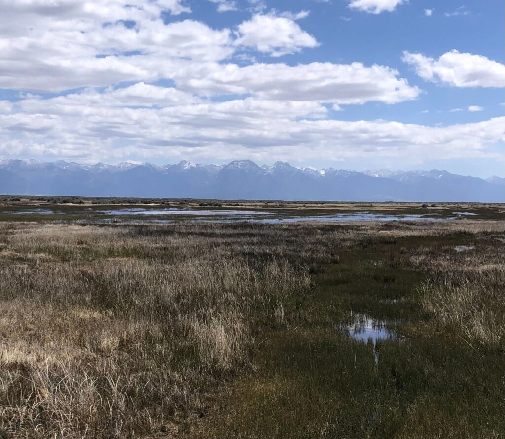
Like much of the Southwest, the San Luis Valley in Southern Colorado, home to the headwaters of the Rio Grande, is facing a historic, near record-setting snow drought; early runoff and all signs point to a severe water shortage. Snow water equivalent (SWE) – how much liquid water is available in snow – in the region is among the lowest on record, triggering dire concerns about the impacts of reduced runoff on agriculture, communities, and ecosystems.
The Rio Grande is essential to the livelihood of people, economies, and the environment, and the demands from human populations and the impacts of climate change have put the Rio under increasing pressure. These pressures are well documented; numerous studies conclude that rivers in the southwest are facing critical shortages, largely as a result of these compounding pressures. Local communities, including those along the Rio Grande and its tributaries, are acutely aware of their water challenges and have come together to identify innovative solutions to address the threats. River and riparian restoration projects, agricultural efficiency and modernization projects, recharging the local aquifer, and protecting small streams and wetlands are just some of the initiatives communities along the Rio are undertaking to protect and restore their community’s lifeblood.
In the San Luis Valley (Valley), the community has long been working on flexible, innovative water solutions to make every drop count. Water managers, conservation organizations, irrigation companies, communities, businesses, agencies, and recreationists have come together to identify programs and projects that provide multiple benefits while also addressing drought and water scarcity challenges head on. Many of the solutions being implemented have known benefits while others are in the earlier stages of research and impact analysis, but early indications suggest some of these solutions provide significant opportunities to address some of the challenges facing Valley communities, and beyond.
Frozen Assets
One such project, “Frozen Assets,” is an innovative and collaborative water management project under way in the San Luis Valley, led by American Rivers in close collaboration with our partners from Wetland Dynamics, Ducks Unlimited, Rio Grande Headwaters Land Trust, Colorado Parks and Wildlife, and other private, state, and federal partners. Frozen Assets is an ongoing project designed to research how winter sheet ice, an innovative water management strategy that mimics natural processes, can support aquifer recovery, assist with native re-vegetation on retired agricultural lands, enhance wildlife habitat, and allow flexibility for agricultural producers in the Valley.
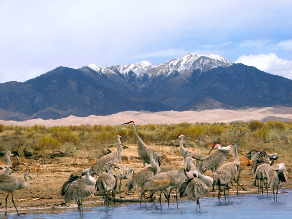
Winter sheet ice has been used historically in the Valley to spread water shallowly across the landscape during the winter and ‘store’ it as ice for early spring use. Sheet ice starts developing when temperatures freeze in the fall, and, through consistent application of water in the winter, producers slowly ‘push’ shallow water across the surface to build upon the frozen layer, creating a large sheet of ice. The slowly melting ice provides water and foraging resources for over-wintering birds and wildlife and early spring migrants like waterfowl and cranes. This slow process results in less water lost to evaporation and transmission, and allows water to infiltrate soils and recharge aquifers, facilitating the growth of early season plant species.
This Project is designed to simultaneously equip water users with information about winter sheet ice and demonstrate its viability as an alternative for seasonal water use that is beneficial to wildlife, enhances soil moisture retention, boosts the resilience of local water tables, improves habitat quality, and promotes the growth of native plant communities.
Rye Resurgence
The Rye Resurgence Project has benefited not just the Valley, but businesses and consumers around Colorado and the greater Southwest region. Established to address the Valley’s groundwater depletion challenges and improve soil health, the Rye Resurgence Project is a community-driven initiative focused on revitalizing the local agricultural economy and environment by promoting San Luis Valley Rye. A winter cover crop, rye requires significantly less water than other rotational crops and has a deep, complex flavor profile that can be used in a larger variety of ways.
The Rye Resurgence Project has a dual mission, partnering with local farmers to grow rye and establishing a market for Valley rye. Ensuring there is a market and diverse buyers for new crops is an essential piece of the puzzle for producers when considering less thirsty crops. The Project has made connections with local and regional businesses – including bakers, millers, brewers, and distillers – to utilize rye in their products. In its first year, the project partnered with farmers to grow 4,500 acres of winter rye in the fall of 2023, which yielded an estimated 4,670 acre-feet in water savings over the course of the first year, and 24 businesses identified as partners.
River and Habitat Projects
The rivers and water flowing through San Luis Valley provide critical habitat for many different species of wildlife; multiple wildlife refuges and state wildlife areas line the river throughout the Valley. The Alamosa National Wildlife Refuge (NWR) provides important habitat for native fish. However, the NWR experiences a highly variable flow regime that places stress on both riparian and aquatic health, and lower streamflows are occurring more frequently, resulting in stress on aquatic species, including fish. To address these challenges, the Rio Grande Headwaters Restoration Project worked with partners to plan and implement the Rio Grande Corridor Restoration Project at the Alamosa NWR.
This Project resulted in restoration and aquatic habitat enhancement both within the Alamosa NWR and on adjacent private lands by reshaping and stabilizing eroding streambanks with rock and native plants, which allows for better floodplain access when higher flows are present. Additionally, channel shaping and enhanced instream habitat improved low-flow and off-channel aquatic habitat. Importantly, this included a specific off-channel habitat feature created for Rio Grande chub, which are present in the area. The Project also benefited visitors to the NWR by redefining adjacent public trail access that reduces recreational disturbance to the area. This is just one example of the many multi-benefit, cross-sector river restoration projects happening in the Valley.
Water is the lifeblood of this region, and collaborative solutions like these will help preserve the economic vitality of the Valley while conserving its most precious resource for the human and wildlife communities that depend on it.
Communities across North Carolina’s Cape Fear River Basin are facing renewed uncertainty after the Environmental Protection Agency’s (EPA) proposed rollback of drinking water protections for several PFAS chemicals, commonly known as “forever chemicals.”
The EPA recently announced two proposed rules on May 18, 2026. One would roll back protections for several PFAS compounds, while the other would delay implementation of existing standards.
What are PFAS?
PFAS are a group of human-made chemicals that can enter rivers and streams through industrial discharges and other sources. They are highly persistent in the environment. Exposure, even at very low concentrations, can cause human health concerns and developmental impacts on infants and children. Drinking water standards are critical to protecting public health. They also create incentives for industries to reduce PFAS pollution at its source—often the most effective and affordable way to protect rivers, communities, and downstream drinking water supplies.
Two years ago, the EPA finalized the nation’s first enforceable drinking water standards for several PFAS chemicals, which marked a major step forward in addressing long-standing contamination concerns. For communities like the ones downstream of the Chemours facility in Fayetteville, North Carolina, that action reflected years of local advocacy, scientific attention, and public pressure to address PFAS pollution in the Cape Fear River system.
PFAS in the Cape Fear River Basin
Communities in the Cape Fear River Basin, just like others across the country, have already borne significant costs associated with PFAS contamination. Now, with these proposed rollbacks, communities are once again confronting basic questions about drinking water safety, long-term health protections, and whether current systems are doing enough to prevent future pollution.
The Cape Fear River Basin is one of the most ecologically diverse regions in North Carolina, with interconnected rivers, wetlands, and floodplains that support unique wildlife, local economies, recreation, and drinking water supplies.
The proposed changes to existing standards focus on drinking water, but they also raise broader concerns about how communities address pollution in rivers and waterways. Communities in the Cape Fear River Basin are facing the reality that protecting clean water requires sustained attention, coordinated action, and accountability across entire watersheds.
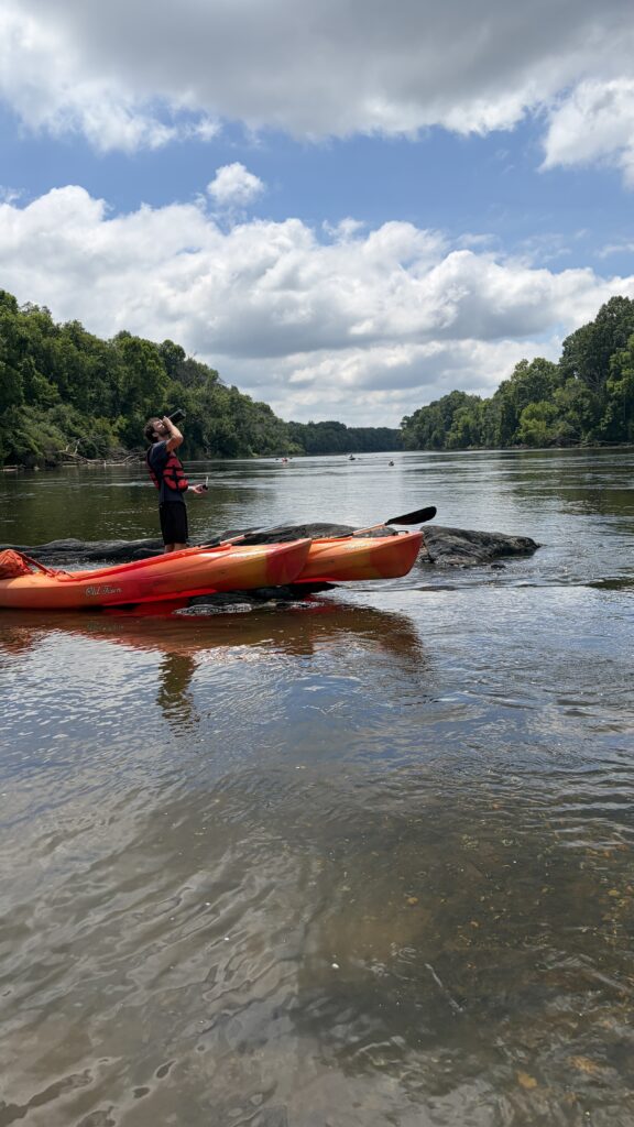
American Rivers is proud to support our local partner organizations working in those communities most directly impacted. Across the watershed, local partner organizations continue to play a critical role in elevating community concerns, documenting pollution impacts, and advancing solutions that protect both people and clean water. Clean Cape Fear, Cape Fear River Watch, Haw River Assembly, and Sustainable Sandhills have helped build public awareness of PFAS contamination while advocating for stronger protections and greater accountability from polluters.
What can we do to protect clean water?
American Rivers supports bipartisan federal legislation that would help communities address PFAS contamination and modernize aging water infrastructure.
Congress can help strengthen protections for communities facing PFAS contamination. We are asking Senators to support the Healthy H2O Act (H.R. 4721 / S. 2436), which would help rural homeowners and communities access water quality testing and treatment resources for contaminants such as PFAS, particularly in areas that rely on private wells.
Protecting drinking water requires more than treating pollution after it reaches the tap. It also means preventing harmful chemicals from entering rivers and wastewater systems in the first place. Keeping pollution out of rivers protects public health, reduces treatment costs, and helps safeguard fish, wildlife, and recreation.