Dolores River
After nearly 20 years of collaborative work, Colorado Senator Michael Bennet introduced the Dolores River National Conservation Area and Special Management Area Act in July 2022. Colorado Senator John Hickenlooper co-sponsored the bill, and Colorado Congresswoman Lauren Boebert introduced companion legislation in the House, emphasizing the bipartisan nature of this proposal. The Act was introduced at the behest of Dolores, Montezuma, and San Miguel counties, as well as the Ute Mountain Ute Tribe, agricultural producers, fish and wildlife managers, and conservation and recreation organizations.
The resulting legislation is bi-partisan and consensus-based, establishing a new National Conservation Area and Special Management Area that will protect wildlife, cultural and historical resources, and existing uses of the land while enhancing local economies well into the future.
What states does the river cross?
Colorado, Utah
WHAT CAN YOU DO?
Please join us in thanking Senator Bennet for introducing the Dolores River National Conservation Area bill!
Stay informed with what is going on with rivers across the Southwest by following our Southwest River Protection Program.
ABOUT THE DOLORES RIVER
The River of Our Lady of Sorrows, the Dolores River, was named “El Rio de Nuestra Senora de Dolores” when a Spanish trader encountered the river in 1765. But in many ways, the only sorrowful thing about the Dolores River is that like so many rivers in the West, it is, perhaps, too well loved, resulting in chronically low flows. Recently introduced National Conservation Area legislation has brought the Dolores River back into the spotlight.
Humans have lived in the region the Dolores flows through for more than 10,000 years, and the archeology in some of the steep, sandstone canyons is unmatched. Now, humans treasure this high-desert river for its sacred value, the crops and cattle it waters, the habitat it sustains for plants and wildlife, the amazing experience of boating it, and the clean water it provides for drinking, among other things.
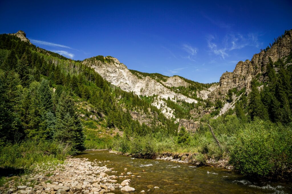
With headwaters at 14,000 feet and a nearly 230-mile run to its confluence with the COLORADO RIVER near Utah, the Dolores is a gateway to truly world-class scenery. Like its neighbor, the SAN MIGUEL, the headwaters of the Dolores River and West Dolores River are also in the San Juan Mountains, but both branches flow southwest before converging just above the town of Dolores. McPhee Reservoir, where Dolores River waters are held for agriculture, is located just southwest of the town. And from there, the Dolores meets a fate shared by many rivers in the West, as every drop is allocated to agricultural production. While some reservoirs help buffer fluctuations in water availability between wet and dry years, that isn’t the case for the Dolores. Despite being the second largest reservoir in Colorado, McPhee Reservoir doesn’t have the storage capacity to store enough water to satisfy both agricultural rights and flows for recreation and endangered fish.
Water released from the dam flows sharply northwest through Ponderosa and Slickrock Canyons, uniting with the San Miguel before flowing through the Paradox Valley and, ultimately, through Gateway Canyon and into the Colorado River.
Let's stay in touch!
We’re hard at work in the Southwest for rivers and clean water. Sign up to get the most important news affecting your water and rivers delivered right to your inbox.
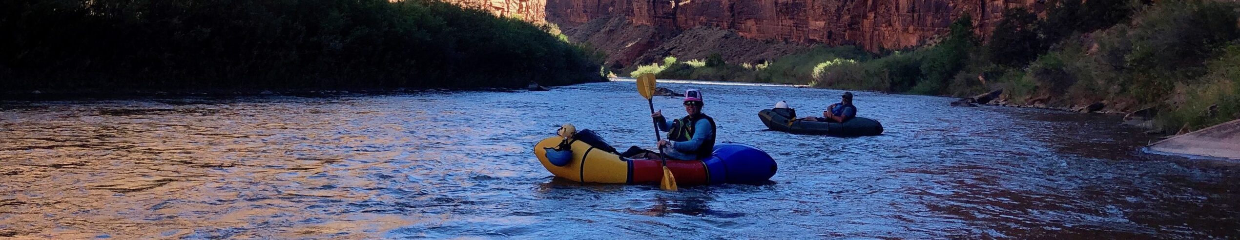
When water is released, nearly 170 miles of it are floatable. In 2016, the Dolores River ran for the first time in five years. A healthy winter snowpack translated to some short-lived and well-celebrated releases that allowed for boating through the amazing Dolores River Canyon. On the rare opportunity to float, paddlers marvel at the towering sandstone walls, the regular encounters with beavers, the unique way floating the Dolores becomes paddling through coyote brush and tamarisk. Because high water flows are such a rare occurrence, campsites are overgrown and under established.
Since 1968 when initial construction on the McPhee Dam began, stakeholders in the region have worked to develop river management plans that support the river’s cold water fish species, alongside agricultural irrigation and the desire for recreation flows. The reservoir was completed in 1984, and in 1990, a dry summer limited flows from McPhee to less than 20 CFS, resulting in a major kill of cold water fish. Even lower summer flows have been recorded in recent years, killing native fish, destroying the geomorphology of the channel, shorting irrigators and the Ute Mountain Ute Tribe, and stressing wildlife.
WILD AND SCENIC ELIGIBILITY
In both 1976 and again in 2013, the Dolores River was found suitable for designation under the Wild and Scenic Rivers Act by the U.S. Forest Service and Bureau of Land Management, giving the Dolores River administrative protections for its free-flowing character and outstanding values. After a lengthy negotiation process, language in the Dolores River National Conservation Area bill would trade away Wild and Scenic suitability for similar protections of the river’s free-flowing character and outstanding values within the National Conservation Area (NCA) and Special Management Area (SMA). However, this would not preclude designating the Dolores River or its tributaries under the Wild and Scenic Rivers Act in the future it there is social and political support for such a designation.