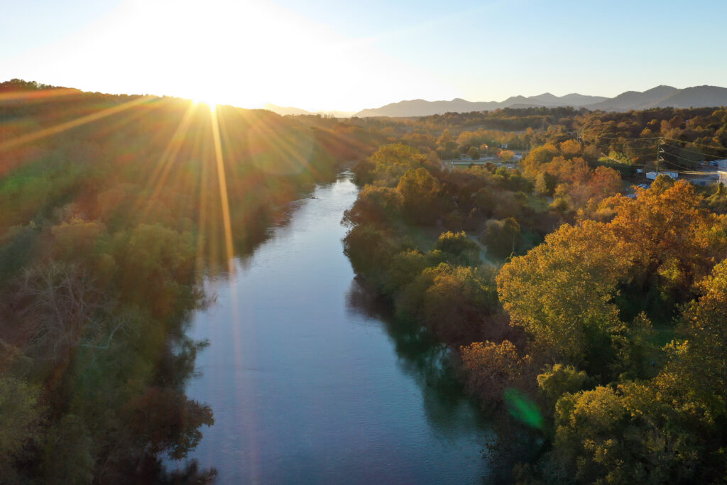
Clean water is a fundamental need, and rivers touch every aspect of our lives. Telling positive stories about rivers is important to ensure every river is clean and healthy for people and wildlife. So it was a pleasure to team up with CBS News on a significant package of stories for Earth Month.
Together, these stories provide an excellent overview of the challenges and opportunities facing our nation’s rivers. They remind viewers about the vital role rivers play in providing our drinking water, supporting fish and wildlife, powering our economy, ensuring healthy communities, and creating endless opportunities for beauty, connection, and joy.
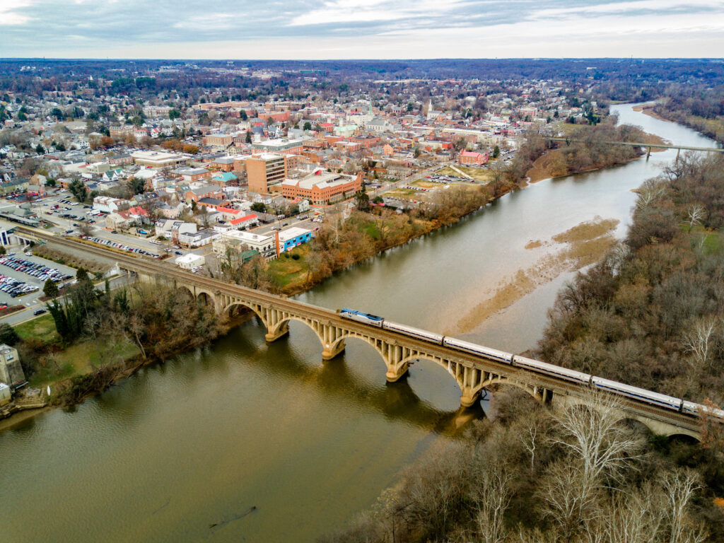
“An American River” – a documentary about the Delaware River
The CBS News crew traveled from source to mouth down the Delaware, meeting people along the way who work on, and speak up for, the river. The documentary is a heartfelt and hopeful look at the vital work underway to protect the river and all the life it supports.
Paddling his canoe, Adam Schellhammer, Mid-Atlantic Director for American Rivers reflects, “It’s not just about fun… from a very basic survival need, we need to protect our waterways.”
America’s Most Endangered Rivers® of 2025
This year’s list of America’s Most Endangered Rivers® is a call to action for clean water and public safety. CBS showcased the campaign with thoughtful news coverage, interviews with American Rivers leaders, and a spotlight on New Jersey’s Passaic River.
Local reports highlighting river threats and solutions
All 14 CBS-owned stations produced local reports highlighting regional rivers’ threats, and had great examples of river restoration. From Maryland to Texas to California, here are some inspiring stories:
Take action and support your river
If you feel inspired after watching these videos, there are great ways to help:
- Take action for America’s Most Endangered Rivers of 2025
- Donate to American Rivers to support our river protection efforts nationwide
- Speak up for your own river: contact your local decision makers and encourage them to be river champions. Find your local river group and support their important work.
Flooding earlier this month claimed lives and destroyed homes and businesses across the South and Midwest. It is the most recent example of how extreme weather is devastating communities and putting our rivers and clean water at risk.
It’s against this backdrop that American Rivers is announcing America’s Most Endangered Rivers® of 2025. Our message is simple, and we have a plan: To stop the cycle of destruction, we must invest in solutions that protect river health and our nation’s clean water security.
Topping the 2025 list is “America’s River”, the Mississippi. As I write this, portions of the river are at flood stage, or approaching flood stage, as a result of recent heavy rain and snowmelt, according to the National Weather Service.
But high water isn’t the only threat. Layoffs at the Federal Emergency Management Agency (FEMA) and calls to abolish both the agency itself and the National Flood Insurance Program put river health and human safety at risk, and could compound longstanding threats to river health.
Spotlighting what matters most
Whether your community is more vulnerable to floods, droughts, or wildfires, we all want to keep our families safe from extreme weather. And no matter where you live, it’s the communities with healthy rivers that are stronger, better equipped, and more resilient in the face of these threats.
In addition to safety, another need we all have in common is clean, safe, reliable drinking water. Most of our drinking water comes from rivers – but half of the rivers in the United States contain unsafe levels of pollution.
Public safety and clean water aren’t red or blue state issues. They are shared values that connect us all. “Our water wealth is one of our greatest assets as a nation,” says American Rivers president and CEO Tom Kiernan.
Protecting these shared values and our nation’s water wealth is the motivation behind America’s Most Endangered Rivers ®. Every year, working with local partners, we sound the alarm and deliver an urgent and timely call to action for the rivers we all depend on. As we celebrate the 40th anniversary of this campaign, protecting clean water and healthy rivers has never been more important.
America’s Most Endangered Rivers ® of 2025: Ten rivers at a crossroads
- Mississippi River: The lifeline of America faces an uncertain future as FEMA’s role in floodplain protections and infrastructure maintenance hangs in the balance.
- Tijuana River: Severe sewage and chemical pollution threaten communities on both sides of the US-Mexico border.
- Rivers of Southern Appalachia: Extreme weather is testing the limits of aging dams while hurricane recovery efforts struggle to keep pace.
- Passaic River: Historical industrial pollution continues to impact this essential New Jersey waterway.
- Lower Rio Grande: A mega-drought combined with outdated water management threatens this crucial border river.
- Rappahannock River: Declining groundwater levels and explosive growth from data centers are creating a perfect storm for water insecurity.
- Clearwater River Basin: Some 700 miles of potential Wild and Scenic River protections are at risk of being lost.
- Susitna River: Road construction and mining threaten one of Alaska’s most pristine waterways.
- Calcasieu River: Toxic and heavy metal pollutants endanger this Louisiana river system.
- Gauley River: Strip mining in the headwaters is introducing toxic pollution to this beloved recreational waterway.
Making a difference together
The America’s Most Endangered Rivers ® campaign has a track record of success. It galvanizes the public to speak up on behalf of the rivers, gets the attention of decision makers, and creates positive change. Together with partners, we have helped stop pollution in the Buffalo National River and prevented harmful mining in fragile ecosystems like the Boundary Waters. The campaign played an important role in protecting Wyoming’s beautiful Hoback River, and has contributed to dam removal and river restoration efforts on rivers such as the Penobscot, Klamath, and Eel.
You can help turn this year’s endangered rivers into success stories. We need your voice for America’s Most Endangered Rivers ® of 2025. Learn more about the rivers, and take action today.
This year marks an important milestone for America’s Most Endangered Rivers®— the 40th anniversary of the campaign that combines years of environmental action and grassroots mobilization. Each year, this campaign has highlighted ten rivers whose fate depends on the decisions we make today. Over the decades, together with our partners, we’ve achieved significant changes to protect our rivers and the communities that depend on them.
However, this anniversary isn’t just a moment to look back and celebrate what we’ve accomplished—it’s also an opportunity to reflect on the road ahead. Over these 40 years, we’ve faced countless challenges, but we’ve also seen victories that continue to motivate us to keep speaking up for the health of our rivers.
As a way to celebrate 40 years of America’s Most Endangered Rivers®, we wanted to highlight some of the most impactful stories; rivers that represent not only the challenges our rivers face but also the solutions we’ve been able to achieve through our collective efforts.
New Mexico’s Rivers: A Hopeful Future
2024 #1 River Listing
In 2024, New Mexico’s rivers were highlighted as the #1 most endangered due to threats facing nearly all streams and wetlands in the state, particularly the loss of Clean Water Act protections. This left the state’s waterways at risk of pollution from industrial runoff and agricultural waste, posing a danger to the local communities and ecosystems that rely on them.
But just last week, New Mexico Governor Michelle Lujan Grisham signed a bill to restore clean water protections that creates a state surface water permitting program to ensure the state’s precious water resources have the proper management and safeguards.
Neuse River: A Turnaround Story
Listed in 2017, River of the Year 2022
When the Neuse River was listed among America’s Most Endangered Rivers® of 2017, it faced threats from industrial agricultural waste being dumped into its floodplains. This was a river that, for decades, has been a vital water source for communities in eastern North Carolina, but its future seemed uncertain.
Inclusion in America’s Most Endangered Rivers® sparked action and amplified community engagement to honor the progress and to support forward momentum, we named the Neuse “River of the Year” in 2022. Local advocates and communities continue to push for improvements to keep the Neuse River on a positive trajectory.
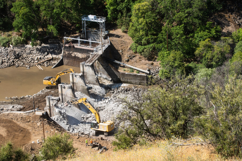
Klamath River: A Milestone in River Restoration
Listed in 2002
The Klamath River, one of the most iconic rivers in the Pacific Northwest, made the America’s Most Endangered Rivers® list multiple times over the years, with four dams devastating river health, water quality, salmon runs, and a vital source of sustenance and cultural heritage for the river’s tribes. The Yurok, Karuk, Klamath, and other Tribes and Indigenous communities advocated tirelessly for river restoration. Last year, dam removal was completed and now the river is on a path to recovery. Learn more about the Klamath Dam removals.
Gila River: The Ongoing Fight for Water Security
Listed in 2019
The Gila River, one of the most critical rivers in the American Southwest, was listed among America’s Most Endangered Rivers® in 2019 due to threats from the proposed construction of a damaging water diversion project.
The diversion could have dried up the Gila River, impacted fish and wildlife, the local outdoor recreation and tourism economy, and harmed critical habitat for seven threatened or endangered species. Declining groundwater levels caused by the diversion could also have harmed some of the last remaining intact riparian forest in the Lower Colorado River Basin.
In a win for the river and all who depend on it, in 2020, the New Mexico Interstate Stream Commission voted 7-2 to end work on the Environmental Impact Statement for the Gila River diversion.
Looking Ahead: A Call to Action for 2025
As we approach America’s Most Endangered Rivers® 2025, the work to protect our rivers is far from over. This anniversary not only celebrates the progress we’ve made but also serves as a starting point to redouble our efforts. The rivers and clean water that continue to face threats need our help now more than ever.
Every action counts, and every voice raised has the power to make a difference. I invite you to join us in supporting efforts to protect and restore these endangered rivers, and all of the rivers we depend on nationwide.
Check back on April 16, when we will announce America’s Most Endangered Rivers® 2025!
This is a guest blog written by Alejandra Galindo, American Rivers MAP Fellow. Alejandra is a dynamic Senior Program Manager at Entrepreneurship for All (EforAll), where she spearheads initiatives that empower early-stage entrepreneurs from underserved, low-income, and minority communities. With a passion for inclusive economic development, Alejandra leverages over a decade of international experience to design and implement high-impact programs that drive innovation and opportunity.
Originally from Colombia, Alejandra holds a degree in Political Science and International Relations from Icesi University, an MBA in Finance from EUDE Business School in Spain, and a Strategic Project Management Certificate from Harvard University. Her global education and professional journey have shaped her into a versatile leader with a deep understanding of both grassroots challenges and strategic solutions.
Fluent in both English and Spanish, Alejandra blends her multicultural insight with sharp operational acumen to build bridges between communities, entrepreneurs, and resources. Her work continues to open doors for aspiring business owners, helping to cultivate resilient, inclusive ecosystems where all entrepreneurs can thrive.
I’ve witnessed firsthand the effects and the legacy of unbridled land use on California’s headwaters in the Sierra Nevada. The streams and meadows from which these headwaters feed rivers like the Tuolumne, Merced, American, or Yuba are the lifeblood of California.
Despite their importance, many of these water sources are still recovering from more than a century of exhaustive mining, grazing, and logging that left them degraded, vulnerable, or polluted.
Restoration projects like those at Ackerson Meadow and Faith Valley Meadow help reverse that legacy, but I can’t help but imagine what those places would have looked like if they had been protected in the first place.
On January 14th, 224,000 acres of California’s Sierra Nevada range were designated under the Antiquities Act as the Sáttítla Highlands National Monument. The designation was a great advance in preserving the land, the headwaters, and the vital underground aquifer beneath them — securing a major source of California’s clean water and the heritage of our communities for generations to come.
The aquifer supports millions of Californians, an agricultural industry that is the nation’s largest food supplier, and the world’s 5th largest economy. The volcanic geology of the region allows for the filtration of flows that can stay underground for over two decades before surfacing as clean, fresh, and cold water. It protects the source waters in the ancestral homelands for many Indigenous peoples and provides some of the cleanest water in California that supports not just world-class trout streams, but drinking water sources for millions of people. It is disappointing and antithetical to the goal of improving the nation’s health, wealth, and well-being for the Trump administration to seek to roll back the Sáttítla Highlands National Monument designation.
This designation did not materialize from thin air. Sáttítla Highlands National Monument is a region of immense cultural and historical importance to Tribes including the Pit River, Modoc, Wintu, Karuk, Klamath, Yana, and Shasta, that have resided in the area for time immemorial. The monument came from an effort initiated in the 1990s by the Pit River Tribe that grew into a coalition of Tribes and organizations who understood the need to protect this area from future development.
For decades, former presidents have used the Antiquities Act to preserve and protect lands and water sources for the betterment of our nation, with more than 100 having been created since the turn of the century.
The value of national monuments extends beyond the ecological. Much like national parks, national monuments are a net positive in economic terms, a strong investment in the state and communities near the monument that creates jobs for the surrounding region driven by increased tourism as well.
In an era of a changing climate, where snowpack is decreasing and extreme weather patterns are disrupting hydrologic cycles, we need to use every tool at our disposal to support the nation’s water wealth and the people and wildlife that depend on it. That includes restoration efforts like meadow restoration, sustainable, climate-smart forest management as well as federal protections.
Simply, the Sáttítla Highlands is exactly the kind of protected place from which everyone benefits. It is a win for people, a win for nature, a win for job creation and our pocketbooks, and an important win for our cultural history.
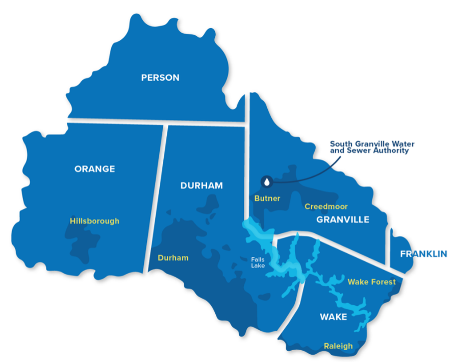
Late last year on a chilly, rainy day, a diverse group of municipal water staff, elected officials, and environmental advocates braved the gloomy weather to gather at the Joint Forum on Falls Lake, hosted by the UNRBA and NC Department of Environmental Quality. The focus? Revisiting nutrient management rules to protect Falls Lake, a drinking water source and recreational gem for the Triangle region. Despite the complex and technical nature of the discussions and the driving rain outside, the room buzzed with energy. Over 70 attendees shared a common goal: build on the success of integrated water management in the Upper Neuse River Basin to advance One Water principles in the Neuse River and beyond.
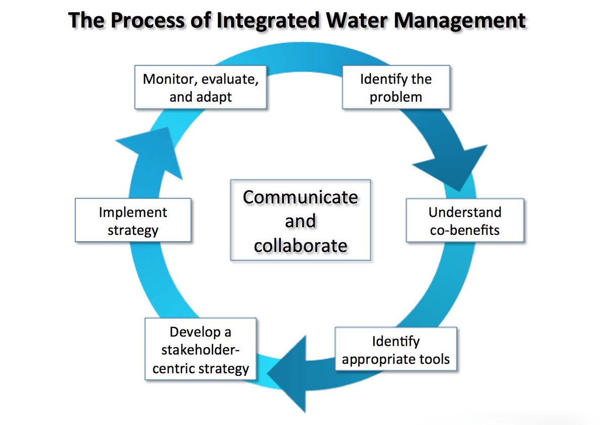
What is One Water?
One Water is a holistic strategy for managing all water resources—surface water, groundwater, stormwater, and wastewater—as a single, interconnected system. This approach emphasizes collaboration among stakeholders, sustainable infrastructure, and equitable water access. Integrated Water Management (IWM) is the set of practices that turn One Water principles into action, balancing environmental sustainability, economic growth, and public health.
North Carolina’s Neuse and Cape Fear Rivers: Where and what to know
Stretching nearly 6,000 square miles, the Neuse River Basin connects North Carolina’s fast-growing Piedmont region to the state’s Coastal Plain before emptying into Pamlico Sound, a vital local fishery that supports both livelihoods and recreation. However, the basin is under pressure from nutrient pollution, algal blooms, and increased sedimentation—threats that endanger water quality and aquatic life.
The Upper Neuse River Basin, home to Falls Lake, supplies drinking water to much of the Raleigh metropolitan area but faces challenges from stormwater runoff, urban expansion, and nutrient overload. Without proactive management, these pressures could compromise the region’s ability to provide clean, reliable water for residents.
Similarly, the Jordan Lake watershed, primarily fed by the Haw River, is a crucial water resource for central North Carolina before flowing into the Cape Fear River and ultimately the Atlantic Ocean. Yet, Jordan Lake struggles with excess nutrients, stormwater pollution, and sedimentation, making it imperative to adopt collaborative water management strategies to maintain its role as both a regional water supply and an ecological treasure.
American Rivers: Driving Nationwide Change
American Rivers is a national leader in promoting One Water strategies. In North Carolina, we are championing policies that support green infrastructure, equitable water access, and climate resilience. By integrating science-based solutions and forward-thinking policy changes into regional water management efforts, American Rivers strengthens initiatives like JLOW and UNRBA, ensuring that communities throughout the Neuse and Cape Fear watersheds benefit from sustainable, collaborative water resource management.
JLOW exemplifies the One Water approach by bringing together local governments, industries, conservation groups, and residents to implement cost-effective, mutually beneficial water solutions. These efforts include climate-resilient infrastructure projects, stormwater management innovations, and ecosystem restoration initiatives. By fostering collaboration across jurisdictions, JLOW helps secure the region’s water future while positively impacting downstream communities, including those in the Cape Fear River Basin.
Similarly, UNRBA applies One Water strategies to address critical water challenges in the Upper Neuse River Basin. Through data-driven decision-making and multi-stakeholder partnerships, the association works to reduce nutrient pollution and mitigate stormwater impacts through an innovative joint investment-based compliance strategy that funds water quality projects with community benefits.
By embracing the One Water approach, North Carolina’s water leaders are creating a model for other regions across the country. These efforts not only safeguard vital water resources but also strengthen communities and economies.
One Water holds the key to solving our most pressing water challenges. By fostering collaboration and breaking down traditional management silos, we can ensure abundant, clean water for generations to come—one watershed at a time.
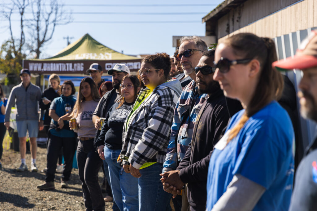
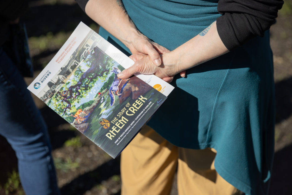
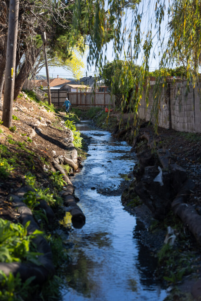
On February 8, project partners from the Rheem Creek Flood Risk Reduction project gathered alongside neighbors to celebrate the completion of a project initiated in 2019, an effort led by the City of Richmond alongside American Rivers, Contra Costa County, Urban Tilth, The Watershed Project, and Restoration Design Group. I walked in to find tables arrayed with family-friendly activities; coloring books for the local kids, plant identification guides, and storybooks. Sitting at those tables were project partners, local representatives, and community members, talking, smiling, and enjoying a day in the sun. Past the tables a gate opened up onto recently restored Rheem Creek, with woody mulch lining the tops of the banks, saplings planted along the steep banks of the creek, and flows nowhere near the top of the bank. The project is doing its job!
In December, an atmospheric river pummeled Northern California, bringing with it heavy rainfall. But if you were in the Rollingwood neighborhood in Western Contra Costa County, you probably didn’t need to bring your rainboots. For two decades, residents had been dealing with flooding as Rheem Creek, which was choked with nonnative vegetation, sediment, trash, and other obstructions, overtopped its banks and spilled out into the streets. Drainage pipes flowed in the opposite direction and homes were flooded and damaged. But this past December, after the construction phase of the project funded by the CA Natural Resources Agency had concluded, Rheem Creek flowed safely and swiftly through the backyards of its neighbors.
Myself and others from the project team joined the neighborhood on a mild winter day as those who were instrumental to this project were recognized for their hard work and success. It had rained the previous weekend, and it was exciting to see how a weather event that would have flooded the streets before this project was implemented had already drained out of the watershed by the time we arrived. Instead of residents scrambling to protect their homes, we could share a warm, sunny day full of laughter, excitement, and wonderful conversation centered on the Rollingwood community.
The Rheem Creek Flood Risk Reduction project is a great example of how bringing people together can serve the community, and how urban creek restorations can transform from an idea into a reality. The project site transects numerous residential properties in the City of Richmond, and impacted homes and streets in unincorporated Contra Costa County, so bringing it to life took creativity, cooperation, and input, combining the dedication and leadership of the City of Richmond, Contra Costa County, the expertise and experience of multiple environmental nongovernmental organizations, and the input of the community to create a positive change for a neighborhood that has been dealing with the effects of a changing climate. And the project isn’t a “one and done” effort. We are currently collaborating with our project partners, including a coalition of community members, to monitor and maintain the creek over the next two years and to help the community maintain the creek in the long term.
And this important work continues elsewhere! American Rivers is looking towards more urban creek restoration across the cities of Northern California, with projects initiated in Sacramento, Brentwood, and Stockton. The work at Rheem Creek is important in its own right, but also serves as a model for how to bring greenspace and all the benefits of flood risk reduction to the communities that need it.
As the leaves turn golden, it’s easy to feel a shift in our moods. While the changing seasons bring beauty, they can have an impact on our mental well-being. Winter can be a challenging time for mental health, with shorter days and colder temperatures often leading to feelings of loneliness and depression. But there’s a powerful antidote to these winter blues — nature!
Research has shown that spending time in nature or green spaces can significantly improve mental health, reduce stress, and even alleviate symptoms of depression. In recent years, medical professionals have emphasized the mental health benefits of spending time outdoors in green spaces. Studies suggest exposure to nature can have profound effects in reducing stress, depression, anxiety, social functioning, and self-esteem. Yet, proximity to green spaces or riverfronts isn’t accessible for everyone. A report by the Hispanic Access Foundation found that communities of color are nearly three times more likely to have less access to open green spaces compared to white communities.
Development and land use decisions have often prioritized profit over protecting the environment, leading to polluted rivers and fewer natural areas for communities of color to enjoy. In many neighborhoods, parking lots and retail spaces have replaced trees and parks, and urban streams are polluted. Like many urban waterways, the Grand Calumet River in Indiana, a once-natural asset, has suffered from heavy pollution due to steel industry pollutants like polychlorinated biphenyls (PCBs), polycyclic aromatic hydrocarbons (PAHs), heavy metals, other industrial toxins, and untreated sewage continue to severely degrade the environment.
This contamination leads to beach closures, fish tumors, and deformities, restrictions on fish and wildlife consumption, and loss of fish and wildlife habitat.
As an urban resident, I understand firsthand how disconnected city life can feel from nature—it often seems like a distant destination requiring a commute or trip. However, there’s a growing movement to invest in river restoration and restore nature in urban spaces. The idea of reclaiming nature in urban spaces-especially in nature-deficient neighborhoods—inspires my work with communities to creatively invest in and reimagine urban spaces through natural infrastructure. By incorporating natural amenities like trees and gardens, we not only improve water quality, mitigate flooding, and reduce air pollution but also have positive public health benefits.
However, communities of color and low-income communities often face significant barriers in accessing natural areas, beaches, riverfronts, and green spaces. According to the Nature Gap, families with children, especially families of color with children, have less access to nearby nature than the rest of the country. American Rivers is working alongside communities of color to identify opportunities to incorporate natural features and develop funding strategies to implement them. For example, the Rivers of Opportunity tool supports communities in reducing the nature deficiency experienced in communities of color and ensuring a clean water future for everyone. Our new online dashboard Lake Michigan Funding Resiliency Dashboard is helping Great Lakes communities identify funding for nature-based projects that provide community benefits and strengthen resilience.
Recognizing the negative impact of environmental disparities such as limited access to nature, poor air quality, and polluted rivers on emotional, physical, and psychological well-being, I sought to learn firsthand how nature influences mental health – specifically in a community burdened by environmental pollution. Can exposure to natural spaces be a “cost-effective public health intervention” in promoting mental wellness? This is particularly relevant in regions like the Great Lakes, where an abundance of rivers and lakes offers opportunities for improving mental well-being through access to nature. I was curious about how spending time near rivers or in parks can improve our mental health, so I spoke with Dr. Tifany Jamison (“Dr. Tif”) to learn more.

As a nurse practitioner serving Lake County Indiana, at Solace Health Solutions, LLC Dr. Tif is dedicated to improving the well-being of her patients. Lake County, located along Lake Michigan’s southern shore presents a mix of urban, suburban, and rural landscapes. Originally inhabited by the Potawatomi, the region is known for its sand dunes, steel mills, and proximity to Chicago. Known for a strong work ethic and blue-collar roots, the area faces economic hardship, as evidenced by higher poverty rates and a median household income 30% below the national average. Beyond the economic challenges, the community has been burdened by the legacy of pollution from the steel industry, which has contributed to increased health risk, including elevated rates of asthma, cancer, and other respiratory diseases. It is precisely this context that makes Dr. Tif’s dedication to uplifting her community and fostering well-being so vital.
When not providing direct patient care, Dr. Tif volunteers her time to facilitate an urban agriculture program led by Black youth. This program empowers young people through place-based learning, equipping them with new skills and knowledge about wellness and environmental sustainability. Recently, Dr. Tif shared exciting news about a new initiative with her place of worship to offer mental health workshops for Black/African American men and women in the community. Despite her busy schedule, Dr. Tif remains passionate about sharing her insights on the therapeutic powers of nature for mental wellness and healing.

As we settled into our conversation, we couldn’t help but comment on the unusual weather this autumn. The uncharacteristic warmth for the Great Lakes region this time of year is a pleasant surprise, providing more opportunities to get outdoors. This led us to the topic of the day: the benefits of nature and mental health.
SV: Does, spending time in nature help reduce stress and anxiety? How?
Dr. Tif: When I think about walking near water, at the park, or even sitting on a bench at the beach, there is something calming that urges your body to relax which significantly reduces cortisol levels – a hormone associated with stress.
SV: Spending time outdoors, under the shade of trees and near calming waters, always makes me feel happy, but scientifically nature provides mental health benefits? Tell me more…
Dr. Tif: Absolutely! Spending time near water can be incredibly soothing. It’s a simple yet powerful way to reduce stress and promote relaxation. When we’re near water, our senses are engaged: the gentle breeze, the soothing sounds, the beautiful sights. These stimuli can trigger a relaxation response in our bodies, slowing our heart rate and easing muscle tension. It’s a simple yet powerful way to reduce stress and improve our overall well-being.
It’s no surprise that water holds a special place in our lives, given that we are primarily composed of water. The rhythmic sound of water can be incredibly therapeutic, acting like a natural lullaby that eases tension and promotes relaxation. It’s a simple yet powerful way to recharge and rejuvenate.
SV: What other natural mood boosters does nature hold? What about people that suffer from depression?
Dr. Tif: Isolation can exacerbate feelings of loneliness and depression, particularly during the winter months. Spending time outdoors, like going for a walk in a park or a forest, significantly improves our mental well-being and shake off those winter blues. Sunlight, for example, increases serotonin levels, a neurotransmitter associated with happiness. A simple outdoor walk, surrounded by the calming hues of nature – blues, yellows, and oranges – can foster a profound sense of peace and tranquility. In fact, incorporating mindfulness techniques, like meditation or yoga, into your outdoor experiences can further enhance the calming and restorative effects of nature. Additionally, encountering other people on trails and in parks can provide opportunities for social interaction and a sense of connection
SV: That’s a great point! The therapeutic benefits of spending time in nature are undeniable.
Dr. Tif: Exactly! Nature promotes both mental and physical well-being. Physical activity, especially when combined with nature exposure, offers a powerful boost to mental health. Activities like hiking or biking not only get our bodies moving but also release endorphins, natural mood elevators.
SV: I’ve come across research suggesting that exposure to nature can increase attention span and even benefit individuals with ADHD. Is there any truth to it?
Dr. Tif: Yes, nature has a remarkable ability to improve focus. By tuning into the natural world and engaging our senses – sight, sound, touch, and smell – we can become fully present in the moment. This heightened awareness can improve our focus, reduce stress, and enhance our overall well-being. This, in turn, restores our attention span and promotes a sense of calm. Even simple activities like sitting by a body of water can be incredibly therapeutic. The vastness of the water can paradoxically help us focus on our immediate environment, allowing us to concentrate on specific tasks.
SV: I’m not a huge fan of the cold, so I tend to stay indoors during the winter. Any tips for getting outdoors even when it’s chilly?
Dr. Tif: If the weather permits, even on moderately cold days, I encourage people to bundle up and spend at least 15 minutes outdoors. Fresh air and sunlight can do wonders for your mood and energy levels. Even a short amount of time spent outdoors or in a green space can make a significant difference in your mental and physical health
When it’s too cold to be outside, Dr. Tif suggested I consider alternative options:
- Indoor Green Spaces: Visit botanical gardens, greenhouses, or zoos. These places offer opportunities to connect with nature, even during the winter months.
- Volunteer: engage with a nearby urban farm or community gardens. The social interaction and physical activity can be incredibly beneficial.
- Indoor Plants: Bringing plants indoors can improve air quality and boost mood.
- Artificial Light Therapy: If you’re struggling with seasonal affective disorder, consider using a light therapy box to mimic natural sunlight.
SV: “Thank you so much for sharing your insights with us, Dr. Tif, Before we wrap up, I’d love to know: What’s your favorite outdoor space to unwind and recharge?”
Dr. Tif: My favorite place to unwind is near a body of water – specifically Lake Michigan. It provides a sense of calm and focus, allowing my mind to wander freely. The sound of water invites me to pause and appreciate the beauty of nature. It’s a place where I can feel a spiritual connection to the world around me, humbled by its vastness and complexity.
Nature, particularly bodies of water like rivers, offers us a vast, natural pharmacy. By simply being near water or engaging in nature, we can experience numerous physiological and psychological benefits. The calming sounds of flowing water, the fresh air, and the beauty of natural landscapes can reduce stress, improve mood, and contribute to improved mental and physical health.
My conversation with Dr. Tifany Jamison sparked a strong interest in how I can better incorporate nature into my daily life to improve my mental well-being. I left our discussion about the mental health benefits of nature with three key takeaways:
- The calming effect of nature can reduce stress
- Rivers, parks and forests are mood boosters
- Nature can enhance mindfulness and support mental clarity
So, what are you waiting for? Get outside and experience the healing power of nature!
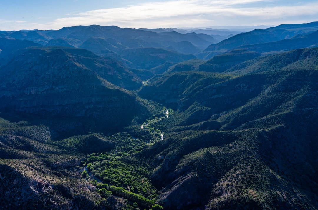
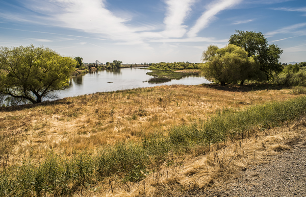
A healthy river system isn’t static. The flow of a river changes dramatically over the course of a year. The tremendous energy of the spring freshet or a flood event will move boulders, rocks, and sediment to rearrange pools, riffles, and runs to new configurations. A river system like the Connecticut that flows through the soft sediment laid down over thousands of years meanders and moves around its floodplain. A healthy river system is dynamic and dramatic, and many river critters have evolved to live amidst this energy and change.
One of those river critters is the bank swallow, whose Latin name of Riparia riparia doubles down on this fellow’s connection to rivers. Avid birders living in southern New England may have followed the dramatic late summer murmuration of the tree swallows that congregate by the hundreds of thousands in the river’s estuary to rest and feed before their southern migration. This murmuration has been celebrated by Roger Tory Peterson as one of the most dramatic natural events he ever experienced.
The bank swallow does not attend that particular avian party in the Connecticut River’s estuary. Riparia riparia is also a social species that nests in colonies they seem to prefer smaller and less dramatic but still noticeable gatherings a bit farther upstream on the Connecticut River.
I spend a lot of time on the Connecticut River north of my home in Holyoke, Massachusetts, including many special trips along the stretch between Lemington, Vermont and Lancaster, New Hampshire. This stretch includes many miles of meanders north of the reaches impounded by hydropower dams. There are many places along the entire river to spot bank swallows, but I have had wonderful visits with these tiny birds in this reach. The gradual bends and turns of the meanders are great places to spot bank swallows. The eroding banks created by energy of water moving around the meander curves exposes the soft and friable alluvium that makes the Connecticut River valley soils so productive. It is easy to spot the dozens of small entrance holes to the bank swallow nests as you round a corner. And while the outside of river bends are always eroding, the inside bends usually provide a wonderful beach from which you can sit and watch the aerial ballet. And at certain times of years if you watch the nests carefully you can see the chicks waiting in the doorway for a food delivery from mom (or dad?).
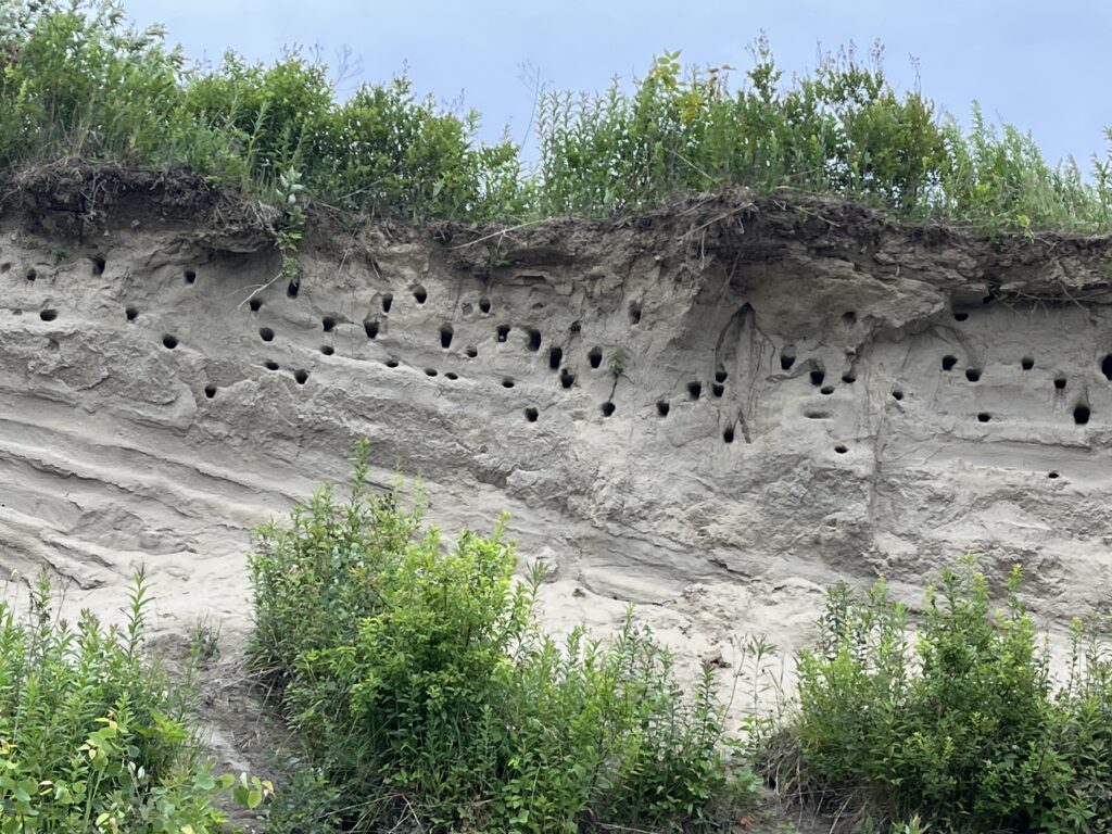
The bank swallows are the smallest species of swallow and have the characteristic angular wing and tail shape of the swallow family with a similar tawny coloration to many of their cousins. They are not as brightly colored as the blue-green of the tree swallow, but they are fetching enough I say. If you have had a chance to stop and watch the bank swallows dart, swoop, dive, and swerve just over the surface of the water you’ve seen these little birds in their glory. Their strength and grace in pursuit of one tiny insect after another is a humbling reminder of the effort these birds make to survive and thrive.
The experts say that the population is healthy, which is good news. Part of the reason for that healthy population is the abundant riverine habitat along the banks of the Connecticut and other alluvial river systems.
That however is a good news / bad news story.
While alluvial river systems like the Connecticut River naturally erode and move and meander around their flood plains, humans have artificially increased bank swallow habitat by cutting down the bankside floodplain forests for agriculture, development, and views. The loss of riparian forests accelerates bank erosion, particularly the loss of the majestic silver maples with root systems able to hold together our friable soils. So while the bank swallows can easily adjust to an eroding bank by digging out a deeper or newer cavity, fixing eroding banks that eat away prime agricultural soils or eventually undermine houses and structures is not an easy fix. A healthy riparian forest allows a river to move at its own pace which creates abundant natural bank swallow habitat while protecting human homes. These little birds with little brains have evolved to succeed with healthy riparian forests.
With our big brains and creativity, we can too.
Here’s to the strength and dynamic energy of the bank swallow, a successful resident of our river valleys. I pay homage to those same characteristics that I see in the many human residents working on behalf of rivers everywhere to make them a better place for everyone and everything.
A version of this blog was first published in the Winter 2024 edition of Estuary, a quarterly magazine for people who care about the Connecticut River; its history, health, and ecology—present and future. Find out how you can subscribe at estuarymagainze. com
What are wetlands? Why are they so important? Here’s what you need to know about wetlands and why they are vital to rivers and your clean water.
1. What are wetlands?
A wetland is a low-lying area of land that is saturated with water, either permanently or seasonally. You can’t really talk about wetlands without streams. Small streams and wetlands are where a multitude of our rivers and lakes originate from. Some are so small they don’t even show up on a map yet these headwaters heavily influence the character and quality of things downstream.
2. Why are wetlands important?
Wetlands play a vital role in improving water quality, controlling floods, providing habitat, and supporting the overall health and function of the ecosystem. Consider this:
- Wetlands are the first line of defense for communities facing severe weather.
- Coastal wetlands physically slow down storms by impeding their path to land and minimize their full force.
- Freshwater wetlands and headwater streams inland act as sponges, absorbing significant amounts of rainwater and runoff before flooding can occur.
3. Why is it important to prioritize restoring and protecting wetlands?
Ensure access to clean water
Healthy wetlands and streams are critical to healthy downstream rivers, lakes, and estuaries. These headwaters have proven especially important because of their significant capacity to store and transform nutrients, specifically nitrogen and phosphorus. Without wetlands absorbing these nutrients, downstream waters would receive elevated amounts of nitrogen and phosphorus that cause nasty algal blooms and low oxygen levels in downstream waters. Protecting and restoring wetlands ensures wildlife and humans who depend on rivers for clean, safe drinking water continue to thrive.
Mitigate Climate Change
The effects of climate change will continue exacerbating extreme weather events, such as fires in California, hurricanes in the Southeast, and drought across the country. Draining wetlands, drying up streams, and paving over floodplains have destroyed the habitats fish, birds, and wildlife need to nest, feed, reproduce, and thrive. Protecting and restoring rivers and their headwaters is the best defense against climate change.
Protect habitats and biodiversity
Small streams and wetlands offer an enormous array of habitat for plant, animal, and microbial life. These small freshwater systems provide shelter, food, and protection from predators as well as spawning sites and nursery areas for fish. In fact, many species depend on small streams and wetlands at some point in their life history. Amphibians such as frogs and salamanders rely heavily on these aquatic systems for some part of their life cycle. While fish such as trout require these cool, small streams for both habitat and spawning sites.
Whether you’re making coffee in the morning, brushing your teeth, or filling up your kids’ water bottles, we all want to be confident that the water flowing from our faucets is safe.
But the water sources for too many Americans are contaminated or at risk:
- A recent news story raised concern about toxins in drinking water supplies and possible links to cancer.
- Los Angeles residents have been cautioned to not drink the water following the catastrophic fires.
- Toxic algae outbreaks – fueled by polluted runoff – have shut down water supplies in places like Toledo, Ohio, and also make playing in rivers and lakes potentially deadly for pets and wildlife.
- Asheville, North Carolina residents were without clean drinking water for nearly two months following Hurricane Helene.
Our nation may be divided on a lot of issues, but one thing we can all agree on is that clean water is a human right and a basic need. No matter who you are or where you live, we all need clean, safe, reliable drinking water. And most of our water comes from rivers.
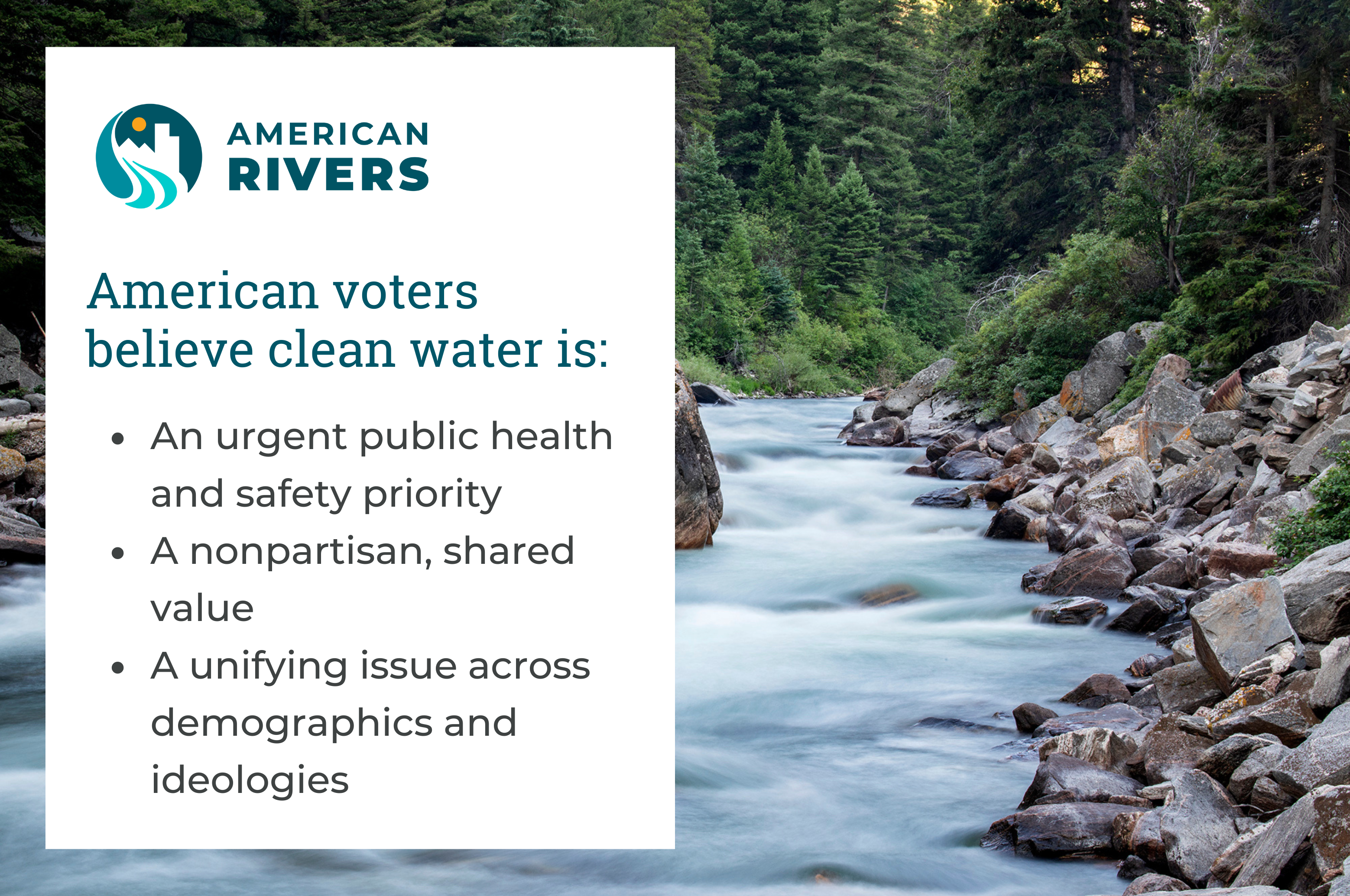
The affiliate of American Rivers, the American Rivers Action Fund, has been conducting public opinion research to understand how people think about water. The findings show that concerns and support for clean water cuts across party lines and demographics.
The main takeaway? Water is a unifying issue that can bridge divides and bring us together around urgently needed solutions for our rivers and communities.
Voters agree. In 2024, all 23 water-related ballot measures across the country passed, safeguarding clean water for millions.
But we have a lot more work to do.
We must continue investing in river protection and smart water infrastructure to improve water quality and reliability for all Americans. Not only is this good for our health and safety, but investing in clean water creates jobs and stimulates the economy.
In addition, decision-makers must resist efforts by polluters to unravel longstanding, common-sense clean water protections. That’s because prioritizing polluter profits over our clean water will compromise the health of our families and make regular people shoulder the costs.
Pollution isn’t patriotic. Every American deserves clean water and healthy rivers. American Rivers is building a bigger, more inclusive effort for our water and rivers. We hope you will join us.
No matter where you live, you are feeling the impacts of climate change and extreme weather.
Right now, the stakes couldn’t be higher — fires are growing increasingly severe, dangerous floods are threatening communities, drought is putting water, food supplies and our livelihoods at risk, and fish and wildlife are being pushed closer to extinction as their streams dry up.
Rivers give us so much; they support the web of life from providing our drinking water to watering our crops and so much in between. In an era of climate change, communities with clean, healthy, free-flowing rivers will be the ones that thrive. We must ensure that all communities, not just a privileged few, benefit from healthy rivers now and in the decades to come.
To address some frequently asked questions about extreme weather and how it affects our nation’s rivers and your clean water, we put together some important information to know:
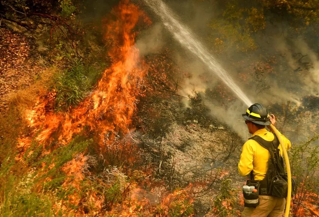
How can healthy rivers help prevent catastrophic fire damage?
Protecting and restoring rivers and their watersheds, including forests and headwater meadows, can both decrease the risk of catastrophic fire, and help ensure clean, reliable water supplies.
- In a healthy watershed, rain can soak into the ground and replenish groundwater supplies.
- We can manage fuels (excess vegetation) in a way that is sensitive to river health and fragile ecosystems.
- Fuels management over less than 10% of a watershed can have a significant impact on water supply while simultaneously reducing wildfire risk.
How does protecting a river ensure clean, safe, reliable water?
Most of our drinking water comes from rivers. Healthy rivers and watersheds work as a natural filtration system, cleaning and storing water for nearby communities.
- Pollution and habitat destruction through harmful logging, mining, agriculture or other irresponsible development contaminates water supplies with sediment and toxins. This can increase water treatment costs (and the cost of your water bill) and in extreme cases, impact public health.
- Smart stewardship of public lands is critical to safeguarding clean, reliable water supplies. Forest Service lands are the largest source of municipal water supply in the nation, serving over 60 million people in 3,400 communities in 33 States. Major U.S. cities including Los Angeles, Portland, Denver, and Atlanta rely on water from Forest Service lands.
How can restoring and reconnecting a floodplain protect homes and businesses?
Floodplains (the low-lying areas along a river) are an integral part of healthy rivers, and the first line of defense when it comes to safeguarding a community from flood damage.
- When the water level rises in a flood, that water needs somewhere to go. This is why a river needs room to move across its floodplain. It’s also why we should build smart, and keep homes and businesses out of harm’s way.
- A floodplain can act as a sponge: when a flooding river can move into its floodplain, the water can slow down, get absorbed into the ground, and prevent damage to homes and businesses.
- Paving over floodplains and walling off the river with levees can make flood damage worse in downstream communities.
How helpful are dams?
While dams can provide water storage and hydropower, they can also take a significant toll on a river’s health. Many dams are useful, but some are destructive. We must evaluate dams on an individual basis and weigh their costs and benefits when determining how to manage them, and whether to keep them in place or remove them.
- When it comes to preparing for increasing floods, drought, and fires, different communities will have different needs. There is no “one size fits all” solution. Many communities depend on a balance of traditional infrastructure (such as dams) and natural approaches (such as river restoration). Protecting and restoring free-flowing rivers is always a smart strategy.
- Building a dam doesn’t create “new” water, it simply stores the water that’s available. As drought shrinks reservoirs across the country, we need to increase water conservation and watershed protection to help secure our water supplies.
- There are already hundreds of thousands of dams across our country. We must optimize the operations of existing dams, and remove the ones that no longer make sense.
- Reservoirs also lose a significant amount of water each year through evaporation – in some regions up to 15% of the water is lost each year to evaporation.
How can removing a dam improve public safety?
Outdated, unsafe dams can fail, with devastating consequences to downstream communities. Dams can also harm water quality, and can be drowning hazards.
- Flood protection: Floodwaters can overwhelm aging dams and cause them to fail, taking lives and destroying property as has recently happened. Many dams have exceeded their design life and require costly maintenance or upgrades to remain safe. Taking down an unsafe dam eliminates the risk of catastrophic failure and can improve flood protection.
- Clean water: Dams can encourage the growth of toxic algae, by slowing and warming the water. Toxic algae harms water quality and can be lethal to wildlife and pets. Dam removal can restore a river’s flow and water quality, and help eliminate this public health risk without removing the potential of the river as a drinking water source for local communities.
- Drowning risk: Low-head dams can create a recirculating hydraulic at the base of the dam. These hydraulics can trap and drown and drown swimmers, boaters, and anglers who get too close. There have been more than 1,400 fatalities at low-head dams across the U.S.
Following his inauguration, President Trump issued a number of executive orders focused on climate and energy—actions that could have major impacts on the rivers and clean water that all Americans depend on. President Trump has said he wants our country to have “the cleanest water,” which is why we must prevent any actions that harm our rivers and drinking water sources.
That’s why we need a responsible national energy strategy that is considerate of our water resources. Responsible energy development means meeting the needs of people without damaging the environment that our health and water wealth depend on.
No matter who you are or where you live, we all need clean, safe, reliable drinking water. Most of our country’s water comes from rivers. Public opinion research shows that Republican, Democrat, and Independent voters of all ages and races overwhelmingly support protections for clean water. Clean water is a basic need, a human right, and a nonpartisan issue we can all agree on.
The details and implementation of these executive orders will matter as we pursue the dual goals of energy and water security.
We cannot return to days where polluters were allowed to devastate rural and urban communities and their natural resources. But these executive orders eliminate efforts to safeguard communities from environmental harm, putting their drinking water at risk.
In addition to protecting Americans from pollution, we also need to help families and businesses prepare for increasingly extreme weather. As Asheville, North Carolina and other communities in the Southeast continue to recover from Hurricane Helene, and thousands in Los Angeles are without homes following recent catastrophic fires, we should be bolstering policies to fight climate change and working to strengthen communities in the face of severe floods, droughts, and fires.
Here’s a look at some of the executive orders that could have significant impacts on water and rivers, as well as communities’ ability to have access to and a say over decisions about their rivers:
Declaring a National Energy Emergency executive order:
- Directs agencies to use their authorities under the National Emergencies Act (“NEA”) to speed the development of fossil fuels on federal lands and elsewhere. Using the NEA authorities, agencies may use emergency regulations and waivers under the Clean Water Act and the Endangered Species Act and eminent domain to fast-track energy projects, including hazardous materials, pipelines, fossil fuels extraction, and hydropower dams, lessening protections for free-flowing rivers risking increased watershed impairment from leaks, spills, and industrial accidents while further exacerbating the climate crisis.
Unleashing American Energy executive order:
- Establishes the policy of the United States “to encourage energy exploration and production on Federal lands and waters.” Under this order, agencies are tasked with identifying “burdensome regulations” and implementing action plans to address these burdens. In many cases, regulations that may slow down project development also serve to protect communities from the impacts of energy development. Fast-tracking permitting for oil, natural gas, coal, hydropower, biofuels, critical minerals, and/or nuclear energy can leave public health and environmental protections behind. This order also undoes appliance efficiency policies. Securing enough water quantity is a significant problem for many communities, particularly in the West, and this new policy could further deplete rivers of their waters.
Putting America First In International Environmental Agreements executive order:
- Withdraws the United States from the Paris Agreement under the United Nations Framework Convention on Climate Change. The 2015 Paris Agreement is a voluntary global climate accord agreed to by almost all countries to progressively reduce greenhouse gas emissions. Climate change impacts water quality, water quantity and severity of catastrophic floods, droughts, and fires.
Rescinding of Executive Order 14030 Climate-Related Financial Risk
- Revokes the Federal Flood Risk Management Standard (FFRMS). The FFRMS was developed to improve the resilience of communities and federal assets from flooding. It addressed flood risk and limited flood damages by focusing on the protection and restoration of wetlands in addition to the recognition of an expanded floodplain at risk of future flooding. Without the FFRMS in place, communities nationwide will be less prepared and more vulnerable to hazardous weather.
Rescinding of Executive Order 14094 Modernizing Regulatory Review
- Will reduce opportunities for public participation in regulations and meetings with decision-makers, particularly for underserved communities.
Rescinding of Executive Order 14096, Revitalizing Our Nation’s Commitment to Environmental Justice for All
- Eliminates the government-wide approach to environmental justice and equitable access to nature for all communities.
Executive orders impacting specific rivers:
- Certain executive orders have a direct impact on individual rivers, including the San Joaquin, Sacramento, Rio Grande and the rivers of Alaska. In California, agencies are directed to route more water out of the rivers. In the Rio Grande, border wall construction could impact water flow and flooding. In Alaska, thousands of miles of rivers in the Tongass National Forest could lose protections.
Water is a shared resource, and all life depends on healthy rivers. For more than 50 years, American Rivers has been successful in bringing people together for river and water solutions. We remain committed to working with our elected leaders to ensure that this shared resource is protected. American Rivers and our affiliate, the American Rivers Action Fund have a blueprint for the Trump administration and Congress, which includes proactive steps to protect clean water and rivers.