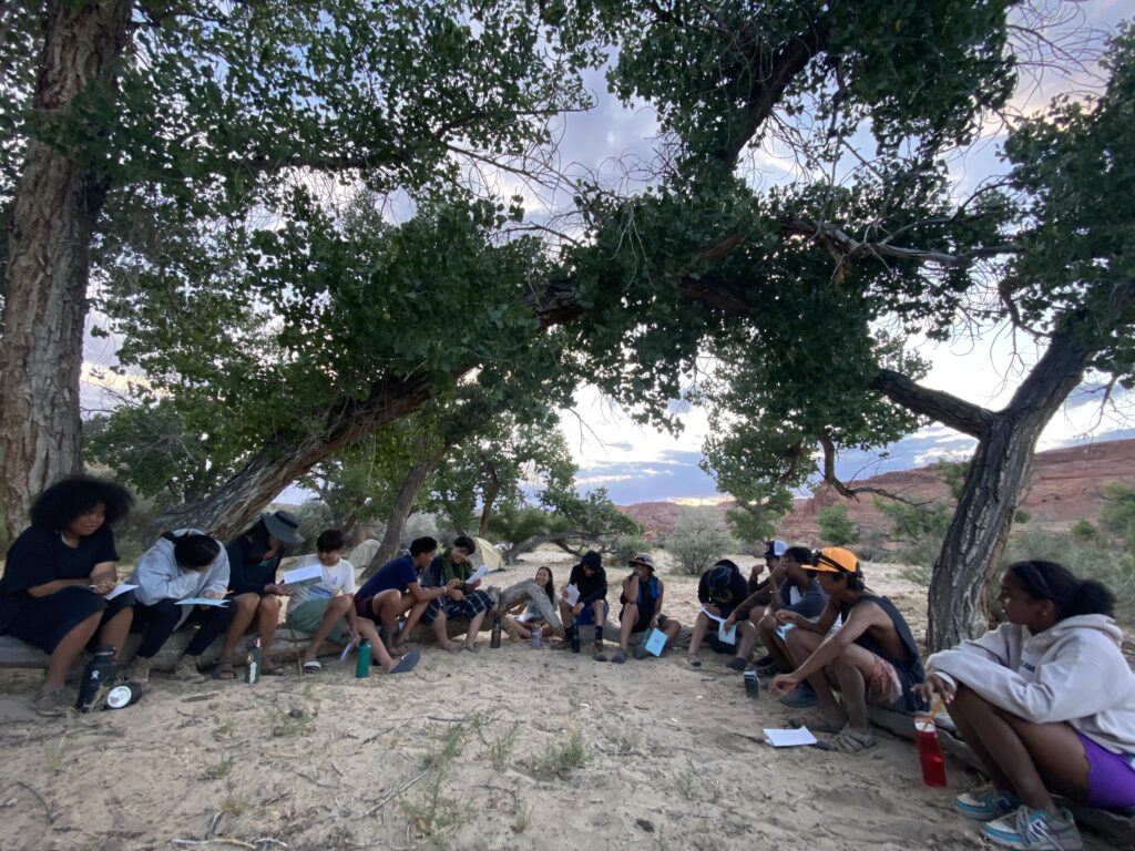
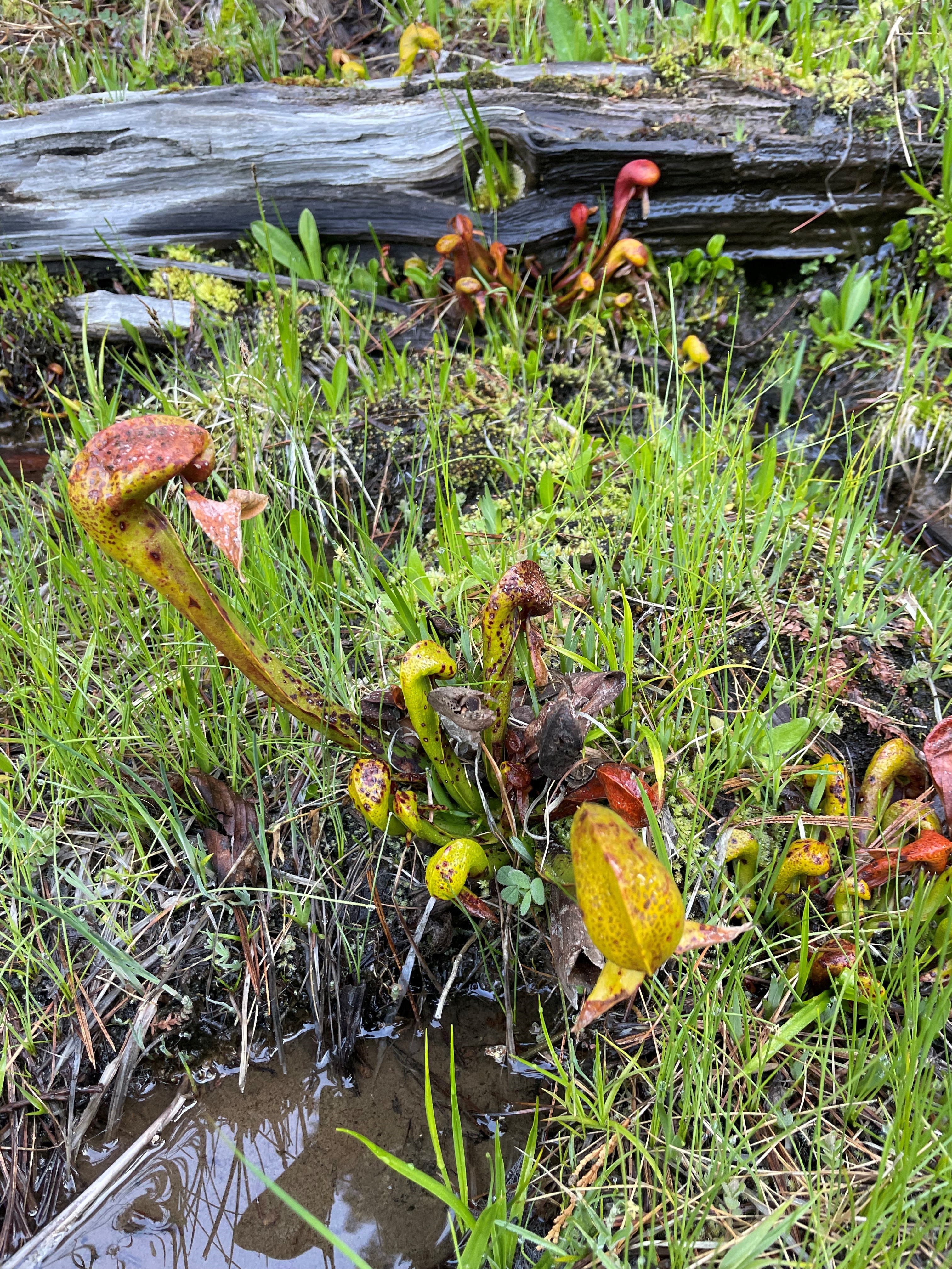
The canyon was a sanctuary of morning shade as we spread out across the natural sandstone benches. The rocks around us mirror the color of our own skin—an intergenerational group of youth and elders nestled in for reverence. The silence before our prayer began was accompanied only by the steady trickle of the creek, a melody to the distant waterfall. The gourds rattled to a familiar beat, and our voices followed the tempo. Eyes closed, smelling the scent of burning tobacco. The harmony of voices, singing in unison, the appreciation for water, for the river.
Months passed after that morning, and I sat in a forest of ponderosa on the rim of that same sacred canyon. I sit pondering how the stream-carved chasm sounds today. It’s absent our singing voices, although our blessings remain in the spirit of that place. Drifting away from the daydream, I’m filled with contentment knowing that the medicine created, shared, and received lives on with the Native youth who sang with me that day.
I live, work, and play across the Colorado Plateau, committing most of my time to engaging with Native youth in outdoor spaces. I build community with Native youth on traditional farms across the Navajo Nation, in deep canyons and forests, and on all the mesas in between. Indigenous youth are our future—a proclamation that became abundantly clear this year as I facilitated culturally relevant outdoor education programs with various nonprofits in the Four Corners region. This level of community engagement in relation to the land represents movement toward the protection of biocultural diversity. Through generations of caretaking, the land of Indigenous peoples has maintained immeasurable biodiversity. The degree of protection and caretaking is evolving in challenge and intensity due to the unfortunate reality that Native communities are disproportionately affected by the severe impacts of climate change. The consequences of climate catastrophe will be left in the hands of Indigenous youth. So how do we inspire them to play a part in the story they are woven into?
It begins with reminding youth that they hold an intrinsic connection to the land. One of the many lasting tactics of colonialism is the forced disconnection of Native peoples from the land. Decades of violent removal, boarding school, and dispossession of land and water have left generations of youth to feel they don’t belong to the land the way their ancestors did. This lack of belonging is exacerbated by the gatekeeping of outdoor spaces by white communities. Socially discouraged accessibility to the outdoors is a barrier to maintaining cultural connection to place.
Growing up in the storied land of the Northern Arizona desert, I began shaping my personal relationship to land at a very young age. My time in red sand and between canyon walls was enriched by the teachings of my family, of my Diné community, that we are a part of this land. While I was never involved in an outdoor youth program, my proclivity for facilitating such programs stems from my belief that Indigenous youth should have limitless opportunity to design an intentional relationship to land and water based on their cultural and personal values.
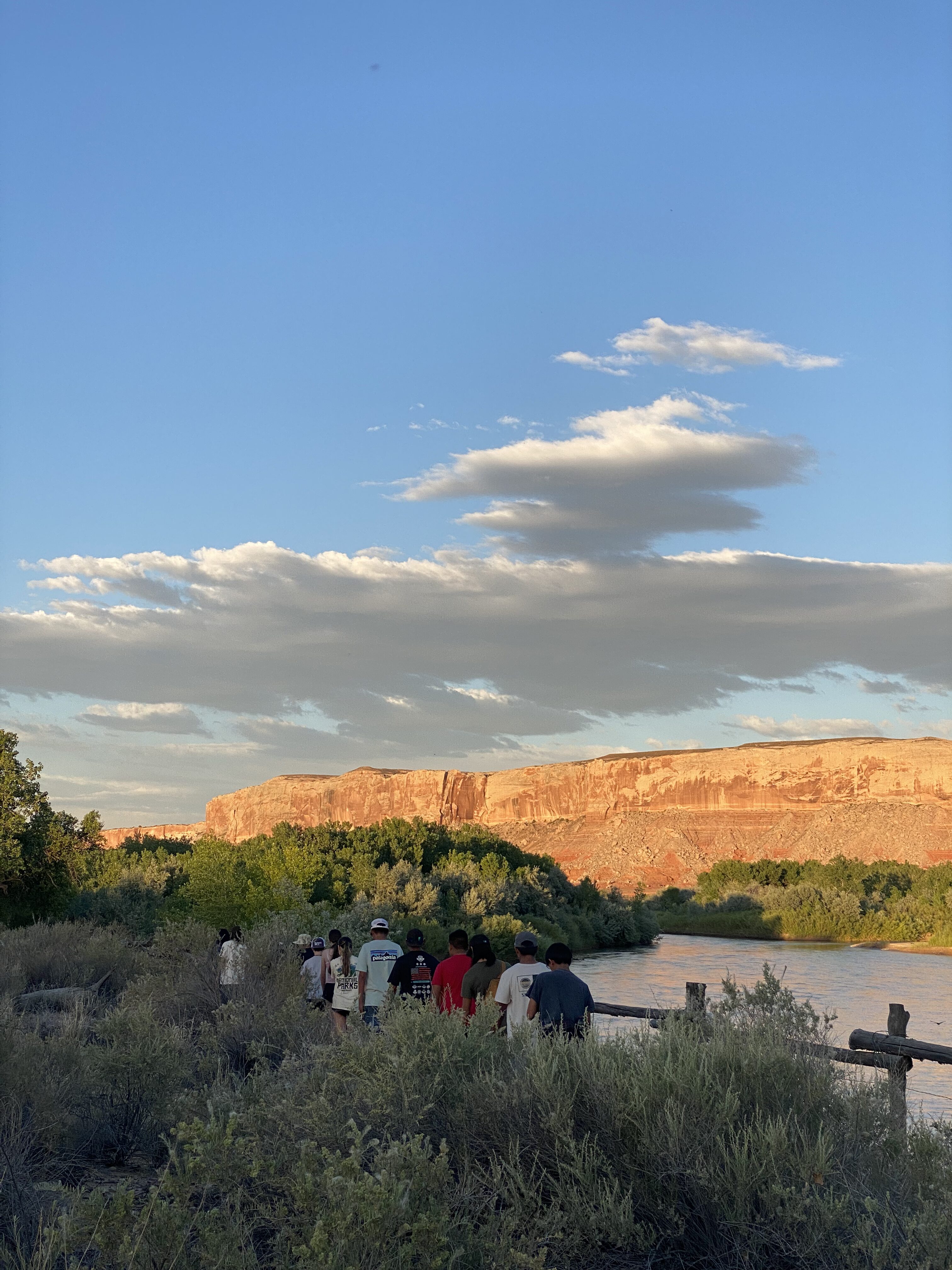
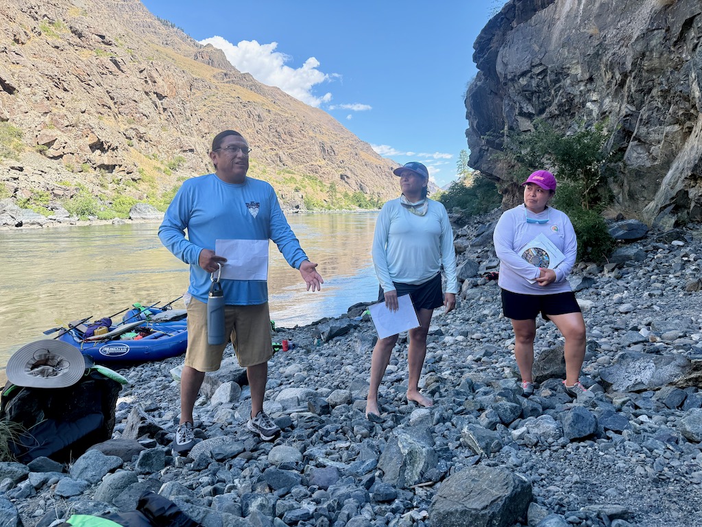
This year, I had the privilege of helping to facilitate the annual RIISE (Regional Intertribal Intergenerational Stewardship Expedition) trip through the Grand Canyon Trust. Indigenous youth and elders gathered to share prayer, tradition, and abundant laughter along the Colorado River. On this trip, we honored the fact that spirit, knowledge, and tradition live in a physical space, brought to life by the stories told and prayers sung. To pass on teachings, Native youth must have access to these places. I’ve shared space and time with over a hundred Indigenous youth this year, and a resounding theme among all of them is a deep desire to know their culture by personally experiencing the land their relatives knew so intimately.
The relationship they desire has been taken away from them by the settler-colonial state we live in, which exploits racial identities to gain economic capital. National Parks are an example of this racial exploitation: land dispossessed from Native peoples has been turned into a commercialized and profitable space. Outdoor recreation is a predominantly white space, a privilege to those who can afford and feel safe in such environments. Outdoor recreation spaces are curated for the white experience, therefore becoming inherently exclusive. Native youth rarely see people of their own cultural background or race represented in the outdoor industry, thus perpetuating the false narrative that they don’t belong.
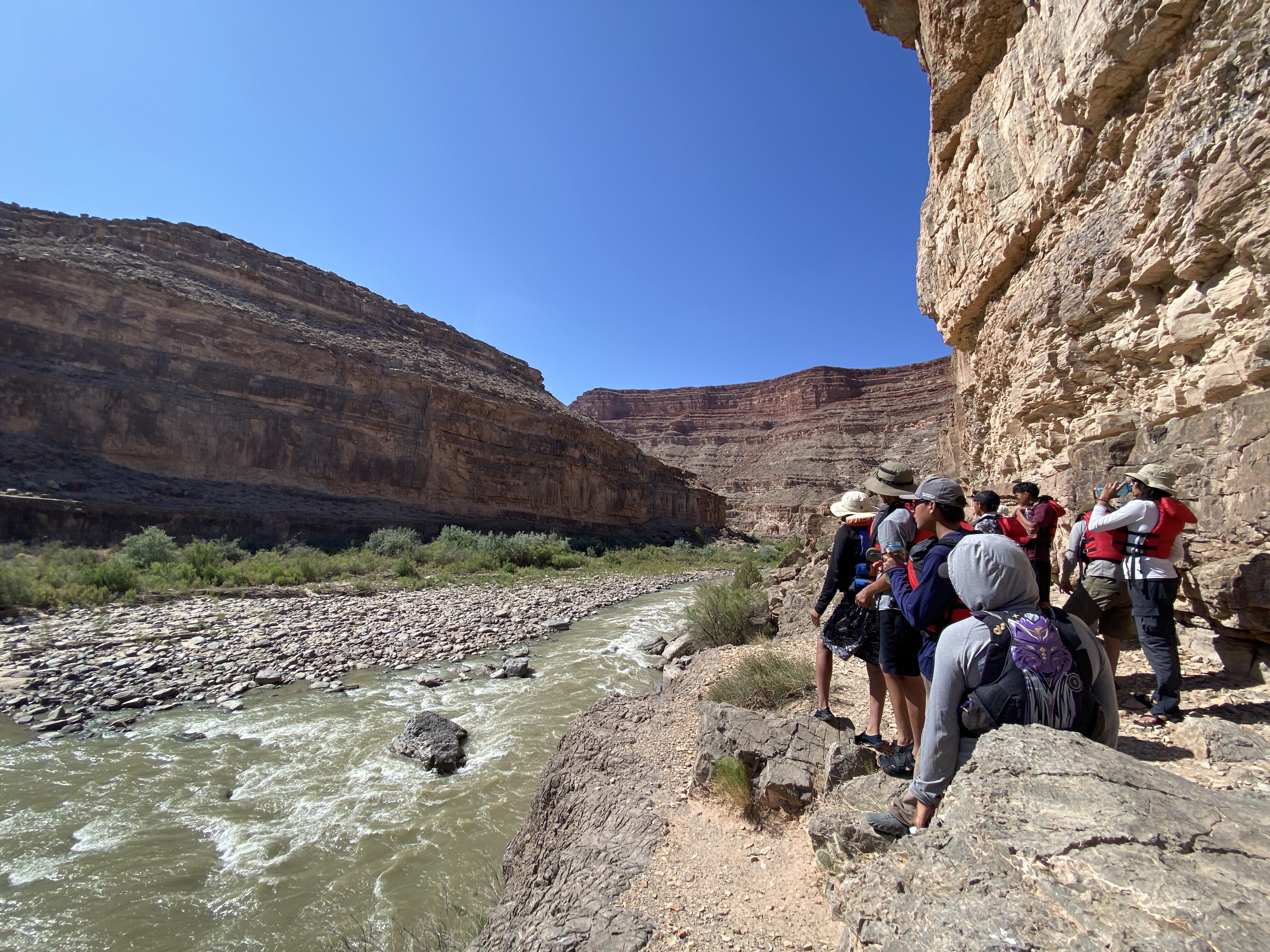
Providing a safe learning space for Black and Brown youth outdoors is a revolutionary act that uplifts both the individual and the community. Time on the land, in community, ignites a sense of belonging; an opportunity to heal the youths’ relationship with land. I observe this phenomenon when facilitating Native Teen Guide in Training trips through the Canyonlands Field Institute on the San Juan River each summer.
We walk alongside sandstone walls that tell of migration in the river corridor from millennia ago. The tradition continues as the youth paddle down the river. This river trip is the first and potentially only time many of these youth will have access to experiential learning and cross-cultural exchange in an outdoor recreation space. The riotous laughter of the youth ricochets across the water as we spend days passing by boats of people who don’t look like us. Some youth notice; others are blissfully oblivious to the racial disparity on display on their ancestral river. Despite these observations, we find our belonging in the stories of our people that etch themselves into the rocks, plants, and animals. Our night air is filled with a steady drum as we round dance, our hands interlaced, feet shuffling in red sand, an offering to the stars.
Outdoor programs geared toward Native youth have an impact that shouldn’t be limited to a singular experience. The magnitude of a culturally-relevant trip is, in essence, a reclamation of a relationship to land and water. How do we ensure the continuous growth of this relationship? We continue to provide Native youth with the opportunity to learn and build relationships with the land and water—to know the river and land as beings with a spirit, as relatives. We help them cultivate an inclination to care for such relatives. By instilling the traditional belief that our lineage is rooted in the land and the water, we can help create a generation of protectors. People protect what they know; they protect who they care about.
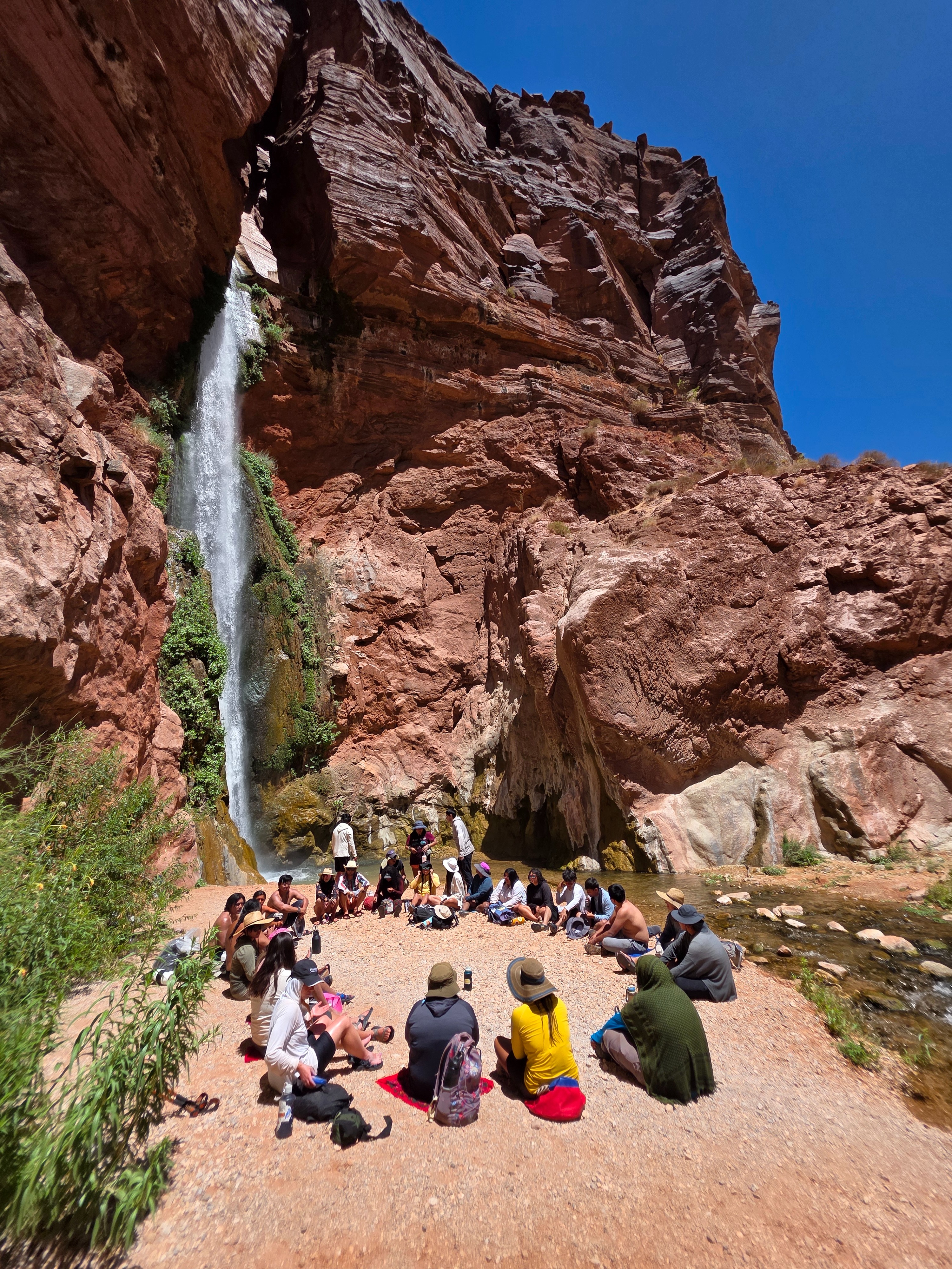
Encouraging the changemakers of the future does not eliminate the feeling of helplessness regarding the water and climate crisis in the Southwest and around the world. On a sunbaked afternoon, bellies full and lungs worked from hours of games at Redwall cavern—in Marble Canyon on the RIISE trip this past summer—the Native youth settled in for a floating talk. They sank into their seats on the rafts, all tied together for the moment, allowing the serenity of the walls to add a dramatic effect for our discussion of water in the West.
Complex topics like water law, legislation, and litigation—and related and problematic jargon, too—hindered a complete understanding of Western water among the youth. A discussion like this can have a similar effect on adults. Worried that we were losing their attention, my mind raced with ideas on how we, as facilitators of the discussion, might connect this topic to their lives, personally. Thinking on my feet, I reminded them of culture: of the days we had already spent giving offerings and blessings to the land and water, learning and strengthening our bond to the sacred. This is specialized knowledge, I told them truthfully.
“There are people in windowless rooms making decisions about a river they may have never floated on, bathed in, or prayed to. Despite this, you cannot forget the generations of wisdom passed through this place, through you, that instructs accountability as land and water protectors.” This dynamic connection to ancestral homelands is what sets Native youth apart; it is their superpower against a world committed to poisoning the earth.
Indigenous youth play a critical role in the unfolding story of our planet. They, too, hold wisdom. The significance of intergenerational knowledge exchange becomes especially evident when in the presence of Native youth. One teaching I received from their enlightened youthfulness is the seamless transition between prayer and play. After an hour-long ceremony at each stop in the Grand Canyon, play promptly ensued. It is a teaching applicable to anyone living in this time, an honoring of the dualities omnipresent in the Indigenous experience. The youth raised my belief that there is room for reverence and laughter in sacred spaces. Our presence throughout the Canyon was marked by steadfast joy: joy for the chance to be in community, to reinhabit the spaces of our ancestors. In this way, joy was our act of resistance.
It’s midday at Whitmore Panel in Grand Canyon (If you know this place, you know scorching heat). We gathered around three young Zuni wisdom holders. We stood, backs of legs burning, listening to the youth sing us into the place in a good way. Taking in the stories on the wall, one of the Zuni youth recognized a symbol. The same symbol he paints on his traditional pottery. Thousands of years between him and his ancestors disappeared at that moment, a lineage connection so profound it forced all of us to recognize the depth of our presence. The presence of Native youth on sacred land is essential for the continuation of culture and the envisioning of the future.
Resistance to the exclusionary character of outdoor recreation is reconnecting Native youth to their right to access their ancestral homelands. Inclusivity begins with acknowledging the barriers to access and understanding how these barriers are a result of systemic oppression. Following this acknowledgment comes owning the part we each play in upholding these systems. Ultimately, this privilege can be leveraged to support Native youth outdoor programs. These programs are gaining traction as we collectively work toward Indigenizing the future. This future honors Indigenous lifeways and values like reciprocity, care, and relationship building. You can be a part of the movement by supporting organizations like these:
- Rising Leaders—Grand Canyon Trust
- Native Teen Guide In Training—Canyonland Field Institute
- Paddle Tribal Waters—Rios to Rivers
- River Newe
- Pandion Institute
- Pollen Circles
You can amplify your support by advocating, donating, and building relationships with your local Native youth programs and community.
Guest contributor Chyenne (she/they) is a Diné adzaani from the small desert town of Page, AZ. The sandstone mesas, canyons, and sagebrush-painted plateaus became her teachers, instilling her creative capacities. Today, Chyenne works and writes as a dedicated land and water protector, applying her lessons from her homeland alongside a MA in Indigenous Studies and BA in Social Justice and Environmental Studies from Prescott College in her work with various non-profits in the Four Corners region.
On the evening of November 19, a packed conference room in the Denver West Marriott erupted in cheers when the Colorado Water Conservation Board approved one of the largest ever dedications of water for the environment in Colorado’s history. This new deal, if completed, will ensure that water currently running through the aging Shoshone Hydropower Plant on the Colorado River, deep in the heart of Glenwood Canyon, will keep flowing through the canyon when the plant eventually goes off-line. It’s not a sure thing yet – water court wrangling over the details and financial hurdles remain. But the Board’s action was a crucial step forward.
Currently, when the plant is running full steam, 1,400 cubic feet/ second (think 1,400 basketballs full of water passing by every second) is diverted out of the river into a tunnel and then into massive pipes visible against the canyon walls, where the power of falling water spins turbines to generate electricity. The water is then returned back to the river. Under the new deal, when the plant stops operating (it is over 100 years old and vulnerable to rockfall), the water would instead stay in the river, vastly improving conditions for fish and the bugs they eat in the 2.4-mile reach between the diversion and the powerplant’s return flows. The dedication of the plant’s water rights to that stretch of river would bring benefits that ripple hundreds of miles up and downstream because of the crucial role these water rights play in controlling the river’s flow through Western Colorado.

In Colorado, as in most of the West, older water rights take priority over newer ones when there’s not enough water to satisfy everyone’s claims. On the Colorado River, the Shoshone Hydropower rights limit the amount of water that can be taken out of the river upstream by junior rights that divert water from the river’s headwaters through tunnels under the Continental Divide to cities and farms on the eastern side of the Rocky Mountains. The new deal to enable the Shoshone rights to be used for environmental flows would preserve those limitations on transmountain diversions in perpetuity.
Upstream from the power plant, near the ranching town of Kremmling, Colorado, the river carries less than half the water it would without the existing transmountain diversions. This stresses fish populations and the iconic cottonwood groves that line the river. The Shoshone rights downstream prevent these diversions from being even larger. Because the power plant returns all the water it uses to the river without consuming it, the water continues to provide benefits downstream from the plant to rafters, farms, cities and four species of endangered fish that exist only in the Colorado River Basin. Securing these flows for the future is particularly important as climate change continues to reduce the river’s flow, which has already declined by roughly 20% over the past two decades.
The people cheering in the hearing room represented cities, towns, counties and irrigation districts from up and down the Colorado River. Their entities had pledged ratepayer and taxpayer dollars to help secure the rights in the complex transaction spearheaded by the Colorado River Water Conservation District. Environmental organizations, including American Rivers, Audubon, Trout Unlimited and Western Resource Advocates, were also parties to the hearing and supportive of the deal, but were vastly outnumbered.
The Coloradans cheering in that room were there because their constituents’ livelihoods, clean drinking water and quality of life depend on a living Colorado River. American Rivers is proud to stand with them and will continue advocating for the completion of this historic water transaction.
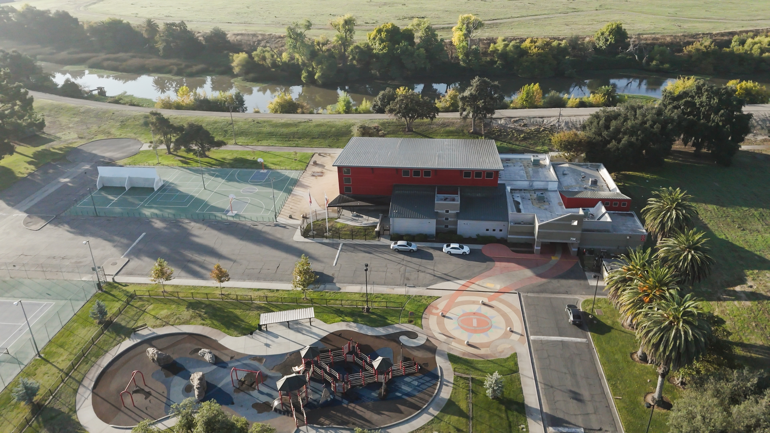
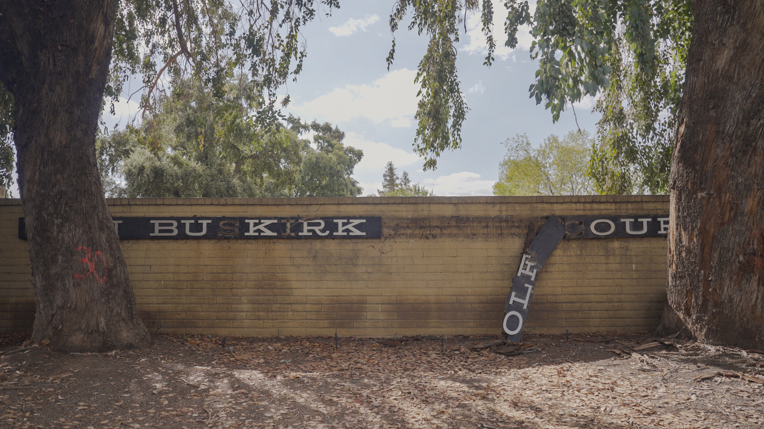
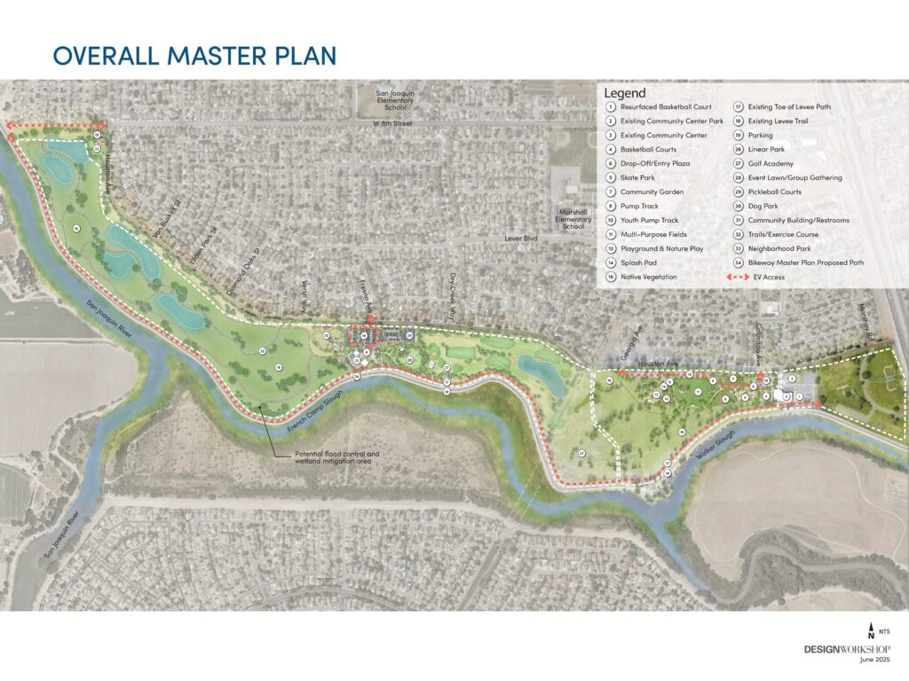
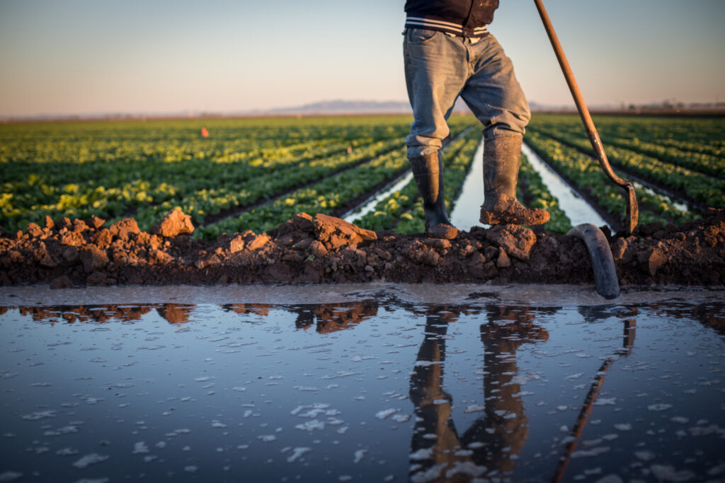
When the city of Stockton, California, closed the Van Buskirk Municipal Golf Course in 2019, local leaders were presented with a prime opportunity. The community of South Stockton, an underserved neighborhood, needed more green space and outdoor recreational opportunities. It also faced the looming threat of catastrophic flooding due to climate change and the aging flood infrastructure along the San Joaquin River. Now, with 192 green acres available, the city could potentially solve both problems if it worked toward a creative, nature-based solution.
A historic floodplain
When the Yachicumne Yokuts and Miwok Tribes were the primary stewards of this portion of California’s Central Valley, the area had been freshwater wetlands that were naturally designed to flood. When settlers arrived in the mid-1800s, the wetlands were rapidly replaced with agricultural fields, and the river was hemmed in by levees built to protect farms and crops from flooding. Over time, Stockton grew into an urban and diverse community of more than 320,000 people.
Although they remain the main tool to contain floodwaters, levees in the Central Valley are aging and in need of repairs. If the network of levees remains in its current state, it poses a great flood risk because the levees stand to fail as extreme precipitation threatens the region.
This is an equity issue. The primarily working-class communities of color living near the levees lack the financial resources, like flood insurance, to recover from the hazards of living in a historic floodplain.
As climate change increases extreme precipitation events and flooding, 1-in-5 San Joaquin River Delta residents will experience flooding each year, costing the city more than $28 billion in damages and impacting more than 17,000 homes by 2050, according to a study by the state of California. Finding a solution to address this risk is critical.
Solution: Build a park and return floodplains to their natural state
The historic wetlands native to the Central Valley were nature’s solution to flooding as the flat lands naturally disbursed excess water whenever the San Joaquin River was inundated.
Levees that set the river in place didn’t allow it to breathe and flood like it naturally would. American Rivers is working with the city of Stockton, the U.S. Army Corps of Engineers, and community partners to address the aging levees and subsequent flood risk. Through the Van Buskirk Park Revitalization project, the city is working to provide recreational areas, while the Army Corps is leading the effort to enhance the levee system along the San Joaquin River.
These projects have the unique opportunity to reconnect the river to historic wetlands and reduce flood risk, while providing more access to green recreational spaces, and potentially restore the area to a biodiverse habitat for wildlife.
The difficult part is the planning. The city has been working since 2021 to plan the park revitalization efforts while coordinating with the Army Corps, community partners, and project partners to plan the levee project at Van Buskirk Park. Meanwhile, the Army Corps is also working to create room for low-impact recreation into the potential setback levee area, as required by the city, as well as the Van Buskirk family, when the land was given to the city.
What to do with the levees?
A big question is whether the Army Corps will repair and enhance the full levee where it currently stands or move a portion of the levee at Van Buskirk Park back from the river to create mitigation space that can give the river room to flood.
Setting back levees produces an environment for fish, birds, and endangered species, while reducing flood risk to the community.
The city of Stockton approved a master plan for the park revitalization project in 2023, which is when American Rivers joined to facilitate communication between different stakeholders and partake in planning the levee project. Since then, progress has been made to fund and permit the first phase of the park revitalization. The Army Corps is planning to enhance some stretches of the levee along Van Buskirk Park, but it won’t make a final determination on setting back a portion of the levee until 2029.
Until then, construction for phase one of the city’s revitalization efforts is expected to begin in 2026, and that will include improving and building public amenities, including a community garden, bicycle pump track, splash pad, and other recreational spaces. The public should begin to see the immediate benefits of having more access to outdoor spaces. Although the decision to set back a portion of the levee is still in the air, there is incredible potential for an ecologically diverse, natural floodplain that will better protect the city from catastrophic floods.
A model for flood-prone communities
Both the Lower San Joaquin River Project and the Van Buskirk Revitalization Project complement each other to provide a model for other communities looking for green spaces and flood protection. For the revitalization effort, the city of Stockton completed several community meetings and surveys that led to the Van Buskirk Master Plan and the upcoming construction of Phase 1. As the project and funding progress, the city plans to hold even more meetings to ensure that the master plan holds true to the needs of the community. Upon completion, not only will people have renewed access to the park, but their involvement in park planning will also boost further engagement. Meanwhile, the US Army Corps of Engineers has the potential to create a setback levee that provides space for the San Joaquin River’s natural processes, while strengthening flood protection. These are exactly the kinds of innovative approaches we need if we want to work with our rivers rather than against them.
More information about the Van Buskirk Park Revitalization project can be found here.
Thank you to all project partners, including the City of Stockton, US Army Corps of Engineers, San Joaquin Flood Area Control Agency, Department of Water Resources, Restore the Delta, and Trust for Public Land.
The unassuming wetland is easily overlooked. After all, they often aren’t majestic like mountain lakes or fun-filled like beloved city riverwalks. But these understated terrains are hidden powerhouses that purify clean water, protect communities from flood damage, and provide habitat for a wide array of species. Among those, the hunter’s, the birder’s, and animal lovers’ delight: waterfowl.
Many of these wetlands form within floodplains, low-lying lands along rivers that naturally flood. The transformation comes quickly after a storm. What was once a dry or muddy landscape quickly comes alive as flood water flows over the land, tempting mallards, pintails, and waterfowl of all kinds to flock to these vital habitats to feast on nutrient-rich seeds and small aquatic creatures, rebuilding the fat reserves that fuel their long migrations. The shallow water creates easy feeding grounds and sheltered havens to rest between flights. Waterfowl, like so many other floodplain-dependent species, have evolved their life cycles to the natural flood pattern.
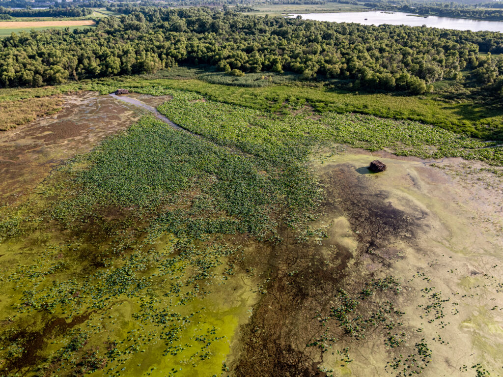
Unfortunately, more than ninety percent of floodplains in the lower 48 have been disconnected or degraded, contributing to more than half of wetlands being lost, and they continue to disappear at an alarming rate. Each acre drained means fewer places for birds to land and fewer natural floodplains to buffer nearby communities from floods.
One of the main governmental agencies that can make or break the health of our nation’s floodplain wetlands — and the services they provide for humans and waterfowl — is the Federal Emergency Management Agency. This agency’s choices on paper can shape what survives after the next storm, from homes kept out of harm’s way to wetlands where life thrives.
3 FEMA programs that impact floodplains, wetlands, and waterfowl
1. National Flood Insurance Program
NFIP offers flood insurance to reduce the financial risk to flood-prone homeowners. It covers flood events typically not covered by homeowner’s insurance. For homeowners to be eligible for the NFIP, a community must put in place minimum standards that guide where and how floodplains are developed. The program relies on FEMA flood maps that show where flooding is most likely and to shape how and where we build.
When construction occurs in floodplain wetlands, the wetlands are commonly drained and filled to make way for homes and roads. Local communities then lose the natural flood protection healthy wetlands offer, and waterfowl lose their habitat. Communities that go above and beyond the minimum standards to keep floodplains open for nature to do its job, storing floodwater and providing space for wildlife, can enroll in the Community Rating System (CRS).
CRS rewards communities with lower flood insurance rates when they take extra steps to build away from high-risk areas and conserve wetlands within floodplains, creating a long-term incentive to protect these irreplaceable landscapes. This allows protected floodplains to become seasonal havens where shallow waters brim with ducks and geese. Beyond prevention, FEMA also works to restore floodplains that have already been lost.
2. Hazard Mitigation Grant Program
The Hazard Mitigation Grant Program helps communities recover from floods and reduce future flood risk through projects like home buyouts and floodplain restoration. Funding becomes available to states, local communities, and tribal governments after the president declares a disaster. When implementing voluntary buyouts, local communities use FEMA funding to purchase flood-prone properties and remove the high-liability buildings. This begins the process of potentially allowing floodplains to recover and come back to life. But the decisions that communities make next are important.
Once FEMA buys out the properties, the agency encourages the land to be managed for natural floodplain and wetland restoration, but does not carry out the restoration work itself. Instead, local governments and community partners decide how each lot is cared for. When the land is left as mowed grass, its ecological value fades. When the land is restored with native plants and reshaped to hold water, it becomes a flourishing wetland again, reviving migratory bird habitat.
3. Pre-Disaster Mitigation Program
FEMA doesn’t just help communities improve their flood resilience after a flood; the Pre-Disaster Mitigation Program can take on acquisitions and other flood mitigation projects before the flood happens. In recent years, PDM got a huge boost with the creation of the Building Resilient Infrastructure and Communities program, which has unfortunately been rolled back under the current Administration.
Through BRIC, FEMA started funding more natural flood-management strategies called nature-based solutions, including programs that reconnect and revitalize floodplains, which create the shallow pools and marsh vegetation that migrating waterfowl rely on each spring and fall.
Advocating for FEMA policies that work with nature by giving rivers room to flood without inundating property and by allowing storm drainage to settle helps support our feathered friends. As storms grow stronger, FEMA can help implement common-sense limits on risky development to avoid draining and destroying our valuable wetlands.
In the stillness of a morning wetland, you can see what’s at stake: a living landscape that protects us as surely as we protect it. Across the country, wetlands are vanishing every year. Now is the time to protect what’s left.
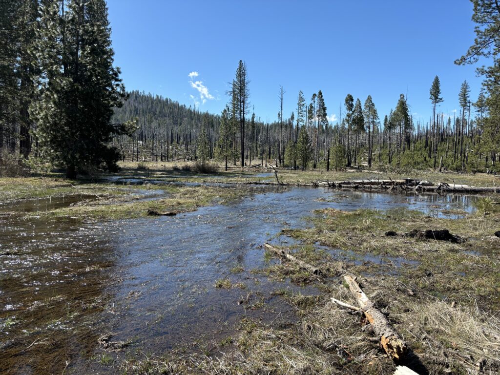
Mountain meadows make up a small percentage of the land area in the Sierra Nevada, but not as small a percentage as once thought. This is exciting news as they have an outsized impact, often functioning as high-elevation floodplains. As snow melts in the springtime, meadows act like a sponge for cold water, holding on to it until the drier months of the year when downstream communities need water most. They also act as a biodiversity hotspot for birds, fish, amphibians, wetland plants, and insects. And a new model is revealing that there may be more meadows in the Sierra than previously estimated.
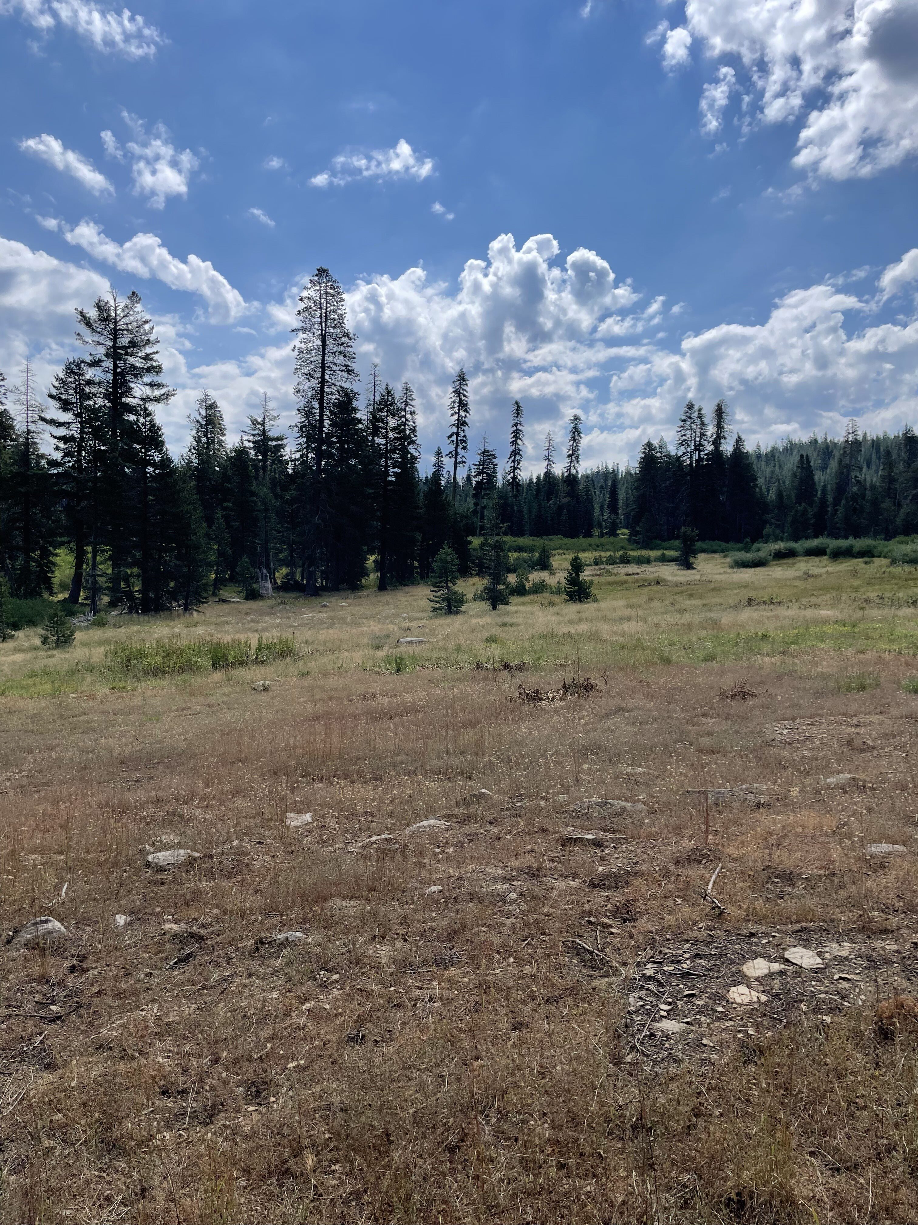
Scientists from the U.S. Forest Service have developed a system to identify potential “lost meadows.” The lost meadow model is based on the idea that disturbances like overgrazing, logging, and mining can disrupt the stability of a meadow, leading to big changes in their physical structure and biologic communities. One of the most troubling changes is the encroachment of large trees onto the former meadow surface. These trees use up water that was formerly available for wetland plants, and they increase fuels in forests that are already at high risk of catastrophic wildfire.
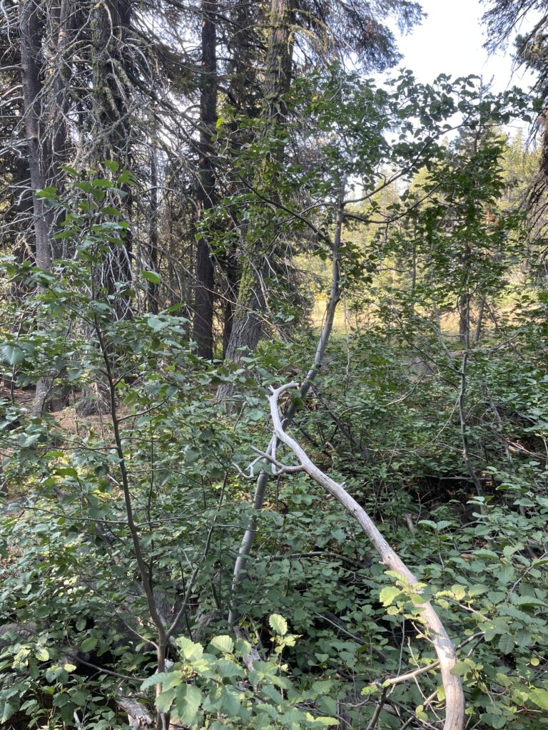
Degradation like what is pictured above can render historic wetlands unrecognizable to a typical observer, but the lost meadow model uses satellite and hydrological data to narrow down the search. With these tools, thousands of acres of potential lost meadows were identified across the Sierra Nevada.
This summer, American Rivers began a multi-year effort alongside the South Yuba River Citizen’s League and the U.S. Forest Service to find out how many of these lost meadows there really are in the North Yuba watershed in northern California, whose headwaters are almost entirely contained within the Tahoe National Forest. Field technicians like me spent months bushwacking through the Tahoe National Forest searching for these potential meadow sites by monitoring their vegetation, hydrology, and geology to determine if they were indeed historic wetlands and if they could be restored.
One season in, the results are surprising: after assessing more than 1500 acres of potential lost meadow sites, a vast majority were accurately predicted by the model (many were even bigger than projected!). We won’t have all the numbers until the project is complete, but the implications of our results so far are significant. If there are even half as many lost meadows in the Sierra Nevada as the model predicts, the restoration of these wetlands could substantially increase the water storage capacity of the Sierra Nevada, bring back historic habitat for wetland species, and sequester more carbon than is currently possible in their degraded state.
The benefits offered by the restoration of lost meadows in this region don’t stop there, though. As catastrophic wildfire risk continues to grow nationwide, it is clearer than ever that responsible forest and watershed management is crucial to protecting rivers, wildlife, and people. Strategic lost meadow restoration could lead to significant forest fuel reduction in a region that desperately needs it. Meadow restorations that remove unhealthy growth, create natural fire breaks, and increase surface water during the driest seasons become ever more important, and understanding lost meadows could be key to accelerating fire-safe restoration across the Sierra Nevada and beyond.
These findings open an exciting new chapter in meadow restoration. At the conclusion of this watershed-scale assessment, we’ll be able to begin exploring entirely new restoration techniques at meadow sites we didn’t know existed, working in collaboration to unlock all the benefits these ecosystems can provide.
River basins don’t get much more complicated than the Colorado – seven states, two countries, 30 Tribal nations, 11 National Parks, and a $1.4 trillion economy span its 247,000 square mile reach, not to mention the countless species of wildlife that rely on the river and its tributaries. Yet, while not perfect, the management of the Colorado River Basin is guided by “The Law of the River,” a series of agreements, treaties, and a few court cases meshed together to keep the peace. For more than 100 years, managers of the Colorado River, including the Basin states of Arizona, California, Colorado, Nevada, New Mexico, Utah, and Wyoming, along with the Federal government, have worked together to manage the river with varying degrees of success.
However, a critical set of rules for how the river is managed is set to expire at the end of this year, and with warming temperatures, unpredictable precipitation, and a growing population across the Southwest all contributing to diminished river flows, the need for new guidelines is urgent. In times of crisis, the states and federal government have been forced to forge short-term, often emergency agreements to conserve water and prevent the system from crashing overall. And for the past two years, negotiators have been working to determine new guidelines for how states and the federal government will manage water shortages and reservoir levels after 2026. A final plan for the new guidelines must be in place by October 2026, when the new “water year” starts and the implementation of the current rules expires.
Last summer, in an attempt to encourage further collaboration and progress, the Department of the Interior set a deadline of November 11, 2025, for the states to come to an agreement. Despite deliberate, concerted effort right up to the deadline, the states have not reached consensus on a path forward. This stalemate is very concerning, as the communities, economies, and ecosystems that rely on the river need certainty around how the system will be managed as we prepare for a hotter, drier future. Management decisions must be grounded in sound science, investments in on-the-ground projects must be made, and efforts to build resilience in communities and ecosystems and expand conservation across the Basin must be pursued. Further, we must ensure that Tribal voices are included in decision-making and that any decisions prioritize the health of the river itself. When we don’t consider the needs of the river, everything else that depends upon it is at risk.
So, where are we now? In a joint statement, the Basin states and the federal government committed to keep striving to reach a consensus, and we applaud their efforts and determination to keep at it. We strongly encourage the states to remain at the table in a spirit of collaboration and shared sacrifice, and the federal government to continue its leadership to hold the process together.
Time is of the essence as the river can no longer sustain all the demands expected of it while we engage in inter-basin political squabbles. Like any complex negotiation, there must be a spirit of honest give and take, with the truest of intentions to find a holistic solution for the river. The river needs flexible tools, inspired solutions, and long-term investments to help communities, agricultural interests, and Tribes prepare for the impacts of drought while ensuring comprehensive water security. And ultimately, we must remember the river when it comes to forging these agreements and reducing risk to the system overall. There is no time to waste – we must act now to sustain the Colorado River.
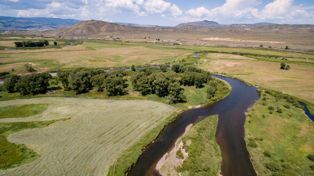
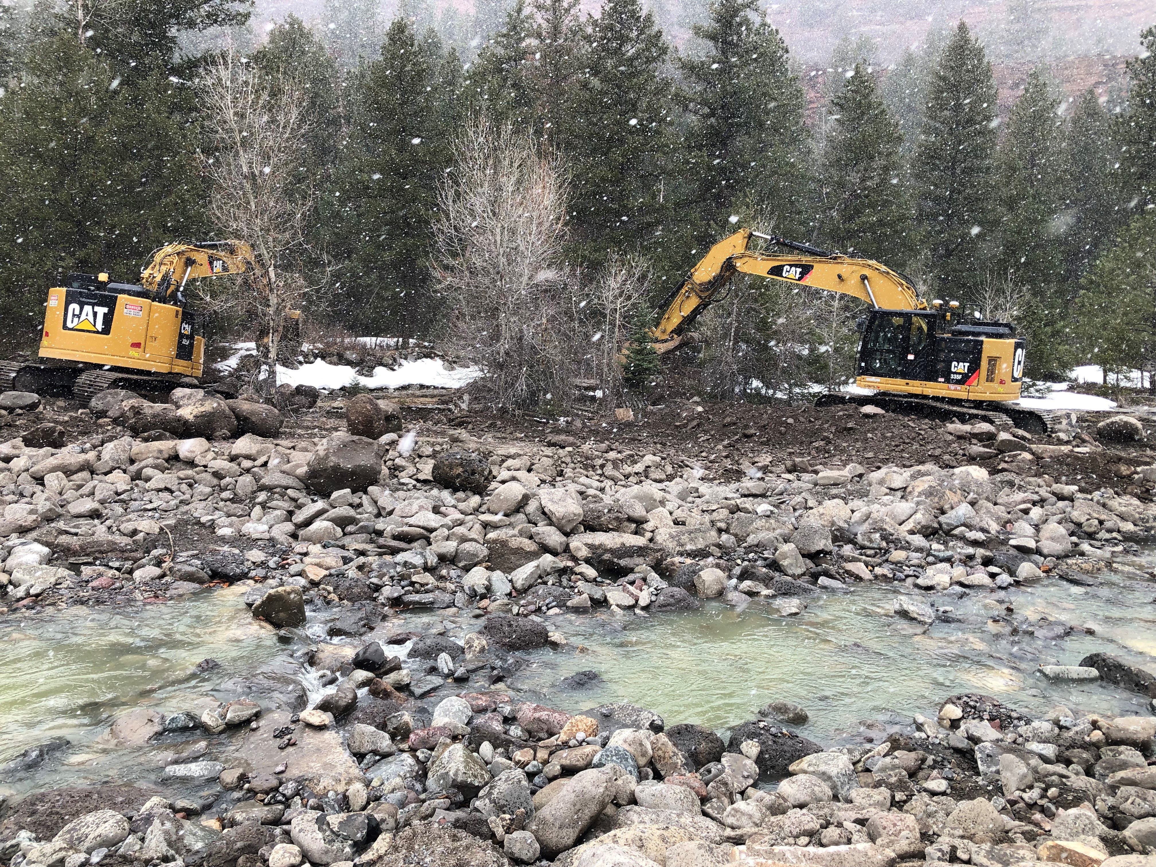
The Uncompahgre River flows from Colorado’s San Juan mountains through the towns of Ouray and Ridgway and then into Ridgway Reservoir, which stores water for farms and households downstream. The river is beautiful, but also troubled; runoff from old mines carries heavy metals into the river, and it is pinched into an unnaturally straight and simple channel as it passes from mountain canyon headwaters into an agricultural valley.
As the river moves through the modified channel, it carves deeper into the valley floor and less frequently spills over its bank. As a result, the local water table has dropped, and riverside trees such as cottonwoods have died, impoverishing this important habitat. Water users on the Ward Ditch at the top of the valley were also struggling with broken-down infrastructure, making it difficult to access and manage water for irrigation. This confluence of challenges created a landscape of opportunity for the Uncompahgre Multi-Benefit Project, which addresses environmental problems along the river and water users’ needs, while also improving water quality and reducing flood risks downstream.
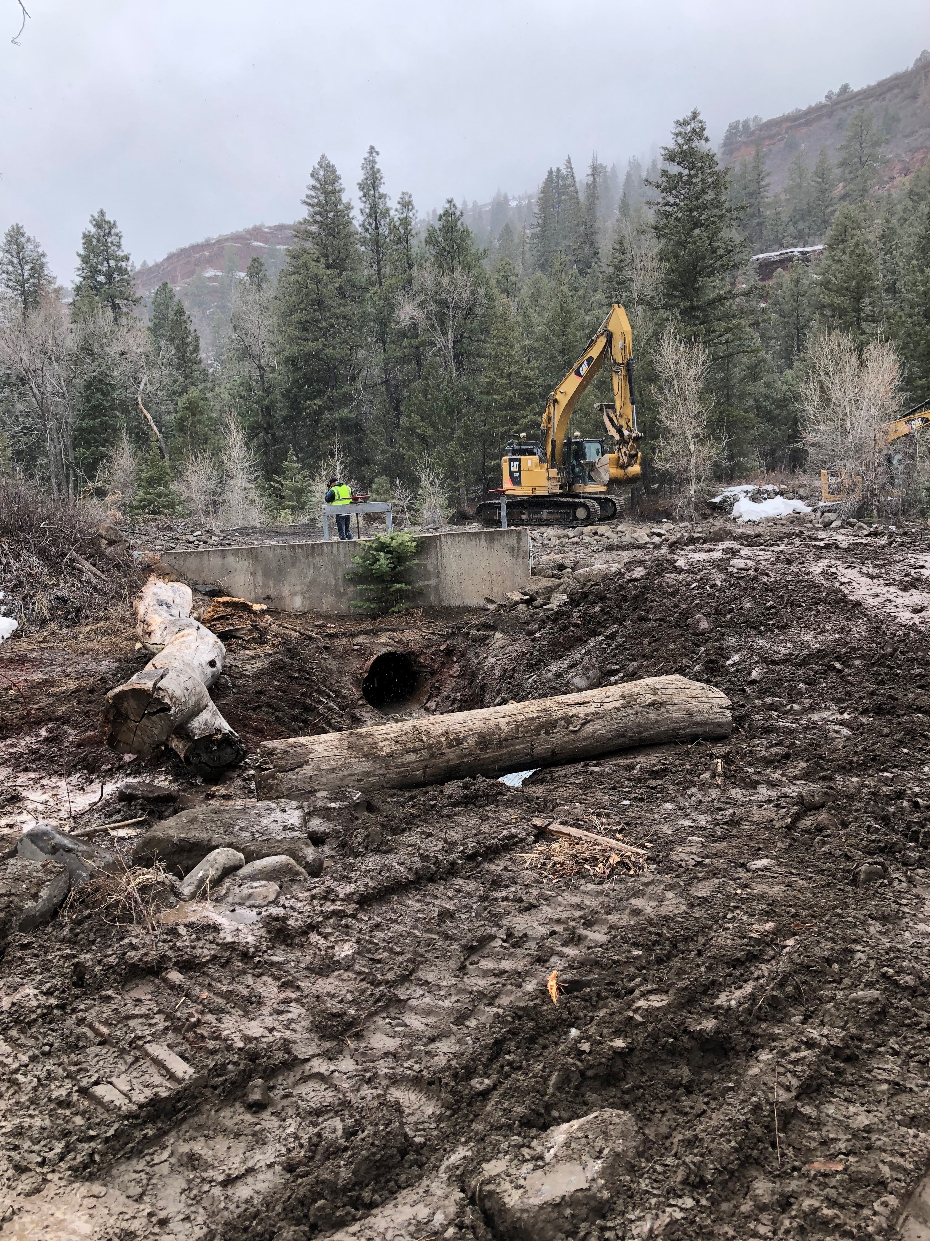
The Project, managed by American Rivers, took an integrated approach to restoring a one-mile stretch of the river, which included replacing and stabilizing the Ward Ditch diversion, notching a historic berm to reconnect the river to its floodplain, and placing rock structures in the river that both protect against bank erosion and improve fish habitat. Meanwhile, ditch and field improvements make it easier to spread water across the land for agriculture and re-establish native vegetation.
In addition to the direct benefits this project delivers for on-site habitat and landowners, the enhanced ability of the river to spread out on its floodplain, both through the ditch diversion and natural processes, also provides downstream benefits. As the water slows and spreads across the floodplain during high flows, its destructive power to erode banks and damage infrastructure downstream is diminished. The same dynamics enable pollutants and sediment from upstream abandoned mines or potential wildfires to settle out before the river flows into the downstream reservoir.
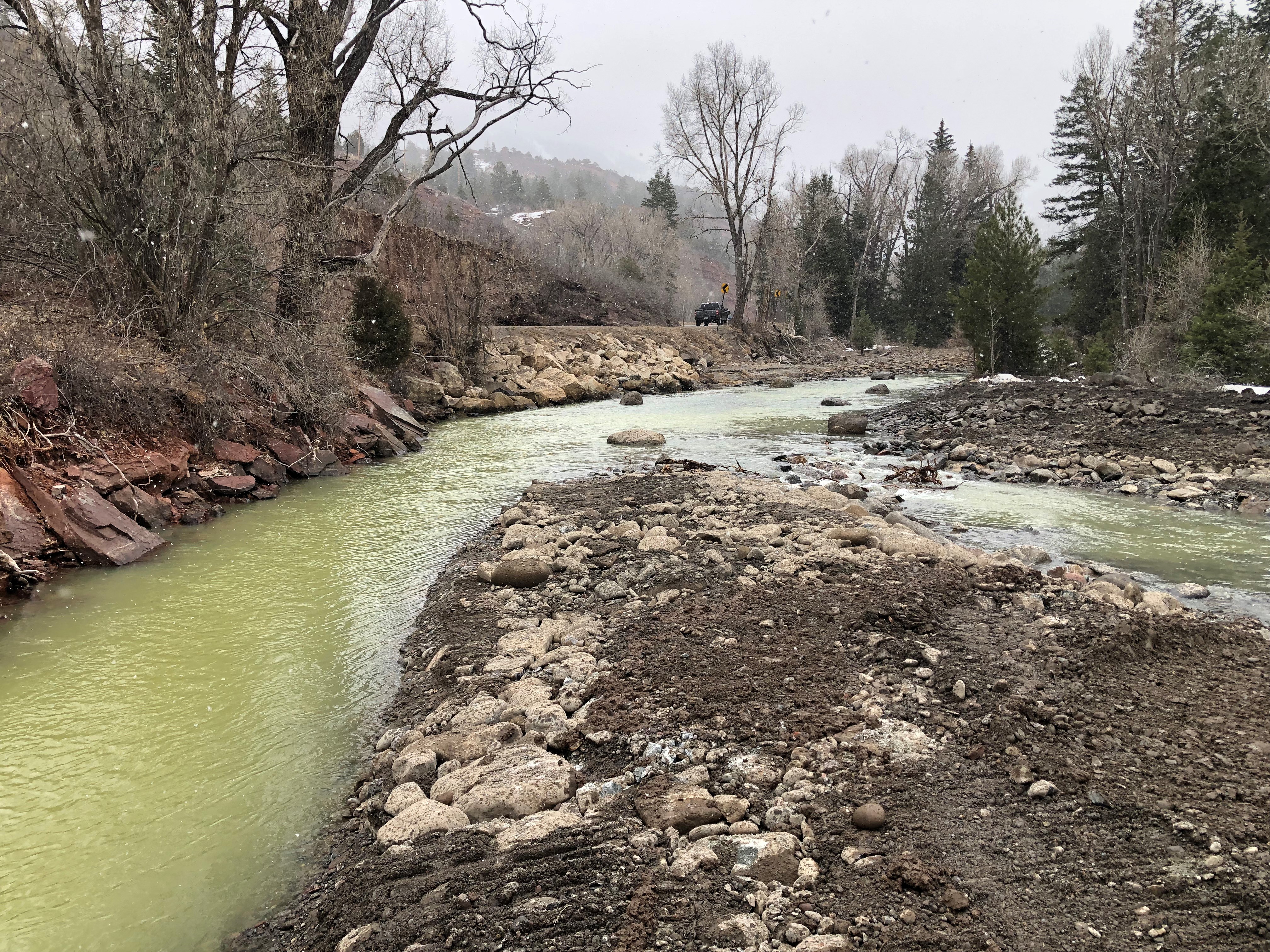
With construction wrapping up in November 2025, the transformation of this stretch of river and its adjacent floodplain is nearly complete. Fields of flowers and fresh willow plantings are replacing invasive species and dead cottonwoods, and new pools, sandbars, and riffles are providing instream habitat, complementing other organizations’ work to remediate old mines upstream. As a bonus, when the water level is right, the reach has become an inviting run for skilled whitewater boaters.
The Uncompahgre River Project would not have been possible without the close collaboration of local landowners, the Uncompahgre Watershed Partnership, the support of the Ouray County Board of County Commissioners, and generous grants from the US Bureau of Reclamation, the Colorado Water Conservation Board, and Colorado River District. American Rivers and our partners are hopeful that this project will inspire other water users downstream to undertake similar projects to keep the momentum going and bring renewed vitality to the entire upper Uncompahgre River and surrounding agricultural lands.
I’m resisting making an analogy between these river critters and the children’s story about the three little pigs. Okay, having just written that, I guess I’m not doing so well there….
One of the many things we have learned over the decades working to make our rivers, streams, lakes, and wetlands healthy and full of life again is that some of the smallest and least conspicuous river critters can play an outsized role in this work.
Readers of this blog may recall the piece on the algae species Cymbella back in 2024 and what this microscopic diatom tells scientists about river health. The caddisfly is another one of these clean water workers who has something to tell us.
The anglers among us may already be thinking ahead and guessing that what the caddisfly has to say is something like “I know how to help you catch that brookie” as a dry fly lure on the end of their line. True enough, angler friends.
But there’s a bigger and more powerful message coming from this taxonomic Order (Tricoptera), the largest group of aquatic insects. While the caddisfly does go through a complete metamorphosis and eventually emerges as a terrestrial flying insect, its more interesting phases are the aquatic ones. The common defining attribute of the caddisfly is its ability to generate silk. These hard-headed (literally), antenna-less critters use that silk in savvy ways to build sophisticated and wildly creative homes.
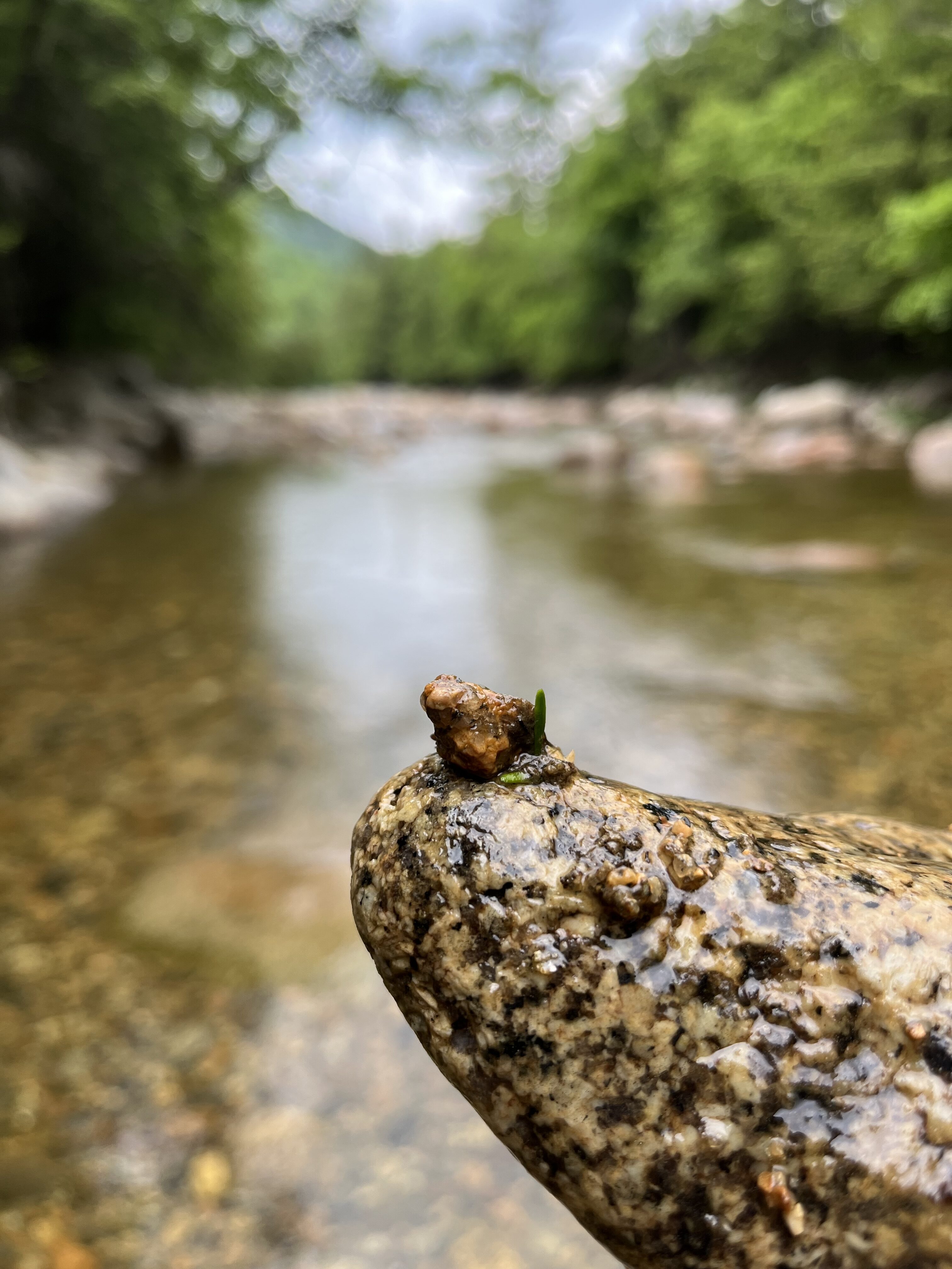
While these insects are small, it’s easy to see their home-building skills if you look closely in a small stream. The many different species of caddisflies have adapted to different aquatic habitats, so you can find them from still pools to quickly rushing riffles. In those quiet pools, they will use their silk to construct homes from leaves or small sticks and twigs. One of the important jobs of the caddisfly is helping to decompose organic matter in streams. While building homes with this organic material, they also shred leaves and twigs with their strong jaws, which contributes to the cycling of freshwater nutrients. To see these leafy homes in pools, look for small collections of shredded leaves and twigs in a gossamer web of silk.
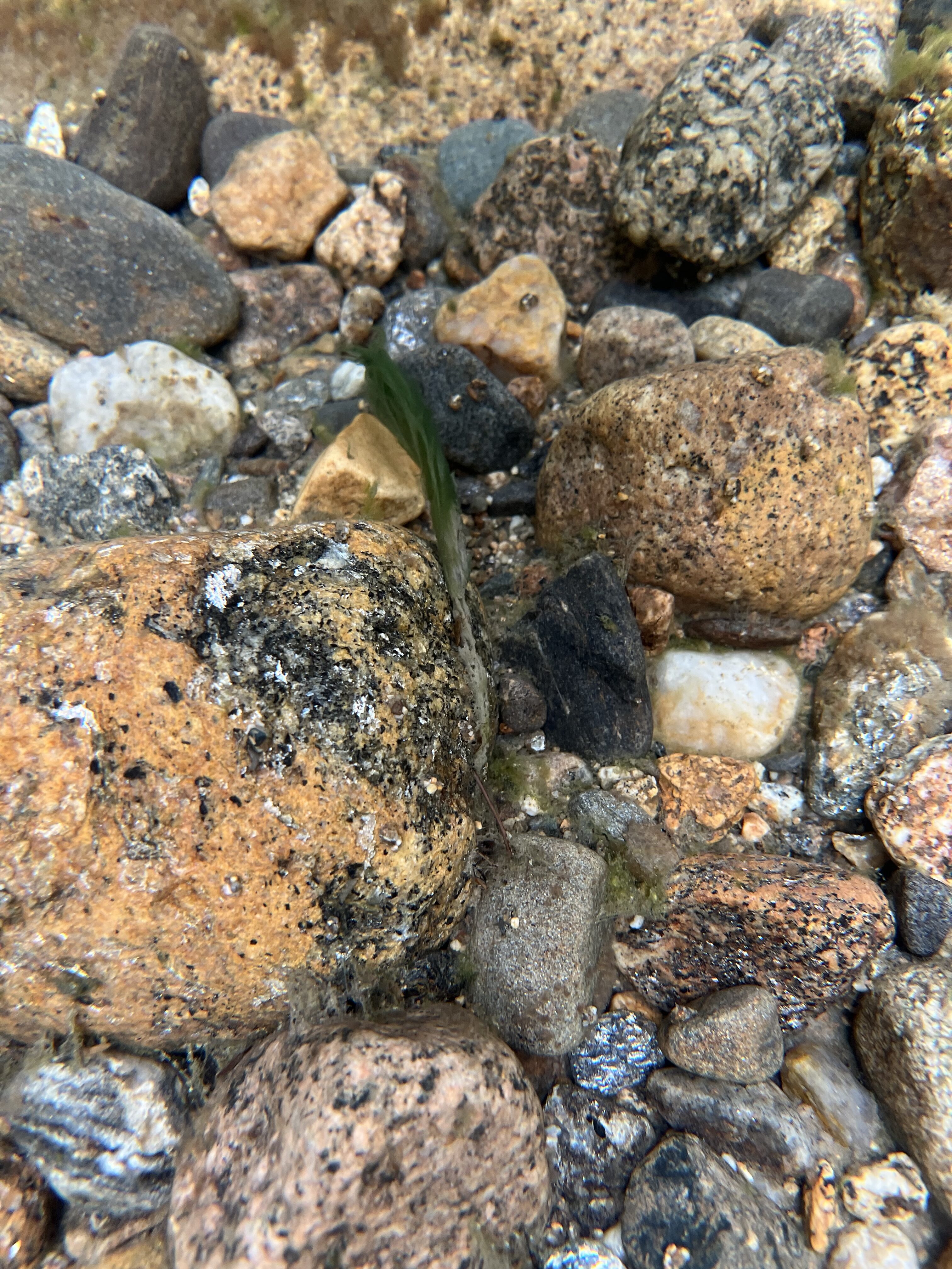
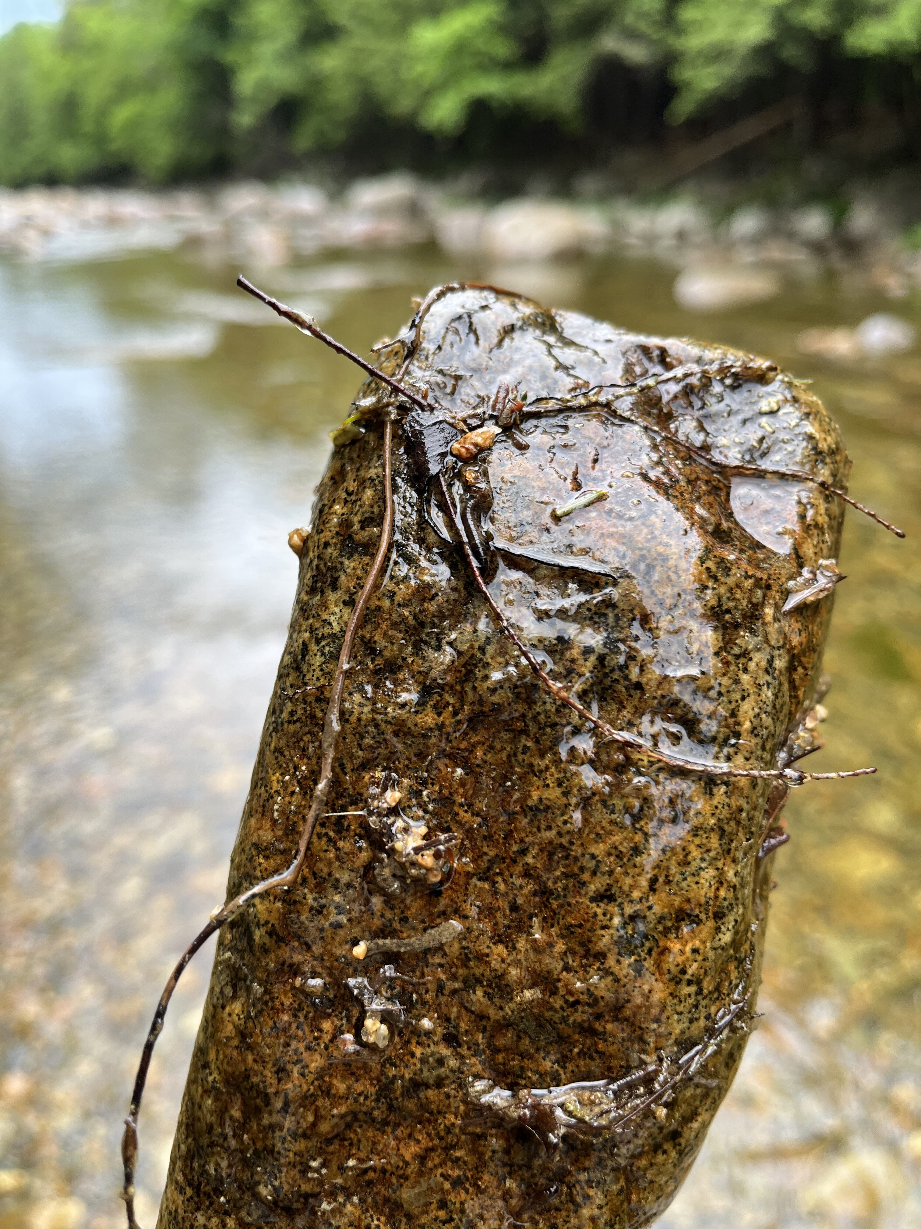
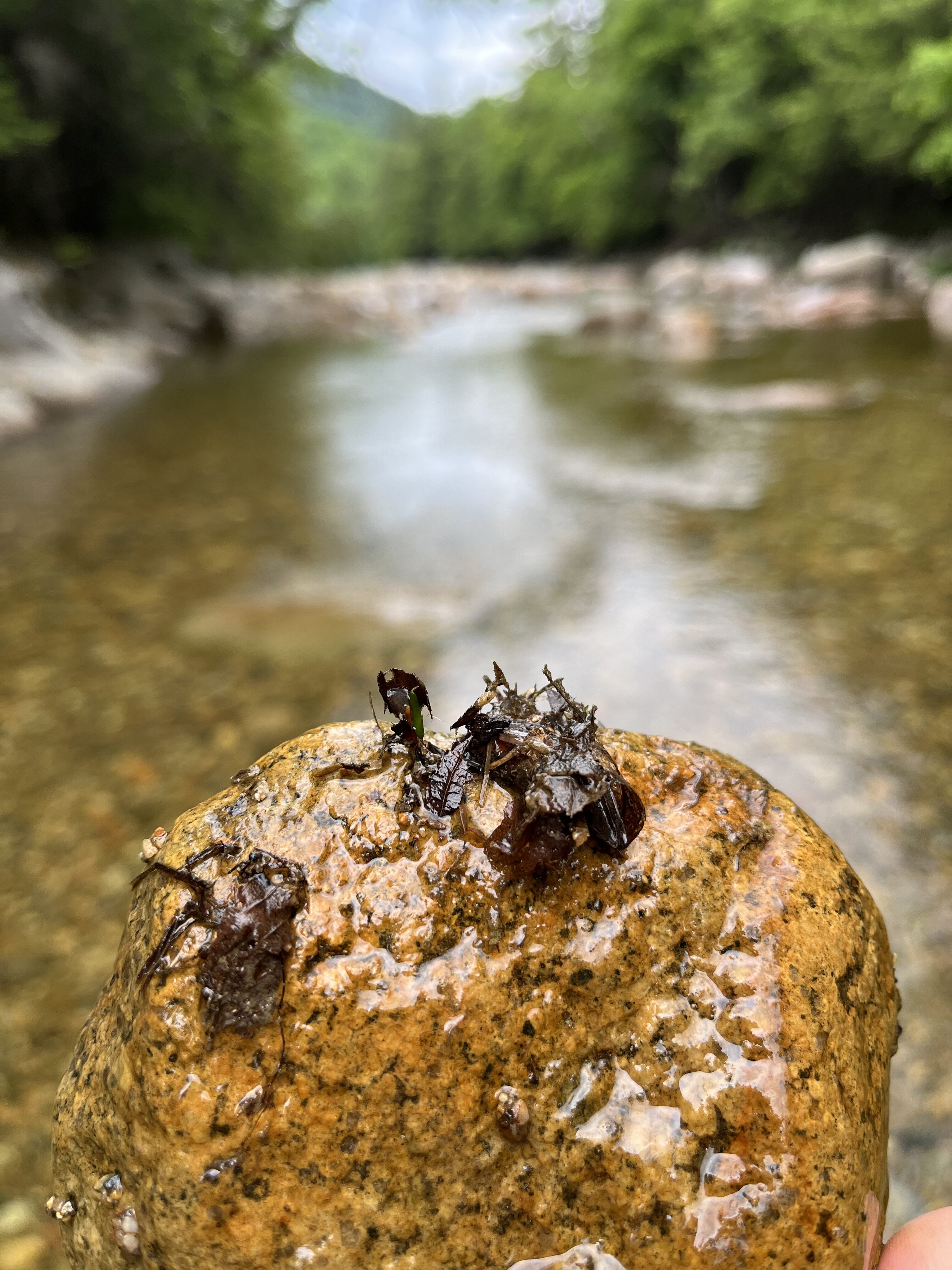
Where water is flowing faster over cobble and gravel bottoms, you will find them nestled into tubular homes made of small stones with just their tough little noggin poking out the end! They collect these stones and artfully build a snug tubular home cemented together with their silk. You can find these sturdier homes by gently turning over rocks and seeing these small structures, usually less than an inch, attached to the underside of the rock.
So there goes the three little pigs analogy – leaves, sticks, and stones – for the straw, wood, and bricks! I know, I know. Kinda like a dad joke…
But back to their clean water work. Most of the different species of caddisflies are sensitive to water quality conditions, particularly the amount of dissolved oxygen in the water. When the dissolved oxygen is low due to increased temperatures or too many nutrients in the water, they are not able to survive. This characteristic is used by aquatic scientists to monitor the health of rivers and streams in ways that are much more powerful than occasionally taking a measurement of dissolved oxygen with a meter or chemical test.
How so?
For over 30 years, scientists have been assembling groups of aquatic organisms – algae, bugs, and fish – and grouping them according to their tolerance for different conditions of pollution. Some river critters are very tolerant of low dissolved oxygen or turbidity, or other chemical conditions, some are not. The caddisfly larvae are important members of these groupings of indicator species.
By creating these groupings based on extensive monitoring and statistical analysis, a robust predictive model is created and used to understand how our work to improve and protect water quality is doing.
So if we watch which critters are living where, they can tell us if a stretch of river is getting healthier with much more certainty than a simple measurement of dissolved oxygen, turbidity, or pH.
Here’s to another clean water worker helping us all to enjoy what our rivers and streams give us all!
A version of this blog was first published in Estuary, a quarterly magazine for people who care about the Connecticut River; its history, health, and ecology—present and future. Find out how you can subscribe at estuarymagazine.com.
Visitation on Montana’s Wild and Scenic Flathead River has grown significantly in the last five years. Yet, just one river ranger remains to steward 219 river miles and 29 river recreation sites following recent federal government workforce reductions. More people coupled with fewer Forest Service staff has residents wondering how the agency and the community will protect the river’s health now and into the future.
Birthplace of the Wild and Scenic Rivers Act
The Flathead Wild and Scenic River includes the North, South, and Middle Forks that ultimately join and flow into the north end of Flathead Lake. A dam proposed on the Middle Fork of the Flathead River within the Bob Marshall Wilderness was the inspiration for the Wild and Scenic Rivers Act of 1968, which preserves free-flowing rivers and their outstanding values. The three forks of the Flathead River were designated as Wild and Scenic in 1976.
Renowned as having the cleanest, clearest water in Montana and beyond, the three forks of the Flathead River are a recreation destination featuring whitewater rapids, scenic floating, a healthy native trout fishery, and unparalleled riverside camping. The Flathead River system is the backbone for a robust tourism economy: Fifteen percent of tourism dollars coming into Flathead County are spent by visitors on outfitters and guides.
Shared Responsibility for the Future
There’s no doubt Montanans and tourists alike love the Flathead River. However, the recent federal employee reductions in force, together with increasing river use, belie a delicate tension between the benefits of loving this river and the consequences of loving it too much to the point of overuse. Loving a place too much can look different in different places: hordes of RVs parked on beaches, long waits at boat ramps, overflowing parking lots, erosion on river banks or human waste.
When impacts from river recreation reach a boiling point, we all share in the responsibility to protect river health. Regardless of staffing constraints, the Forest Service is required to act. Part of what’s needed is a transparent menu of actions–from staggering boat launch times to requiring human waste packout–that the agency can choose from to lessen recreation impacts while still providing access to the river.
Partners and outfitters can and do help as well. And they’re needed now more than ever, with more staffing reductions predicted across the federal government. Each year, Flathead Rivers Alliance mobilizes 300 volunteers contributing more than 1,700 volunteer hours, distributes 4,000+ reusable cleanup bags, and collects litter from 80 miles of river, manages volunteer river ambassadors to educate river visitors on how to Leave No Trace, conducts noxious weed pulls on 40 miles of river, and monitors water quality. This summer, river outfitters also helped to keep bathrooms and river access sites clean, work that was formerly done by the Forest Service.
While we need more public-private partnerships to extend agency capacity, it’s critical that the Forest Service take proactive actions to prevent impacts from overcrowding, pollution in the form of trash and human waste, streambank erosion, and overfishing on the river, despite staffing shortages.
How You Can Engage
You can join American Rivers and Flathead Rivers Alliance in asking the Forest Service to put the appropriate safeguards in place to ensure we love the Flathead River responsibly. Assuming the process remains on track, concerned community members will have an opportunity this winter to give the Forest Service feedback on their proposed management plan for the Flathead Wild and Scenic River. The plan should set science-based thresholds on river use, commit to monitoring river health and visitor experiences, and creatively forge partnerships to monitor and enforce needed changes to visitation timing, location, extent, and behaviors, now and in the future. Montana, and the nation, have only one Flathead River. As the new management plan for the river is crafted, we must put the health of the river first.
Follow announcements by the Flathead National Forest on the Flathead River Comprehensive River Management Planning Process, sign up to volunteer with Flathead Rivers Alliance, and contact Montana’s congressional delegation to share your concerns about impacts to the Flathead River from federal government workforce reductions.
Bob Jordan serves as President of the Flathead Rivers Alliance Board of Directors and Sheena Pate serves as Executive Director. Lisa Ronald is an associate conservation director with American Rivers in Western Montana.
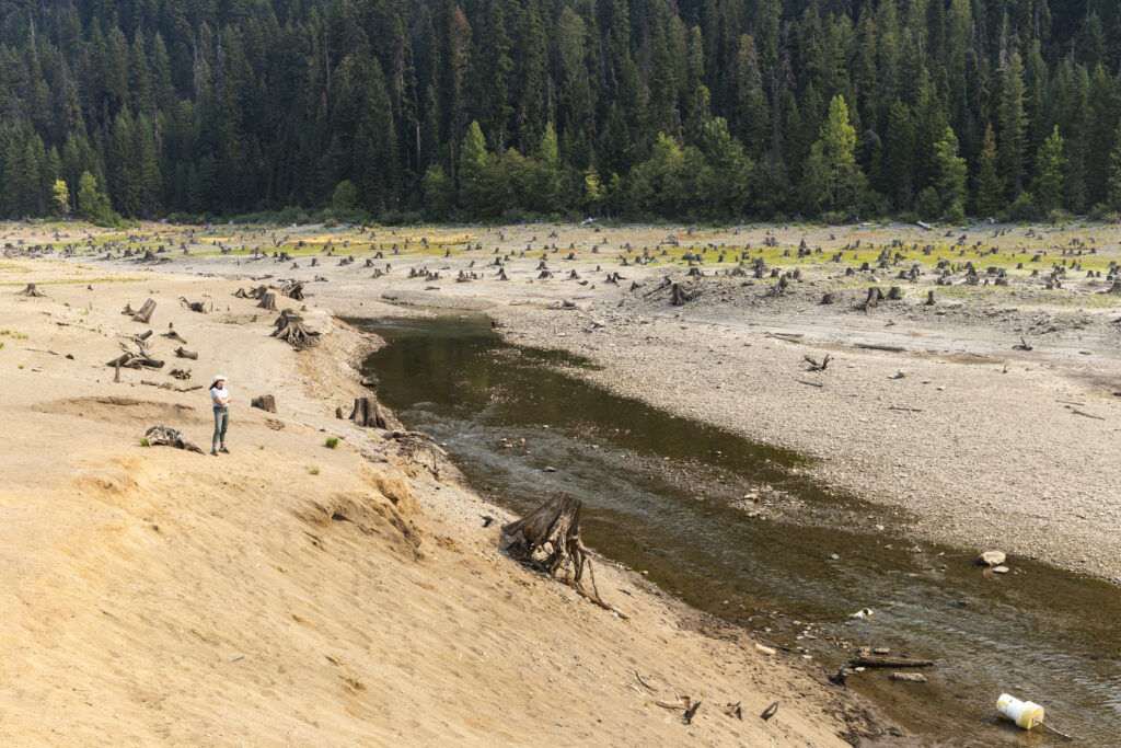
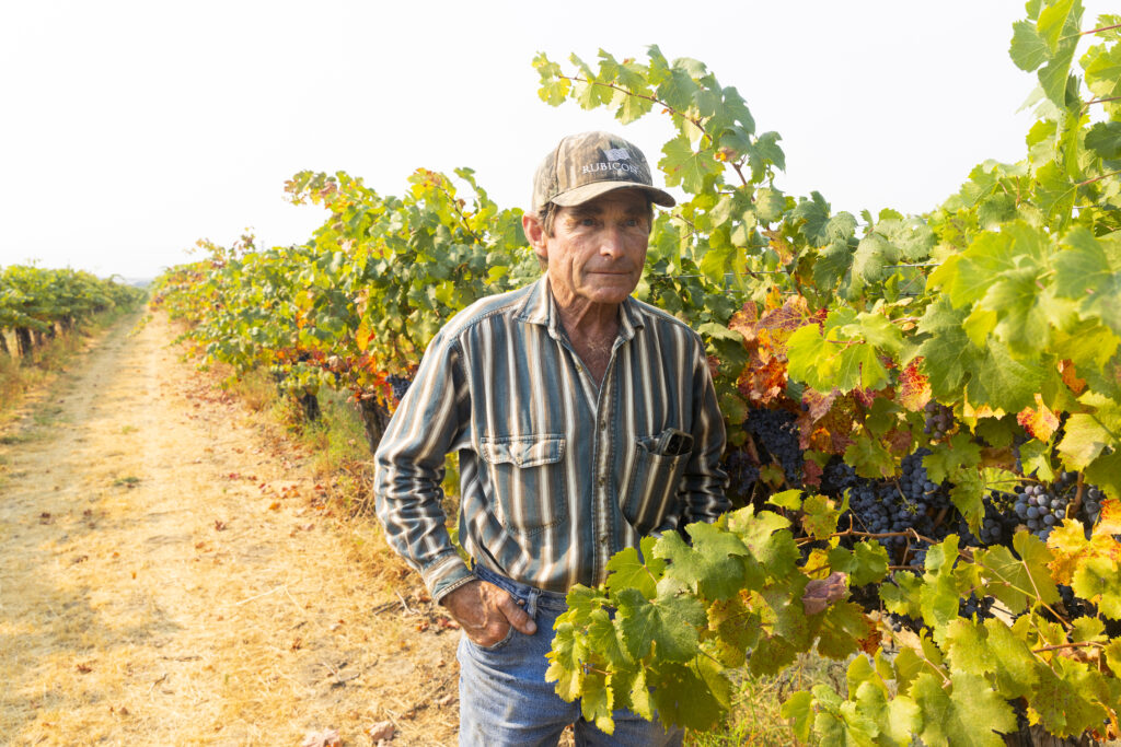
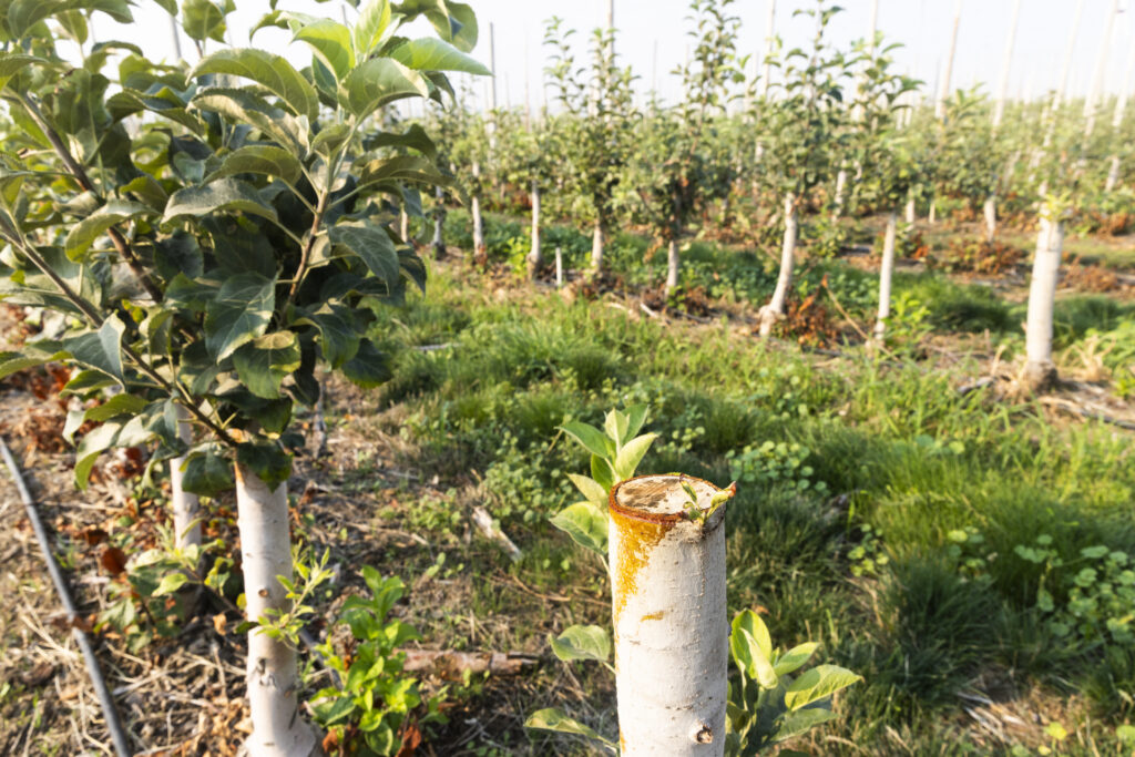
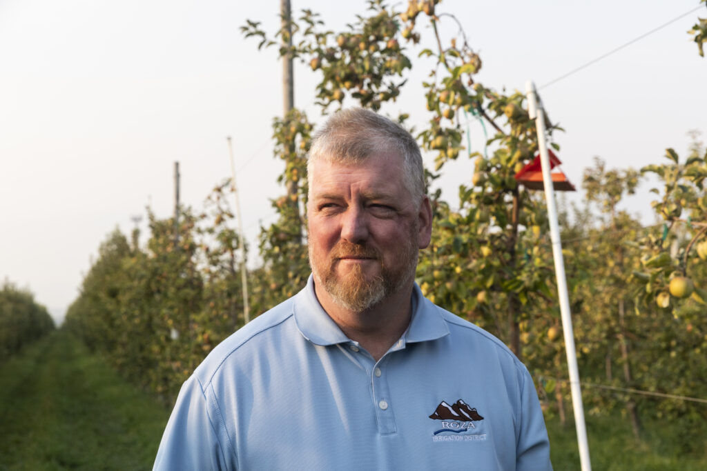
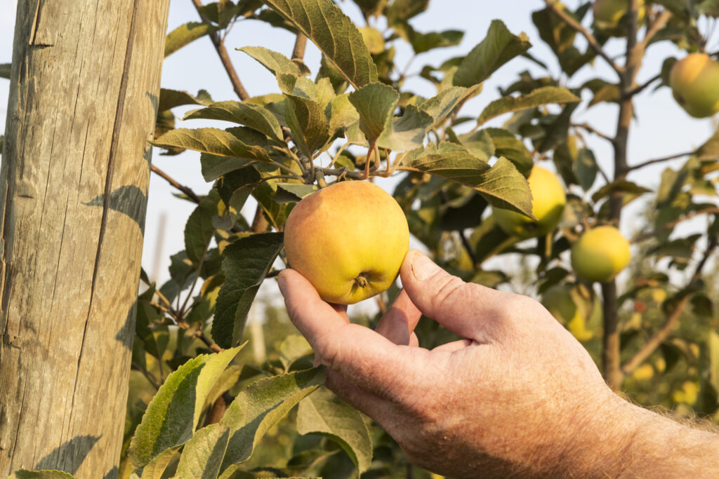
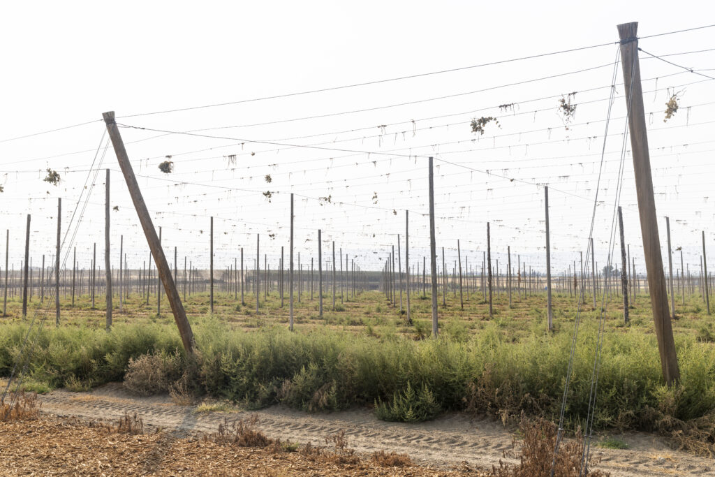
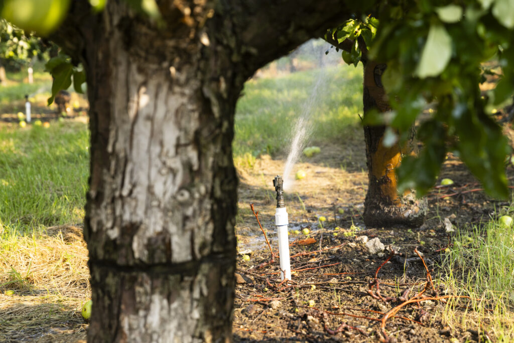
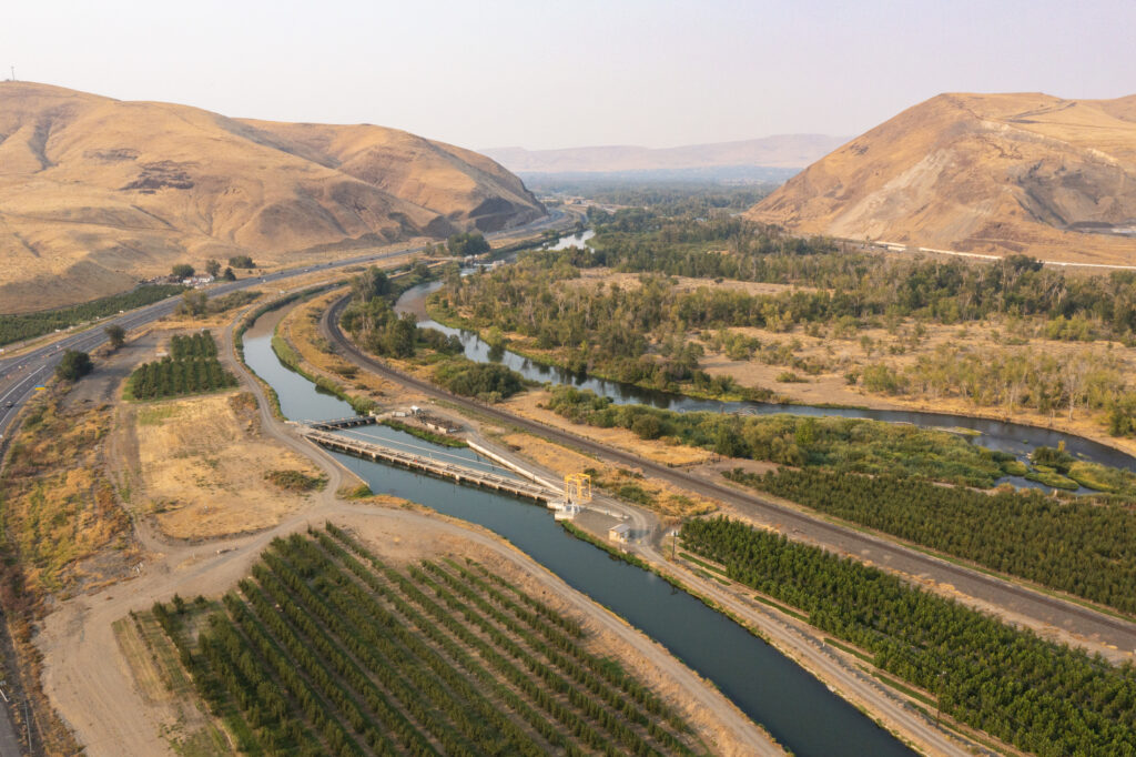
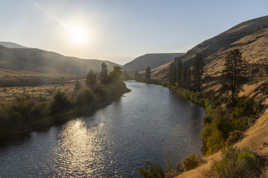
The Yakima River Basin in Central Washington is experiencing one of the worst prolonged droughts in modern history. American Rivers visited our partners in the Yakima Basin Integrated Plan to witness the river and better understand the drought’s impacts on the fish, farms, and communities it supports.
Photographer David Moskowitz was able to help capture the story through the incredible images seen below.
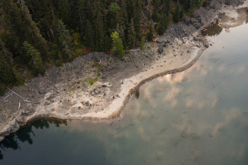
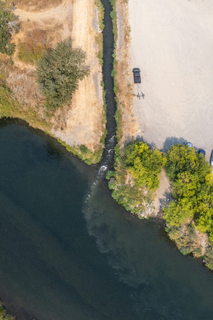
Of all the signs that something is wrong—the curling leaves of stunted crops, the multiplying mats of river stargrass, the tense expressions of water managers—nothing tells the story of this drought like standing on the dry, hard bed of a drastically receded reservoir.
Between 1910 and 1933, the U.S. Bureau of Reclamation built five reservoirs to harness water for Washington farms and towns in the 6,000-square-mile Yakima Basin. Together, Kachess, Keechelus, Cle Elum, Bumping, and Rimrock store about one million acre-feet of water.
But not this year.
By September 2025, capacity was a mere 20%. That’s the lowest level since recordkeeping began at the reservoirs in 1971, marking a historic water shortage.
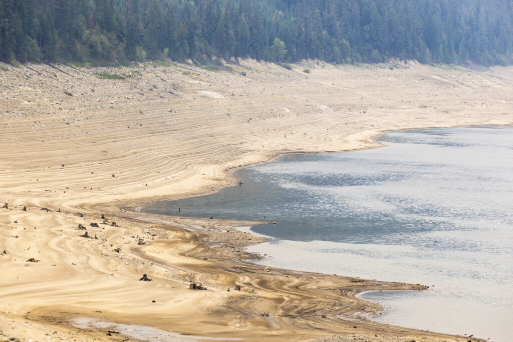
There simply wasn’t enough snowpack in the Central Cascades to fill the reservoirs in early 2025, leaving them with just 35% of the water they usually store at that time of year. Additionally, winter and spring rainfall was well below normal in the mountainous catchment in western Yakima County.
On April 8, this reality led the Washington Department of Ecology to declare that the upper Yakima, lower Yakima, and Naches watersheds had officially crossed into their third consecutive year of a severe drought.
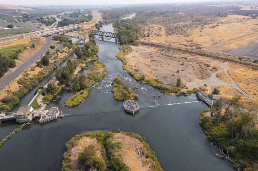
What happens—or doesn’t happen—with stored water in the upper basin sends huge ripples downstream to the Yakima River and its tributaries.
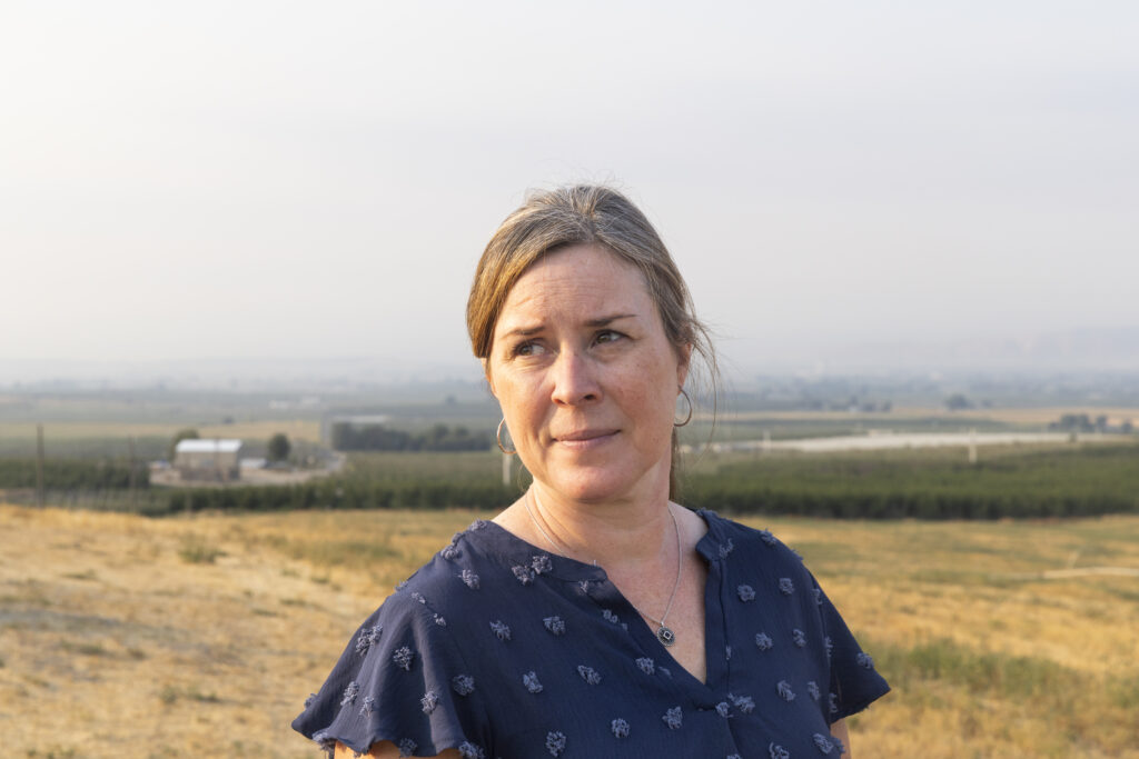
Irrigation districts that rely on human-made diversions in the river have been struggling to supply enough water to a $4.5-billion agricultural industry. Junior water rights holders, such as Roza Irrigation District and Kittitas Reclamation District, have strategized on the best ways to ration their reduced allotments—just 40% of the full amount they are generally entitled to—throughout the hot summer months of 2025.
“We’re running the canals the lowest we ever have,” says Sage Park, policy manager for Roza. “Our growers are facing a very hard time, with bad water supplies on top of bad markets.”
Some farms have gone out of business, confirms Jim Willard, owner of Willard Farms and Solstice Vineyards near Prosser, when we stop by. But he is hanging on. Willard established his farm in 1952, which means he has weathered the drought years of at least 1977, 1993, 1994, 2001, 2005, and 2015.
How does the current year compare?
“It’s another lousy drought,” Willard shrugs. “You know what you’ve got to do, the decisions you’ve got to make to keep the farm viable into the future.”
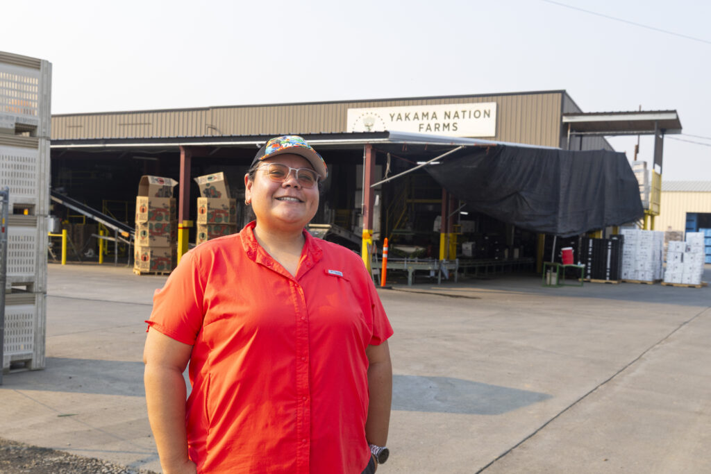
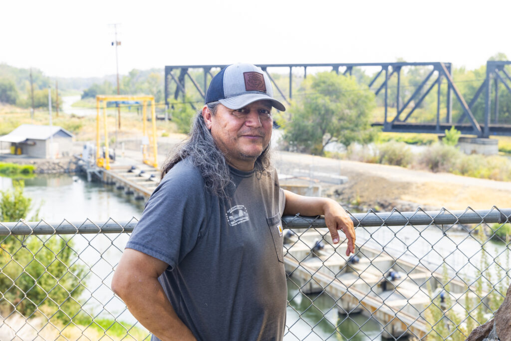
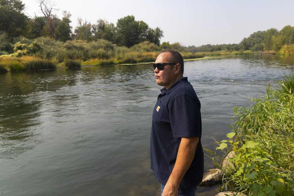
“The fish are always in drought,” Joe Blodgett, manager of Yakama Nation Fisheries, says matter-of-factly as soon as we meet at the Wapato Dam on the lower Yakima River.
The last significant drought in 2015 hit out-migrating juvenile salmon hard. Warm, shallow river water reduced their numbers from 1 million to 200,000. The fishery is still recovering—and now, another major drought.
Joining Blodgett is his team of engineers and scientists, who are dedicated to restoring habitat, improving fish passage, and growing and releasing hatchery salmon, bull trout, and lamprey to bolster drastically declining numbers.
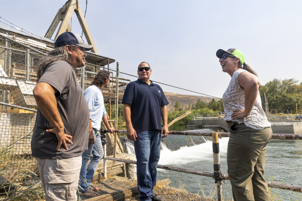
The Yakama Nation’s connection to native fish species in the basin traces back thousands of years. The salmon trade was the first economy of the basin, and that link remains critical to the tribe’s identity and cultural and economic survival today.
A little downstream, a small fishing scaffold protrudes into the river—a reminder of a bygone era long before the dam, and a symbol of the harvestable and sustainable future the Yakama Nation’s 10,000 members envision returning to.
One day. After the drought breaks.
Until then, the fisheries team is preparing with an ambitious plan to update the ailing Wapato Dam, built in 1917, and construct modern fish passage to improve survival rates.
“Each species has a story to tell,” Blodgett says, smiling, as we part ways for today.
Even in drought, the Yakama Nation and the irrigation districts, conservation organizations, and government agencies that make up the Yakima Basin Integrated Plan collaborate to increase flows of cool river water that fish need to survive.
Maybe it’s truer to say especially in drought.
That collaboration is unique in the West. It extends to a multitude of projects, many costing tens of millions of dollars, to modernize aging infrastructure, protect and restore fisheries and river habitat, improve water supply reliability, and store more ground and surface water.
“This is a terrible drought,” says Brandon Parsons, American Rivers director of river restoration. “But we’d be in a lot worse shape if we hadn’t made years of prior investments in the river. We have to continue to work together and implement projects if we’re going to lessen the impacts of more droughts like this.”
People in the basin know more frequent and severe droughts are on the horizon. They’re racing to ready the region and keep it habitable in a rapidly changing world. Families, fish and wildlife, business and agriculture—all life depends on the Yakima River’s ability to provide clean, cool, reliable water into the future.
American Rivers recognizes the power of getting out and being on the rivers we are called to protect. Just as we need those rivers for our survival, the rivers need us, too.
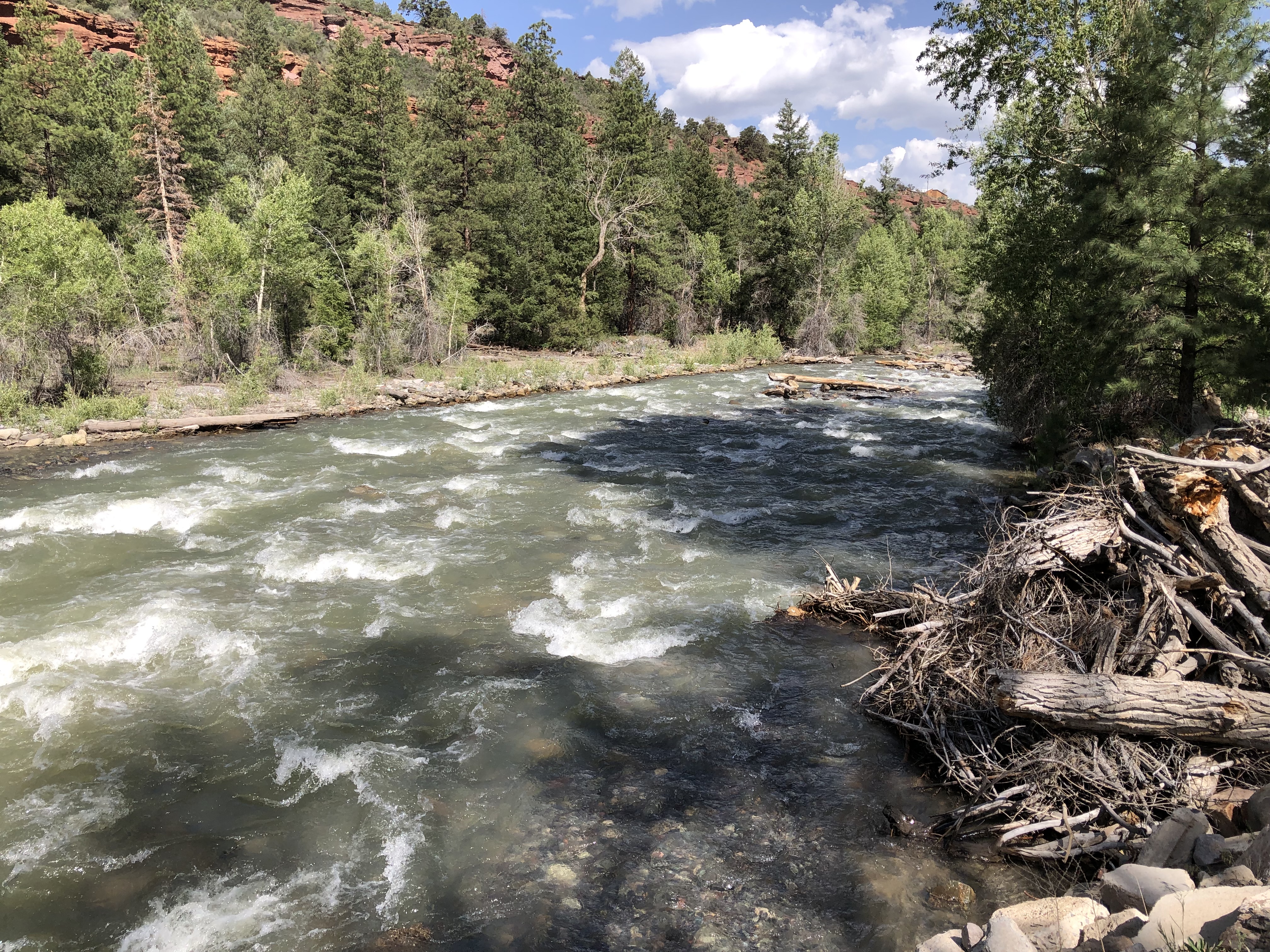
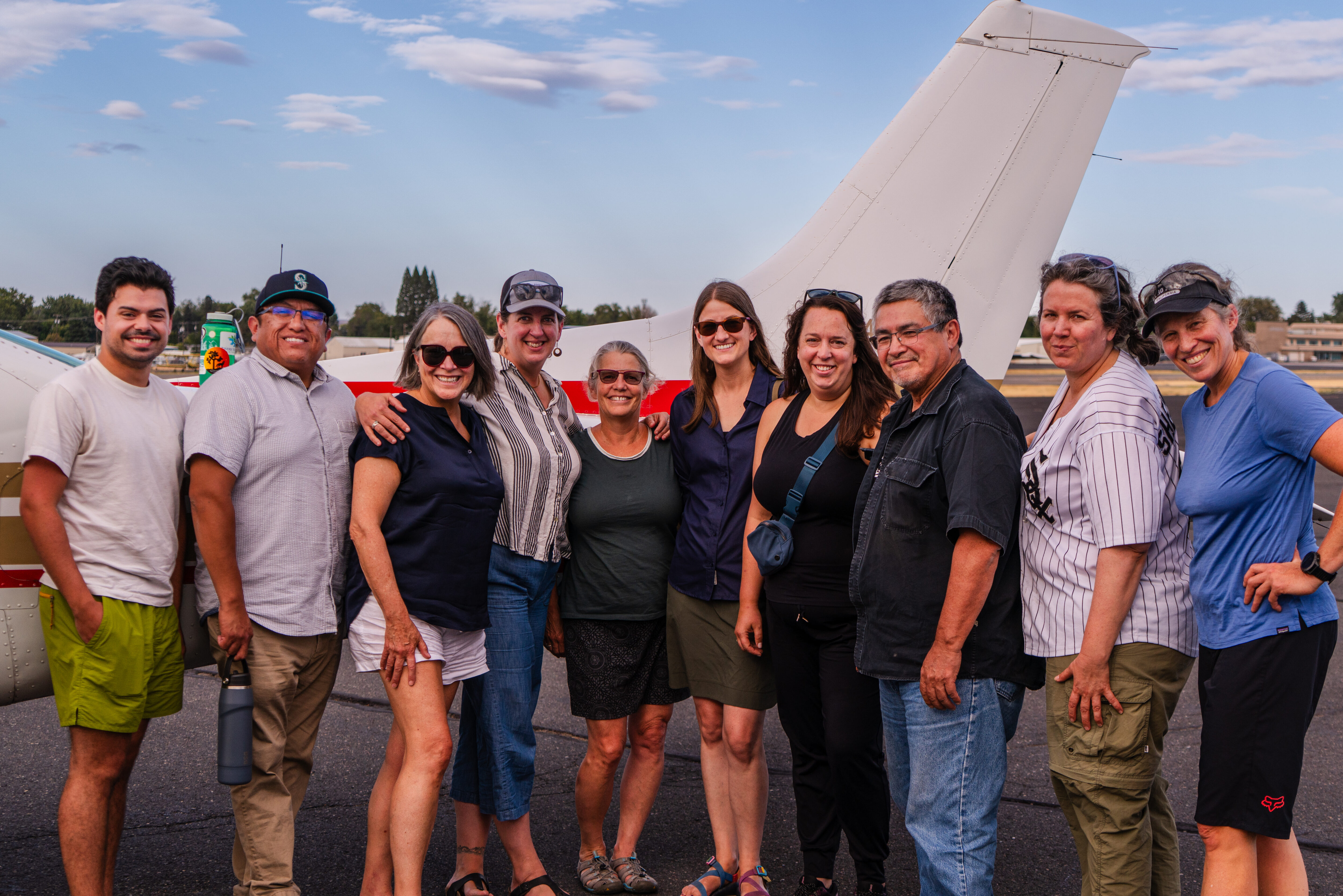
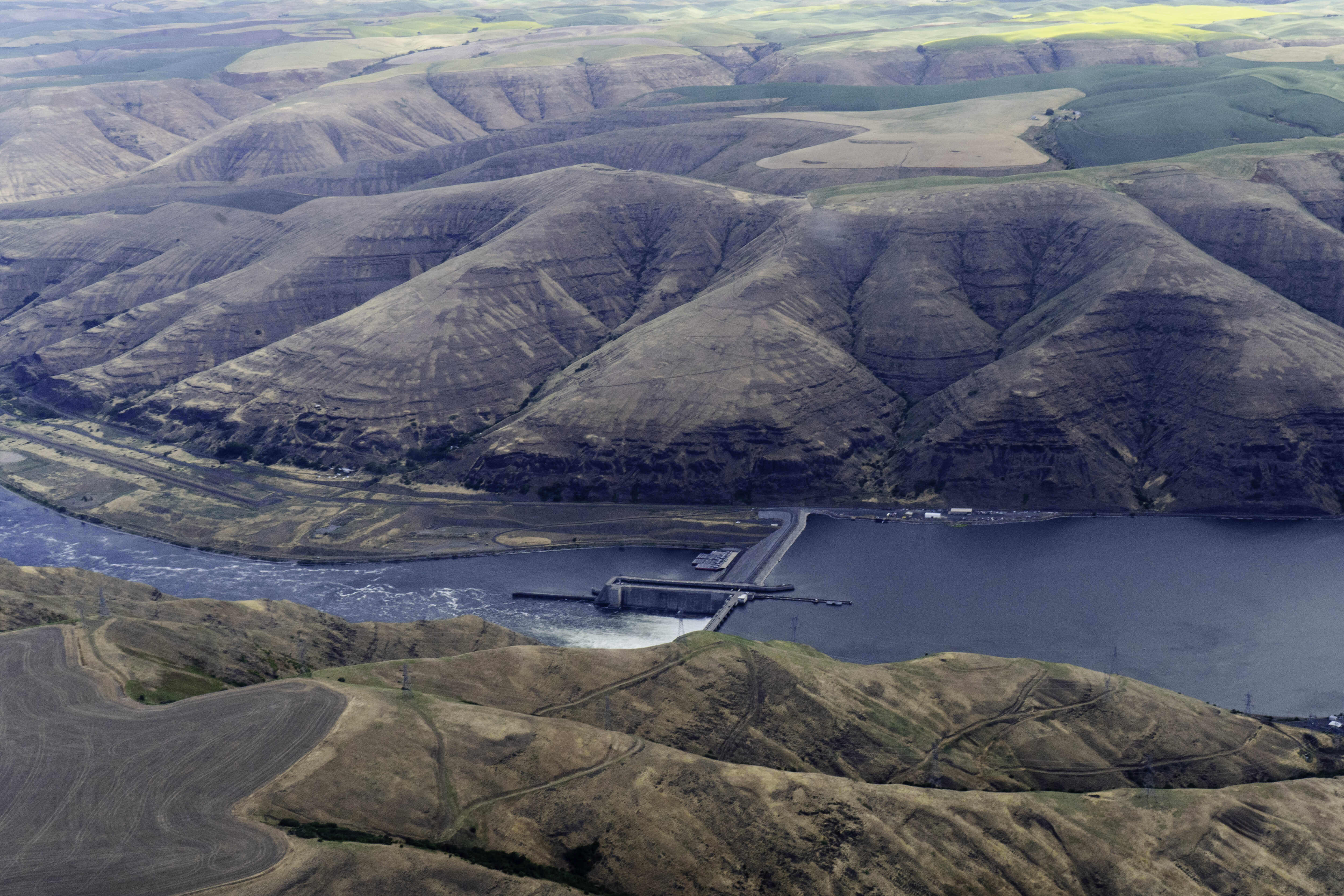
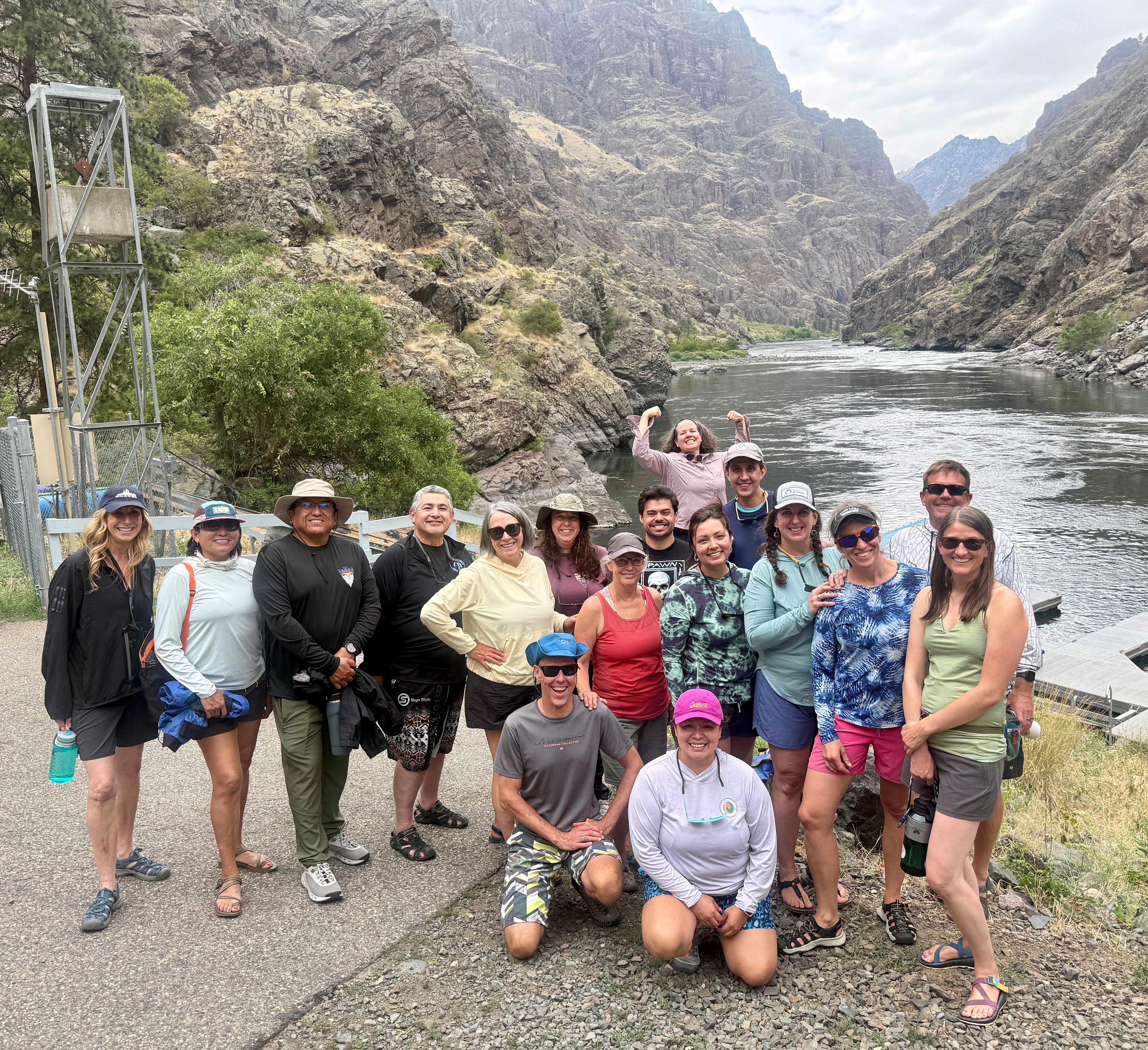
When the federal government recently withdrew from a historic partnership known as the Resilient Columbia Basin Agreement, we knew it was time to take to the river once again to chart our path forward. We helped the Nez Perce Tribe lead a team of 17 Tribal representatives and multiple state legislators, congressional staff, and non-profit partners on a five-day Snake River trip through Hells Canyon, on the border of Oregon and Idaho. During this impactful trip, the group discussed current challenges and the historical context that brought us to this point, and brainstormed solutions for our region’s future.
Convening in Idaho: Day 1
After everyone arrived in Lewiston, we met up with EcoFlight to get an aerial view of the river and the surrounding landscape. We flew over the confluence of the Snake and Clearwater Rivers, through golden dryland wheat fields as far as the eye can see, and over Lower Granite Dam, where we spotted a lone wood products barge waiting at the lock for passage downriver.
Our group then joined the festivities at Hells Gate State Park, where groups were preparing food, art, and music for a “Free the Snake” flotilla the following day.
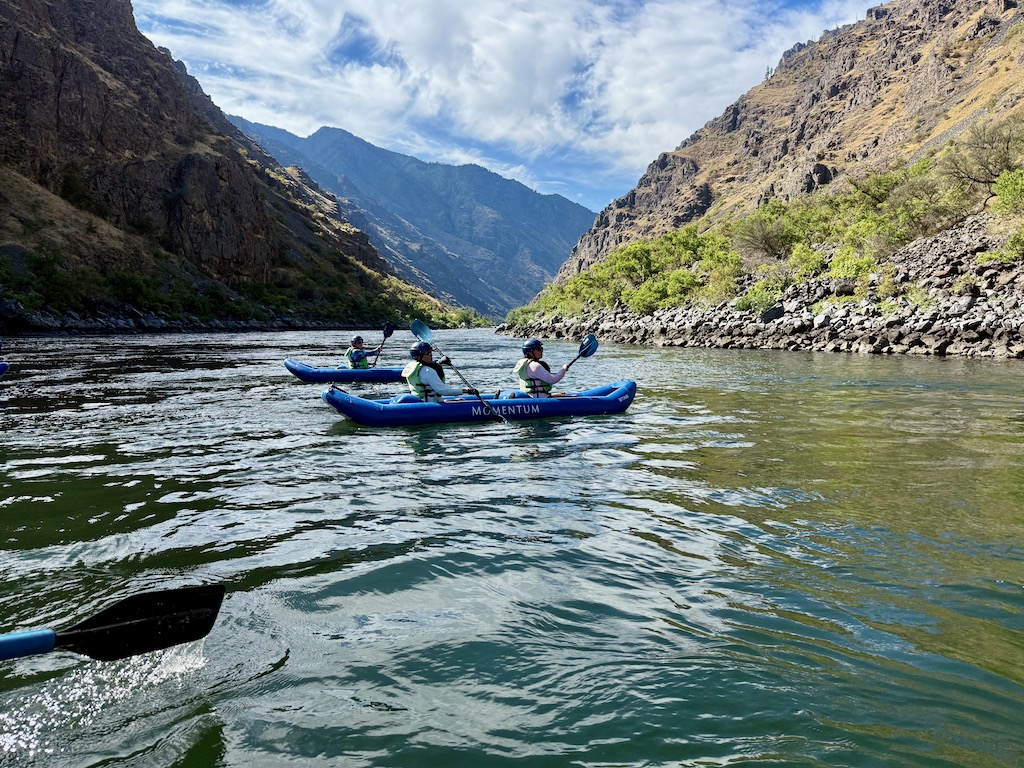
Not long after arrival, we all went to bed to get ready for our early flight to meet our river guides in Halfway, Oregon, for our descent through the deepest gorge in North America.
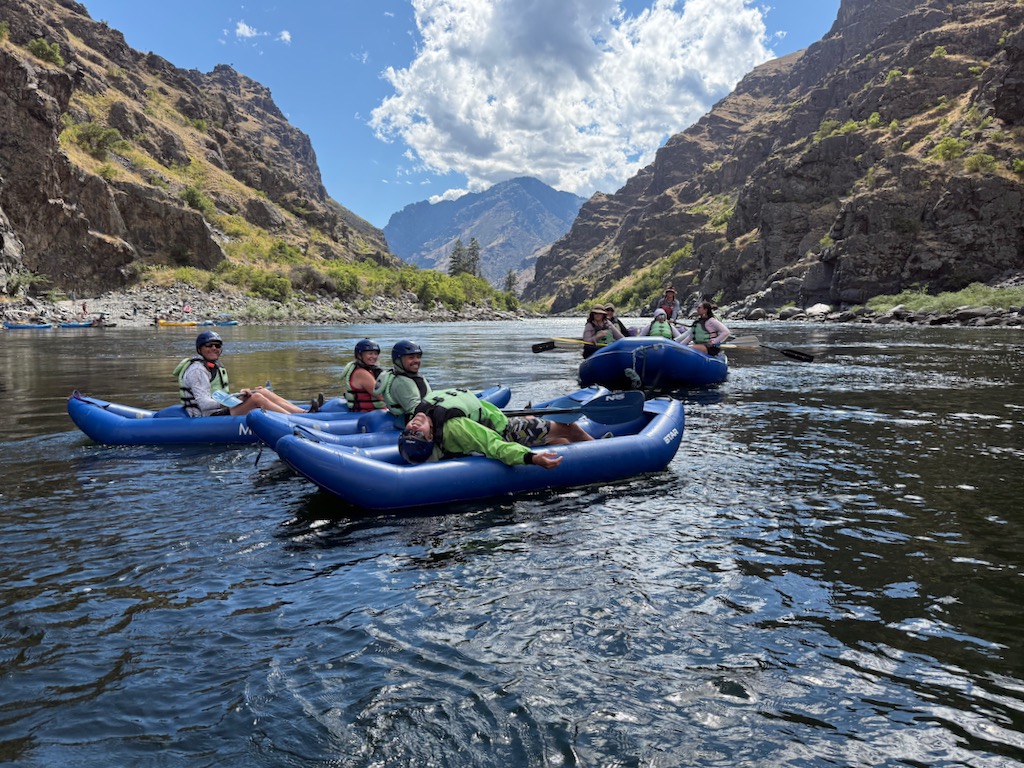
On the river: Day 2
After a safety talk the next morning, our giddy group began our four-day, three-night journey downstream. With the launch dock still in sight, we landed a rainbow trout on the first cast – clearly a good omen for the trip to come.
Our first lunch stop offered a warm welcome to Nimiipuu country from our gracious Nez Perce hosts, where we were grounded in creation stories and the importance of salmon, who represent the “first treaty” of a sacred promise between the animals and the Creator to care for the Nimiipuu people.
We took turns sharing who we were, where we came from, and our intentions for this experience.
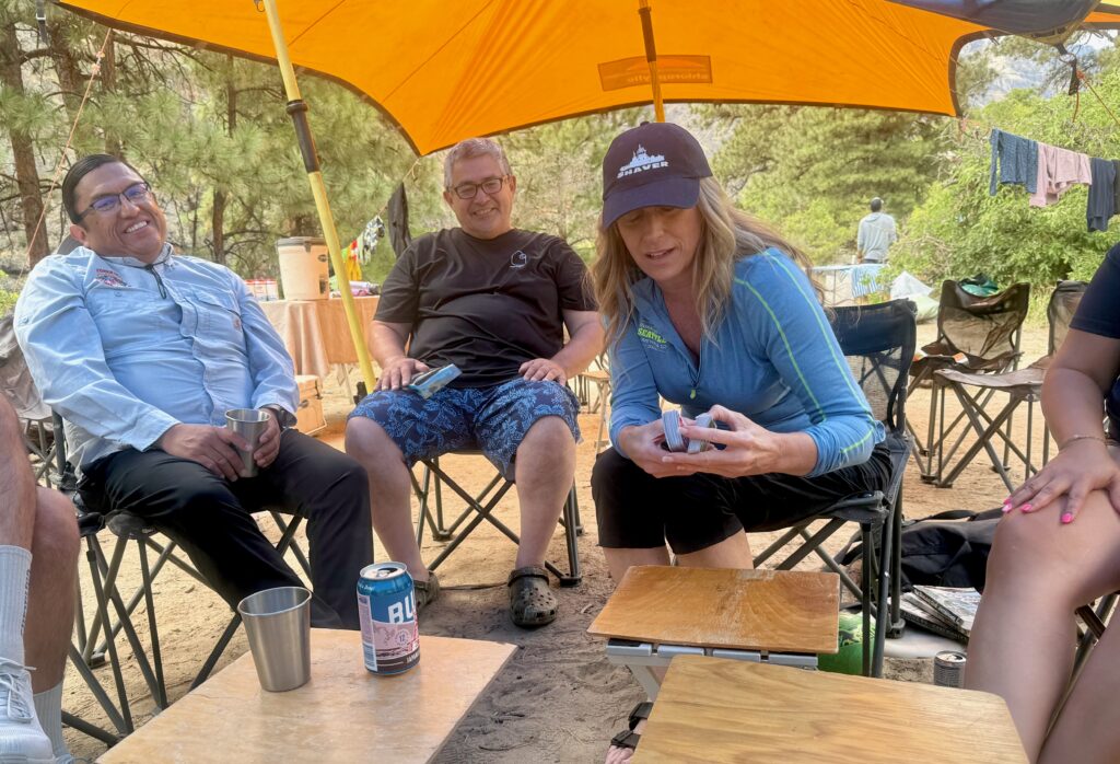
After an easy day on the water in bright blue paddle rafts and sporty inflatable kayaks, we spotted a round black bear on the hillside, right above our camp. While our guides prepared dinner, a lively game of UNO sent laughter into the canyon, and the first of several sturgeon fishing efforts got underway.
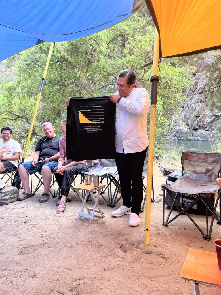
After a bit of fun, it was time to get to work. We had an in-depth conversation about the Columbia River Basin, which included the health of the fish that depend on it and the results of our conservation efforts. We used clothing props and home-laminated maps to aid the conversation, which continued through dinner and dessert, until the darkened canyon told us it was time to go to sleep.
On the river: Day 3
Day 3 started with early morning conversations about regional energy needs over camp coffee. To advocate responsibly for breaching the four hydroelectric dams on the lower Snake River, we need to co-create clean energy alternatives that consider impacts to Tribes.
Lunch was dedicated to learning about first foods and seasonal rounds. Tribal members generously shared their histories and ties to place, how important their traditional foods are to their culture and well-being, and how each Tribe and place are unique.
After paddling through Wild Sheep and Lower Granite rapids, most of our crew beat the heat by jumping in the water to float the remaining distance to our second camp. Our group had found the river magic!
Although this camp is technically called Oregon Hole, I will forever remember it as Sturgeon Hole. Since we were skunked the previous night, I wasn’t holding my breath that we would land a fish. A little later, while I was setting up my tent at the edge of the campground, I heard hoots and hollers and immediately knew what was happening – we got one!
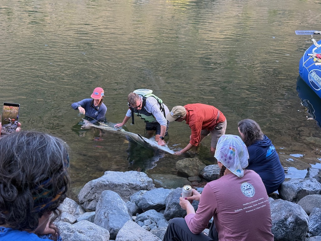
My good friend, Rein Attemann, had reeled in a six-foot sturgeon! The fish was in the water, upside down, while a Nez Perce biologist evaluated her and explained her physiology to the captive group.
Like sharks, sturgeons are mostly made of cartilage, and flipping them upside down induces a trance-like state called “tonic immobility”. In this state, the fish becomes calm, allowing them to be handled gently before being released.
After dinner, we heard the second sturgeon line ping and several of us raced down to the water. I was keen for this experience and had bought a fishing license in Halfway. It took me a few tries to develop a rhythm, and reeling in this fish was no easy task, but as she got closer to the boat, I could see she was beautiful, mysterious, and massive – like a living dinosaur.
At 7.5 feet in length, she was likely at least 50 years old, making her bigger and older than me. She was probably alive before some (or all) of the four lower Snake River dams were constructed. She had a Floy tag, which meant she had been caught before. We wrote down the numbers to report to Idaho Fish and Game, turned her right side up, and released her to power downriver.
On the river: Days 4 and 5
Our last full day and a half on the river was filled with deeper conversations about how to develop a truly just energy transition in the Northwest, in partnership with Tribal Nations, and how to face opponents and stakeholders who resist the restoration of the Snake River and greater Columbia Basin.
Our time was also punctuated by play and laughter – it’s important to have fun and take care of each other along the way.
Being on the river brings out the most intense and authentic version of who people are. It allows relationships and conversations to progress at warp speed relative to what is possible in the normal course of our work. I returned home confident and knowing that this group can do hard things. We will keep up the momentum, keep supporting each other, and continue to have the hard conversations – preferably on the river!
Construction and revegetation at Ackerson Meadow are complete, and now it’s time to let nature do the work it does best! This marks a huge milestone in the movement towards headwaters restoration in California’s Sierra Nevada, with the Ackerson restoration standing as the largest full-fill meadow restoration in the Sierra Nevada and the largest wetland restoration in Yosemite National Park’s 135 years. When meadow restoration began as a practice in the Sierra roughly 45 years ago, a project of this size was a pipe dream for restoration practitioners, with significant hurdles to funding, permitting, and cross-agency collaboration standing in the way. But now, 150,000 cubic yards of soil and 434,000 wetland container plants later, water is flowing across the entirety of this fully restored meadow. Now the project’s partners, Yosemite National Park, Stanislaus National Forest, Yosemite Conservancy, American Rivers, and anyone who values clean water, healthy rivers, and thriving wildlife can celebrate.
The work at Ackerson is a gift that will keep on giving to generations of recreators, wildlife enthusiasts, and downstream water users. The benefits of restoring mountain meadows are both significant and wide-ranging, and a restored meadow has a sort of multiplier effect on the surrounding landscape and watershed. A healthy, fully restored Ackerson is projected to store 70.8 million gallons of groundwater each year, or enough water to satisfy the daily use of almost 250,000 households, while filtering out pollutants before flows enter the South Fork Tuolumne River. Of course, California is known as a global biodiversity hotspot, and Ackerson Meadow is home to nearly 60 species of birds and provides refuge for threatened and endangered species such as the Little Willow Flycatcher, Great Grey Owl, and northwestern pond turtle.
But Ackerson is also a gift for scientists and agencies who want to see this sort of work fine-tuned and expanded. We will monitor the site over the coming years, and the findings will feed into this ‘meadow movement’ organized by the Sierra Meadows Partnership, as we quantify the benefits of restoration: hydrological changes, soil carbon sequestration, and habitat recovery for endangered species.
Outside of the direct benefits to rivers, ecosystems, and the scientific community, Ackerson is both a milestone and a launching pad, setting the table for expanded public-private partnerships with the federal land management agencies and nonprofit conservation organizations. Through our years of project management, we demonstrated how a nonprofit like American Rivers can bring technical expertise, fundraising capacity, and the flexibility to achieve conservation outcomes in short order. These partnerships and this project have shown not only the power of collaboration across different sectors, but also how a common vision can be approached from different angles, leveraging our collective expertise to the benefit of the communities we live in, the wildlife we cherish, and the rivers that are the lifeblood of California.