Yadkin Pee Dee River
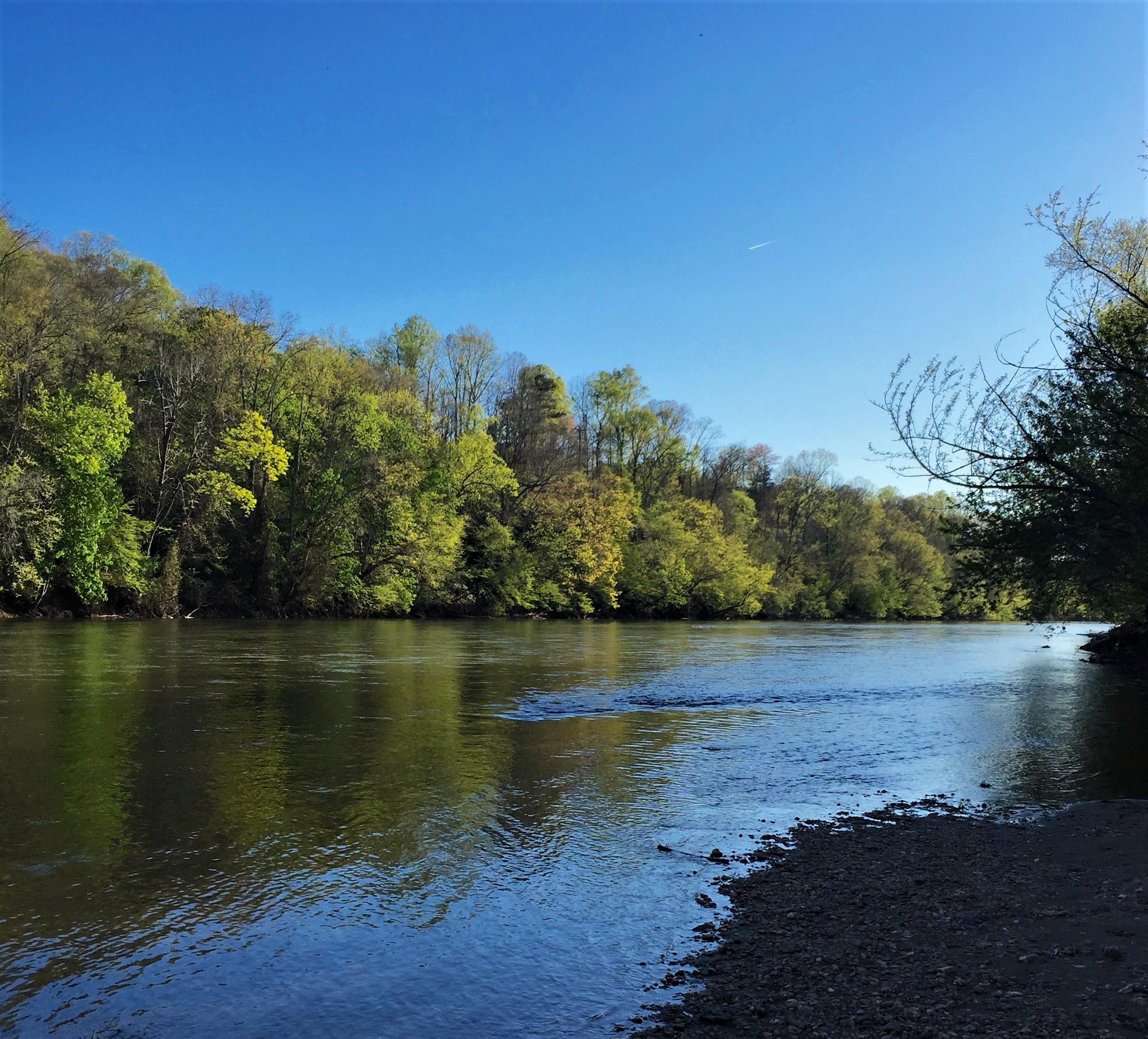
The Yadkin Pee Dee River Basin covers more than 7,200 square miles of the Carolinas connecting the mountains of northwestern North Carolina to the Lowcountry of South Carolina. From its headwaters near Blowing Rock, the Yadkin River flows east and then south across North Carolina’s densely populated midsection. It travels 203 miles — passing farmland; draining the urban landscapes of Winston-Salem, Statesville, Lexington and Salisbury; and fanning through seven man-made reservoirs before its name changes to the Pee Dee or Great Pee Dee River below Lake Tillery. The Great Pee Dee is a free-flowing river for another 230 miles to the Atlantic, leaving North Carolina near McFarlan, meandering through the South Carolina towns of Cheraw and Gresham, and the Waccamaw National Wildlife Refuge and ending its journey at Winyah Bay in South Carolina. It is the principal source of water for the central Carolina region; however, it is threatened by industrial pollution, population growth and poor management.
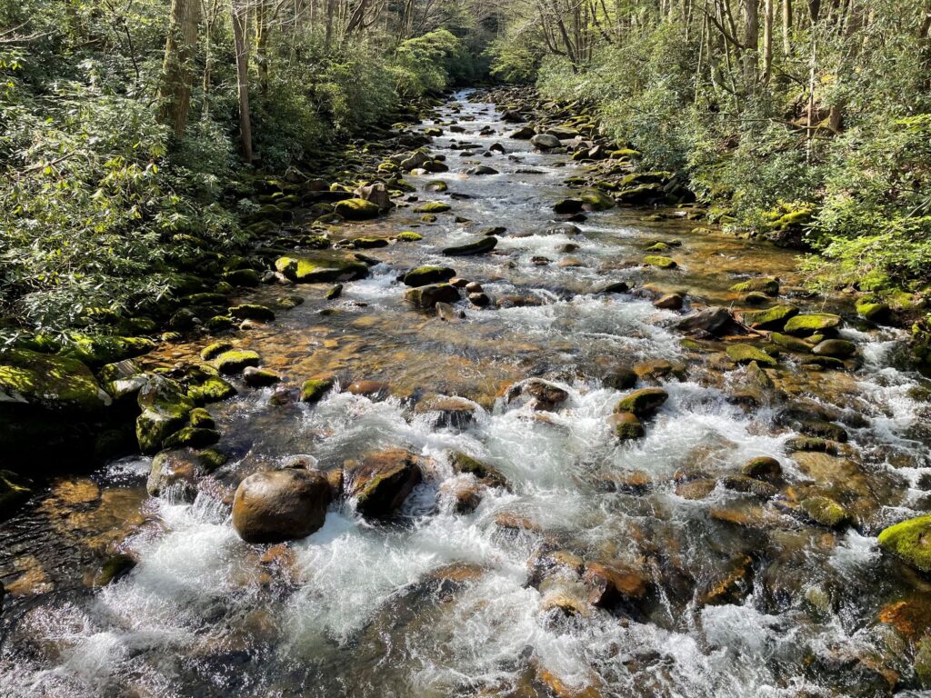
Since it originates in the Blue Ridge and drains portions of the Piedmont, Sandhills and Coastal Plain, the Yadkin Pee Dee River Basin contains a wide variety of habitat types, as well as many rare plants and animals. The basin’s rare species (including endangered, threatened, significantly rare or of special concern) include 38 aquatic animals. Two species are federally listed as endangered — the shortnose sturgeon, a migratory marine fish that once spawned in the river but has not been spotted in the basin since 1985; and the Carolina heelsplitter, a mussel now known from only nine populations in the world, including the lower basin’s Goose Creek. Five new species, all mollusks, have been added to the state’s endangered species list — the Carolina creekshell, brook floater, Atlantic pigtoe, yellow lampmussel and savannah lilliput.
Forests cover half of the basin, including the federal lands of the Pee Dee National Wildlife Refuge, the Blue Ridge Parkway, Uwharrie National Forest and the Waccamaw National Wildlife Refuge which lies completely within the basin. Most of the watershed’s forestland is privately owned though. Nearly one-third of the watershed is used for agriculture, including cropland (15.6 percent) and pastureland (14.1 percent). Just 13 percent of the land is developed, although this figure is rising rapidly.
WHAT STATES DOES THE RIVER CROSS?
North Carolina, South Carolina

The Backstory
The Yadkin Pee Dee River provides residents and visitors with a host of benefits, including scenic views, recreational and economic opportunities, clean drinking water and floodwater storage. However, the river and riverside lands that provide these values are at risk due to population growth and poorly planned development. Increasing water demand has led to more competition for the limited water resources available while outdated water reclamation facilities are causing unnecessary spikes in pollution. Riverside forests are also being cleared to make way for new development and forest products which increases polluted stormwater run-off that contaminates streams and pose challenges to drinking water treatment. High Rock Lake- south of Winston-Salem, NC- experiences dangerous and unnatural algal blooms due to the poor water management system in the upper portion of the river. Logging operations for wood pellet production have decimated wetlands critical to filtering pollutants out of stormwater and absorbing floodwaters. Additionally, numerous large and small dams clog the river disconnecting the natural flow through the system. These issues are exacerbated by the prolific growth of underregulated poultry farms that have questionable waste management strategies around water protection.
Let's stay in touch!
We’re hard at work in the Southeast for rivers and clean water. Sign up to get the most important news affecting your water and rivers delivered right to your inbox.
The Yadkin river has been significantly impacted by numerous dams built on it. The uppermost reservoir is W. Kerr Scott Reservoir. The southern portion of the Yadkin has been impounded by a chain of six reservoirs: High Rock, Tuckertown, Badin (Narrows), Falls, Tillery and Blewett Falls. The first four built in the first half of the 20th century to power Alcoa’s aluminum smelters and later two were built to provide power to the region. High Rock is the first and largest of the Yadkin chain lakes. Badin, the oldest, was built in 1917 just below the gorge called “the Narrows” to power an aluminum plant in Badin. Alcoa’s smelting operations have been closed in NC and Cube Hydro now operates those dams to sell power and Duke Energy is licensed to operate the other two for its electric utilities. The Pee Dee River is then free flowing through South Carolina to the ocean.
The region is also experiencing impacts from climate change. Frequent flooding has caused damage to infrastructure and loss of property. The frequency and intensity of storm events are expected to escalate as climate change causes greater hurricane activity and associated rainfall. Drought conditions have also affected natural and human communities in the basin. Combined, these changes are exacerbating existing water quality and quantity issues in critical habitats along the river, posing greater treatment challenges for the region’s utilities, and creating financial burdens for local governments, families and businesses.
Looking to the Future
The development pressures in the watershed require better water management. The upper portion of the Yadkin River is sandwiched between development occurring in Winston-Salem and the growth of Charlotte. In the lower portion coastal development is pushing into the floodplain endangering critical habitats, threatening water quality and placing infrastructure, homes and businesses in harms way. Investing in the protection and restoration of these rivers and riverside lands is a cost-effective and sustainable solution to these pressing climate and growth challenges and will ensure that they are preserved for generations to come.
Efforts that are designed to protect and restore rivers should center the voices of communities who are most impacted rivers and river-related decisions. Communities advocate for their rivers when they are connected to their rivers. Whether those connections include recreation, subsistence, advocacy, environmental education, sustainable economic development or other activities, communities should be supported in connecting to their local rivers in ways that address their needs, values and interests.
Collaboration between diverse partners including community leaders, local governments, conservation organizations and businesses is needed to build the financial support, knowledge, natural infrastructure, policies and community capacities needed to promote equitable watershed management strategies that safeguard clean water and build resilience for people and wildlife.
The growing communities of the watershed should look to use water management strategies that find the full value of water- such as an integrated water management or One Water approach. These strategies define the value of the natural landscapes and utilize water management strategies that mimic the natural processes- like green stormwater infrastructure and floodplain restoration.
The relicensing of the Cube Hydro and Duke Energy projects were completed between 2010 and 2018 and the projects will be improving their water quality and land protection investments in the coming years over the course of the license.
The poultry operations in the watershed continue to grow and more oversight is needed to ensure that ecological damage is avoided and sustainable agricultural operations are encouraged in the watershed.