Oconaluftee River
WESTERN NORTH CAROLINA’S ONCE-THRIVING RIVER FOR THE NATIVE CHEROKEE INDIANS
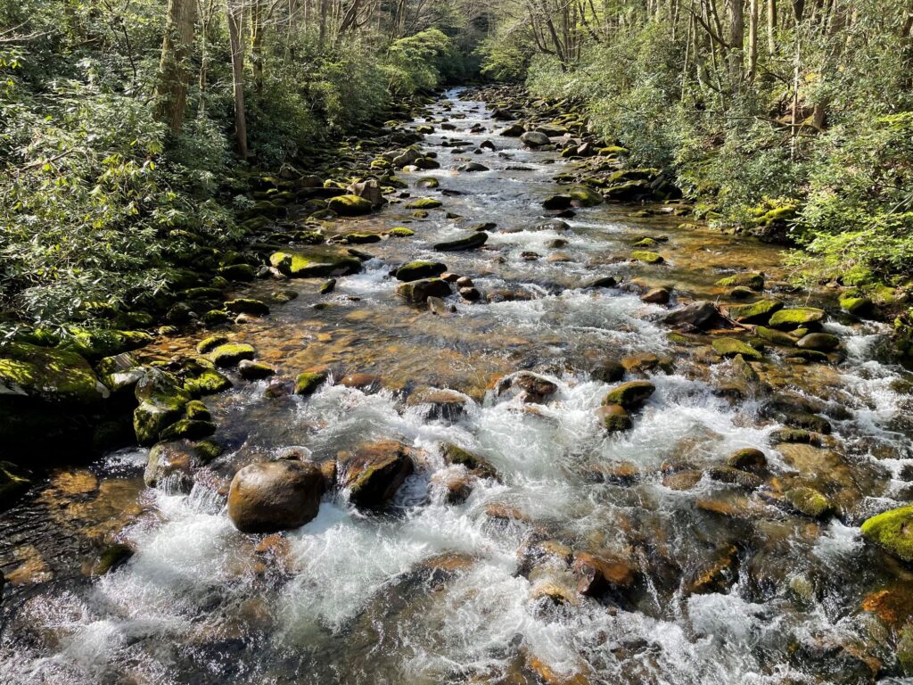
The Oconaluftee River has been part of the culture of indigenous people in what is now called Western North Carolina for thousands of years. It is home to 11 sensitive and rare aquatic species, some of which are only found in a few streams and rivers in western North Carolina.
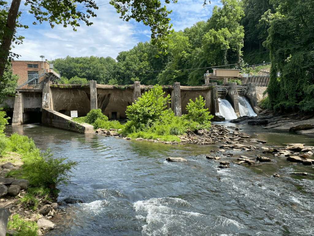
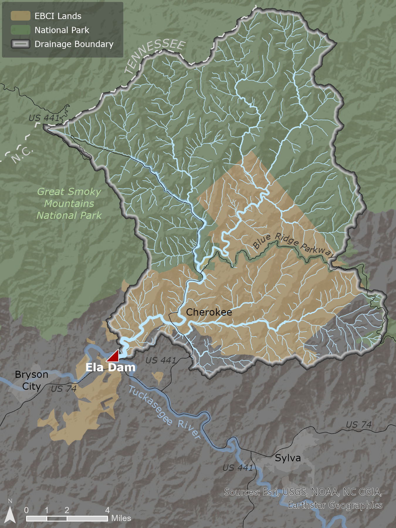
Stemming from the Great Smoky Mountains, the Oconaluftee River flows south through the Qualla Boundary – reservation land for the Eastern Band of Cherokee Indians (EBCI). The Cherokee people used to rely on the Oconaluftee as a thriving fishery and food source more than 100 years ago before the Ela dam was erected in Whittier, NC, in 1925.
Approximately 18 miles long, the Oconaluftee connects to a much larger river system, feeding into the Tuckasegee, Little Tennessee, Tennessee, Ohio, and Mississippi rivers. Its name is considered sacred by the Cherokee people and was derived from the name of a Cherokee village, Egwanulti. Oconaluftee translates to “by the river” in English.
Finding the Oconaluftee River
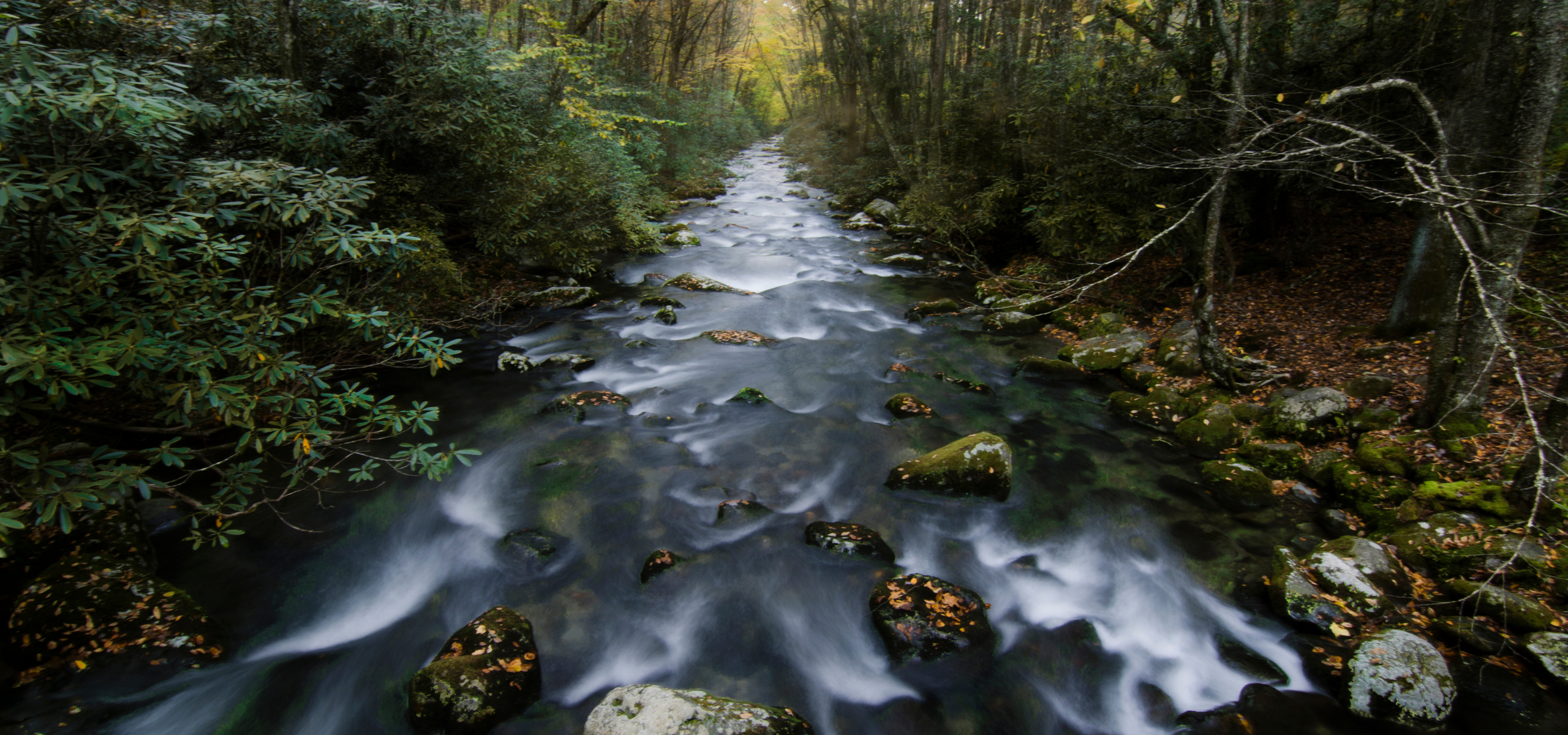
An hour west of Asheville, NC, the Oconaluftee River flows across the Blue Ridge Parkway and through the town of Cherokee. Ela dam sits in the town of Whittier, NC, with a population of about 5,000 people. The Oconaluftee provides plenty of opportunities to enjoy river sports such as fishing, kayaking, and tubing in the summer months.
Where is the Oconaluftee River in North Carolina?
An hour west of Asheville, NC, the Oconaluftee River flows across the Blue Ridge Parkway and through the town of Cherokee
Did You know?
The Cherokee people have lived in the Southeastern U.S. for more than 11,000 years and populated land spanning 140,000 square miles in what today encompasses part of seven southern states. As early as 1725 it is recorded that the Cherokee Nation had treaties with the British and began assimilating into European practices and religious institutions.
About the river
Migratory fish species such as Sicklefin Redhorse that once spawned in the upper Oconaluftee River and its tributaries were an important fishery and food resource for the Cherokee people prior to the construction of the Ela dam. Each year, thousands of redhorse fish reach the dam but are blocked from continuing their journey to historic spawning streams.
Let's stay in touch!
We’re hard at work in the Southeast for rivers and clean water. Sign up to get the most important news affecting your water and rivers delivered right to your inbox.
The construction of Ela dam resulted in a physical and cultural disconnection from a free-flowing Oconaluftee River and resulted in the accumulation of tons of sediment behind the dam. The reservoir, also known as Ela Lake, experiences a reduction in water quality due to the disruption of the natural flow of the river, resulting in increased temperatures, lower oxygenation, and other impacts to water quality indicators.
The benefit of the dam removal to the community and the general public will be fresh, clean, free-flowing water again in the Oconaluftee River.
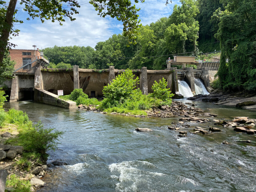
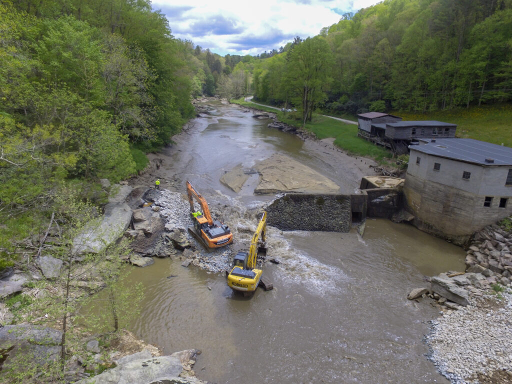
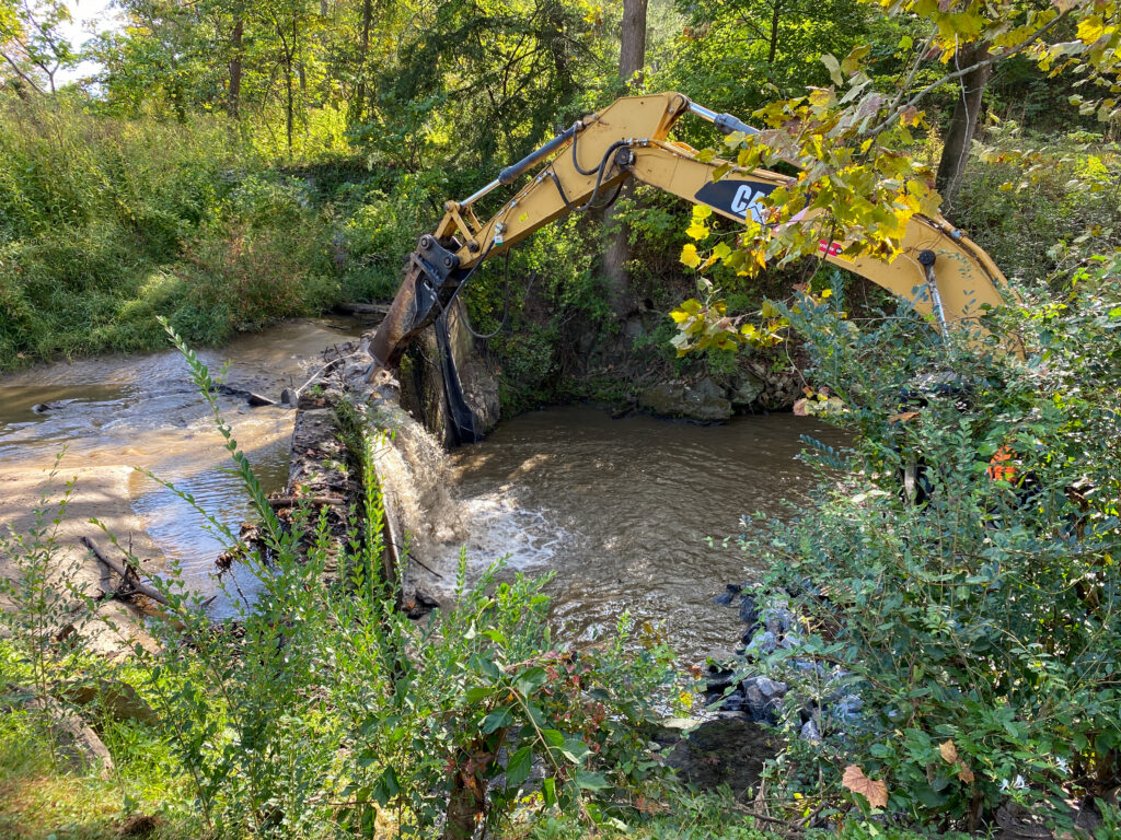
Ela Dam Removal Project
American Rivers is currently working on a massive effort to remove the Ela dam and restore the land and Oconaluftee River to its natural condition. Partnering with the Eastern Band of Cherokee Indians, American Rivers is part of a coalition of federal, state, public, private, and non-profit organizations that has formed to remove the Ela dam.
Stolen Land and the Cherokee Nation
The Cherokee people have lived in the Southeastern U.S. for more than 11,000 years and populated land spanning 140,000 square miles in what today encompasses part of seven southern states. As early as 1725 it is recorded that the Cherokee Nation had treaties with the British and began assimilating into European practices and religious institutions.
By 1825, however, many of the existing treaties with the U.S. had ceded away most of the Cherokee Nation’s once vast lands. In 1838 efforts to displace Cherokees from their land were underway, and an estimated 16,000 people were forcibly relocated to land west of Arkansas. In what was called the “Trail of Tears,” Cherokees and members of other tribal nations were relocated to reservations, many of them dying along the way as they suffered from disease, starvation, exposure to harsh elements, and exhaustion.
During this time of forced migration, the Cherokee tribe was allowed to purchase plots of land for individual households only if they agreed to leave the tribe and become U.S. citizens. Land purchase was otherwise restricted and only allowed for white men. One notable local who befriended and became an advocate for the Cherokee people was William Holland Thomas, who purchased land in North Carolina with his own funds to be used by the Cherokees. Much of this land is now included in the Qualla Boundary. In the late 1800’s the Eastern Band of Cherokee Indians purchased the land adjacent to the Ela dam back from the U.S. government.
Today, the tribe currently occupies the 56,000-acre Qualla Boundary and operates as a sovereign nation with the government headquartered in Cherokee, NC. About 9,000 of the EBCI’s 16,000 registered members live on the Boundary which is situated in Swain and Jackson counties and parts of Cherokee and Graham counties in western North Carolina. There are approximately 400,000 people in the Cherokee Nation across the country.