Nissequogue River
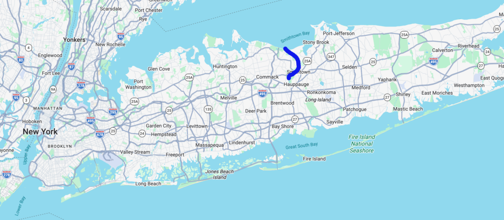
The Nissequogue River flows for nine miles, from groundwater sources, through glacial moraine, and eventually meanders through tidal marsh into the Long Island Sound. It is the largest tributary to the Long Island Sound on Long Island. The river is named after the indigenous people who lived off the abundant resources it provided. It has been subject to the effects of development beginning with Mill dams in the late 18th Century that have cut off migratory fish patterns and water quality issues from septic systems, lawns, golf courses, and road runoff.
The Nissequogue holds significance both as a home to rare natural ecological communities and as a large and accessible open space region. The entire river was once a sea-run brook trout habitat, but due to dams along its length, the remnant population of native brook trout is limited to the upper reaches.
What state is the Nissequogue River in?
The Nisseguogue River is located in New York.
How long is the Nissequogue River?
The Nissequogue River is 9 miles long.
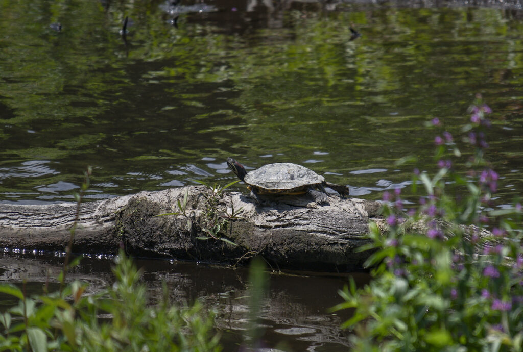
The River corridor contains a rare Atlantic white cedar swamp, home to the Hessels Hairstreak Butterfly. At its mouth, the river is an important habitat for marine fish, birds, shellfish, and Northern Diamondback Terrapin. The State of New York, Blydenburgh County, and neighboring towns have invested significant resources in protecting the Nissequogue watershed through areas such as Caleb Smith State Park Preserve and Blydenburgh County Park, and the river is designated a “Wild and Scenic River” by the State of New York.
Nissequogue River Listed as one of America’s Most Endangered Rivers® of 2026
The Nissequogue River is a unique natural treasure on Long Island, offering important habitat for birds, fish, and wildlife. The failure of a dam in 2024 freed a stretch of the Nissequogue, allowing the river to restore itself and come back to life, with benefits for both people and nature. Now, a proposal to rebuild the dam threatens this progress. County and state agencies must consider alternatives to rebuilding the dam, and support a long-term vision for a healthy, free-flowing Nissequogue River.
Join us in urging the County and State agencies to conduct a comprehensive environmental review and consider alternatives to building a new dam.
Speak up for a Free-Flowing Nissquogue!
Proposals to rebuild a broken dam threatens the progress the river has made since being able to flow free. Tell State agencies to consider the harms this project poses to the Nissequogue.
Stump Pond Dam Failure on the Nissequogue River
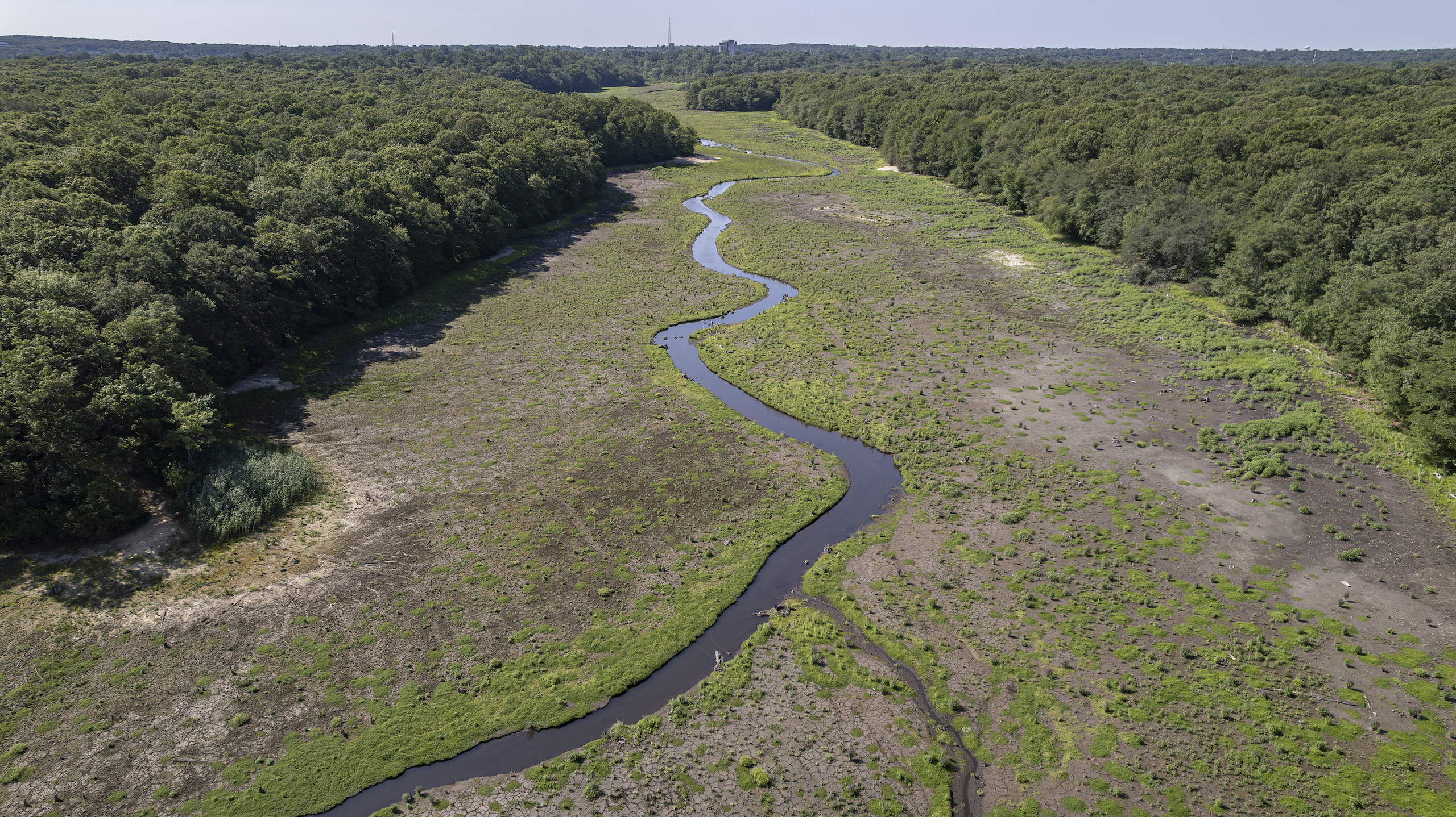
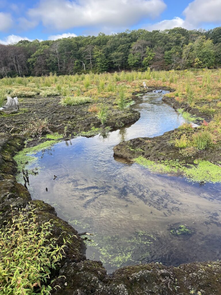
In August 2024, the Stump Pond Dam failed during a major storm, draining the former impoundment overnight and flooding properties below. The breach rapidly transformed a 118-acre pond into more than two miles of free-flowing stream and reconnected the river to its natural floodplain.
Since the dam breach, more than 120 plant species have been documented in the floodplain — including seven species listed by New York State as Species of Greatest Conservation Need, and the Atlantic Cedar whose stumps gave the pond its name will likely re-establish. 11 species of birds have been seen here for the first time in ten years, and forty six species have had all time high counts. Stump pond lowered water quality downstream by raising water temperatures and creating conditions for toxic blue-green algae blooms. Since the breach, water temperatures have been significantly cooler, reducing stress on the trout population. The 100 acres of open floodplain habitat now helps slow, store, and absorb floodwaters — reducing flooding risk both upstream and downstream during increasingly intense storms. Nearby residents have reported noticeably drier basements upstream. Looking forward, the primary remaining barrier to migratory fish passage in this river reach is the downstream Phillips Mill Pond Dam. Save the Sound and New York State Parks are working to advance a conceptual plan they developed together in 2023 to address this barrier through dam removal.
Now, citing flood risk and the recreational importance of the pond, Suffolk County is advancing a proposal to construct a new dam at the Stump Pond site, at significant expense to taxpayers. Rebuilding the dam would reverse recent gains by disrupting fish passage, degrading water quality, trapping sediment, warming the river, eliminating valuable floodplain, and reducing the floodplain’s capacity to manage stormwater. American Rivers has joined the Free the Nissequogue Coalition, along with over 20 local and national groups, to advocate for a free-flowing Nissequogue. The coalition is asking Suffolk County to demonstrate leadership by taking the time to evaluate costs, risks, and feasible alternatives through a transparent public process — including the option of keeping this reach of the river free-flowing.