East Rosebud Creek
OFF THE BEATEN PATH
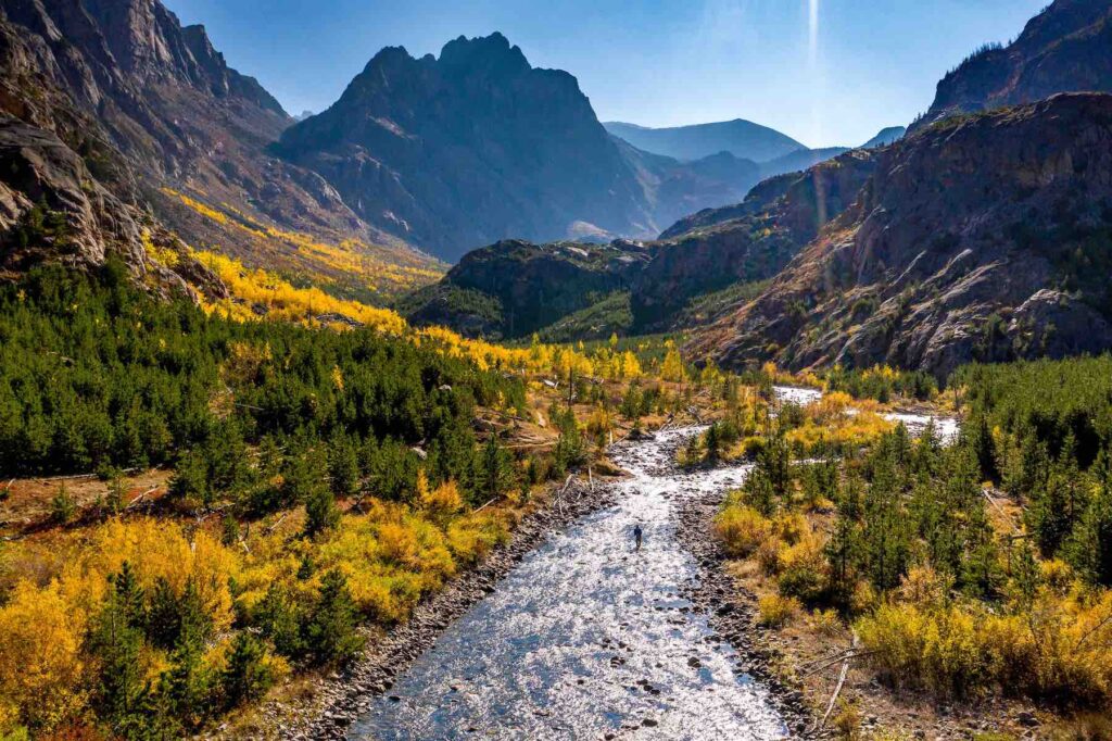
If you truly want to discover the natural wonder and beauty of Montana and the Beartooth Mountains, take “The Beaten Path.” It’s a 25-mile backcountry hiking classic traversing over-the-top alpine scenery between dramatic canyon walls interlaced with waterfalls and more than a dozen sapphire lakes brimming with wild trout. At the heart of it all is East Rosebud Creek.
Did You know?
Montana currently has four Wild and Scenic Rivers – a 150-mile reach of the Upper Missouri and the North Fork, South Fork, and Middle Fork of the Flathead River.
All four of Montana’s Wild and Scenic Rivers were designated in 1976.
Along with the Stillwater Trail, East Rosebud Trail (“The Beaten Path”) is one of two trans-Beartooth Mountain routes.
What states does the river cross?
Montana
The path’s formal name is East Rosebud Trail. Originating near Red Lodge, the hike’s fame stems largely from the East Rosebud Valley, cut from the creek’s cascading waterfalls as it tumbles from the Absaroka-Beartooth Wilderness near Granite Peak (Montana’s highest at 12,807 feet). Just before it leaves the mountains, East Rosebud Creek flows through East Rosebud Lake before spilling into a glacially carved valley and then joining the Stillwater River, a tributary of the Yellowstone.
Let's Stay in Touch!
We’re hard at work in the Northern Rockies for rivers and clean water. Sign up to get the most important news affecting your water and rivers delivered right to your inbox.
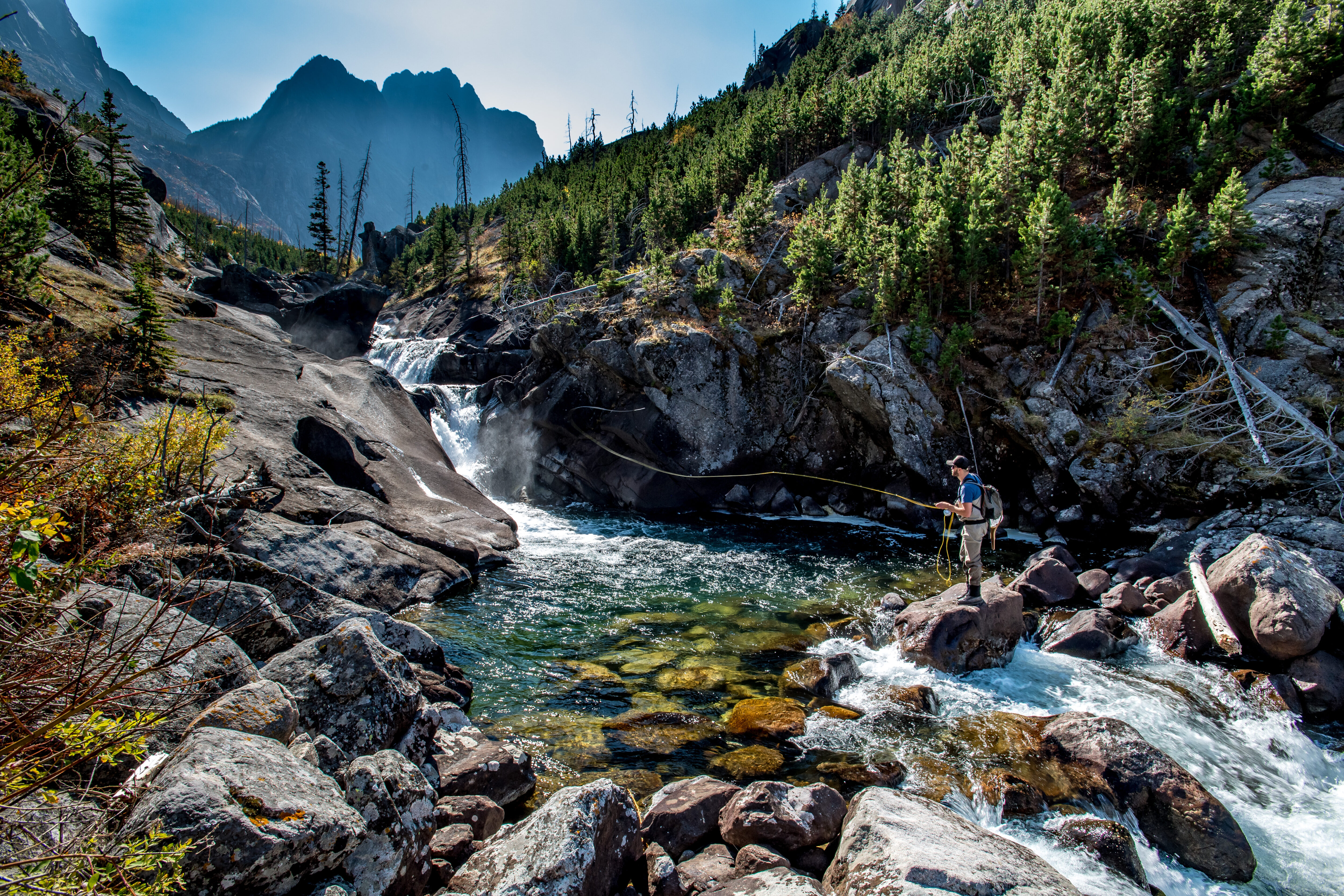
Both East Rosebud Creek and Lake have long been popular areas for trout fishing, whitewater paddling, hiking, and mountaineering. A cluster of cabins lines the north side of the lake, forming a quaint alpine village. Moose browse the willows while raptors soar overhead.
Because of its outstanding scenery, recreation, and geology, the U.S. Forest Service has declared 13 miles of East Rosebud Creek above the lake and 7 miles below it eligible for designation under the Wild and Scenic Rivers Act, our nation’s most powerful river protection tool. One look at the stunning beauty of East Rosebud Creek should convince even the fiercest skeptic that it is deserving of Wild and Scenic designation.
The Backstory
East Rosebud’s widely-popular Wild and Scenic campaign originated in 2009, when Bozeman-based Hydrodynamics Inc. applied for a permit to build a hydropower project on East Rosebud Creek. The project would have been located on public land within the Wild and Scenic–eligible reach just below East Rosebud Lake, and would have entailed building a 100-foot wide diversion dam, a 2-mile long penstock, substation, powerhouse, and transmission lines.
American Rivers and several of its conservation partners filed formal objections to the project and launched an aggressive media campaign that eventually pressured the hydropower company to abandon it in 2013. Although the dam is no longer an immediate threat, the proposal was the second of its kind since the year 2000, suggesting the need for constant vigilance.
The Future
In August 2018 President Trump signed the East Rosebud Wild and Scenic Rivers Act, which permanently protects 20 miles of the creek from all new dams, diversions and other threats and established Montana’s first new Wild and Scenic River since 1976 and the state’s fifth overall.