Congaree River
SOUTH CAROLINA’S WILDERNESS CONNECTION
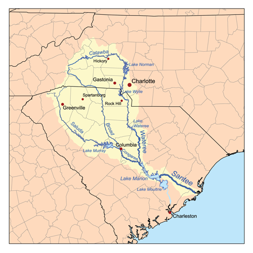
It’s only 50 miles long, but the Congaree is many rivers in one. From its origin at the confluence of the Broad and Saluda rivers near the Piedmont fall line in downtown Columbia, South Carolina, to its remote, bottomland terminus at Congaree National Park, the Congaree has a rich cultural history, varied wildlife and remarkable habitat linking South Carolina’s capital city to one of its large natural landscapes.
There is much to explore along the Congaree River, making it an obvious choice for the first Blue Trail established by American Rivers and our partners in 2007. Starting near Columbia, the aquatic trail is the ideal way to experience all the river has to offer through canoeing, kayaking, fishing, and other family-friendly activities. But the undeniable highlight of the journey is Congaree National Park, the largest protected wilderness in South Carolina.
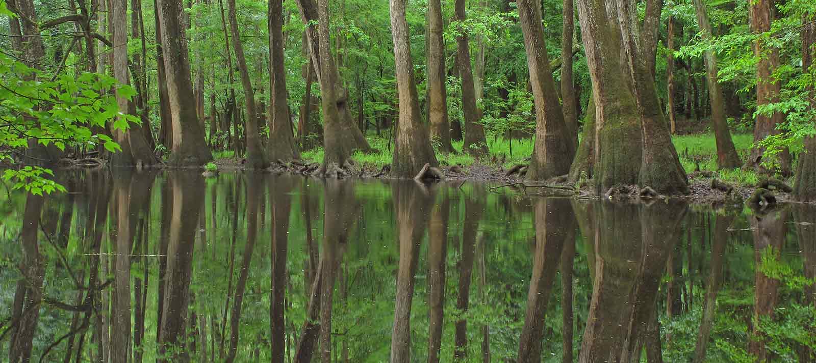
Designated as an old growth forest, an International Biosphere Reserve, a Globally Important Bird Area and a National Natural Landmark, Congaree National Park boasts 90 species of trees and the tallest Loblolly Pines alive today (169 feet). The park preserves the largest tract of old-growth bottomland hardwood forest left in the US, including enormous bald cypress trees throughout. The wilderness provides cover for bobcats, deer, wild pigs, coyotes, armadillos, turkeys, and otters while the river hosts turtles, snakes, alligators, and several types of fish.
Visitors can enjoy nature study, hiking, fishing, birding and camping. They can also paddle 20 miles of the Blue Trail within the park. The Congaree merges with the Catawba-Wateree to form the Santee River at the southeast corner of the park before flowing into Lake Marion and eventually the Atlantic. The Congaree merges with the Catawba-Wateree to form the Santee River at the southeast corner of the park before flowing into Lake Marion and eventually the Atlantic.
Did You know?
The Blue Trail program was founded on Congaree River when 50-mile river was recognized as an important connection between the city of Columbia and Congaree National Park.
Congaree National Park is South Carolina’s only National Park. In 2014, Congress voted to fund expansion of the park by 2,000 acres in order to connect the section on the Wateree River Blue Trail.
The Congaree River is home to many of the tallest trees in the Southeast, found within the federally designated wilderness area in Congaree National Park.
WHAT STATES DOES THE RIVER CROSS?
South Carolina
The Backstory
The Congaree River is heavily influenced by upstream dams, including the 200-foot-high Saluda Dam that creates 48,000-acre Lake Murray, the Columbia Diversion Dam on the Broad River just above the confluence, and the Parr Shoals Dam forming Parr Shoals Reservoir about 25 miles higher upstream.
After being blocked by the Columbia Diversion Dam and Canal for 125 years, those 25 miles of the Broad River above Columbia are now open to American shad and other migrating fish—and to the anglers who chase them—thanks to a fish passage installed in 2006. In addition to shad, blueback herring, and American eel, the rare robust redhorse sucker and other resident species now use the fishway to ascend the river and return to native spawning grounds.
Let's stay in touch!
We’re hard at work in the Southeast for rivers and clean water. Sign up to get the most important news affecting your water and rivers delivered right to your inbox.
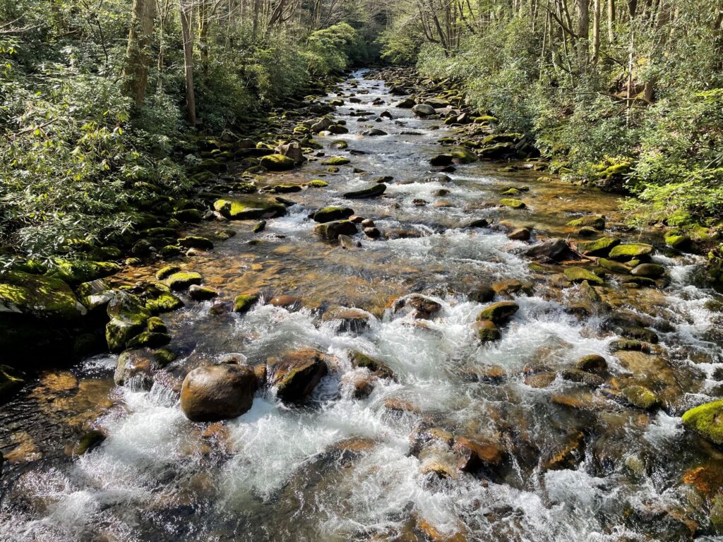
The fishway was the first in the Southeast to be constructed and operated through the federal licensing renewal process. In a separate relicensing agreement for the Saluda Dam in 2009, American Rivers helped negotiate an agreement that provides more natural, seasonal flows on the Saluda River for several weeks a year that benefit the health of the river and its web of life extending to the Congaree. The agreement includes protection and restoration measures for striped bass and shortnose sturgeon as well as rare freshwater mussels and rocky shoal spider lilies. Recreational access and special water releases for fishing and whitewater paddling are also included.
The Future
The next piece of the federal relicensing trifecta is on the Broad River’s Parr Shoals Dam, where American Rivers is among a coalition currently seeking more water released downstream from Parr Shoals and its sister reservoir, Monticello. We’re also asking dam operators South Carolina Electric & Gas to install a fish ladder and improve recreational access as part of the relicensing process that occurs every 30 to 50 years.
It’s the least we can do for the Congaree River, that does so much for so many. Programs like Blue Trails, born on the Congaree, have helped thousands to connect to nature and learn important life skills, earning recognition from the Department of the Interior as a model for how communities are connecting with America’s great outdoors through their rivers.