Suwannee River
Florida’s Liquid Heart
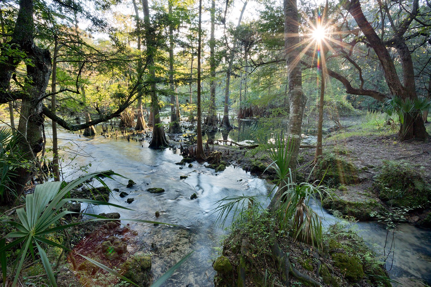
The Suwannee River is a 246-mile, primarily blackwater system flowing from Georgia’s Okefenokee Swamp to the Florida Gulf Coast. The basin hosts over 300 springs, including 21 first-magnitude springs, which provide over 50% of the river’s average flow. The Suwanee faces critical threats from nutrient pollution, agricultural runoff, and over-pumping of the Floridan Aquifer.
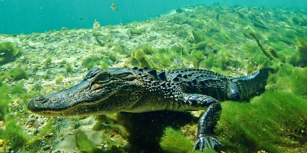
As an “Outstanding Florida Water” harboring unique biodiversity like the Gulf sturgeon, the river’s health is severely compromised by These stressors are compromising the river’s health, impacting its ecosystems and the communities reliant upon it.
The Suwannee River basin supports exceptional ecological diversity, acting as the sole habitat for the endemic Suwannee alligator snapping turtle and the largest remaining population of the federally threatened Gulf sturgeon. Due to its unique features and critical role in northern Florida, the Suwannee has been designated as an Outstanding Florida Water with increased protection set up to safeguard its clean and reliable water. The Suwanee River system connects blackwater streams with crystal-clear springs, supporting over 60 fish species, 230 bird types, and providing 60 percent of the freshwater sustaining the Big Bend’s extensive seagrass areas.
The Suwannee River basin has been inhabited for over 12,000 years, beginning with Paleo-Indian groups who relied on the river’s high-banked crossings and chert outcroppings for toolmaking. By the 16th century, the region was the stronghold of the Timucua people, specifically the Utina and Potano tribes. Their sophisticated society along the river used the rich floodplains for agriculture and the river’s bounty for fishing. By the early 18th century, the Timucua population had collapsed due to the introduction of European diseases, such as smallpox and measles.
What states does the Suwannee River Flow Through?
The Suwannee River flows through the states of Georgia and Florida.
How long is the Suwannee River?
The Suwannee River is 246 miles long.
What makes the Suwannee River a blackwater river?
The Suwannee River is considered a blackwater river. A blackwater river is a type of river with a slow-moving channel that flows through forested swamps or wetlands. Blackwater rivers are lower in nutrients than whitewater rivers, which leads to unique flora and fauna.
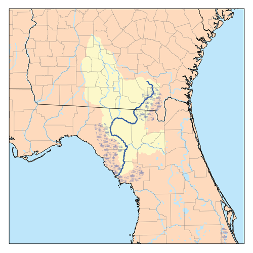
The Suwannee River watershed drains 11,000 square miles across southern Georgia and northern Florida, originating as a slow-moving blackwater stream in the Okefenokee Swamp. It transitions from a surface-runoff system in its upper reaches to a groundwater-dependent system as it crosses the Cody Escarpment, exposing porous limestone in the Middle Suwannee. This karst landscape produces deep, vertical limestone walls, “karst windows,” and unique features like the Class III rapids at Big Shoals State Park.
The watershed includes communities such as Live Oak, White Springs, and Branford, which are historically tied to the timber and turpentine industries. Agriculture still is the primary economic driver within the inland portions of the watershed, covering roughly 25-31% of the watershed’s land, significantly influencing regional employment and land use. Major crops include irrigated corn, peanuts, hay, beans, carrots, and watermelons. And the basin is home to over 40 dairies and nearly 180 poultry producers.
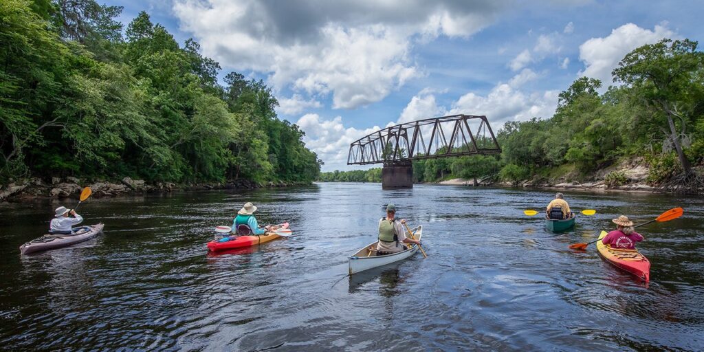
The economy of the watershed is now increasingly focused on tourism via the Suwannee River Wilderness State Trail. The river supports a “paddler’s paradise” with 170 miles of navigable water. Communities like High Springs help drive the springs economy with sites like Ichetucknee Springs generating over $28 million in annual visitor spending and supporting hundreds of local jobs.
The Suwannee River basin is the “springs heartland” of Florida, boasting more than 300 documented springs, including 21 of the state’s 33 “first-magnitude” giants. These springs, such as Ichetucknee, Fanning, and Manatee, act as the river’s lifeblood by contributing over 50% of its average flow. Ecologically, they provide a stable, 72-degree thermal refuge vital for the survival of the West Indian manatee during winter months. Socially, the springs are a cornerstone of North Florida’s identity and economy; according to the Florida Springs Institute, spring-related tourism generates over $1 billion annually, supporting local communities through recreation like cave diving, paddling, and swimming.
Despite their value, these “windows into the aquifer” are currently facing an existential crisis. As highlighted by the Florida Springs Council, the dual threats of over-pumping and nutrient pollution have drastically altered their chemistry. Excessive groundwater withdrawals for agriculture and industrial use have lowered the Floridan Aquifer’s pressure, causing some springs to stop flowing or even reverse. Simultaneously, high levels of nitrates from fertilizers and livestock waste have fueled the growth of thick, filamentous algae. This “green slime” (filamentous algae) smothers native eelgrass and destroys the clear-water habitats that define the Suwannee’s unique karst landscape. Nitrogen loads at the mouth of the Suwannee have increased by over 700% since the 1950s, reaching roughly 5,500 tons per year as of recent assessments.
Suwannee River Listed as one of America’s Most Endangered Rivers® of 2026
The Suwannee River is famous for its springs, which ensure a consistent flow of clear, clean water. The river’s flow nurtures fish and wildlife and provides world-class recreation opportunities. But pollution and excessive water withdrawals are contaminating the river and causing vital springs to dry up. The Florida legislature and the state’s Department of Environmental Protection (FDEP) must allocate funds to protect the springs and enforce pollution limits.
Join us in calling on the Florida Department of Environmental Protection to provide much-needed funding to restore Florida’s natural heritage and reverse the decline of Florida’s world-class springs and rivers.
Restore the Suwannee River to Protect Florida’s Heritage!
Call on the Florida Department of Environmental Protection to provide much needed funding to restore Florida's natural heritage and reverse the decline of Florida's world-class springs and rivers.
Threats on the Suwannee River
The river faces a severe “slow-motion” crisis of nutrient pollution, with runoff from poultry, dairy, and row-crop agricultural operations leaching high concentrations of nitrate-nitrogen pollution into the Floridan Aquifer. This pollution fuels toxic algal mats that destroy native vegetation and choke out sensitive species like the Suwannee moccasinshell mussel, further degrading the water quality.
Industrial pressures threaten to destroy wetlands that naturally filter water before it enters the river. Simultaneously, the over-pumping of the aquifer for agricultural irrigation is dramatically reducing the river’s base flow, making it increasingly vulnerable to drought and saltwater intrusion.