Niobrara River
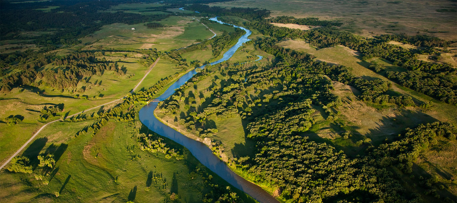
The Niobrara River is an oasis for paddlers, anglers, and wildlife. A major tributary of the Missouri River, the lower portion of the Niobrara is protected as a federal Wild and Scenic River.
The Lower Niobrara is increasingly threatened by too much sediment backing up in the upper reaches of Lewis and Clark Lake behind the Missouri River’s Gavins Point Dam.
The sediment is raising the level of the Niobrara and threatening local communities with flooding. To safeguard the Wild and Scenic Niobrara and its communities, the U.S. Army Corps of Engineers must improve sediment management within the Missouri River system and must prioritize funding for this critical issue in their budget.
Threats to This River
Dams and other flood control structures built in the mid-1900’s on the Missouri River have caused sediment to accumulate in the reservoir system. When sediment builds up on the riverbed it raises river levels, creating flooding issues for tributaries like the Niobrara River. At one time, most of that sediment was flushed out of the system to the Mississippi River where it helped build coastal wetlands along the Louisiana Delta— keeping saltwater intrusion at bay. Now, reservoirs behind dams act as sediment traps, slowing the flow of the river and allowing sediment to settle, accumulate, and consequently deplete reservoir flood storage capacity. At the same time, water management for navigation using water released from dams has caused lowering of the riverbed below Gavins Point Dam. Without sediment replenishment, it takes more water to serve downstream authorized purposes.
What states does the river cross?
Nebraska, South Dakota, Wyoming
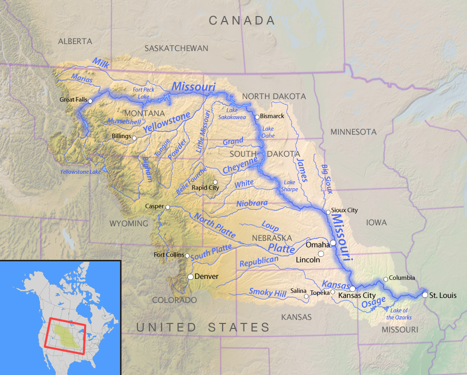
The sediment build-up is so extreme at the confluence of the Niobrara and Missouri Rivers that the overall level of the local water table has increased substantially. This leads to flooded cropland and basements, and greatly impacts boating and other recreation. Flooding due to sedimentation forced relocation of the Village of Niobrara in 1973. Downstream from the confluence, Lewis and Clark Lake is expected to lose 50 percent of its water storage capacity by 2045 due to sediment accumulation in the reservoir— to date, it has already lost 30 percent of capacity.

Let's stay in touch!
We’re hard at work in the Central Region for rivers and clean water. Sign up to get the most important news affecting your water and rivers delivered right to your inbox.
As the sediment builds within the system, the Lower Niobrara is slowly losing the seeps, springs, riparian forests, prairies, and canyons that characterize this Wild and Scenic River. Only a few of the great cottonwood trees in the confluence area have survived the recent sustained high waters. The USACE has purchased thousands of acres of riverside land to limit future liability, but this is not the long-term answer. The underlying sediment problem must be addressed now to secure a future for this Midwestern treasure.

